7/29 - Trey Tonnessen's "Feeling 100" Monday Morning Forecast
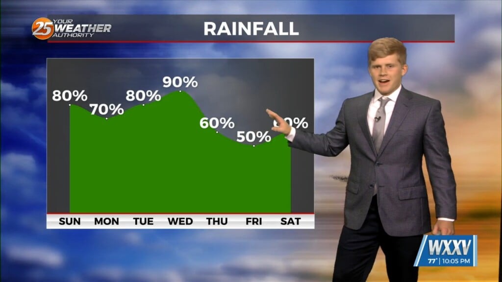
Lower precipitation numbers today and the next several days, will begin to dry the area out. They will also bring the heat back. More normal chances…
Lower precipitation numbers today and the next several days, will begin to dry the area out. They will also bring the heat back. More normal chances…
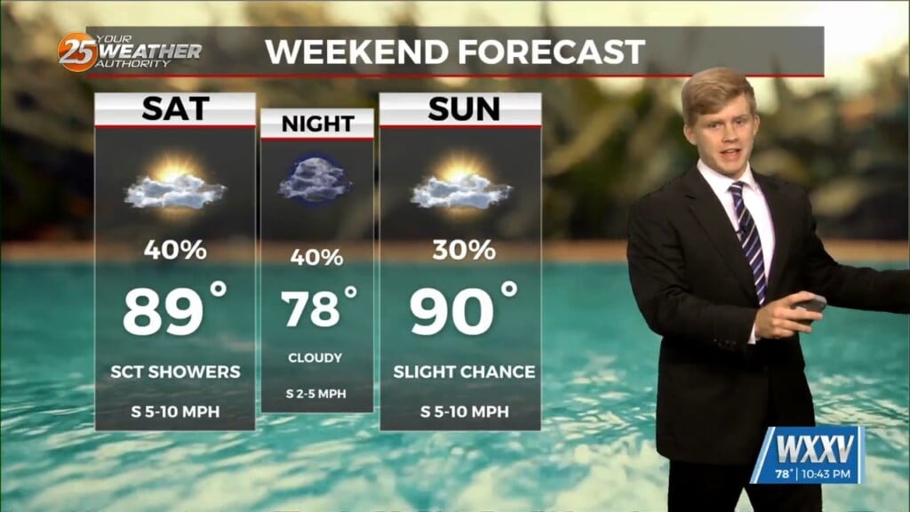
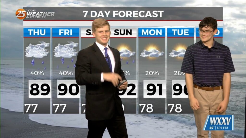
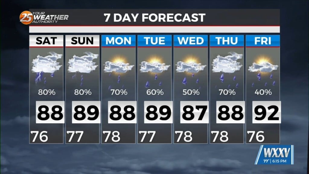
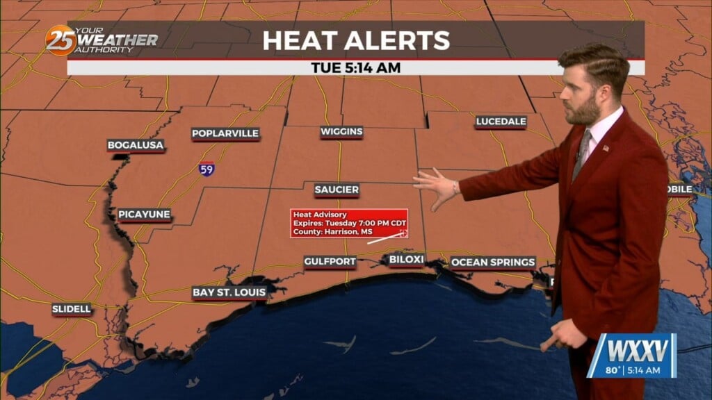
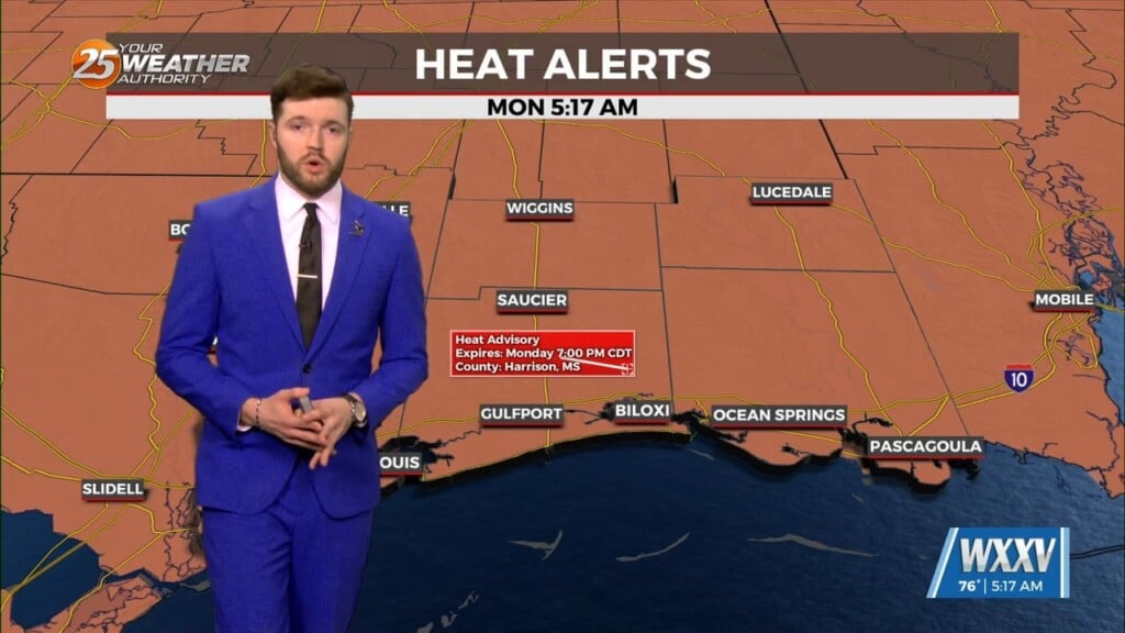
Looking into this upcoming week we see temperatures above average in fact, Stone and George counties will have heat advisory until tomorrow evening. However, the…
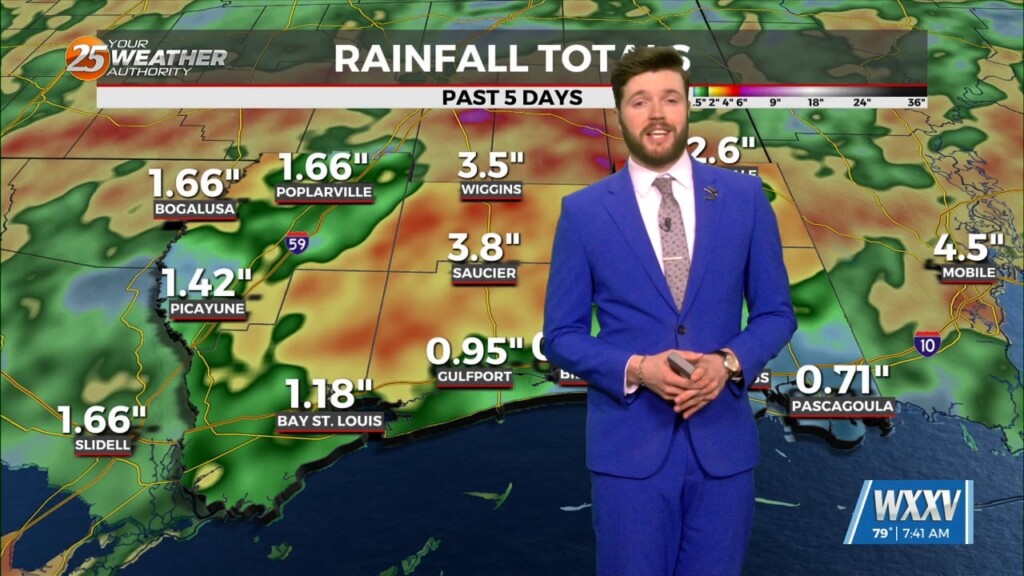
We have had active southwesterly flow aloft and today it was an entertaining and loud afternoon. Numerous showers and thunderstorms have developed and several locations have gotten…
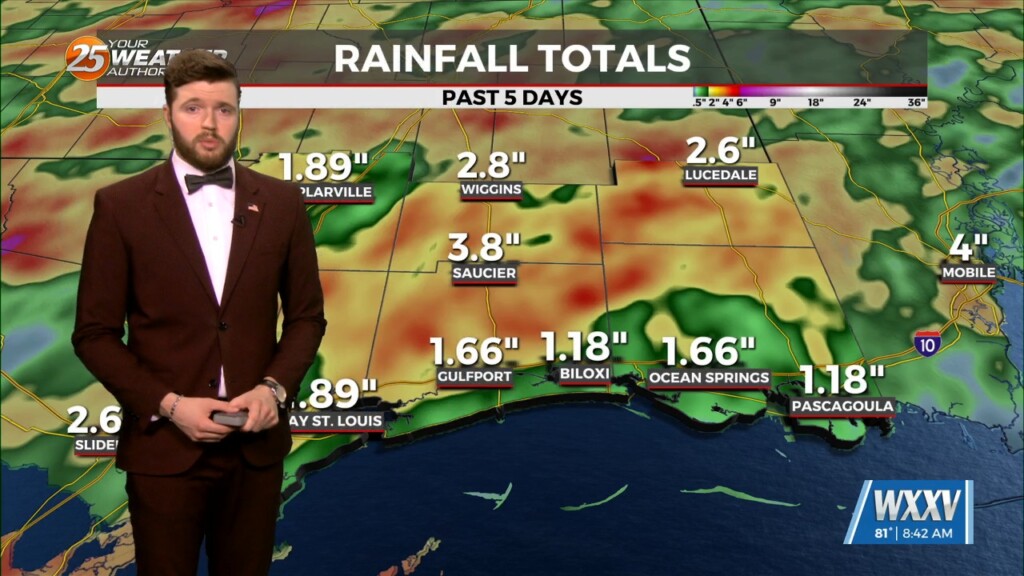
This sounds like a broken record...and it is. Deep tropical moisture will continue to stream north mainly into a weak trough found from central Miss to SW…
As we have experienced this week, we`re still in this wet but still pretty hot summer pattern. This evening I have been seeing many outflow boundaries kick…
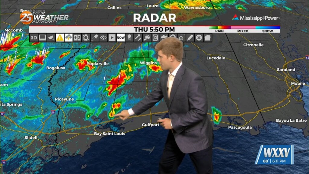
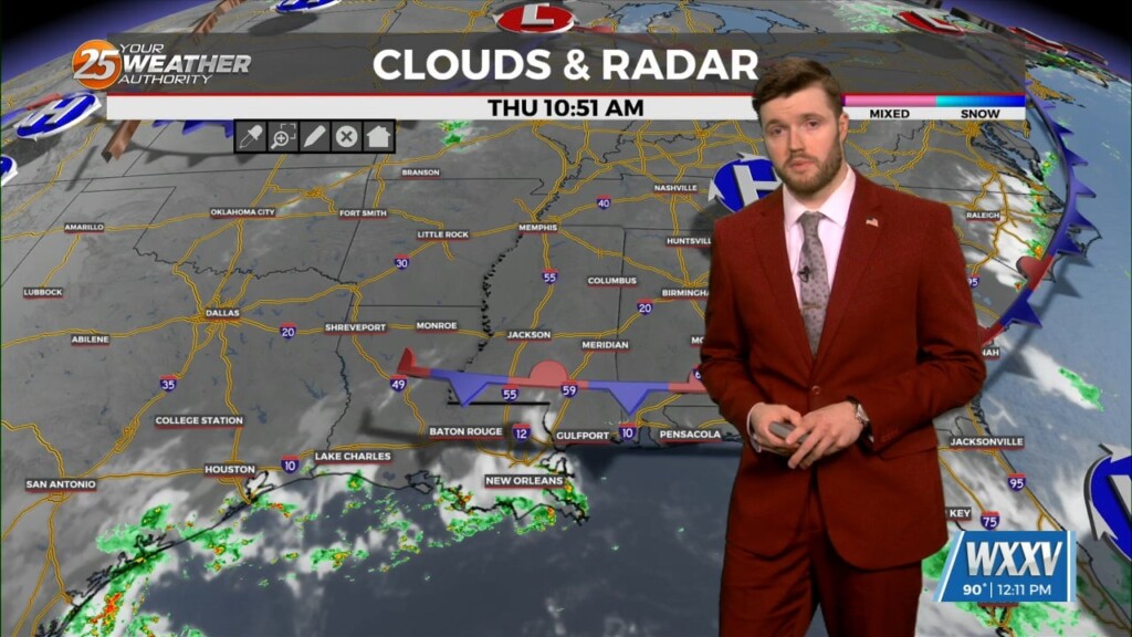
Excessive Rainfall Outlook including South Mississippi When: Timing is better for Thursday afternoon, with best chances mid-afternoon thru the evening hours, continuing moderately overnight. Traveling:…
At the surface we have a stalled frontal boundary draped just north of the southern six counties. Two additional pieces of the atmosphere worth noting…
Looking at the temperature structure, one can easily see where we expect the most activity through most of the day. Moisture values remain high and…
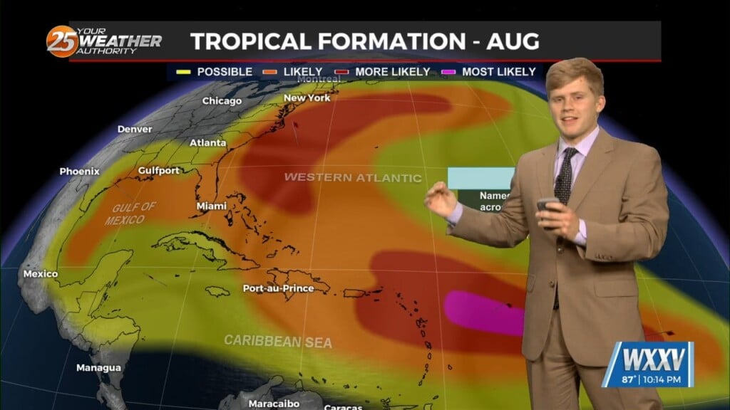
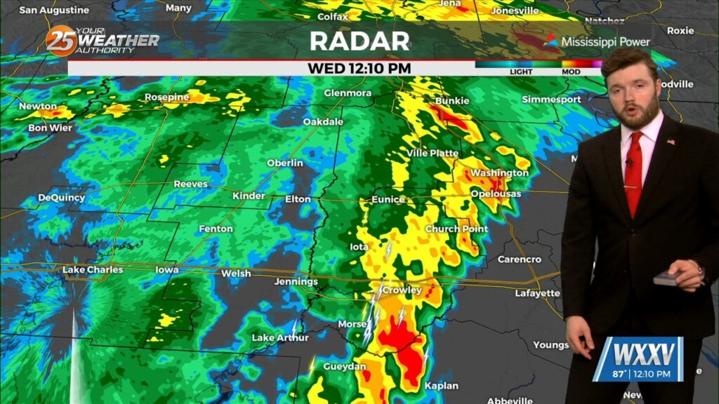
Deep tropical moisture continues to stream northward from the southern gulf. This will set up over the coastal bend of Texas into the Lake Charles…
For tonight and through the next couple of days will continue this rainy wet pattern. Looking at models, plenty off and on showers and storms will be expected…
A lot of deep tropical moisture is streaming northward from the southern gulf this morning. Most of this will be found from the area down through…
Summer afternoon thunderstorms are gradually propagating northeasterly into southern Mississippi. These storms will be capable of heavy downpours, frequent lightning, and gusty winds. After sunset, showers…

Monday's main areas of thunderstorms should develop around the same locations as Sunday, mainly along the coast. This should then spread and develop eastward through the…
A wet rainy weekend we had but Plenty of showers and thunderstorms are still to come this week. Although the coast is fairly worked over, we…
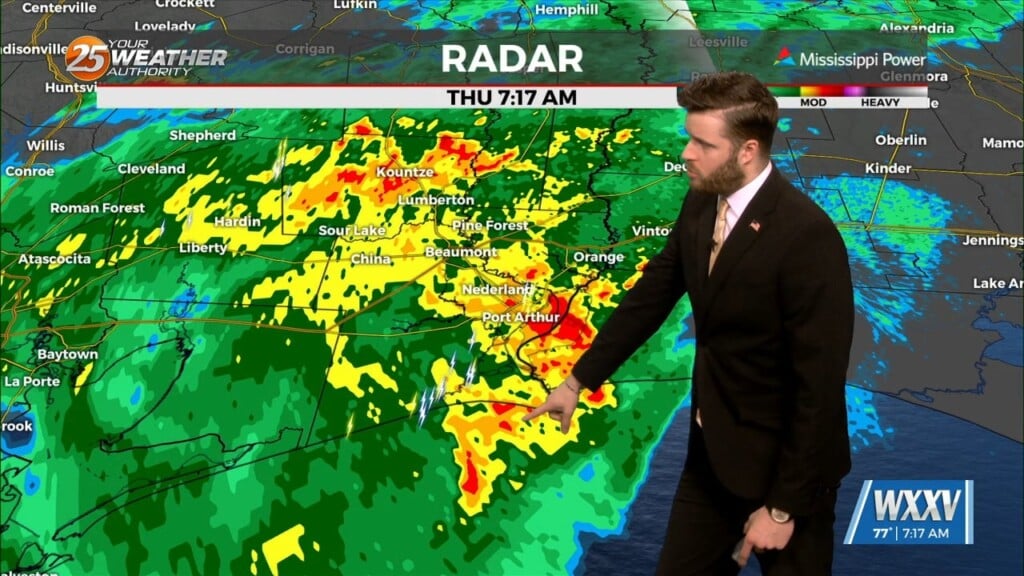
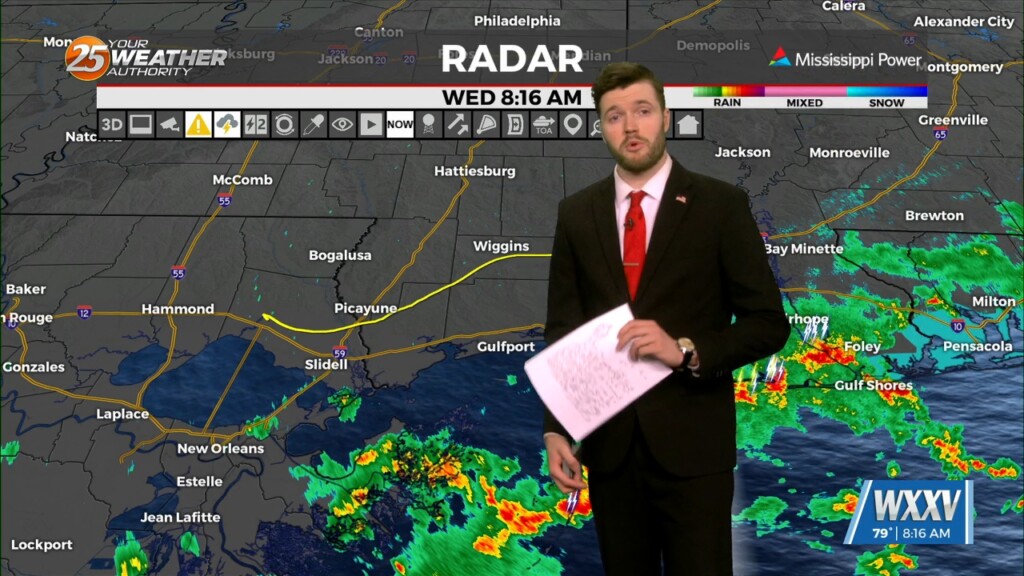
Rain continues to make its way through southern Mississippi Due to a deep upper level trough over the south eastern U.S. and a weak low pressure heading…
Another hot day is expected across the region as upper level heights remain elevated, with the close proximity to the mid level ridge across the Gulf of…
Similar to the last few days, conditions will remain hot with a ridge centered across the Gulf of Mexico and southwest Atlantic Ocean. At the surface,…

A shallow trough is in place between highs extending from the Great Lakes to near the Missouri/Arkansas border. This pattern is relatively typical for summer with…
Lingering moisture and afternoon thunderstorms will be the case for the next few days as well as into the extended forecast. Again, these storms will have…
A daily swing in precipitation will occur with due to the same boundary. Some overnight showers and thunderstorms should also get going each morning…
Showers and thunderstorms could pop up through any day of the next seven. A daily fluctuation will happen with moisture here on the Mississippi Gulf…
Deep tropical moisture is moving into the area from the west this morning with plenty of showers developing ahead of it. Dry air is working…

Monday will be another suppressive day expected with heat continuing to be an issue. The only areas that should escape this will be where cloud cover…

Today we are already seeing isolated to widely scattered convection and these storms appear to be in the middle of the deeper moist airmass, in the…