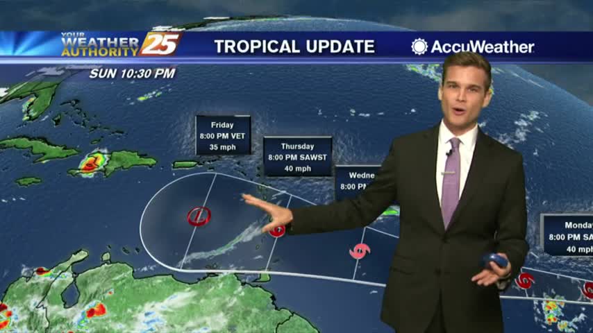
9/27 - Rob's Thursday Afternoon Forecast
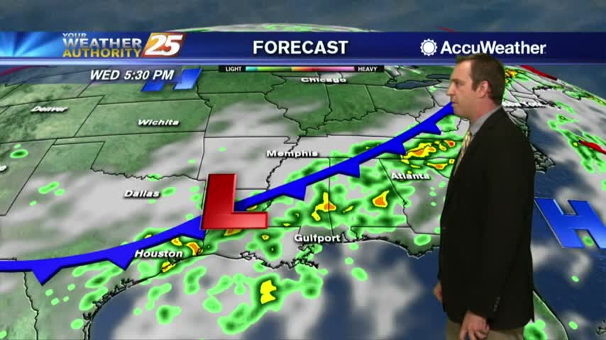
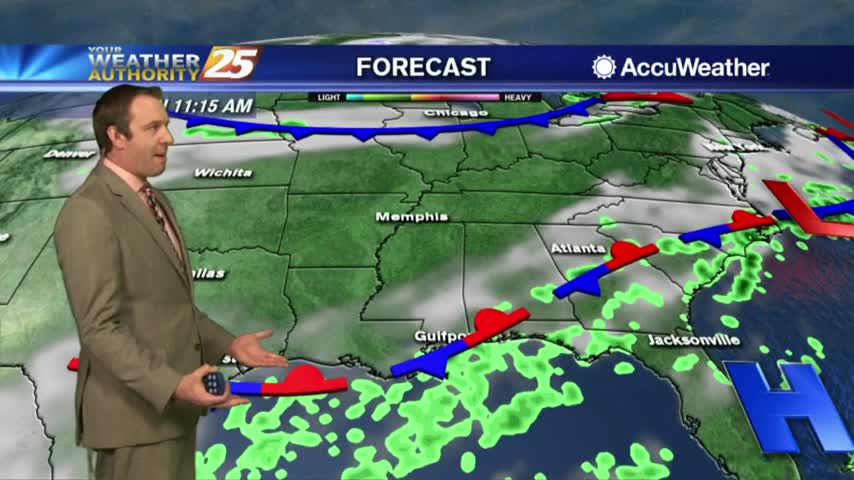
HEAVY RAIN is moving into south Mississippi from the SW...

HEAVY RAIN is moving into south Mississippi from the SW...

Only minimal activity this morning but widespread showers/t-storms will develop again today...
The showers continue through the night, and even more will move in tomorrow....
The showers and thunderstorms will continue through the night, and while we'll see more tomorrow drier days are in sight....
Activity is beginning to redevelop with daytime heating...
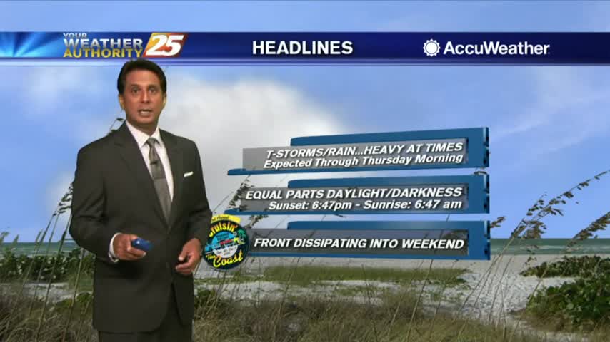
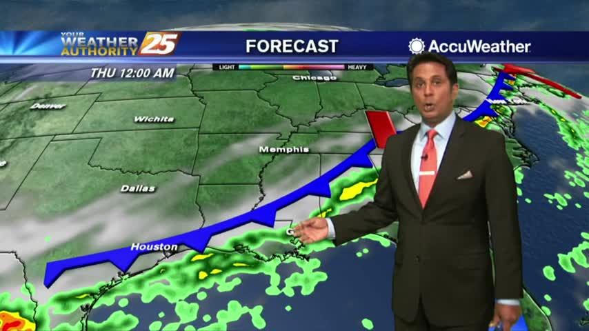
A VERY WET start to the day as a plume of moisture is bringing showers/t-storms with HEAVY RAINFALL and frequent lightning...

The rain weakened as expected through the night, but it'll return each day for the rest of the week....
The storms started over the weekend and won't stop until the next, so we're in for more tomorrow....
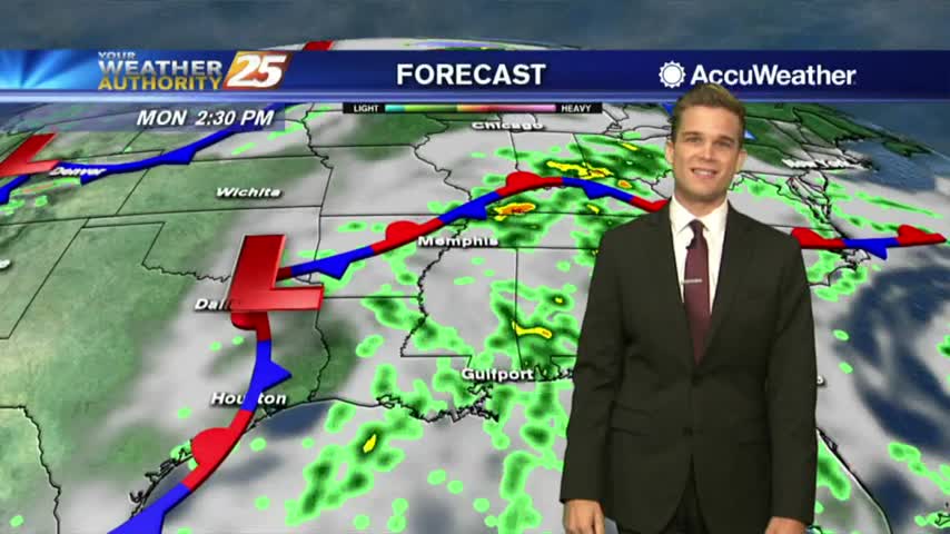
Cold front on the way along with greater rain chances.
Another rainy morning along the viewing area with warm and humid conditions...
Another day of hit or miss showers and thunderstorms.
A wet start to the day/workweek with showers moving in from the Gulf of Mexico...
Fall is here but cooler temperatures are not.

The rain chances keep going up through the weekend, and the storms will linger into the beginning of next week....

The slightly cooler, more cloudy and rainy trend continued today, but overall it was still a nice summer afternoon. Expect more rain through the weekend though....
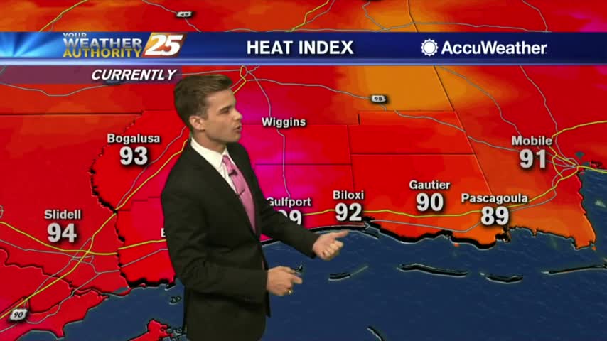
Another HOT afternoon ahead as the heat indices are already in the triple digits...
A warm and humid start to the day with a few light showers moving in from the GOM...
Tonight will be the last clear sky we'll see for a while, as rain and thicker cloud cover will move in for the weekend and aren't in any hurry to leave....
Today was a little more cloudy than yesterday, and slightly more rainy as well, a trend we'll continue through the weekend....

A HOT afternoon with the Heat Indies already in the low 100s as ambient temps are in the upper 80s...

A few showers south of the coast line are dissipating as they move towards the beach...

Today may have been rain-free, but we'll see a bit more each afternoon into the weekend....
Almost no measurable rain popped up this afternoon along the sea breeze front, but we'll see a few more each day ahead....

Another hot day as the humidity has brought HIGH HEAT INDICES to the area...