5/9 – Rob Martin’s “Warmer Mid-Week” Monday Night Forecast
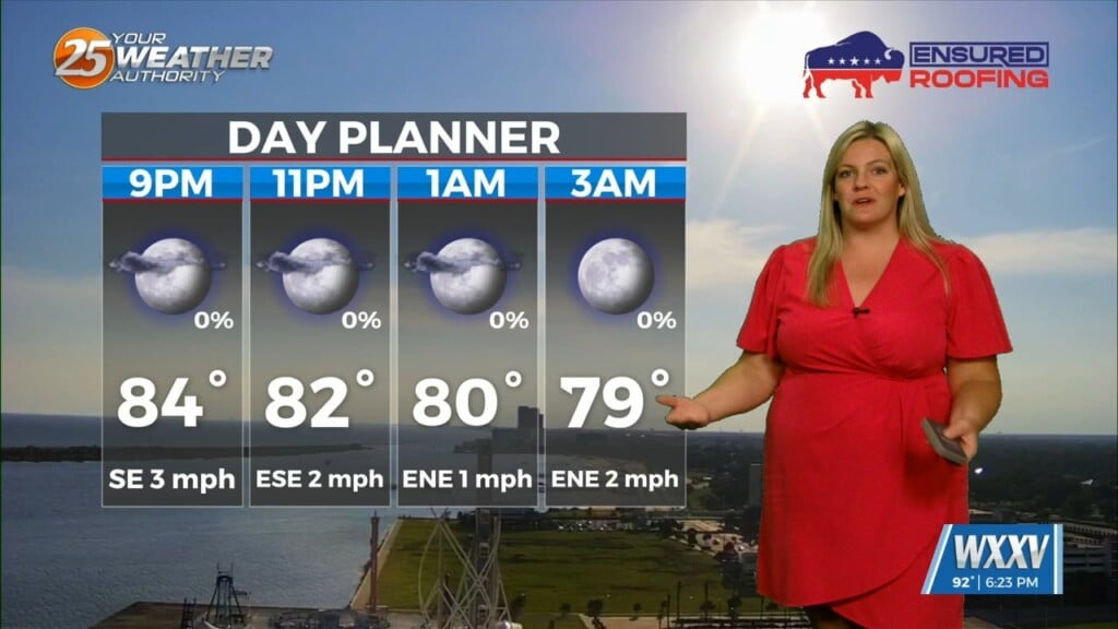
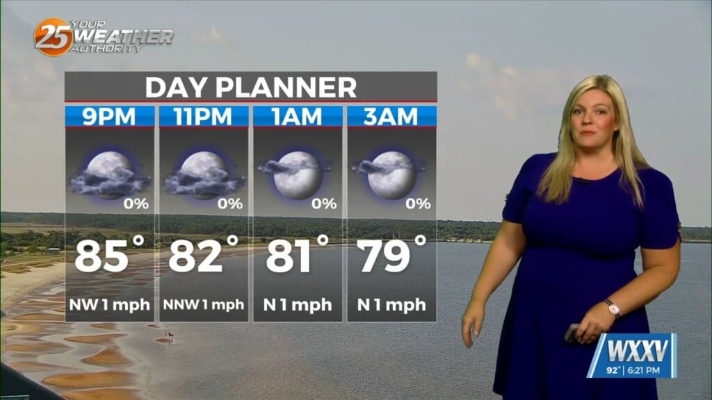
Steady as we go in the short term. Humidity was up today, and it will be with us through the week, although it won’t be oppressive. That means mild overnight temps with afternoons running a bit above-average for the season.
Our Bermuda High will continue ridging in early this week, keeping rain and storm chances suppressed. An upper-level low off the eastern seaboard will drift slowly westward later in the week, increasing our chances of afternoon showers and storms then. This will displace our high pressure ridge a bit to the west.
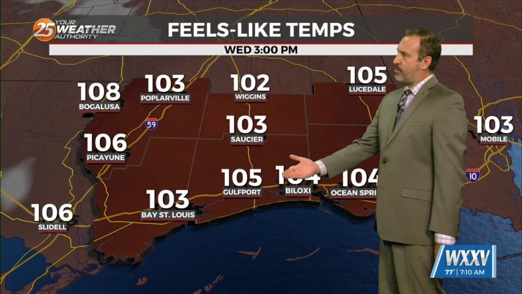
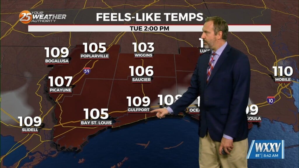
With the continued southerly flow and displacement of the high, maximum temperatures later in the week have trended down a bit, so we’re not looking at some summer-like heat coming our way, but simply a slightly warmer version of what we have today. The best chance of any rain or thunderstorms looks to be Saturday and Sunday. Slight chances for isolated showers or storms (20%) exist for Thursday and Friday.