3/7 – Meteorologist Rob Martin’s “More Active Weather” Monday Evening Forecast
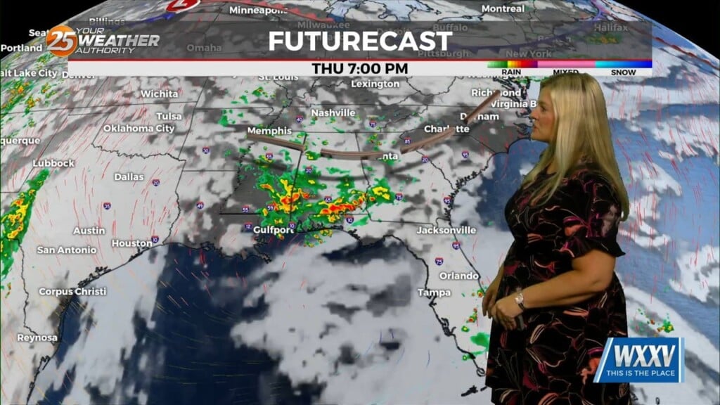
A more-active weather pattern is shaping up this week. A cold front moves slowly through the area tonight with some early showers. As the surface low continue to lift northeastward, the cold front will continue to get pulled eastward today until it becomes parallel to the upper flow over our coastal waters overnight tonight. Models are indicating that general nature of any precipitation today is likely to be scattered showers that don’t top out much higher than about 10,000 feet. There is at least some potential for a few t-storm into early evening.
However, the front pulls a stall tactic late tonight. Multiple impulses will move across this boundary keeping rain potential in the area, the first round coming Tuesday morning and afternoon. Some thunderstorms are possible in this environment as well. The strongest impulse arrives late Tuesday night into early Wednesday morning, with a threat of some stronger storms then, so this bears watching then. The area could see anywhere from 1-3 inches of accumulations through the week. We’ll get another brief break on a mostly-dry Thursday while between systems.
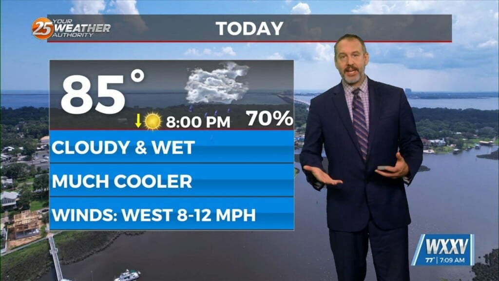
A more vigorous cold front will move through the area Friday night clearing the atmosphere and bringing a cold blast to the Mississippi gulf coast. Expect a 20+ degree drop in temps from previous days. Highs will struggle to reach mid-50s and lows will drop to the freezing mark for at least the northern half of the area. We’re past the mean (average) last freeze date (or will be by this weekend) at most locations, so it’s not out of the question that Freeze Warnings may be necessary in some portions of our area this weekend.