3/4 – Meteorologist Rob Martin’s “Eventually Wetter” Friday Evening Forecast
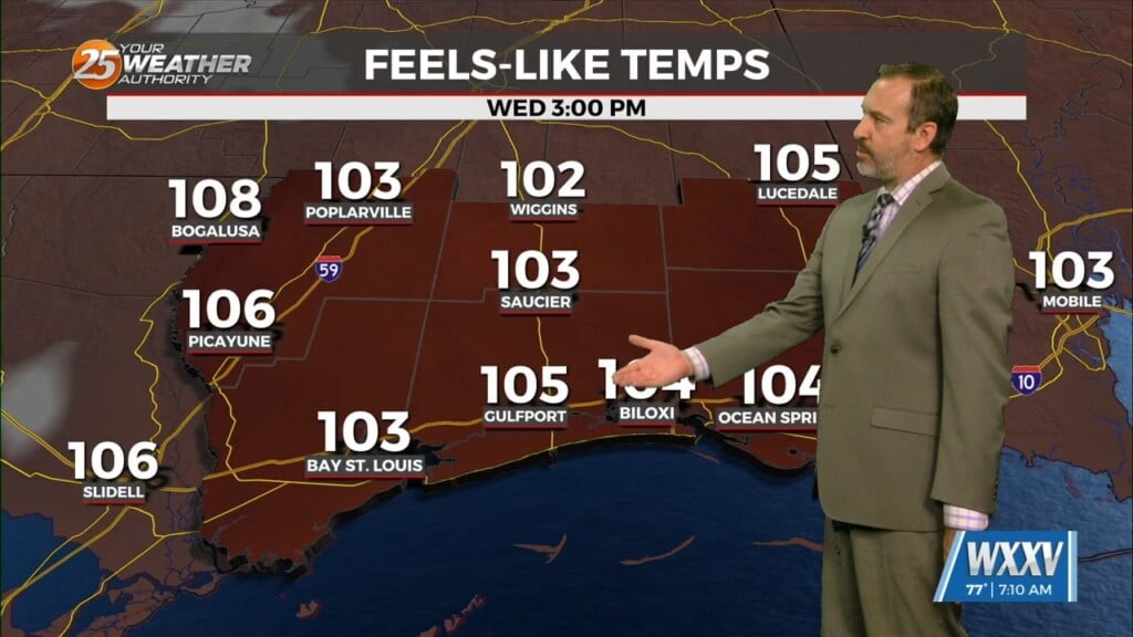
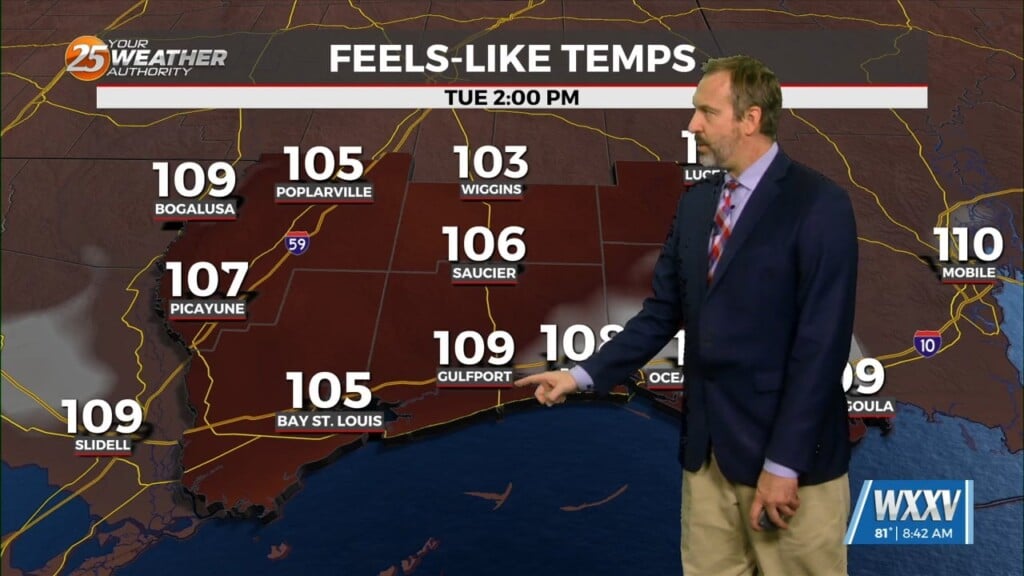
Bit by bit this weather pattern changes heading into next week. The calm wind regime, for starters, is over. Winds have come around to the southeast, keeping coastal areas from warming up a lot compared to yesterday, plus bringing back some waves to the sound.
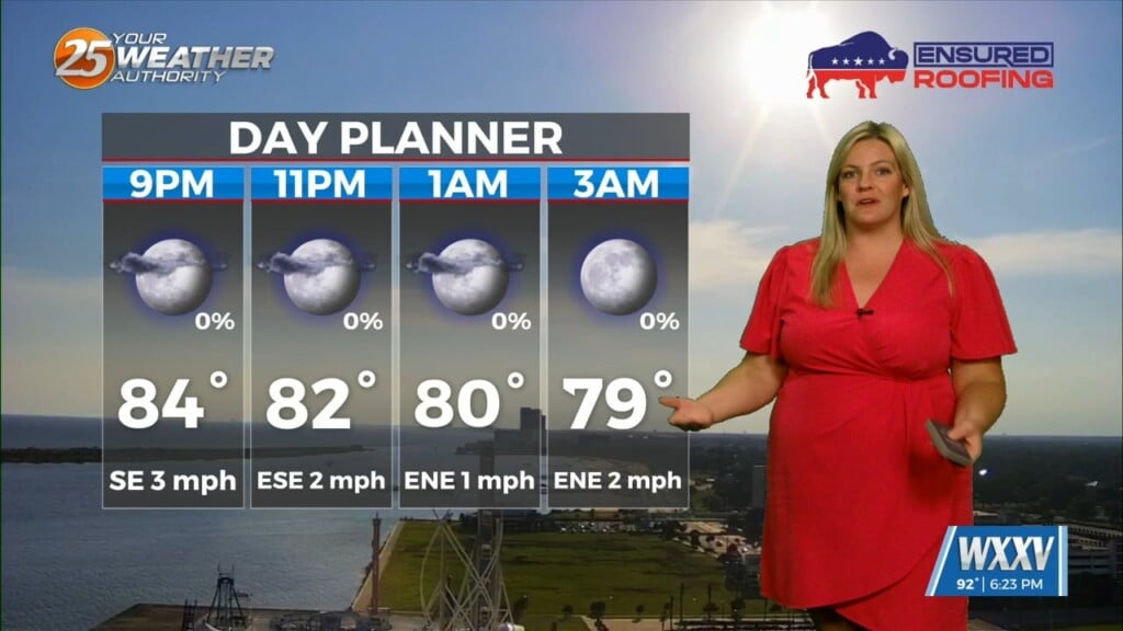
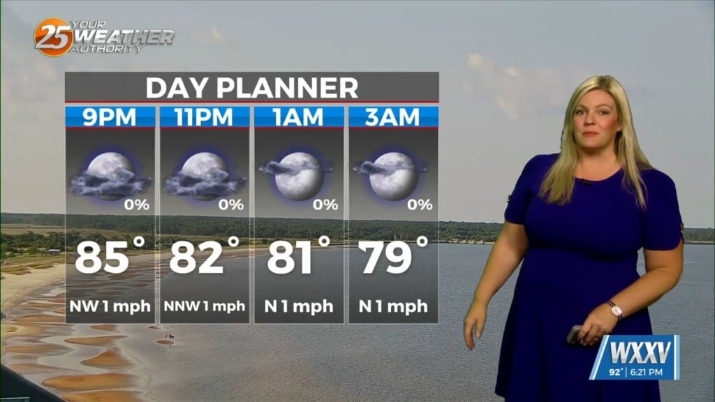
That onshore flow and increased humidity will result in a noticeably-milder night with a return of some early-AM fog both weekend nights.High temperatures should reach their potential, primarily in the upper 70s near the coast, possibly the 80s farther inland, You’ll feel the bump in weekend humidity, but of course nothing like summertime.
As southerly flow becomes more prevalent later tonight into Saturday, we can expect some lower clouds to develop as the increased moisture gets trapped in the low levels. I can’t totally rule out a shower or two across extreme western portions of the area, mainly west of McComb and Baton Rouge, late Saturday afternoon. Warmer temperatures and increased humidity will become more noticeable tonight with overnight lows a good 10 to 15 degrees warmer than this morning. Increased cloud cover on Saturday should stop things from getting too warm, but won’t be surprised to see areas away from direct marine influences reach the lower 80s. A slow moving cold front will approach Sunday with a few scattered showers popping up in the afternoon, but it doesn’t look like a game changer. We get wetter by Monday afternoon as the front finally gets here with a batch of widespread showers and perhaps a clap of thunder. The front could stall over the northern gulf, leading to an unsettled cooler and wet pattern Tuesday and Wednesday.
Leave a Reply