Looking sunny, but feeling much cooler across South Mississippi
Meteorologist Sam Lucey has a look at the week ahead
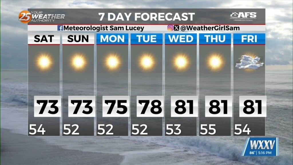
We’ll see partly cloudy skies tonight as temperatures fall into the low and mid 50s, but brisk north winds will pick up through the evening, making it feel a little cooler and drier across the area.
Saturday will be sunny, but it will also still be breezy. Highs will reach the low 70s, with north winds around 15 to 20 mph. If you have plans outdoors, keep in mind that those winds may make it feel cooler, especially in exposed areas and in the early morning or late evening hours, it’s going to start feeling a little chilly.
With dry conditions and gusty winds expected, fire danger will also be a concern Saturday. Avoid outdoor burning and use caution with anything that could create sparks.
A Sunny Sunday and a Cool Start to the Week
The sunshine sticks around Sunday, with highs again in the low 70s. Winds will remain out of the northeast at 10 to 15 mph, but conditions will gradually become less breezy heading into Monday.
Overnight temperatures will stay in the low 50s through most of the week, so you’ll want a light jacket if you’re heading out early in the morning.
Monday will be sunny with highs warming up slightly from the weekend. Even still, highs only top out in the mid 70s but it will be another comfortable day with lighter northeast winds and mostly clear skies Monday night.
Temperatures Warm Up by Midweek
The warming trend continues Tuesday, with highs climbing to around 78 degrees under sunny skies. By Wednesday, afternoon temperatures will reach the low 80s, with highs near 81 degrees.
That stretch of sunshine continues through Thursday and Friday, with highs staying around 81 degrees and overnight lows gradually climbing into the mid to upper 50s.