Summer-like heat lingers, despite lower humidity
Meteorologist Sam Lucey has a look at the forecast for south Mississippi
Tonight is looking mostly clear, with temperatures falling into the low and mid 70s.
Thursday and Friday will be mostly sunny, with highs around 91 degrees. It will be a little breezy Thursday with an east-northeast wind at 10 to 15 mph following a weak cold front, but otherwise, it’s looking fairly quiet weather-wise. Overnight temperatures by Friday morning will likely fall into the upper 60s across much of South Mississippi, with a few coastal areas remaining in the low 70s.
By the weekend, afternoon temperatures climb a bit more. Saturday and Sunday will both be mostly sunny and hot, with highs around 94 degrees. There is a small chance for an afternoon shower or thunderstorm both days, but most locations should stay dry.
Overnight temperatures will gradually warm back into the mid 70s, while some inland areas will likely bottom out in the lower 70s. So, while it may not exactly feel cool, mornings should be a little more comfortable than the afternoons.
Rain chances increase somewhat heading into next week. Monday through Wednesday will bring a better chance for afternoon showers and thunderstorms, although we’ll still see plenty of sunshine between storms. Highs will stay around the low 90s, with overnight lows mostly in the 70s.
Tropical update
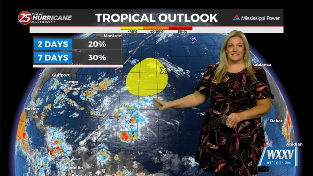
The tropics are relatively quiet right now, but there is one area we’re watching.
A small area of low pressure several hundred miles east of Bermuda has become a little better organized over the past day. Conditions could become somewhat more favorable for development over the next few days as the system moves slowly west to south across the subtropical Atlantic.
The National Hurricane Center gives it a 20% chance of developing over the next 48 hours and a 30% chance over the next seven days.
For the Gulf Coast, there are no tropical threats, but we’ll continue to keep an eye on the Atlantic as we move through the rest of hurricane season.