06/18 Ryan’s “Stormy & Wet” Thursday Afternoon Forecast
Expect to get wet again today after rounds of strong-to-severe storms all morning long, leading to more flooding.
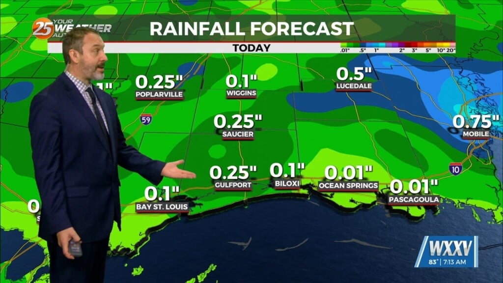
Our week of wet weather continues again today, what will likely end up the wettest day due to several inches falling once again. In fact, since Monday nearly 20″ of rain have fallen on the western half of South MS, leading to widespread flooding issues. Low-lying areas and locations with poor drainage will most certainly be seeing issues, and river flooding is starting to catch up as the wet pattern continues. Today’s rainfall is enhanced by the remnants of Tropical Storm Arthur, which has brought upwards of 9″ today alone over Picayune. Continue to avoid flooded roadways, and avoid traveling at all if possible.
Today also saw a noticeable severe weather threat, with multiple Tornado and Severe Thunderstorm warnings. The severe risk is diminishing as we head into the afternoon/evening. But we still have a few hours where we’re not out of the woods just yet.