11/20 – Chance For Showers Returns Friday
Meteorologist Sam Lucey has a look at your forecast
Clouds increase tonight with temperatures holding steady in the mid to upper 60s and a light southeast breeze.
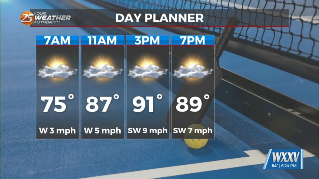
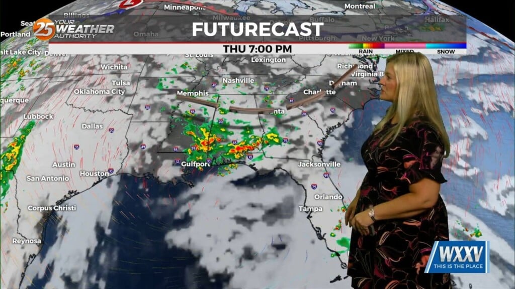
On Friday, expect the chance for showers and thunderstorms to return, mainly before 2 p.m., followed by some breaks of sunshine in the afternoon. Highs reach the upper 70s again, and while rainfall totals should stay light, a few storms could produce heavier pockets of rain. In total, we’re looking at around 0.10″ (one tenth of an inch).
The weekend starts with patchy fog possible early on Saturday with temperatures in the mid 60s, but skies turn mostly sunny by the afternoon and highs top out near 80. Winds remain light, shifting to the west during the day as we see a weak cold front sliding through, but it’ll help us dry out a little and temperatures overnight will likely drop into the upper 50s. Sunday brings another pleasant day—mostly sunny with highs in the upper 70s and light, shifting winds.
Early next week continues the mild, but unsettled pattern. Monday stays mostly sunny with highs in the mid 70s, then clouds increase Monday night as a warm front lifts northward and increases our chance of showers after midnight. More showers, and possibly a few thunderstorms, return Tuesday with highs in the mid 70s and breezy south winds 10-15 mph. Another chance for showers lingers into Wednesday, with highs dipping into the low to mid 70s as winds shift to the north.
By Wednesday night, a few stray showers or storms could still pop up, but cooler, drier air will start to filter in following a cold front, just in time for Thanksgiving.
While Thursday looks mostly sunny and comfortable with highs in the mid 60s, there is some much cooler air in store for us by the weekend.