10/23 – Pleasant Friday, but Unsettled Marine Conditions Over The Weekend
Meteorologist Sam Lucey has a look at your extended forecast
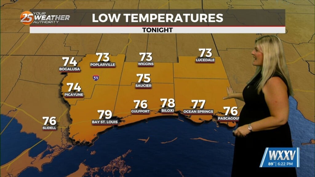
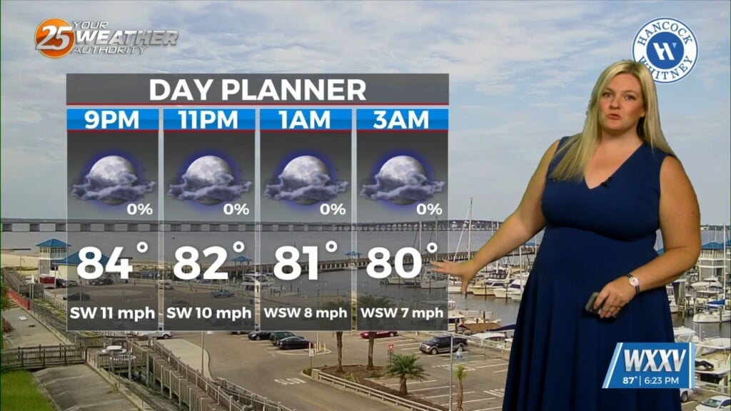
We’ll start off our Thursday night on a quiet note with partly cloudy skies and comfortable temps dipping into the mid 50s.
Friday looks fantastic with plenty of sunshine and a warm afternoon with highs in the low 80s. Winds will pick up a bit through the day, shifting from northeast to southeast by afternoon, giving us a nice breeze, but also bringing a little more humidity to South Mississippi as well.
Boaters should be ready for increasing winds and building seas through the weekend. Northeast winds on Friday shift to the east and strengthen, with waves around 3 to 4 feet. By Saturday, winds turn southeast and could reach 20 to 25 knots with 4-foot seas—making for choppy conditions on the water. We’ll likely see a Small Craft Advisory issued for coastal waters for Saturday and possibly into Sunday as well.
On land, clouds start to build back in Friday night, and by Saturday it’ll feel a bit more humid, and showers could arrive as early as late Saturday night around midnight.
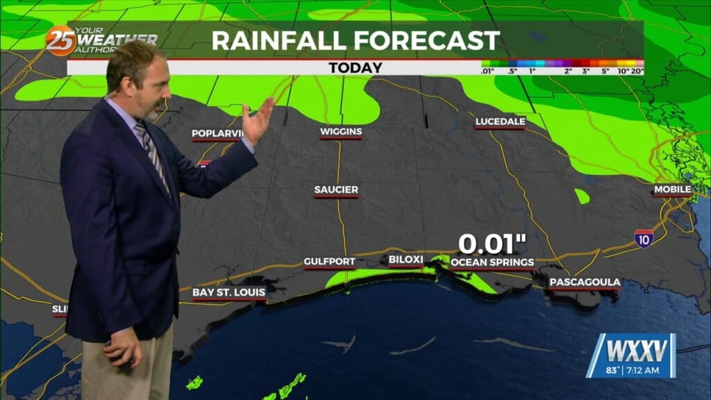
Sunday brings the best chance for rain, with showers and a few thunderstorms likely, especially through the morning and early afternoon. It won’t be an all-day washout, but keep the umbrella handy and the WXXV25 Weather Authority App if you’ve got outdoor plans. Highs will stay in the upper 70s.
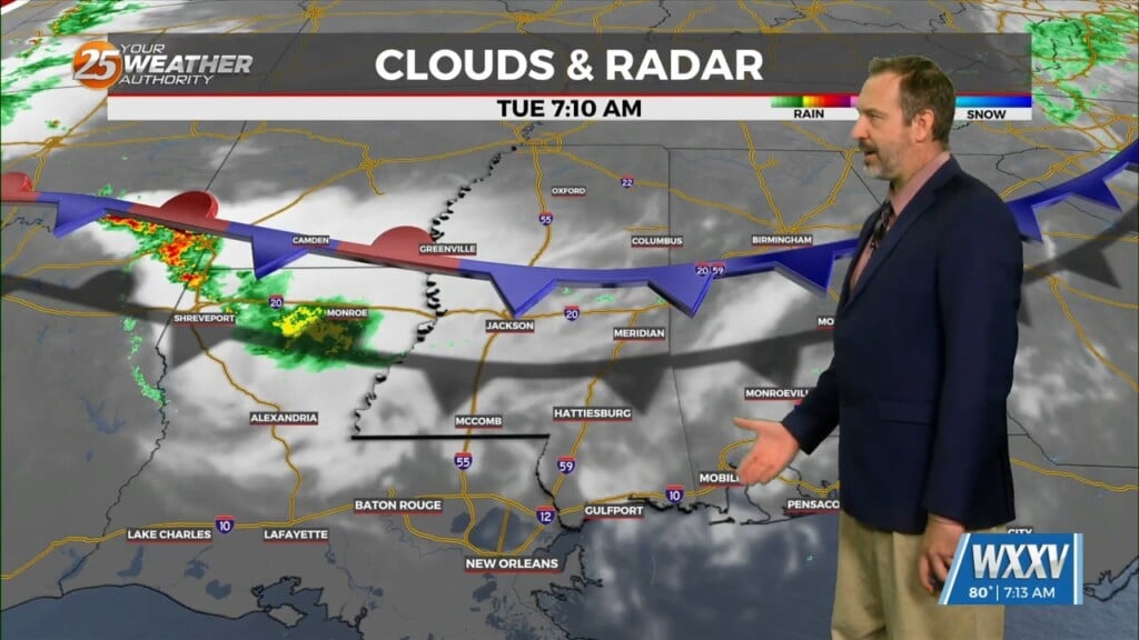
As we move into Monday, rain chances taper off and sunshine returns as a weak cold front comes through. We’ll hover near 80 once again before another slight chance of showers sneaks in Monday night and Tuesday.
By midweek, the second cold front will come through and then we’ll really start to feel that crisp fall air. Highs dip into the mid 70s on Wednesday and Thursday, with overnight lows falling into the low 50s and eventually mid 40s.