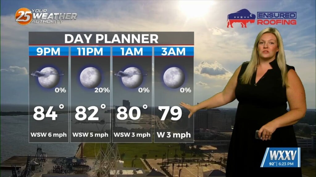
7/31 – Sam Lucey’s “Mostly Dry” Thursday Evening Forecast
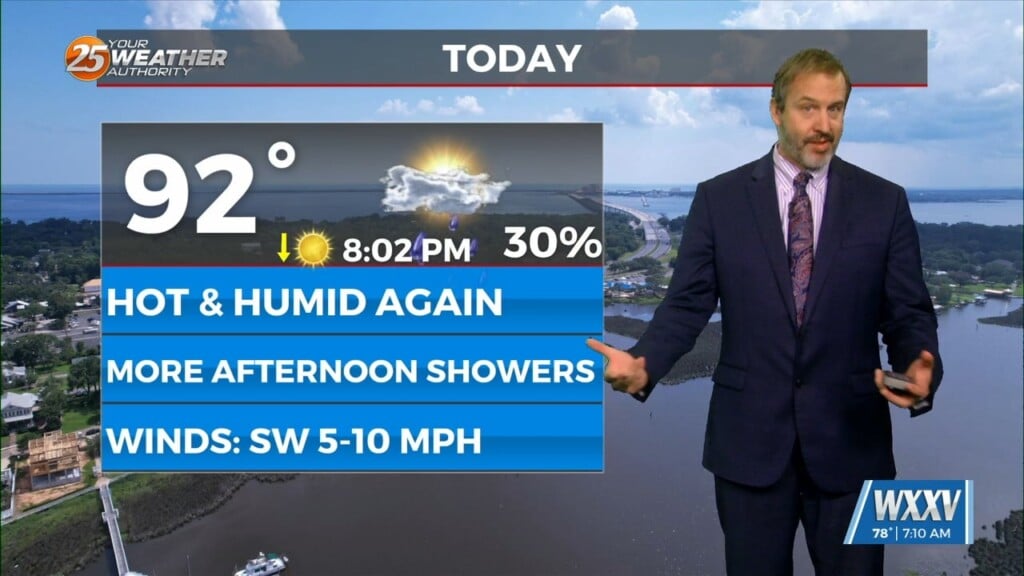
We’re looking at mostly clear skies tonight with temps dipping to the upper 70s. Friday brings sunshine early on, with the possibility for scattered showers and storms in the late afternoon, some of which could bring heavy rain. It’ll be hot too, with heat index values pushing 106. Rain and storms remain a possibility Friday night, with lows in the mid-70s.
The weekend continues the stormy pattern. Saturday through Monday, expect daily afternoon thunderstorms, highs in the low 90s, and heat index values over 100. Overnight lows will stay in the mid-70s, with scattered storms still possible.
By Tuesday and into midweek, more pop-up showers and storms are likely each afternoon, with temperatures holding steady in the upper 80s to low 90s. While it’s not a washout, keep your umbrella handy and stay weather-aware if you have outdoor plans.