7/16 – Sam’s “Stormy and Wet” Wednesday Evening Forecast
Invest 93L is creating unsettled weather across South Mississippi
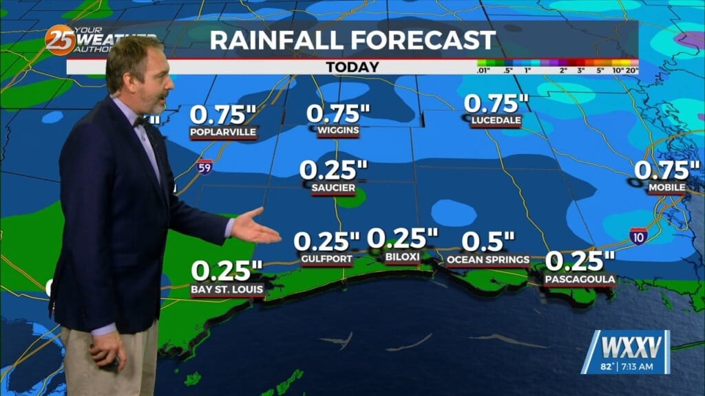
Widespread rain and storms continue to impact the region over the next few days due to Invest 93L moving west over the northern Gulf. Showers and thunderstorms will linger this evening, with scattered storms possible overnight, and temperatures hovering in the mid 70s.
Thursday looks stormy from start to finish, with a 90% chance of rain and highs near 89. With several rounds of rainfall expected, be on alert for localized flooding. An Areal Flood Watch remains in effect through early Saturday morning.
Rain chances remain high through Friday as well, with storms likely both in the morning and the afternoon. Temperatures will hover in the upper 80s to low 90s, before the rain chance tapers off by the evening hours.
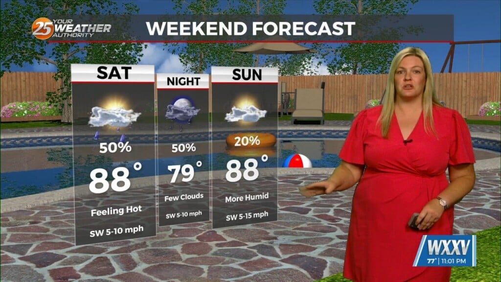
Saturday brings yet another round of storms, especially in the afternoon. The good news is that we could see a little sunshine returning by late Saturday and continuing into Sunday, with slightly lower rain chances. That does mean highs will be rebounding into the low to mid 90s.
Early next week we can expect a mix of sun and pop-up storms, with highs climbing into the mid-90s by Tuesday.