7/4 – Sam’s “Warmer and Mostly Dry” Friday Evening Forecast
Skies will stay mostly clear tonight across South Mississippi and nearby coastal areas, with lows dipping into the mid-70s and calm winds.
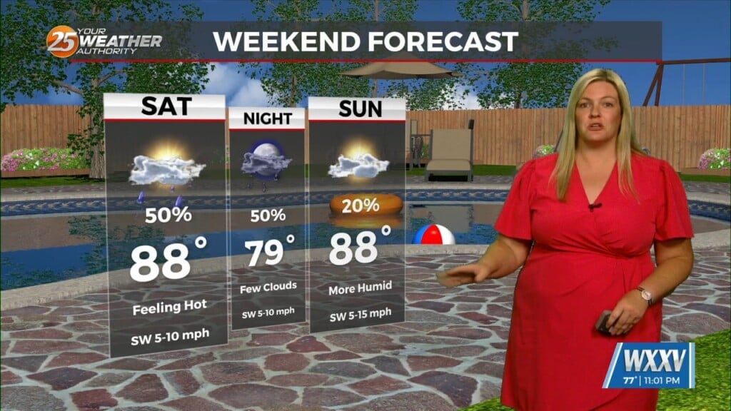
On Saturday, expect increasing clouds through the day with highs in the low 90s. A few isolated storms could pop up during the afternoon, especially after 2 p.m. Winds will shift from the north to the south later in the day. Saturday night looks mostly quiet with only a small chance of an evening storm.
Rain chances go up a bit on Sunday, with scattered afternoon storms possible. It’ll still be warm and mostly sunny, with highs in the low 90s. Light winds will turn from the northeast to the south. A few storms may linger into the evening, but most areas will stay dry overnight.
The pattern stays pretty typical for this time of year as we head into next week. Expect a mix of sun and clouds each day with daily chances for showers and storms—mainly in the afternoon. Highs will remain in the low 90s, and overnight lows will hover in the mid-70s.
Storm chances become more widespread by late next week, especially Thursday and Friday, when scattered to numerous storms are likely. While not everyone will see rain each day, some storms could bring locally heavy downpours, lightning, and gusty winds—so it’s a good idea to keep an umbrella handy and check the forecast often.