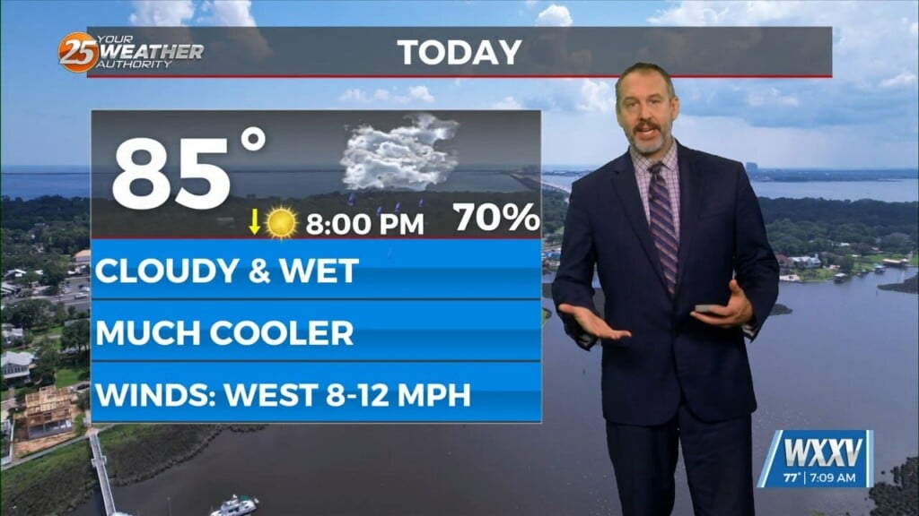
1/26 – The Chief’s “Heavy Rain, Round 3” Friday Morning Forecast
With a stalled frontal boundary overhead and moisture surge from the GOM, another round of showers/t-storms will move in around mid-morning. Moisture values will support very high rainfall rates at times, but have opted not to put out a flash flood watch for now as the convection may turn cold pool dominant fairly quickly and push more over the eastern waters in the early afternoon hours. If this occurs, it will limit the overall flood threat. Further inland toward Baton Rouge and Southwest Mississippi, a slightly drier mid-level airmass lingering from the weak high pressure.
A very brief respite in heavy rainfall is expected to occur later this afternoon into this evening as the entrance region to the jet streak lifts to the north of the area. However, another region of enhanced upper level forcing will develop as the nose of another 100 knot jet moves into the Lower Mississippi Valley later tonight into tomorrow morning. The result will be the development of another line of thunderstorms over western Louisiana that will push east across the forecast area generally between midnight tonight and Noon tomorrow. There may be enough instability to support some strong to potentially severe storms during this time frame. However the probability of severe storms remains low, but not completely ruled out. By Saturday afternoon, the best dynamics will have shifted to the east as strong negative vorticity advection takes hold of the forecast. Gradually clearing skies and drier weather can be expected from mid to late afternoon Saturday.
A much quieter period of weather is expected to develop by Saturday night and continue through the end of the forecast period. This will be entirely due to a very persistent northwest flow regime remaining in place through the middle of next week.