03/22 – Brantly’s “Warm Up Continues” Sunday Night Forecast
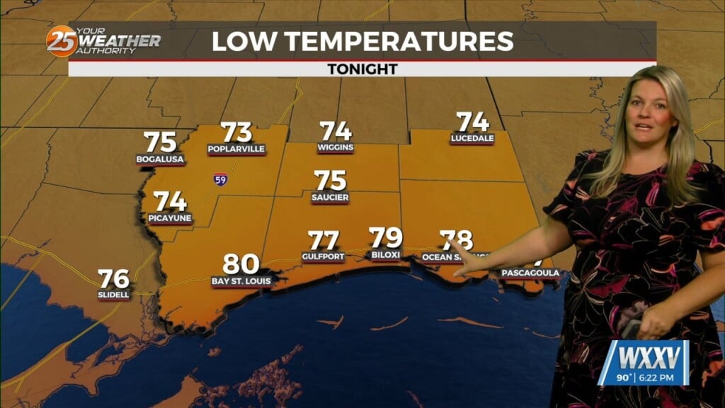
The warm front has lifted north from the coast to just north of the forecast area today with visible satellite imagery and surface observations clearing indicating the southerly low level flow and warm sector. Temperatures have responded with values rising substantially from the cool early morning values to well into the 70s to near 80 at mid-afternoon with no showers detected on radar.
Dry conditions are expected in most or all areas tonight with patchy fog possible after midnight through early morning on Monday.
Any showers on Monday should occur over mainly the more inland portions of the forecast area. Another shortwave trough and associated surface low pressure system is expected to move across the mid-Mississippi valley/Ohio valley region Tuesday into Tuesday night.
Energy on the southern periphery of this system and a weak frontal system sagging south to just north of the forecast area may bring a few showers to far northern/inland areas, otherwise mostly dry conditions are expected through the period, especially on Wednesday as a subtropical ridge aloft builds again over the Gulf of Mexico.
A gradual warming trend from day to day will occur with mid 80s highs becoming more common.


Leave a Reply