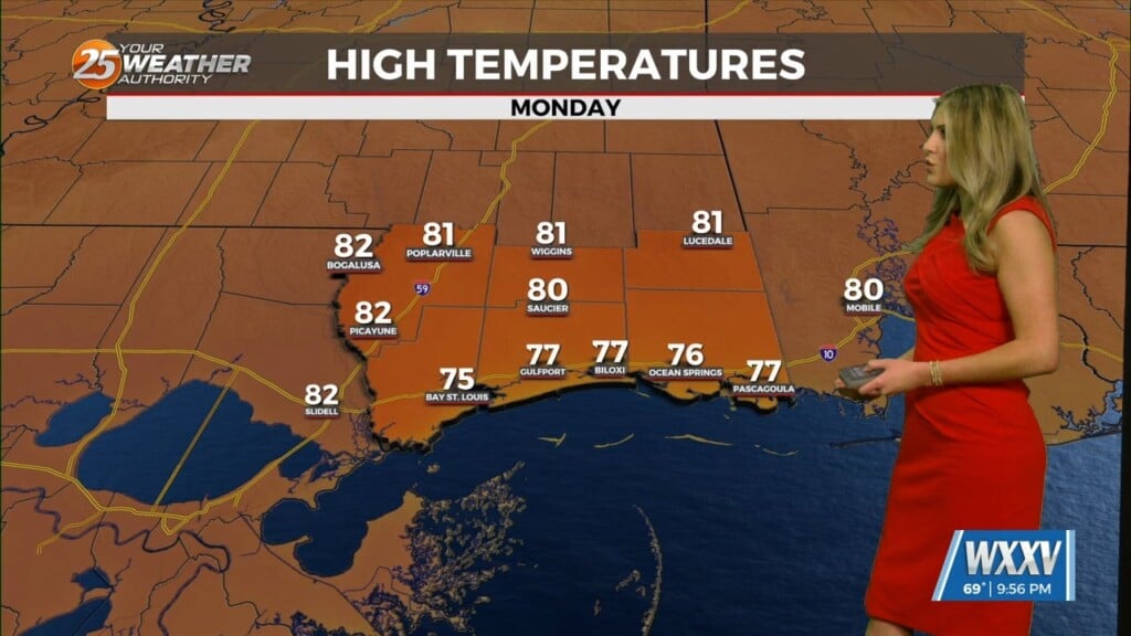
6/17 – Rob’s “DANGEROUSLY HOT” Weekend Forecast
With high-pressure to the south and an approaching cold front from the north, HOT & HUMID conditions area already in the area. A HEAT ADVISORY is in effect through this evening as the mercury will push into the mid/upper 90s…the HEAT INDEX will be between 102-110°. Isolated showers will begin overnight with showers and t-storms on-tap for Saturday. As the front pushes over the sound, it will begin to stall and wash out. Rain potential will continue for FATHER’S DAY with COOLER temps to close out the weekend and for the official start of Summer on Monday.


Leave a Reply