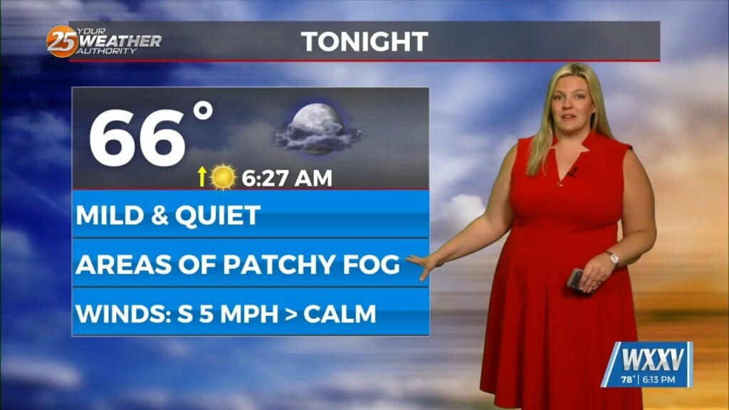
6/6 – Trey Tonnessen’s “Double Sun” Thursday Night Forecast
Meteorologist Trey Tonnessen
Upper ridging expands eastward across the Gulf of Mexico briefly over the weekend. This will keep any significant precipitation away from the area and high temperatures in the lower and middle 90s. Some potential for a weak sea breeze to temper highs on the Mississippi coast slightly, but that might be a late day occurrence. As East Coast upper trough reloads early next week, upper flow becomes northwesterly once again (similar to much of this week). This will push a weak boundary toward the area Monday or Tuesday, and will also open the door once again for seemingly daily mesoscale convective systems. Global models haven`t exactly been trustworthy in this type of pattern, and expect that to be the case again early next week.