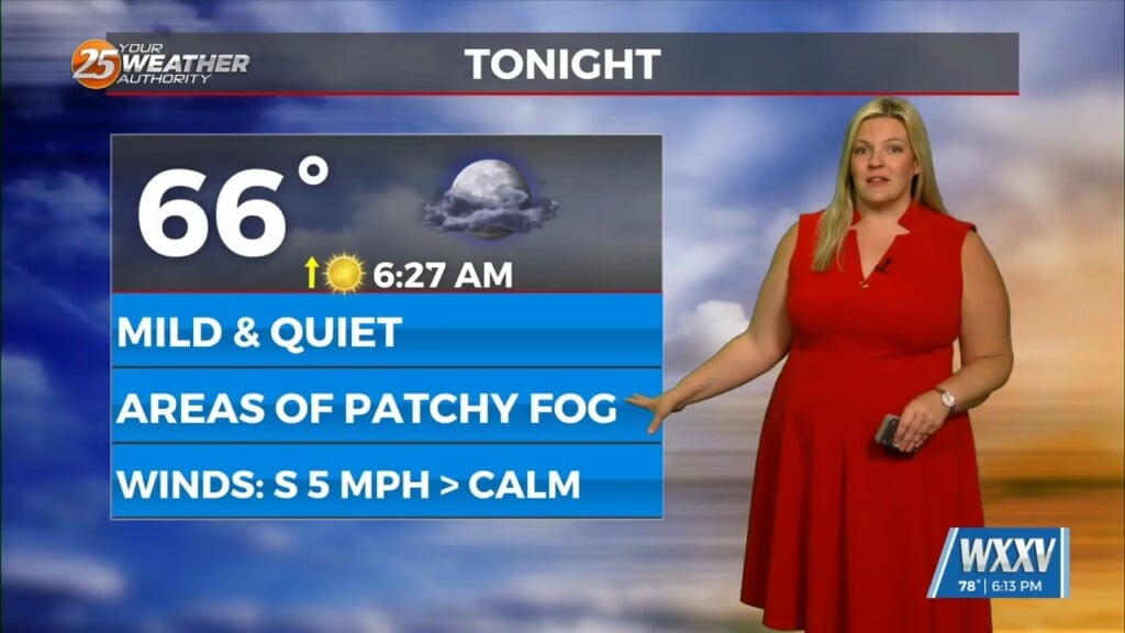
5/27 – Trey Tonnessen’s “Calculating Feel” Monday Evening Forecast
Meteorologist Trey Tonnessen
After a hot and generally dry Memorial Day weekend, temperatures will be trending back down some. Although we likely won`t get down to normal temps, at least shouldn`t be flirting with record highs. These cooler temps come thanks to an upper level trough that`s pushing south out of Canada. The first of a few embedded shortwave troughs is now passing across the Ohio Valley. The frontal boundary associated with the trough isn`t cold but definitely a bit drier. Locally today, still watching sea breeze convergence boundaries for afternoon convective potential. The best chance through the next few hours will probably be in Southeastern Louisiana along and south of Lake Pontchartrain. Earlier some activity tried to get going but the CAP aloft knocked them down pretty quickly.