5/19 – Night Rob’s “Weekend Changes Coming” Thursday Evening Forecast
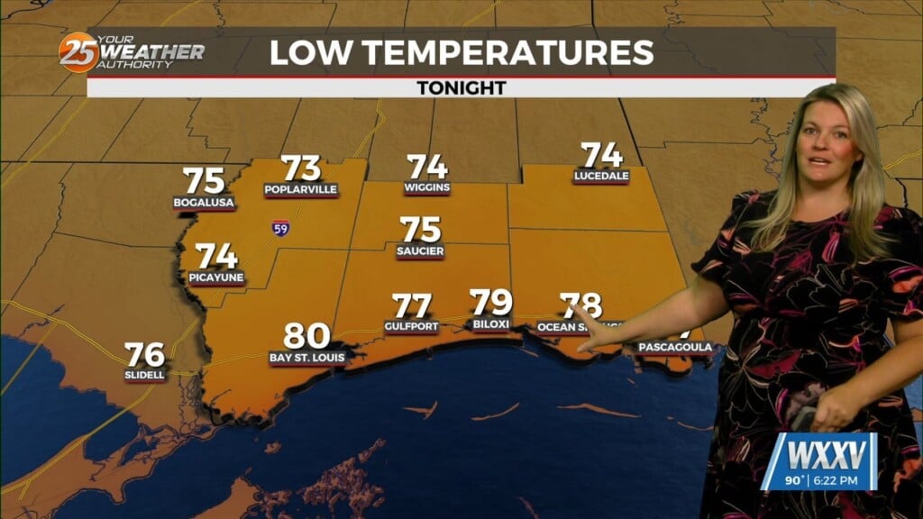
It was a bit more comfortable today due to a slight decrease in humidity and more of a sea breeze. However, tonight and Friday night’s lows will like be even warmer as a southerly flow off the gulf deepens. So, expect similar weather Friday with a slight chance (20%) of very spotty showers, although it looks like most of that will stay to our east.
High pressure continues to drift east Friday, which means less sinking air to counter rising air near the surface. Thus, our “cap” on thunderstorm development will end rather abruptly this weekend. Widespread and numerous heavy showers/thunderstorms get going Saturday afternoon with only a minor threat of anything severe…the main story will be rain.
A slow-moving front will also crawl through the region Sunday into early next week, with a peak rainfall day on Sunday, but continued afternoon/evening thunderstorms are likely through the middle of next week. Rain totals of 3-5 inches are possible from the Saturday-Tuesday time frame, which would put a dent in our 8-inch rain deficit for the calendar year. Increasing cloud cover will help to keep temps down considerably; highs may only reach the low-mid 80s, although overnights will remain on the warm side of seasonable.