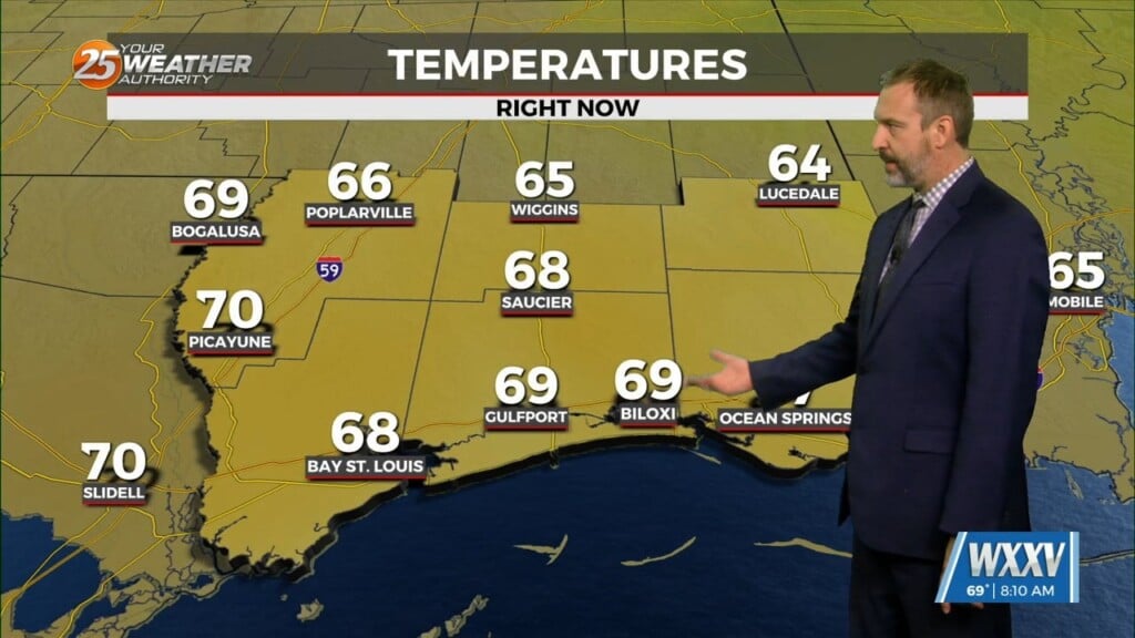
4/3 – Rob’s Monday Morning “SEVERE THREAT” Forecast
As a vigorous cold front approaches from the west, this morning will bring the threat for a few SEVERE T-STORMS. The main threat as the front moves across the Southern 6 will be HEAVY RAIN…which could lead to FLASH FLOODING, STRONG WINDS, HAIL and TORNADIC activity is also in the mix. The activity will move to the east by midday with clearing occurring this afternoon-evening. Please tune in to Wxxv25 “Today” from 5-9 a.m. for details, also download the Wxxv25 Weather App to help keep you safe and updated where evener you are.


Leave a Reply