2/6 – Jeff’s “GORGEOUS” Monday Afternoon Forecast
A beautiful afternoon is on tap for our area. Temperatures will be warmer than seasonal averages and there will be abundant sunshine. Clouds will be on the increase along with moisture tonight. There is the potential for fog to develop overnight.
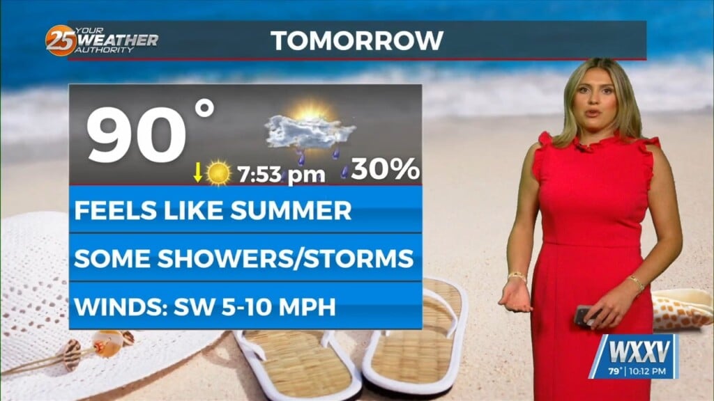
Skies Tuesday will be partly to mostly cloudy at times. There is a 30-40% chance of showers during the day. A frontal system moving out of the Rockies during the middle portion of this week will bring elevated rain chances. The best rain chances will be from Wednesday afternoon through Thursday.
South Mississippi is under a Level 1 of 5 risk for severity Wednesday. That is when the best heating, instability, and dynamics will be in place for isolated strong thunderstorms with damaging wind potential. The main issue will be efficient rainmakers as there is the potential for greater than 1 to 2 inches of rain.
The cold front will sluggishly make its way through our area Thursday. Moisture will gradually wane following its passage. It will take until the latter half of the day Friday to clear out entirely. This weekend looks to be cooler.