05/01 Ryan’s “Week’s Wettest” Friday Morning Forecast
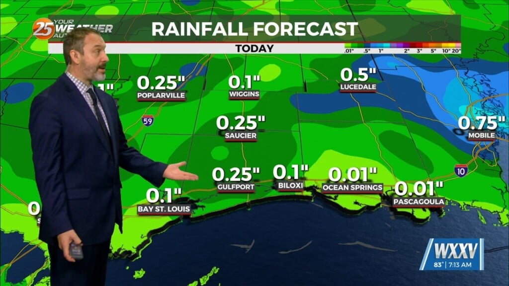
We've had a few rainy days this week, but today is looking like the wettest as it wraps up for the weekend.
We’ve seen some rainy days this week, but today will end up the wettest as the light rain will continue ahead of a final round of thunderstorms tonight. Biggest risks with this weather will be the potential for flooding as the heavy rain begins later this evening and continues into the overnight hours, especially in low-lying or poor drainage areas. There’s a low end risk of severe weather as well, with isolated winds in excess of 60 mph, quarter-sized or larger hail, and an even lower chance of tornadoes. The coastal areas have the highest chance of seeing this activity as we head into the overnight/early morning hours of Saturday. Chances are very low, but it’s always good to have a way to get warnings, especially for these overnight events. If you don’t already have it, now is a good time to download our free WXXV Weather Authority app for those warnings.
As far as today goes it’ll also be the coolest of the week with an afternoon high near 70 thanks to the grey skies and rain cooled air, with even cooler mornings ahead in the low 50s for the weekend.