01/30 Ryan’s “Warmer for Now” Friday Morning Forecast
We're waking up warmer than any other morning this week today, but it's short-lived as it gets even colder over the weekend.
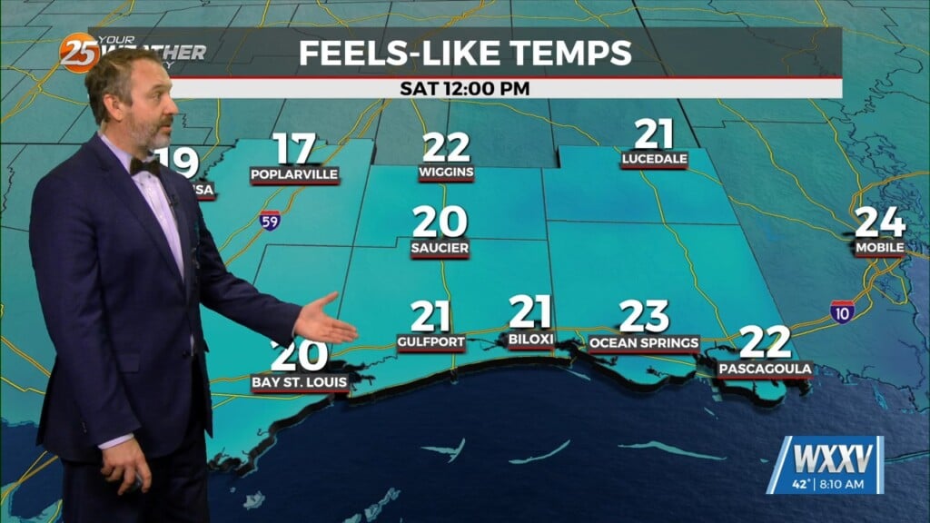
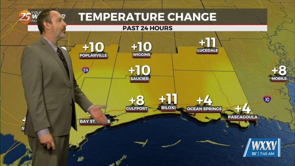
This morning is warmer than any we’ve seen so far this week, but still chilly in the mid-to-upper 30s and low 40s across the area. That tells you how cold it was earlier, since we’ve warmed every day and night since Tuesday and just now barely made it back to “normal.” This afternoon’s high will be the warmest of the week, rising into the low 60s fairly early on in the day around lunchtime ahead of today’s front that’ll bring a massive drop in temperatures. Lows will fall as low as 21° overnight, with winds upwards of 25 mph! That’s going to lead to wind chills in the low tweens-mid teens range initially, with more in the way of single digits by Sunday morning. Saturday afternoon’s high will fall into the mid 30s at the warmest, meaning wind chills Saturday afternoon aren’t likely to rise above 24 degrees!