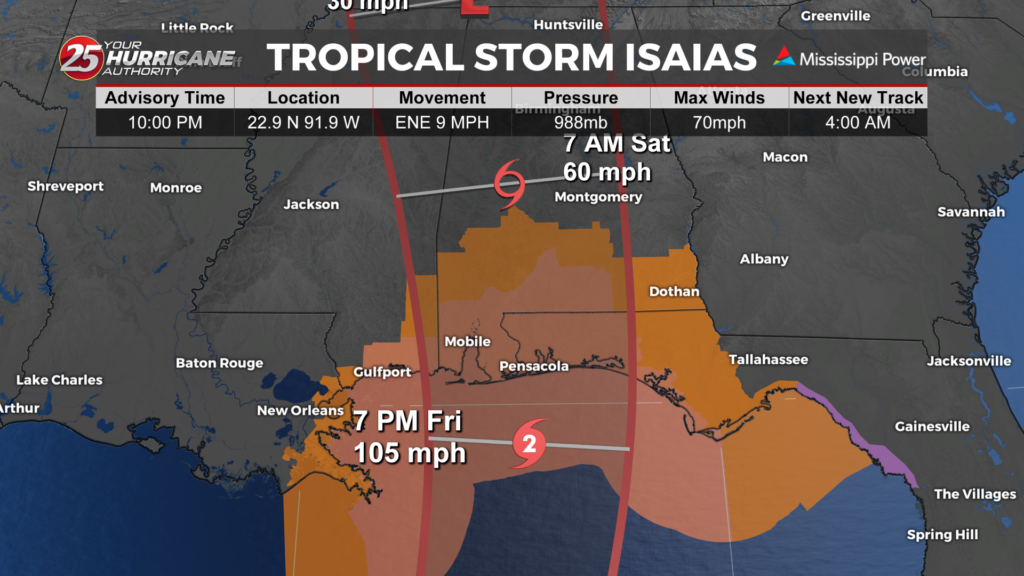
tropical storm and hurricane warnings issued as Isaias continues to strengthen


As of the 10 p.m. advisory, Isaias has maximum sustained winds of 70 mph and is moving east-northeast at 9 mph. The storm is expected to continue strengthening as it moves toward the northern Gulf Coast.
A Hurricane Warning is now in effect from Ocean Springs, Mississippi, to the Bay/Gulf County Line in Florida. This means hurricane conditions are expected somewhere within this area, and preparations should be rushed to completion.
For the Mississippi Gulf Coast, the biggest concerns will be hurricane-force winds, storm surge and heavy rain.
Earlier forecasts called for 5 to 7 feet of storm surge from Ocean Springs eastward. The exact amount of flooding will depend on Isaias’ track, the strength and size of the storm, and the timing of the surge with high tide.
Storm surge is particularly dangerous because it can push water inland quickly, flooding normally dry areas. People in vulnerable coastal areas should follow evacuation orders and instructions from local officials.