1/1 - The Chief's "Sunny & Warmer Welcome To 2024" Monday Morning Forecast
A very progressive upper level wave pattern will keep things rather unsettled through the short term period as a series of disturbances pass…
A very progressive upper level wave pattern will keep things rather unsettled through the short term period as a series of disturbances pass…
The main focus is once again on the possibility of a light freeze in areas that may not have experienced a freeze, then on the…
The biggest forecast challenge in the short term is the temperature forecast and the threat of a light freeze for many areas that may have not seen…
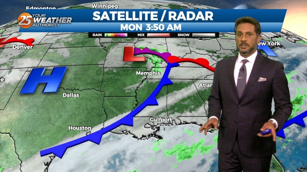
Weak upper level high pressure is currently over the southern Gulf of Mexico with a weakness moving eastward through Kansas. A stronger disturbance was…
An upper-level high-pressure sits over the Mississippi River Valley with weakness off the New England and California coasts. At the surface, high pressure was centered near the…
The general upper high pressure over the lower and middle Mississippi River Valley extends off the eastern seaboard. At the surface, high pressure was centered…
An upper-level disturbance moving into New England and the Pacific Northwest will provide for high pressure moving out of the Rockies into the Plains States. At…
The region will remain under a mostly dry northwesterly flow aloft today. Overall, temperatures will remain right around normal with most of the region climbing into…
There has been somewhat of a delay in surface winds responding to the system moving southward over the front range of the Rockies, but they will…
The current large scale pattern has an upper level closed low-pressure moving into the desert southwest and broad high pressure over the Caribbean, combining…
Weak high pressure in the upper levels will work in tandem with a surface to mid-level based high pressure system centered over the Deep South, will induce…
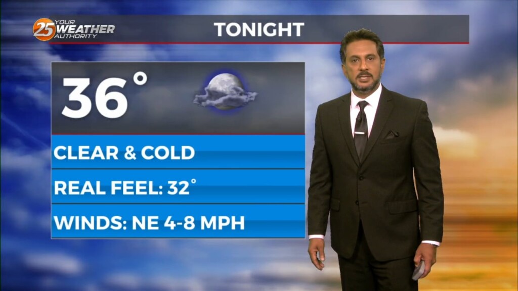
A departing surface high pressure will continue to induce light north to northeast flow, low Dew-points, and clear skies through this morning. Upper-level clouds will continue to…
The winds will begin to relax from west to east across the region this morning. Along with clear skies and calmer winds, temperatures have dropped well…
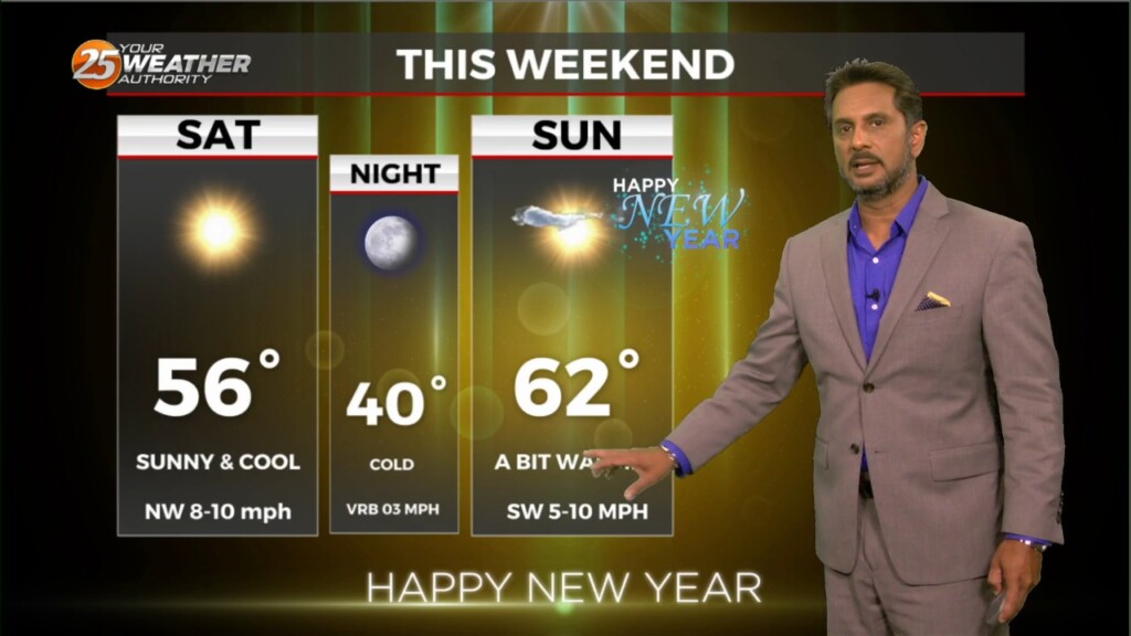
High pressure centered off the South Carolina coast will continue to shift east today, with a return of southerly flow and an increase in…
Temperatures will warm up nicely today with ample sunshine and upper level clouds moving in this afternoon. Surface high pressure will build to our east allowing…
A large upper disturbance over the eastern states will continue to move off into the western Atlantic on later today. High pressure albeit fairly weak…will…
A relatively benign pattern will continue today before a weak cold front moves through the area. This frontal passage is expected to be dry due to…
A broad upper level disturbance over the eastern third of the CONUS will be the primary feature impacting the forecast area through Wednesday. Pacific based…
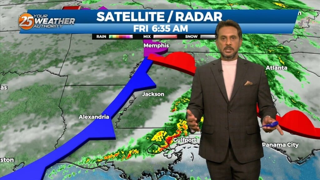
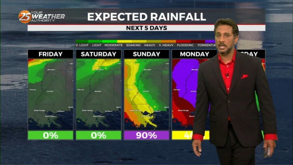
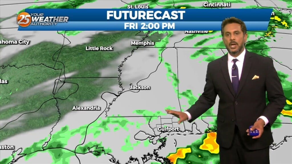
The first of 3 disturbances moving through this morning and should be out of the area by 10am today. This does not mean that the rain…
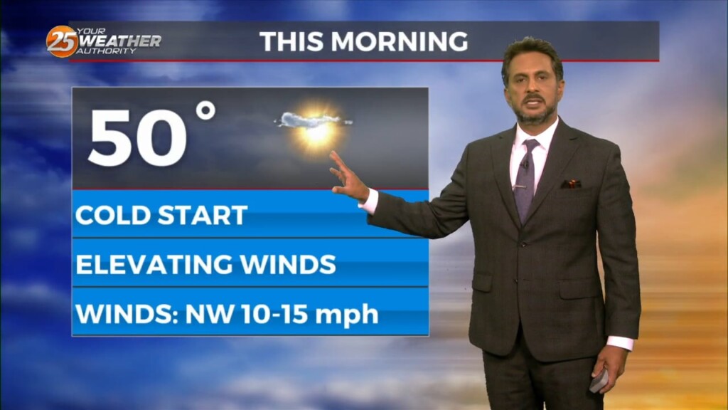
It’s a warmer start this morning but still cold across the region. Surface flow will begin to transition today as the high continues to migrate east and…
The midweek upper disturbance is now over Florida with weak high pressure over Texas. A northern stream disturbance extends from Hudson Bay to Lake Superior to the…
The upper level support for the system to the SW has now moved to the NE. The surface feature is to the south of the…
Mostly light showers have been intermittent across the region this morning as rain continues to move in from the south. An area of…
High pressure has shifted well to the east of the area, with a weakness running from the Great Lakes to near Phoenix. At the surface, a…