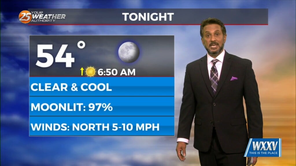
4/4 - The Chief's "Clear & Cool" Thursday Morning Forecast
A highly amplified pattern in the mid and upper levels will remain in place through Saturday night across the CONUS. Today into tonight, the forecast area…
A highly amplified pattern in the mid and upper levels will remain in place through Saturday night across the CONUS. Today into tonight, the forecast area…
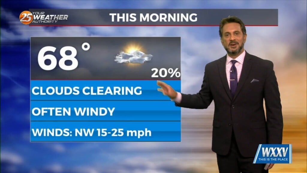
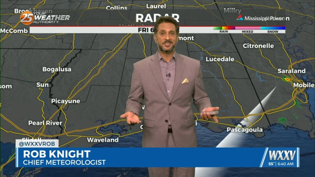
All precipitation has cleared the coast at this point as cloud coverage will continue through mid/late morning. High pressure to the NW will move in…
High pressure is moving eastward as a trough of low-pressure is progressing into the area, extending from the Great Lakes down through Texas. At…
No real issues to discuss today. High pressure over the Gulf will continue to dominate the region while low level temps keep slowly stepping up.…
We’ll likely see a period of sunny skies this afternoon and mostly clear skies overnight. However, the upper level support to this feature to the NW won’t…
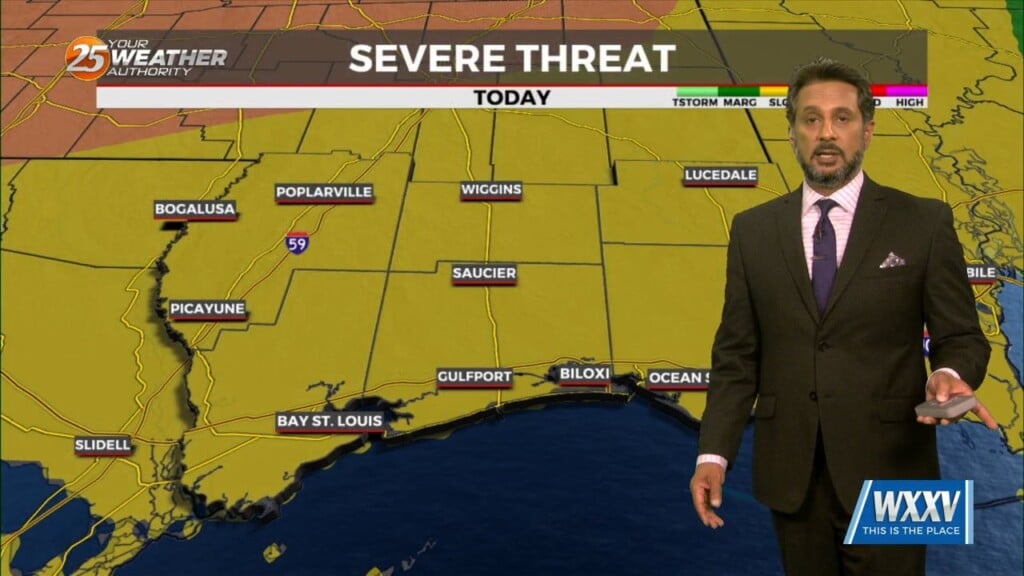
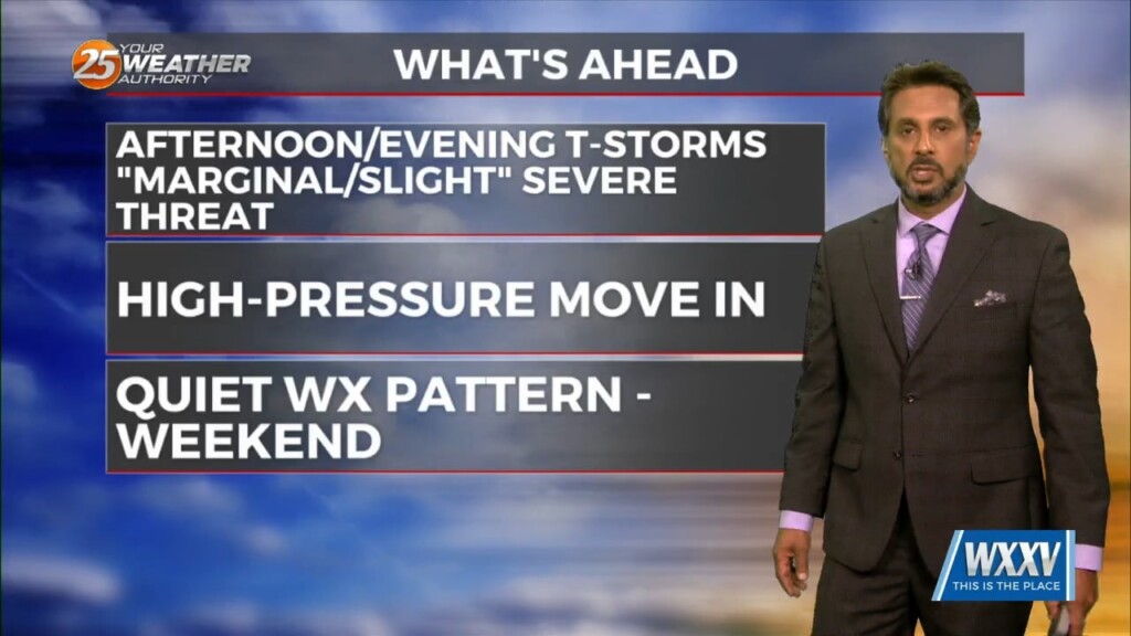
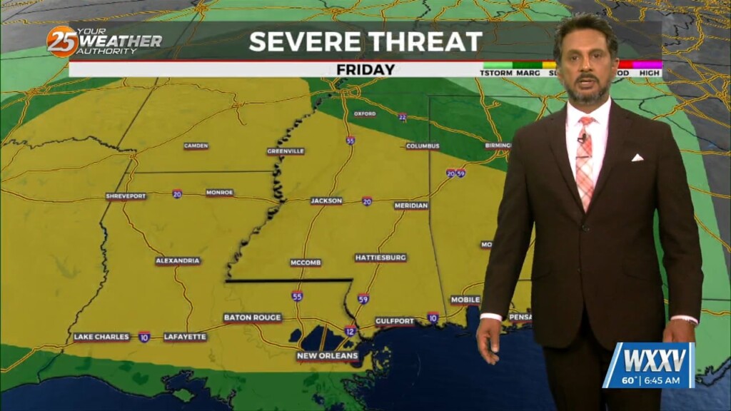
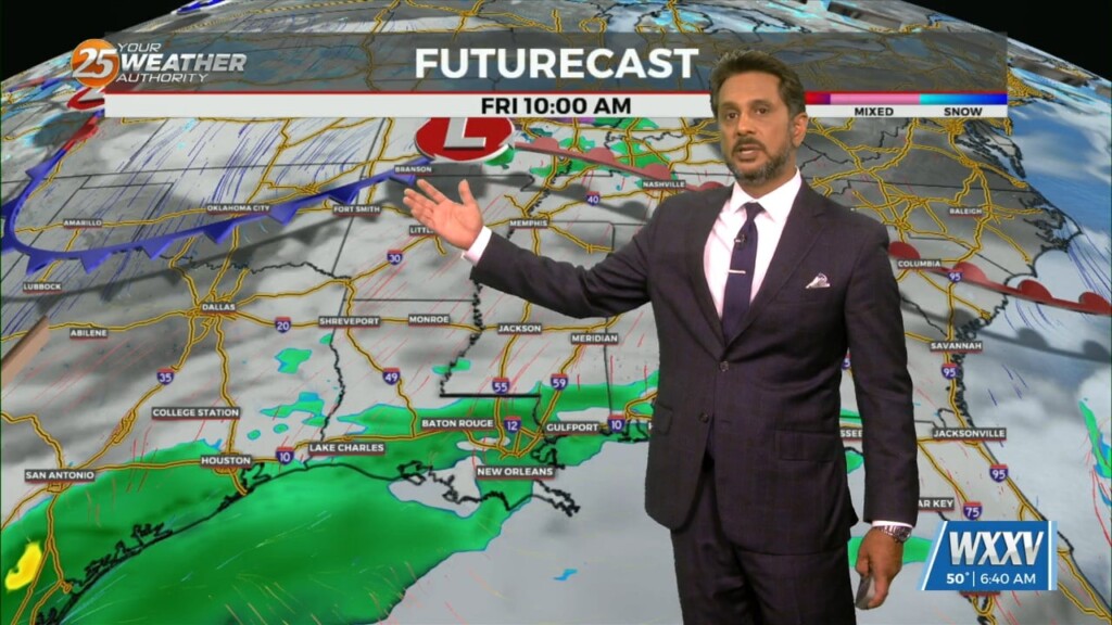
Anticipate multiple potential hazards in the first 24 hours of the forecast before the weather quiets down for a while. Low pressure over western Kansas this…

A system to the west with a warm front to the SW will continue to move E/NE and into the area this morning, crossing the local area…
An area of low-pressure remains over Arizona, with a cold front to the SE of the area. A few sprinkles early this morning, but that’s about…
Despite a fairly vigorous disturbance moving through the Lower Mississippi Valley today into tonight, a lack of moisture in the low to mid-levels of…

A surface warm front is at the coast moving northward continuing to destabilize the atmosphere. All variables that would support severe storms will also exist today…
A beautiful day is ahead with mostly clear skies becoming partly cloudy this afternoon. The next frontal system will be getting together by tonight as the…
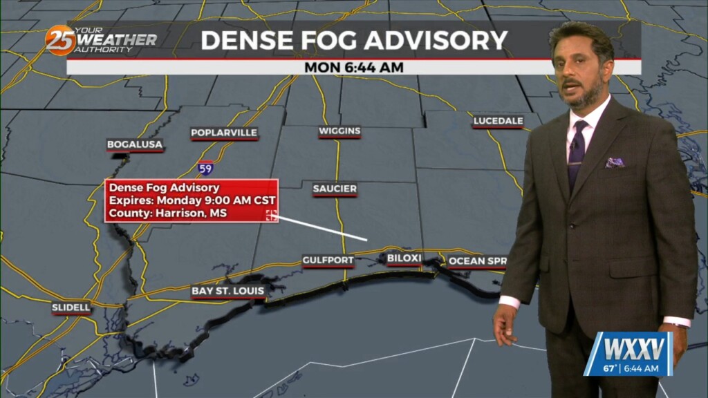
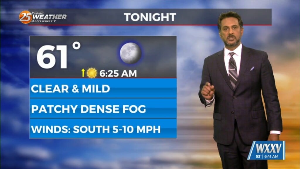
Dense morning fog will be a factor though late morning with a dense fog advisory in effect. Tonight, sounding profiles are showing a…
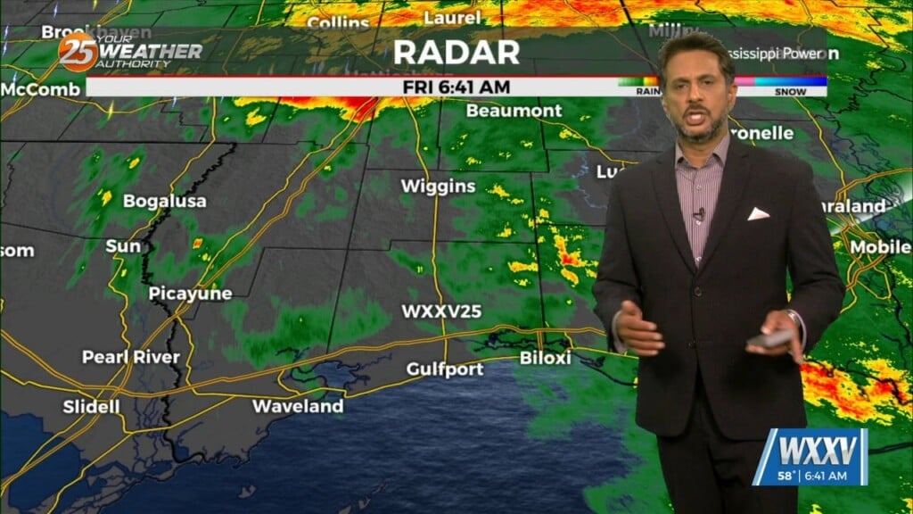
Multiple disturbances are moving through west-southwesterly mid-level flow across the northern Gulf Coast. Most of the thunderstorms with these impulses are expected to track south of the area.…
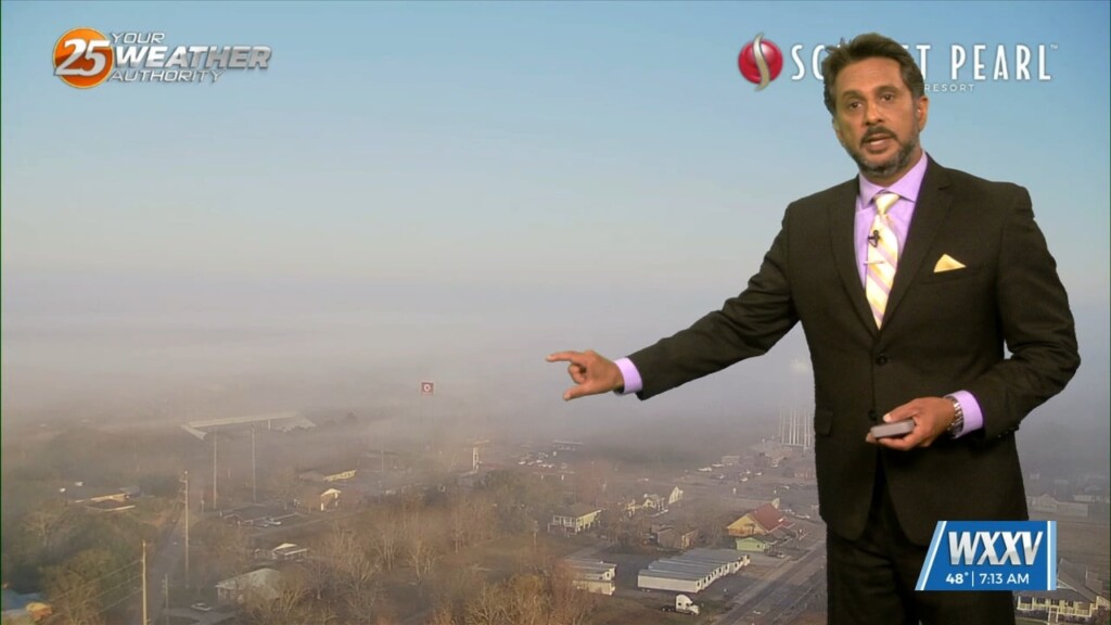
Fog will be in and out at most locations this morning. This fog should get lifted rather quickly by mid-morning as the entire boundary layer should…
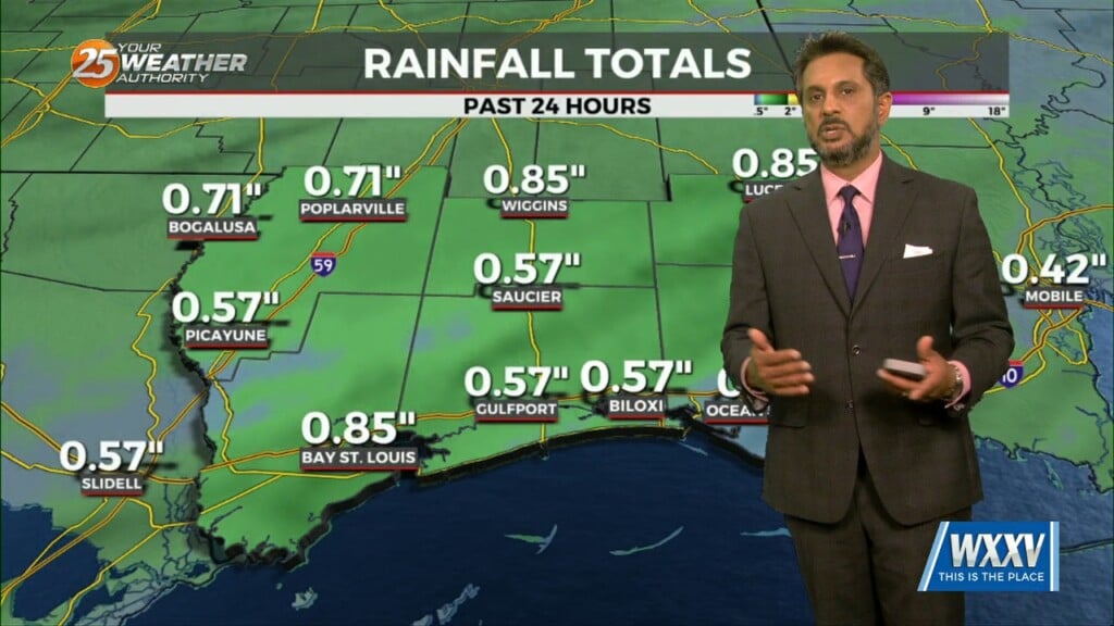
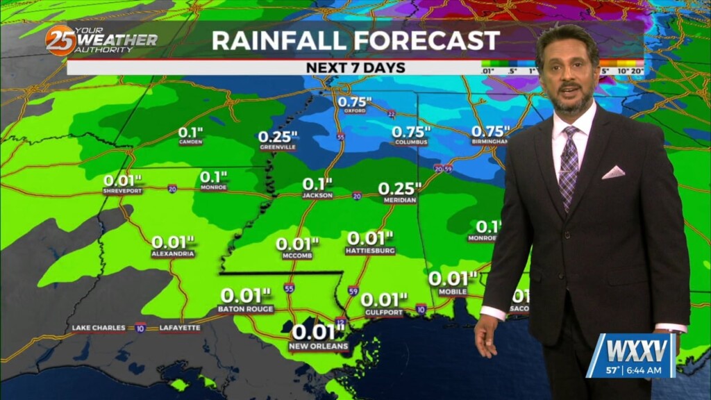
UNSETTLED is the word for the next several days. Heavy rainfall will tapper slowly through the day. Very few severe storms are expected with this…
A dry airmass continues to reside across the region this morning with a fairly active WSW flow aloft with moisture continuing to stream into the…
The only story this morning will be fog developing along the MS Gulf Coast. Aloft, a dry northwesterly flow should persist through the near term period.…

A cold front has cleared the area with cloud coverage clearing from west to east. The upper-level feature will also move through the area today…
An area of upper-level high pressure remains over Mexico with weakness off both coasts. At the surface, low pressure was centered over Oklahoma with a…
DENSE FOG ADVISORY in effect through mid-morning… High pressure extends northward from Mexico through the Plains States with upper level weakness off the Carolina and…
An area of upper level high-pressure extends from western Mexico northward through the Rockies. At the surface, high pressure extended from New England to the Louisiana…
A broad region of enhanced upper level forcing will develop over the Gulf South today and continue into Saturday. This forcing will be driven by the…
No significant changes in forecast though the weekend. An area of low-pressure along the W’tern Gulf will bring higher rain chances for the start of the weekend.…

A post frontal airmass continues to push into the region with the center of surface ridge currently over the state of Mississippi. The remainder of…