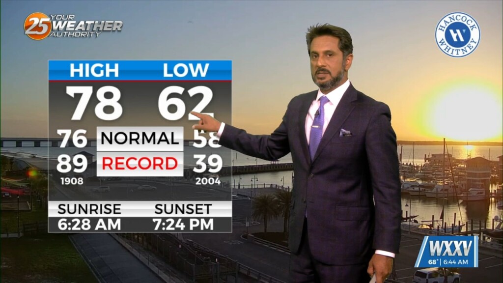
5/16 - The Chief's "Humidity Returns" Thursday Morning Forecast
The old frontal boundary is stalled near the coast this morning and drapes inland near Terrebonne Parish westward to Beuregard Parish. The back end of this front…
The old frontal boundary is stalled near the coast this morning and drapes inland near Terrebonne Parish westward to Beuregard Parish. The back end of this front…
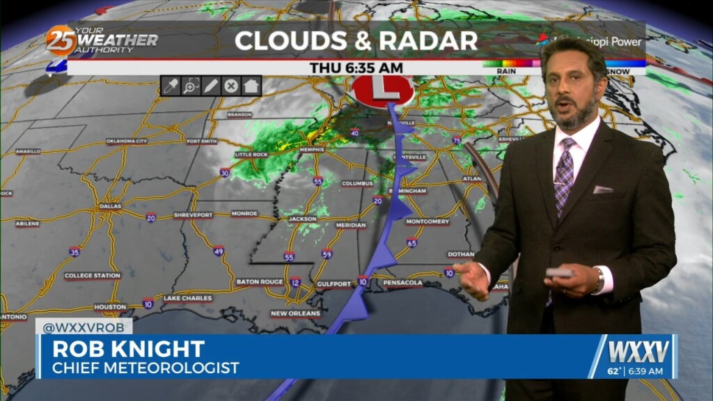
A cold front is currently slowly moving south through the area this morning. This boundary will be very important for this forecast, as it will…
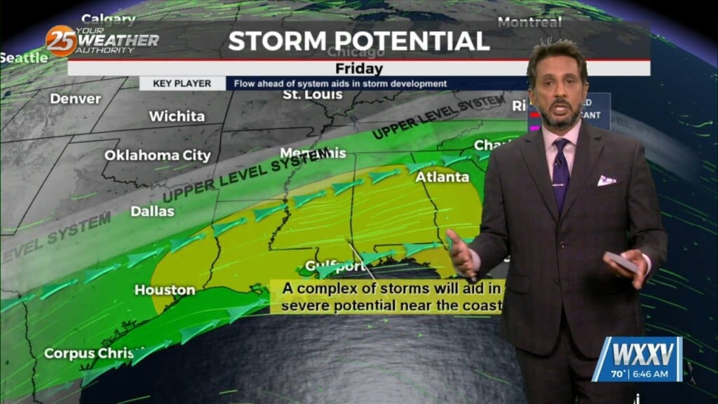
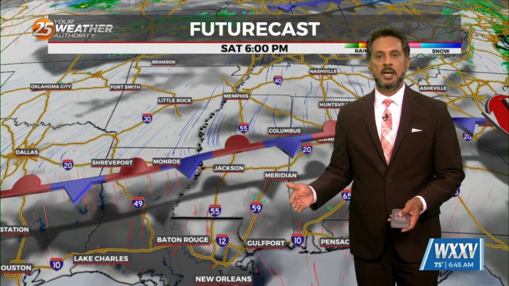
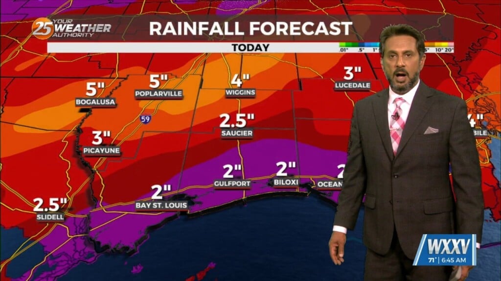
The upper flow is now supportive and subsequent lower level flows are also lining up to support the training of HEAVY RAINFALL. The first of 2 rounds…
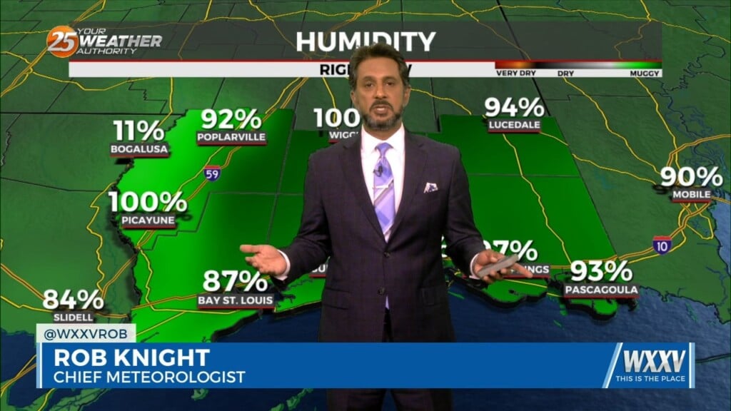
Cold front is moving through the area this morning and will be slow to do so. Dry air will move over the area bringing cloud…
First things first this morning it appears there could be a few isolated low topped showers develop with the initial impulse moving into NW Louisiana.…
A rather zonal/progressive upper level flow will continue through the morning and into the afternoon hours across our region. Later today and…
T-storm complexes will stay on the lee side of the Rockies this morning and have been for a while. Another weakening one is moving up from…
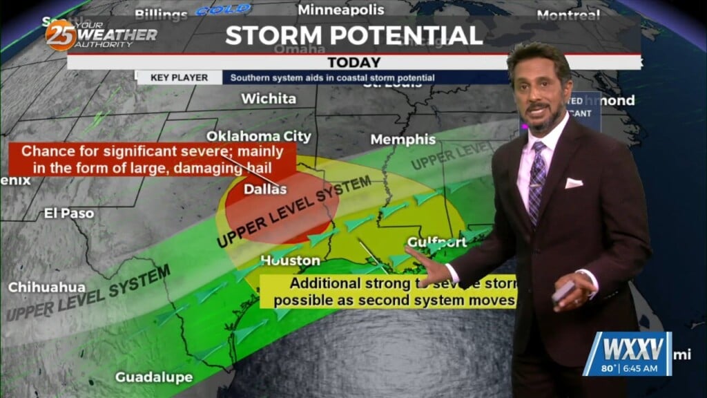
A disturbance along the NE’tern portion of Texas will continue to eject to the NE moving across the extreme NW portion on Mississippi later this afternoon. Friday…
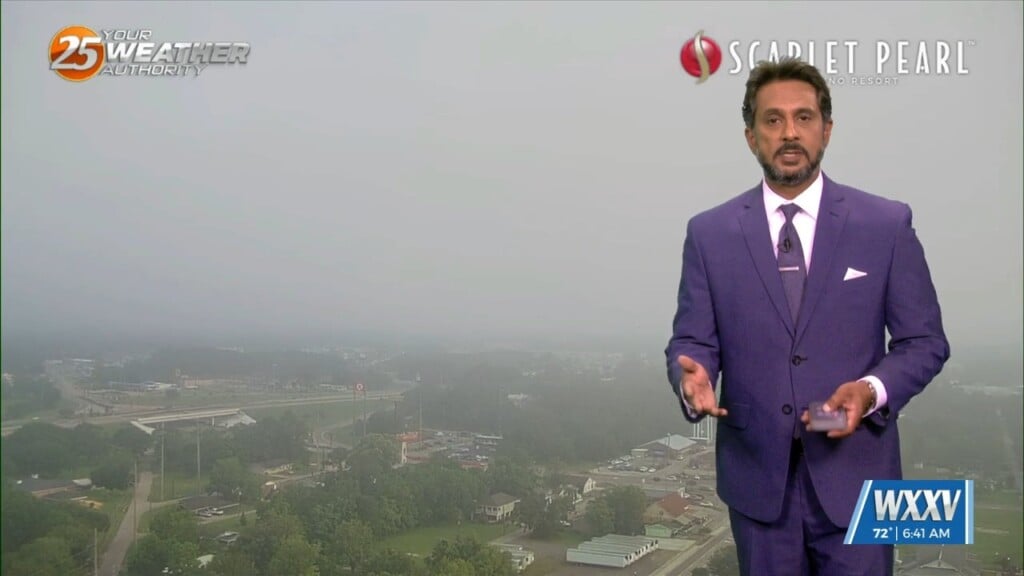
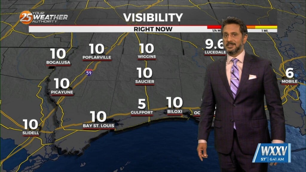
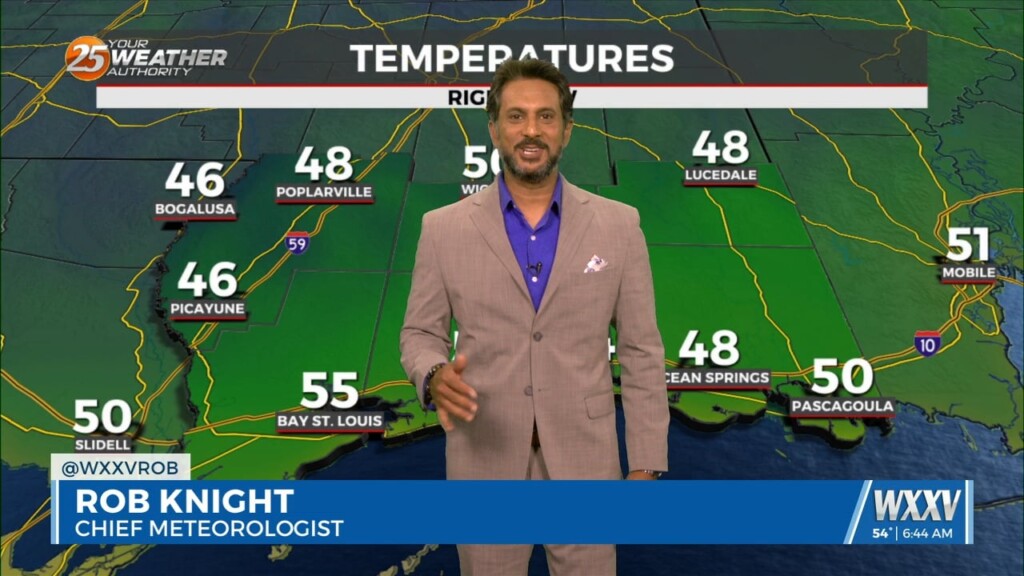
Dense fog should quickly burn off in the following hours after sunrise and temperatures will rapidly warm into the upper 80s to low 90s area…
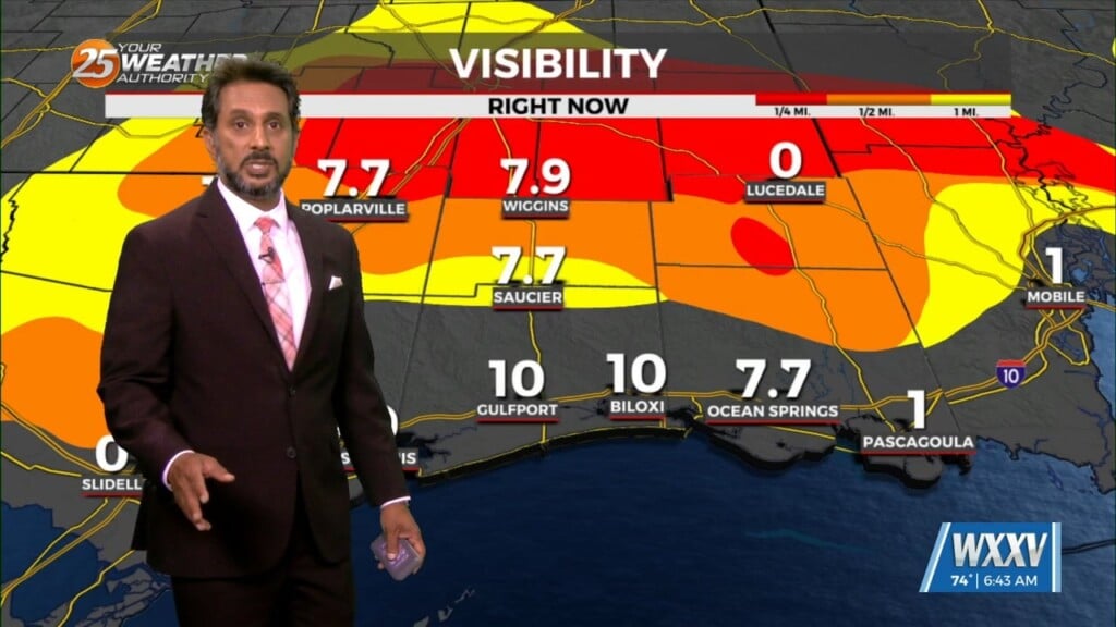
Fog has been an issue this morning and will continue to be a factor through the weekend. The cloudy skies are hanging on over areas where the…
Finally…winds will begin to weaken today dropping below advisory thresholds. But there will still be gusts to 25mph at times and even higher winds up…
Another wonderful day ahead with sun and clouds mixed, with increasing cloud coverage tonight. A tightening gradient will continue to bring breezy conditions to the area…
With high pressure still in control along with a weak cold front to the NW, sunny skies and a zonal/progressive upper flow regime across the…

In the wake of yesterday’s cold front, strong dry air surge at the mid and upper levels is continues to move into the area.…
As temperatures warm into the 80s, low level instability will increase and some cumulus development is expected to take hold by late morning. However, a…
High pressure continues across the Gulf of Mexico, with an upper level disturbance noted over southern Minnesota and over Saskatchewan into the Idaho Panhandle. Surface…
High pressure extended from the Gulf of Mexico to Wisconsin, with an upper-level low pressure near the Colorado-Kansas border. Low pressure was noted over Nebraska with a…
The upper air pattern shows high-pressure extending from south Texas to the Dakotas, with an upper low-pressure centered near Las Vegas. At the surface, high pressure…
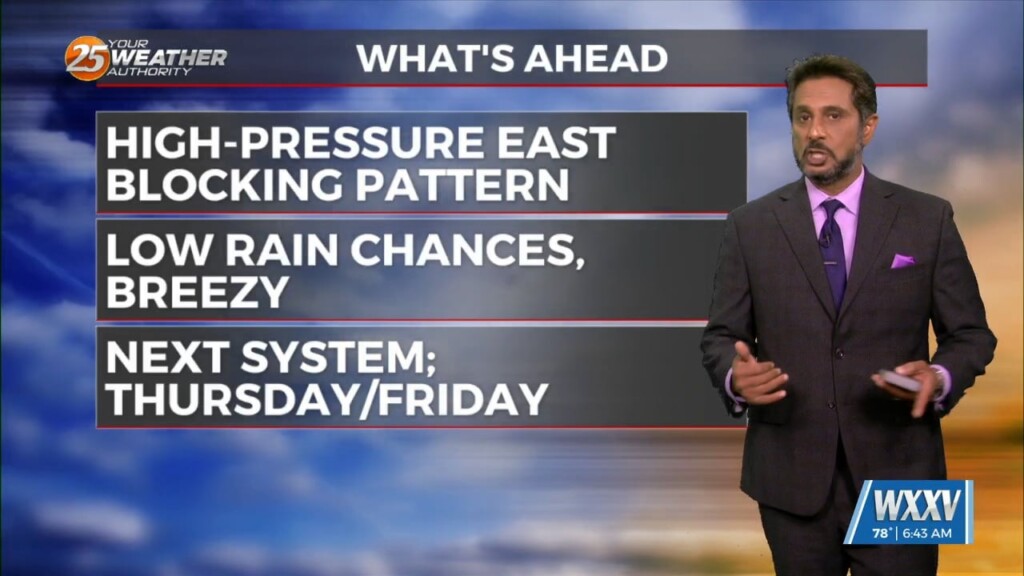
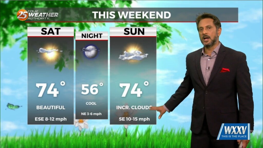
MAKE PLANS FOR OUTDOOR ACTIVITIES THIS WEEKEND... High pressure moving into the region from the NW will provide for dry conditions, which will go a long…
Now that the most violent weather has moved east, we will now work with the back side of the surface low-pressure that still wants to hang…
A stable layer in the low-levels of the atmosphere is eroding, Which thus far has protected us so far, but this is currently leaving and…
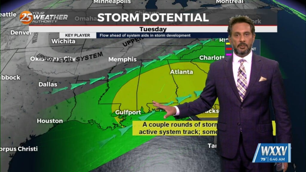
Again today, we should see showers and a few t-storms around. But as we move forward in time, a few of these storms could become…
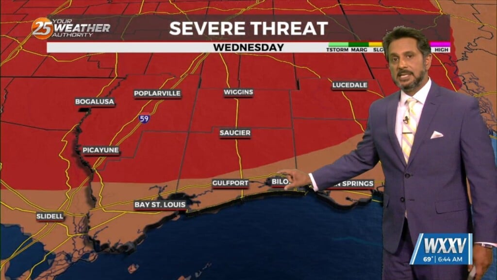
Cloud coverage and breezy conditions will increase this morning as an approaching cold front to the west stalls. Early Wednesday we will see a cold front…
Overall, entire weather pattern is benign with the high pressure bringing moderate temperatures and no precipitation. Northwest flow aloft will give us one more night of cool…