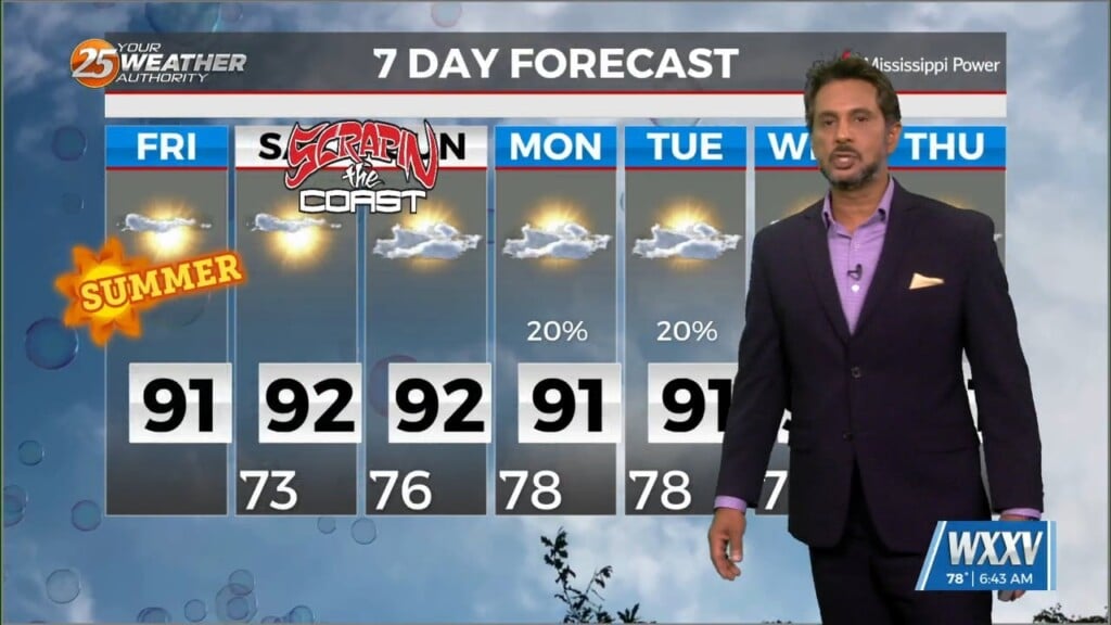
6/25 - The Chief's "Heat Advisory" Tuesday Afternoon Forecast
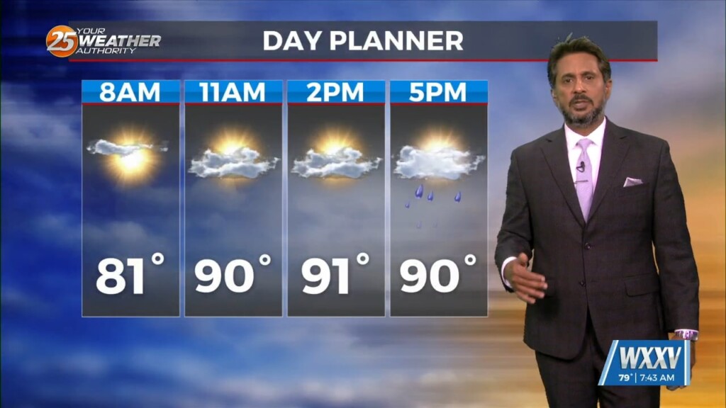
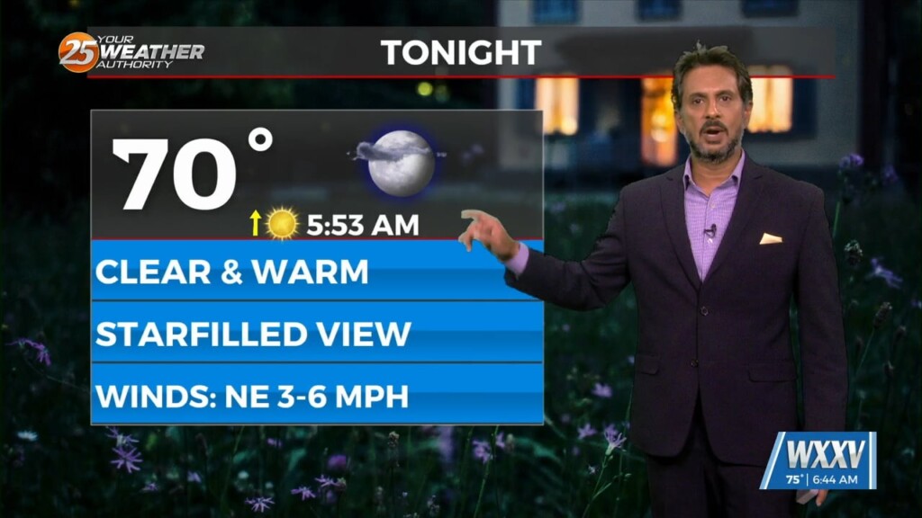
Just walk outside and you will know the forecast. It`s Summer, hot, muggy, daily rain chances, and just downright oppressive conditions. This afternoon temps will warm into…
Just walk outside and you will know the forecast. It`s Summer, hot, muggy, daily rain chances, and just downright oppressive conditions. This afternoon temps will warm into…
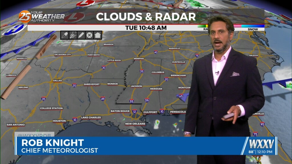
The main story today will be the heat as high pressure continues to spread eastward along the Gulf Coast today. Low level moisture will be on the…
While the low level circulation of former Tropical Storm Alberto dissipated yesterday afternoon, the mid and upper circulation is still evident with…
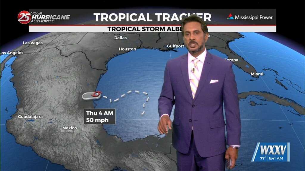
Tropical Storm Alberto has made landfall along the Mexico coastline and continues to move west and weaken. As the pressure gradient weakens, the wind field should…

Strong high pressure is centered over Pennsylvania extending southwestward to Mississippi and Alabama. Potential Tropical Cyclone One (PTC 1) continues over the southwestern Gulf of Mexico…
Currently an area of high pressure is centered over the Carolinas with a weakness over the Rockies and Intermountain West. The area of low-pressure over the…

An area of high-pressure is currently centered over the Carolinas this morning, with a weakness along the southern plains. This is combining with the Central American flow to…

Activity will remain suppressed today and tomorrow as high pressure becomes centered over the region. Very dry air aloft associated with subsiding air will…
Today will bring increasing subsidence through the area.as high pressure begins to expand eastward from the southern Plains and Texas. At most, some fair weather cumulus cloud…
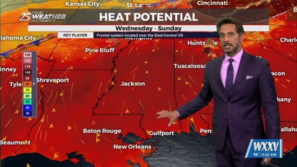
Overall the forecast as a whole is a tale of two scenarios with the first part being: high confidence, mostly dry, and HOT. The second part:…
At the surface, a frontal boundary was drifting into the N’tern GOM. Dew-points are in the low/mid 60s in the area with slight cooler temperatures this…
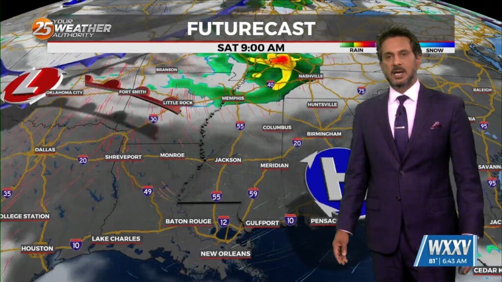
The first 24 to 36 hours of the forecast are somewhat uncertain. Currently we have widely scattered showers that have been developing off the coast along…
The very weak front has finally settled and now stalled in the outer-coastal waters. The drying throughout the column has been achieved bringing rain chances close to…
The front that has been talked about is arriving this morning. This is more of a weakness at the surface than a front, but there is some…
A cold front has a surface low-pressure system in Manitoba this morning with a front from there through Wisconsin to Missouri to around the…
As a stalled boundaries form last week move northward and leave the gulf coast, rain chances will drop off through the weekend. A…

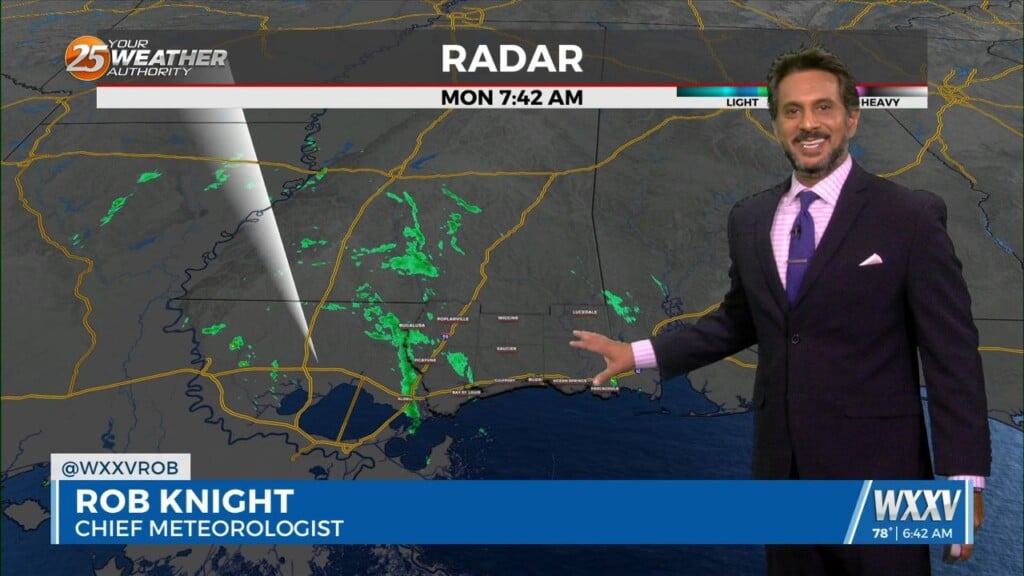
The old front has backed off into central Mississippi which is where showers/t-storms are developing this morning. A few storms are moving NE as they follow this…
An upper high pressure remains over Mexico but has been suppressed southward by a weakness extending from the Great Lakes to Texas. A cold front…
Upper level high pressure near the Bay of Campeche continues to nose up into the western Gulf of Mexico and Louisiana. Energy will…
A disturbance moving east over central Mississippi this morning will help cause some shower activity over the northern half of the area. There will be some boundaries…
The fight between a series of fast moving disturbances sliding along the I-20 and further north and high pressure to the E/SE will be the main forecast…
Little change in the ongoing pattern of deep layer high pressure currently in place across the Gulf South is expected through Thursday night. The result will be…
High-pressure and strong dry air in the mid/upper levels of the atmosphere will continue. This will effectively suppress cloud development to below the inversion, and result in…
Strong high pressure will dominate the Gulf South through the entire short term period. The deep layer subsidence associated with this high pressure will result in…