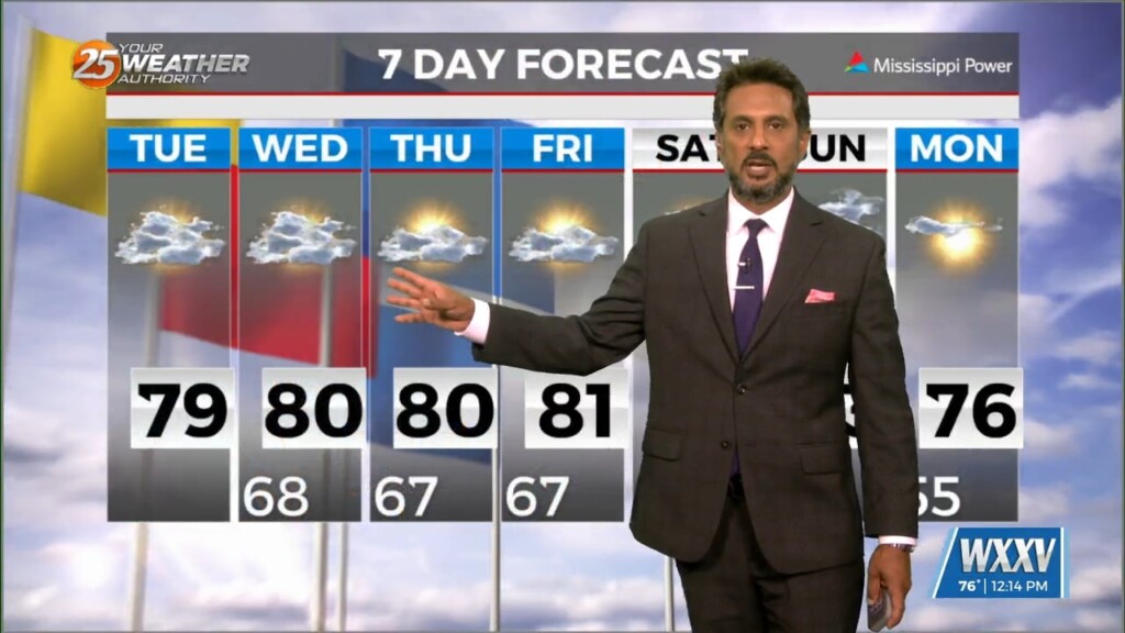
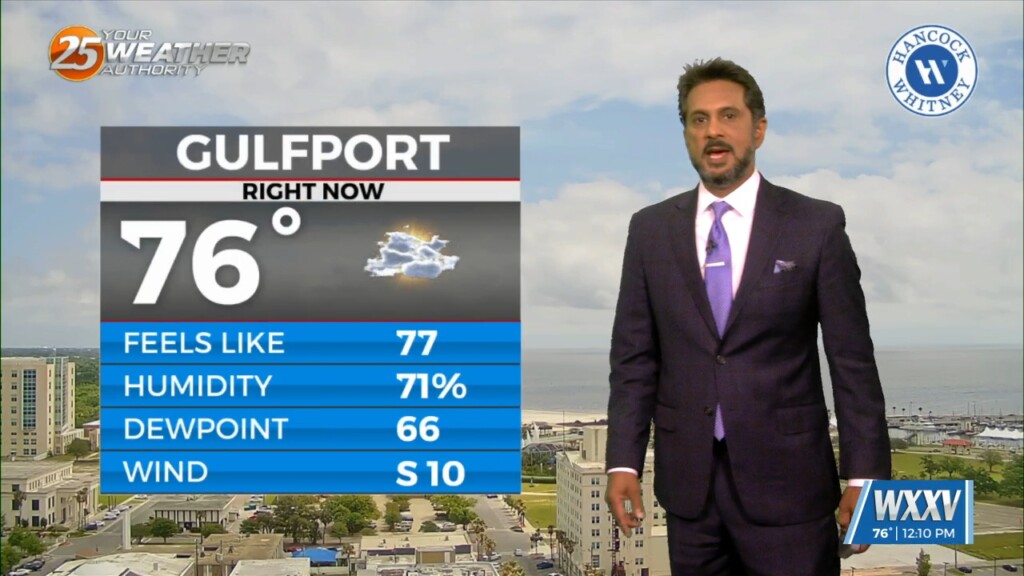
6/18 - The Chief's "Tropical Moisture Slowly Departing" Tuesday Afternoon Forecast
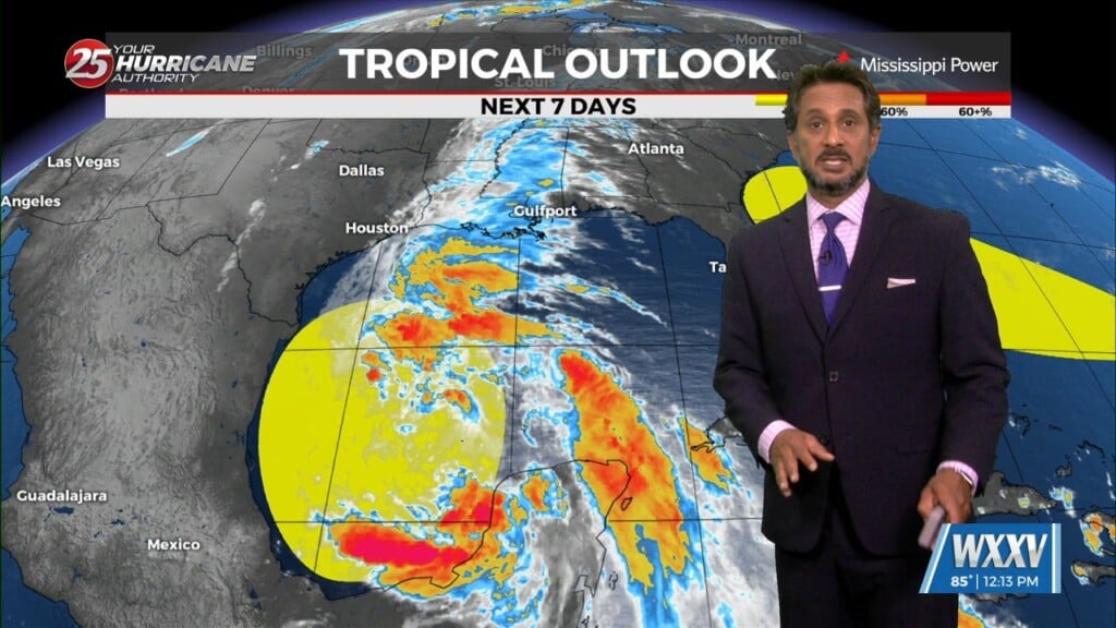
The area of low-pressure over the Bay of Campeche has been designated Potential Tropical Cyclone 1. Still have a fairly significant surface flow between the…
The area of low-pressure over the Bay of Campeche has been designated Potential Tropical Cyclone 1. Still have a fairly significant surface flow between the…
A drier air mass will continue throughout the column bringing rain chances close to zero. As high pressure moves into the region to shape the forecast…
A complex of t-storms well to the NW will continue SE and dissipate late this evening. The activity will move in to the region and traverse…
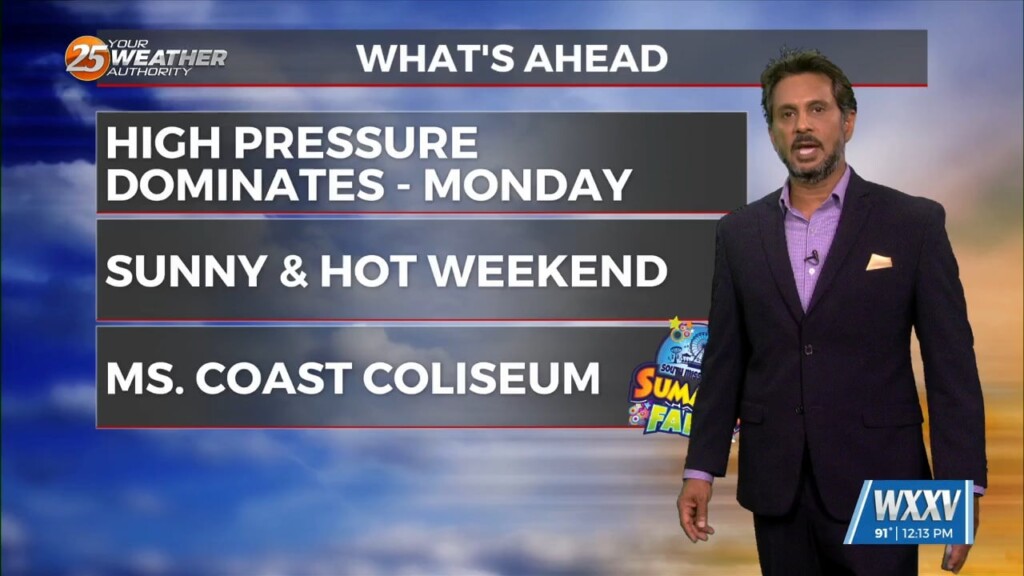
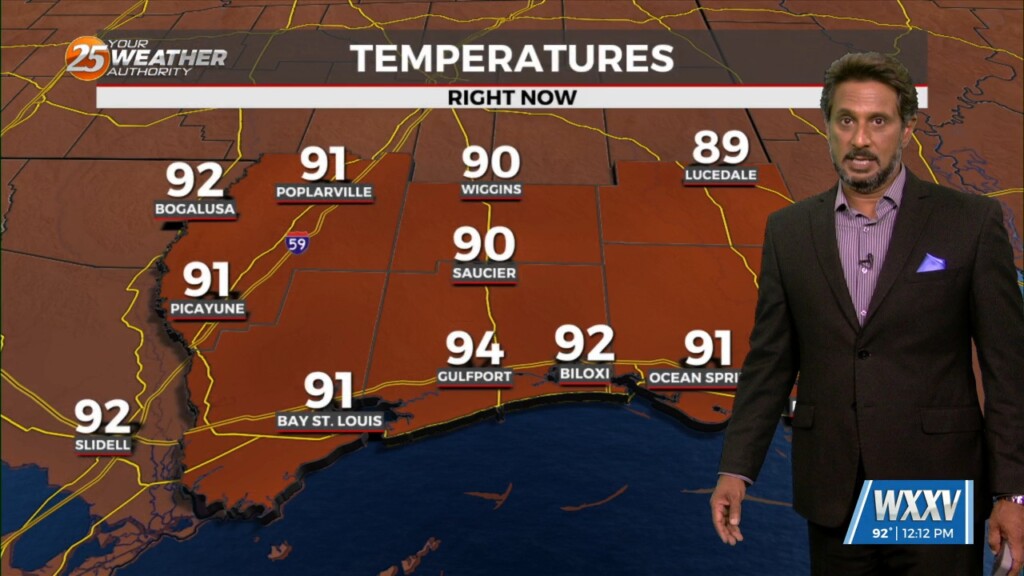
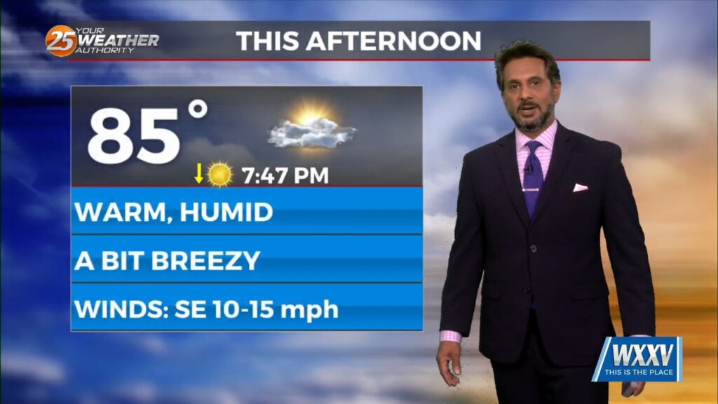
HOT temperatures this afternoon will feel like the low 90s with the heat index! As a stalled boundaries form last week move northward and leave the…
A stationary front overhead will be the focal point for activity into the weekend. This boundary will help a very large complex of elevated storms develop later…
High pressure through the region will continue to provide subsidence and warming through the period. This will result in a dry forecast through the…
An area of weak low-pressure overhead will slide to the east and dissipate. We will transition into somewhat lower dew-points and maintain those conditions for the next…
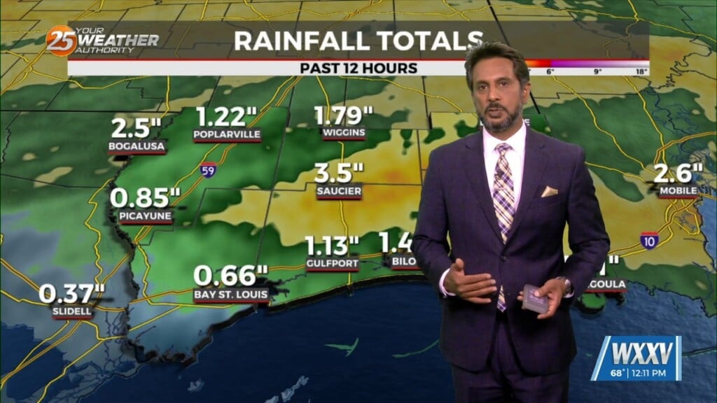
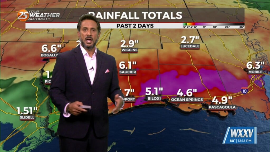
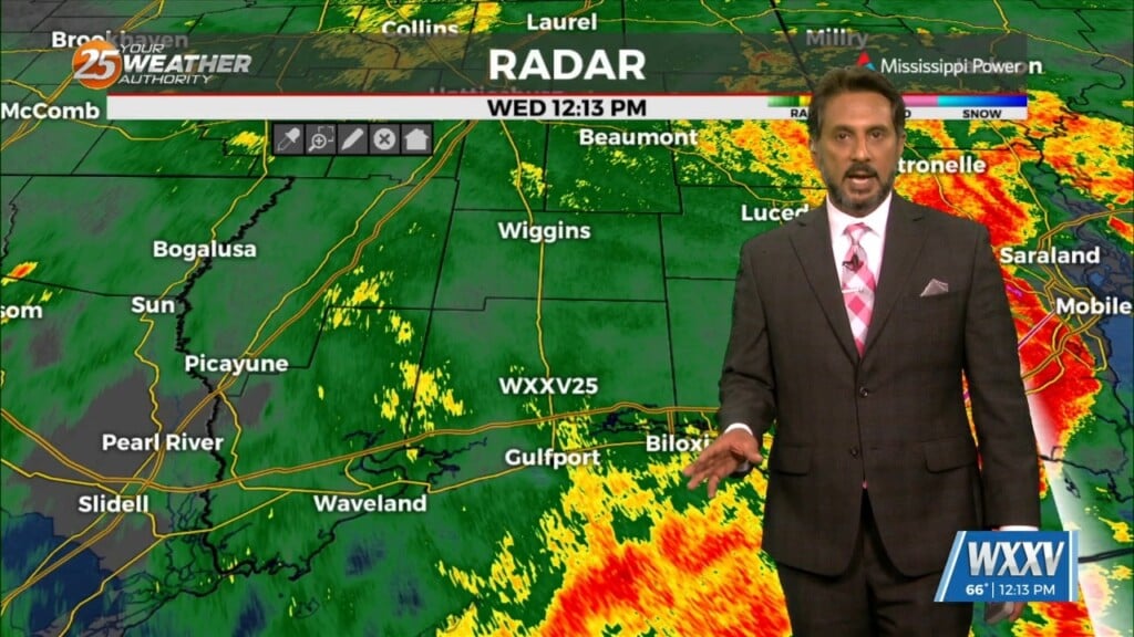
THREAT FOR HEAVY RAINFALL AND SEVERITY. The Flood Watch will remain as rainfall amounts are still coming in from 3 to 6 inches with the…
HOT...HUMID & BREEZY afternoon ahead... On Thursday a strong upper level disturbance will help send a cold front southward toward the region. During the…

Low stratus continues this morning as very rich low level moisture continues to stream northward from the Gulf. The low stratus deck will begin…
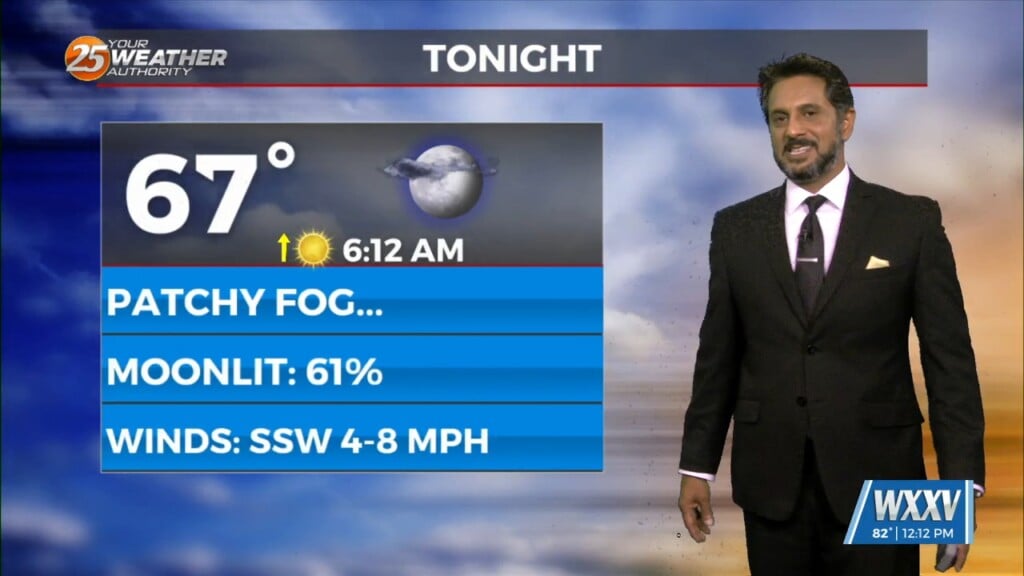
Sunny skies on-tap this afternoon as the cloud cover continues to move to the east. Again tonight, it will be a radiation fog night as well…
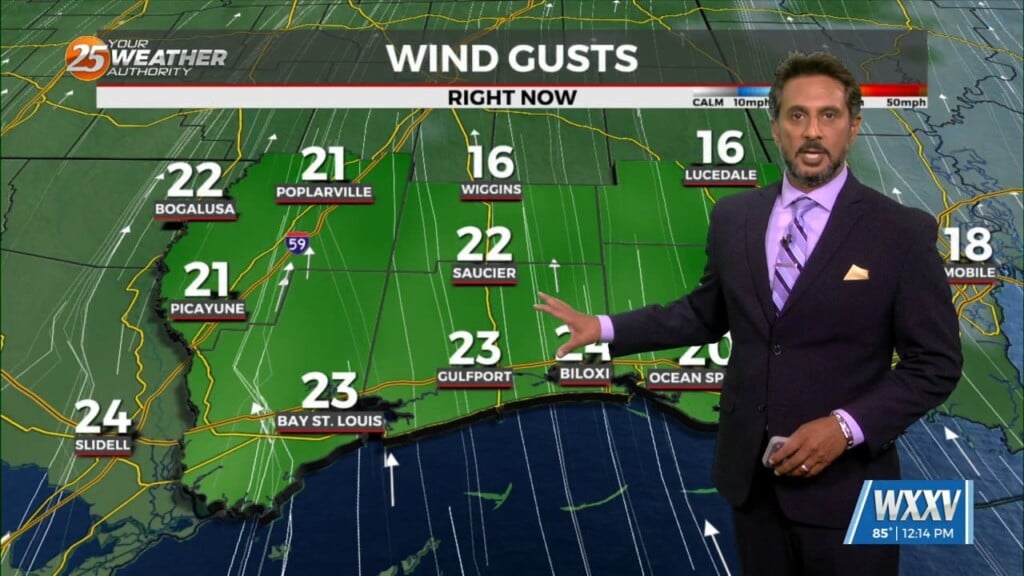
Winds will begin to weaken dropping below advisory thresholds this afternoon. But there will still be gusts to 25mph at times and even higher winds up…

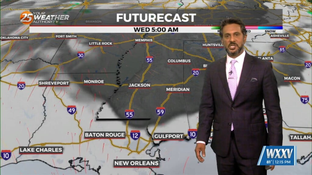
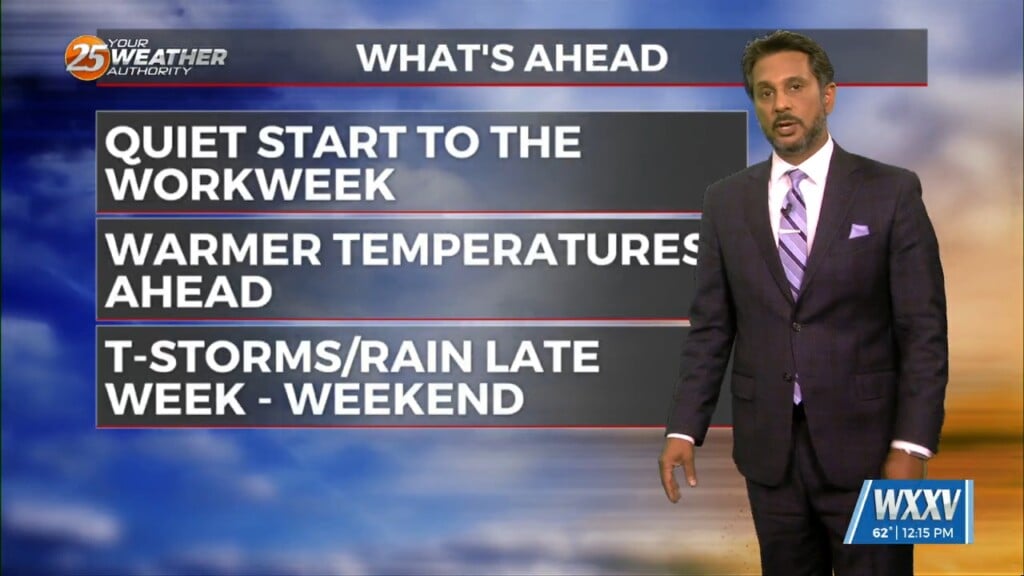
The forecast over the next few days and generally even into the weekend is quiet with the only real noticeable change being warmer temps and slowly increasing…
A MUCH DRIER air mass at the surface though the upper levels continue to flow into the region. This dry surge will move through and out…
An are of upper-level low pressure will continue to move northeast over the next 36 hours as it gradually gets absorbed by a stronger system over…
At the surface, high pressure extended from near Bermuda westward across much of the northern Gulf of Mexico. A stationary frontal boundary was well to the…
A vigorous storm system continues to move east though the region. Activity from this morning will begin to taper-off…with another batch of energy moving tough the…

Early Wednesday we will see a cold front moving toward the area with very moisture content for this time of year. If this were stalled over the…
The strong solar insolation expected this afternoon will allow highs to climb to near average this afternoon, but low tonight will quickly plunge into the 40s north…
This afternoon will continue to bring breezy conditions from the south...increasing the moisture. Tuesday is still the main forecast issue but honestly it…

SEVERE THREAT this afternoon/tonight, with multiple potential hazards in the first 24 hours of the forecast before the weather quiets down for a while. A…
The cooler, drier air has been slow to arrive, with dew points only now starting to drop over southwest Mississippi. The local area will be under a…
Pretty quiet conditions expected through the short term as high pressure gradually shifts eastward allowing southeasterly winds to take hold of the area. The southeasterly winds…
Drier air in the low levels is associated with a fairly strong surface high pressure centered over the region. Temperatures will also continue to run slightly below average…