7/28 - Jeff's "Very HOT, Unsettled At Times" Weekend Forecast
Any isolated thunderstorms this evening will be out of the picture by around sunset. Skies will clear out overnight leaving us with sunny skies to start…
Any isolated thunderstorms this evening will be out of the picture by around sunset. Skies will clear out overnight leaving us with sunny skies to start…
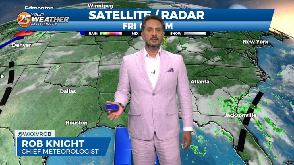
Starting the last Friday morning of July with cloud coverage in the area, due to a disturbance over the eastern portions of Florida off the coast.…
Skies will be mainly clear the rest of tonight with warmer temperatures as compared to last night. Tomorrow will become hot and humid…
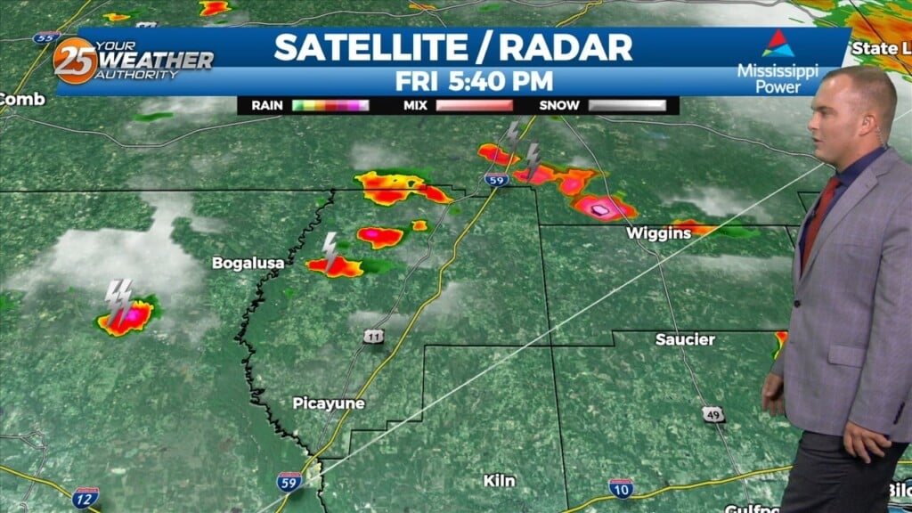
Spotty to isolated shower/thunderstorm chances will be around early this evening. Rain chances will drop off and skies will clear out tonight. Temperatures will be a…
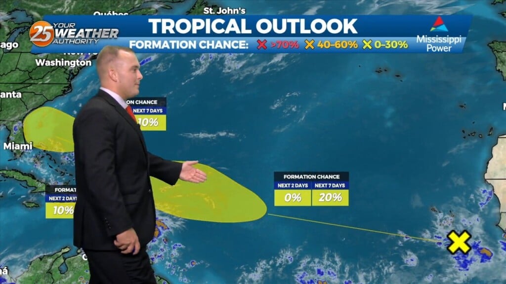
We could just maybe have a possible shower this afternoon but very LIMITED activity through Friday. High pressure will continue to be the main factor shaping the forecast into the final weekend of July…more so into early August, as RECORD…
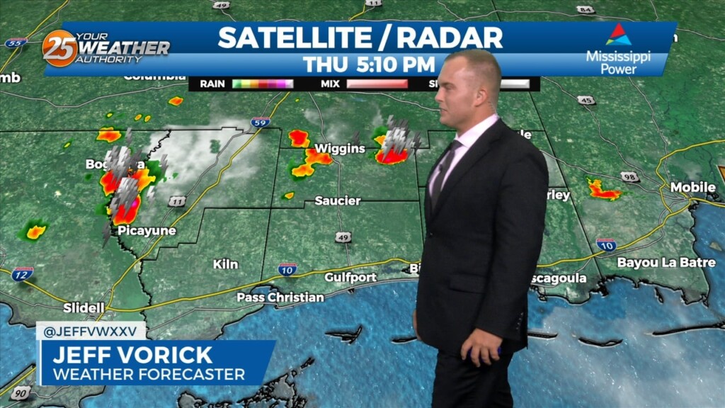
Not much difference this morning than the past couple of days with another warm and humid start. A possible shower can be expect this afternoon…
Skies will remain mostly clear overnight as temperatures will once again cool to milder readings. Humidity is very gradually on the uptick but it is still…
Skies this evening will clear out towards the overnight hours. It will be mild out the door tomorrow but there will be some increases in humidity and warmth.…
Another mild night can be expected as humidity is still fairly tame. The front to our south will retreat northward and our normal summertime pattern builds…

Typical summer heat continues but humidity remained at bay again today. A few clouds early will clear out overnight and another mild night can be expected. The front…
Manageable heat and more in the way of sunshine will continue this afternoon for the southern six counties. Currently a cold front is to the south of…
Another day of manageable heat and more in the way of sunshine is in store for the southern six counties. Currently a cold front is to…
Expect clear skies out the door tomorrow and fairly mild temperatures. Humidity will remain out of the picture for the next couple of days as…
A stationary front moving through our area ushered in a change to the feel of the air. Somewhat drier and milder air is around for the first part…
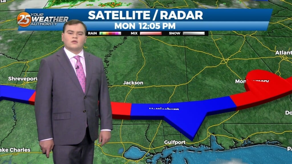
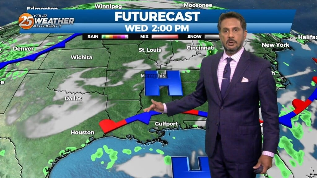
This afternoon a stalled stationary front just north will push to the south bringing subtle changes. This will also keep most of the shower and thunderstorm…
The dog days of summer are here to stay this week. A stationary boundary will begin to move out of the area tomorrow into the start of the…

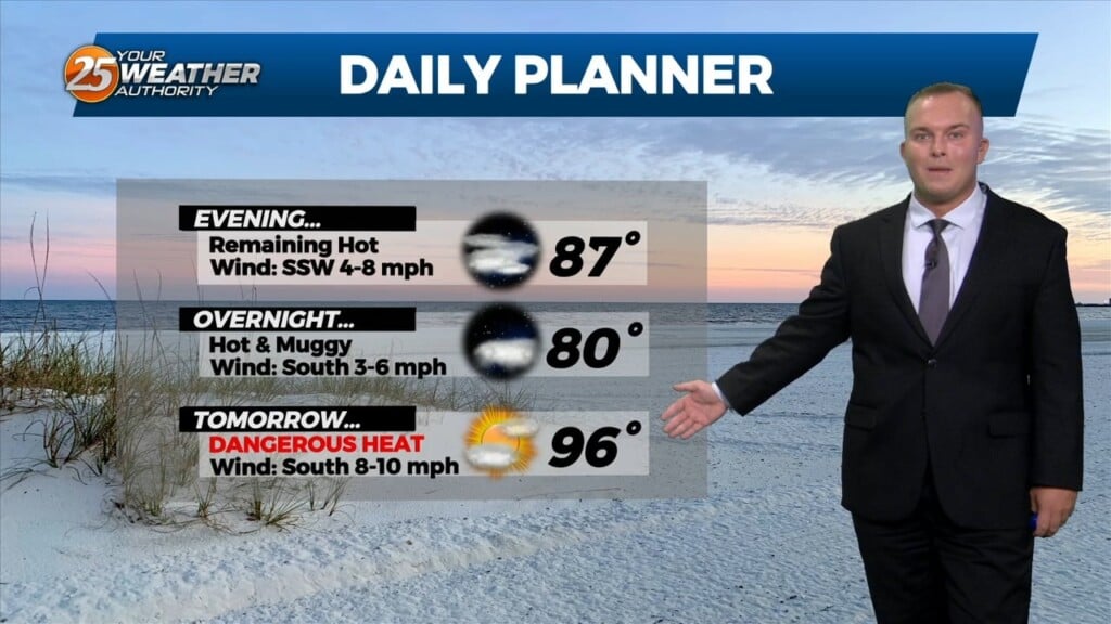
Hot and humid conditions continue into the first part of the weekend. Heat alerts will be in effect for some of tomorrow due to sunshine and the hot…
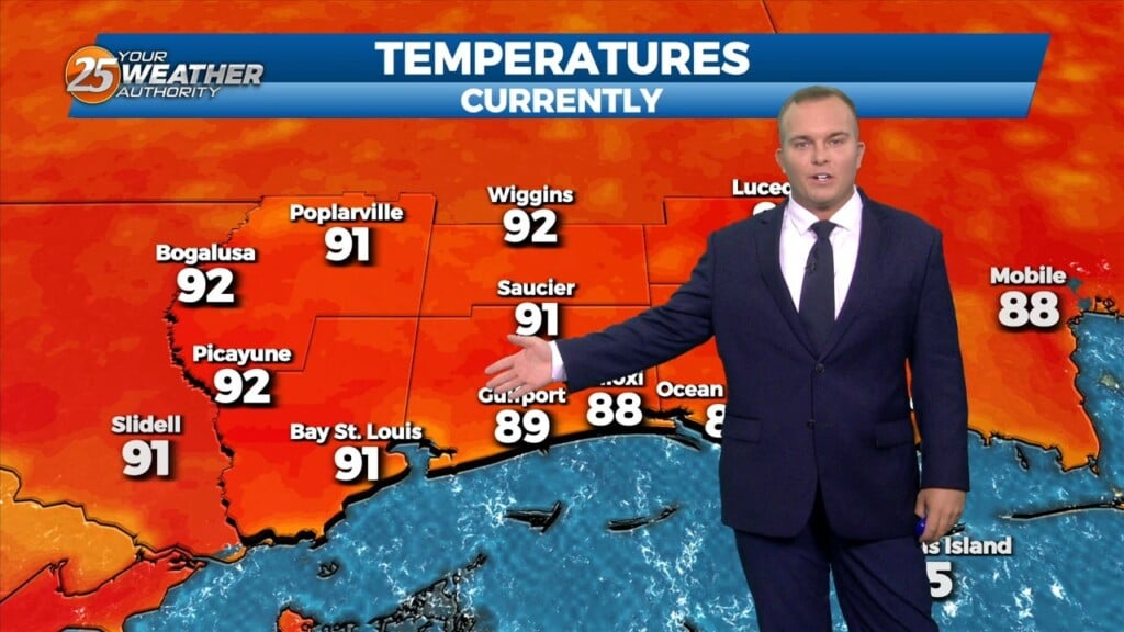
It will remain very warm and humid overnight with temperatures in the 80s for some. A very muggy start tomorrow will become dangerously hot again. Partly cloudy…
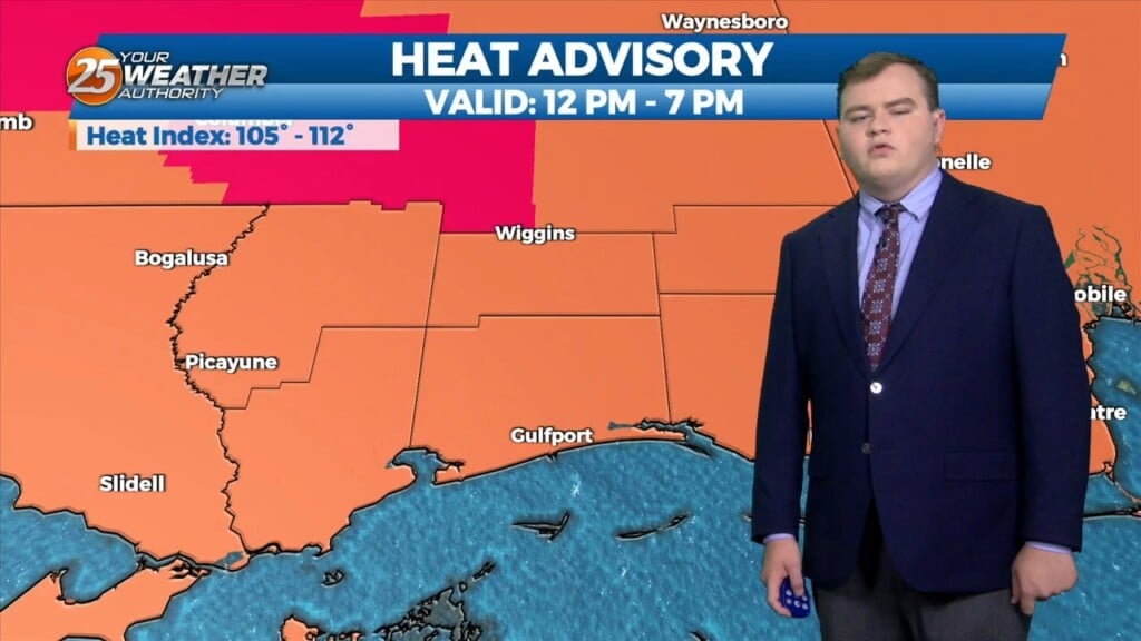
A Heat Advisory remains in effect until 7 PM. Heat index values will remain very uncomfortable into the night as humidity is elevated. Some clouds…
The pattern in the area is starting to feel like a broken recorded with oppressive temperatures daily. High pressure is the dominant feature and will continue to be…

The pattern in the area is starting to feel like a broken recorded with oppressive temperatures daily. High pressure is the dominant feature and will continue…
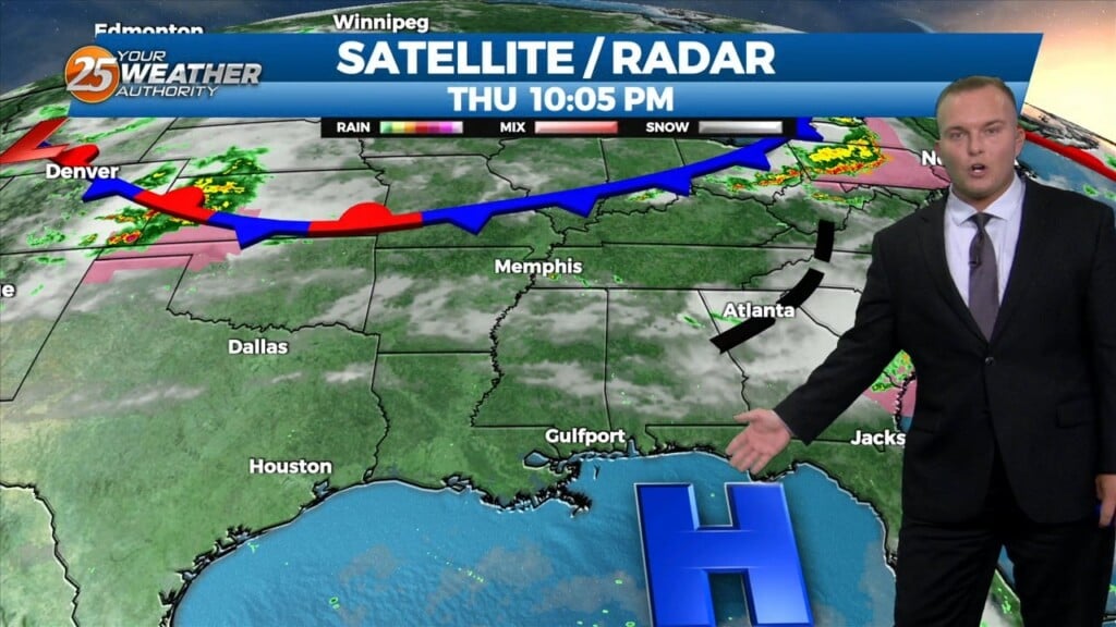
It will remain warm and humid overnight. A very muggy start can be expected for your Thursday as southerly flow continues. A few clouds to partly…
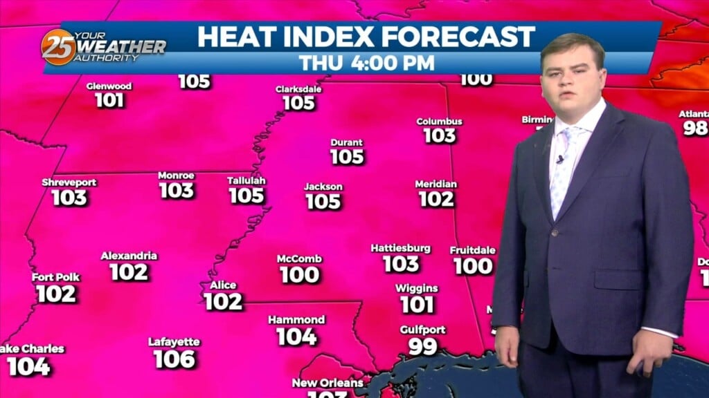
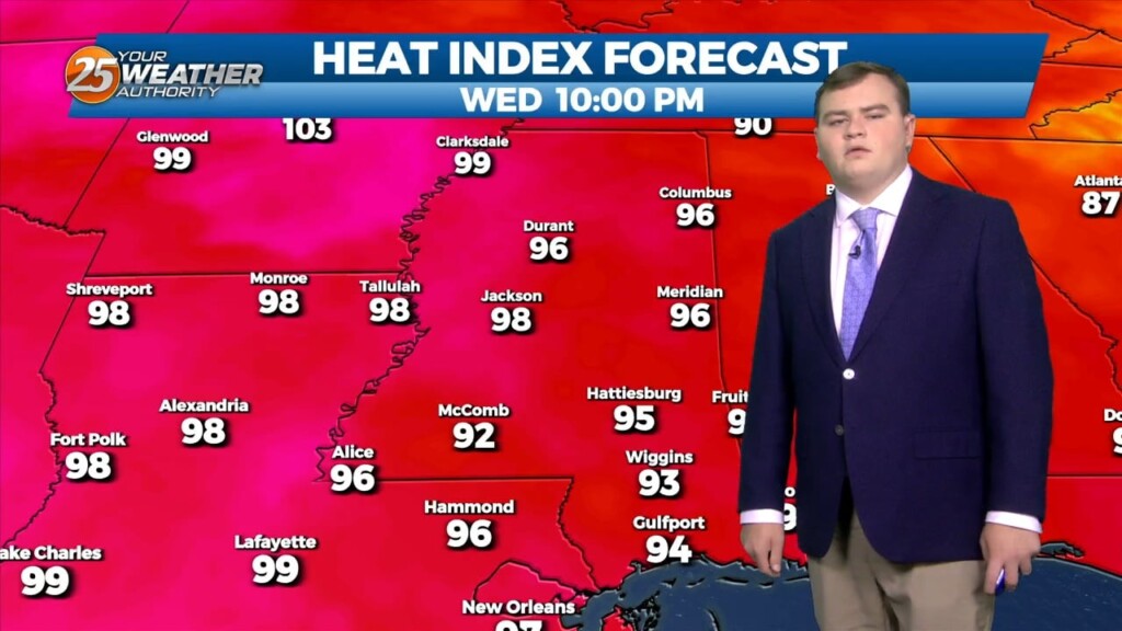
A Heat Advisory remains in effect until 7 PM. Very hot and humid conditions will persist through the rest of the week with high pressure dominating the…
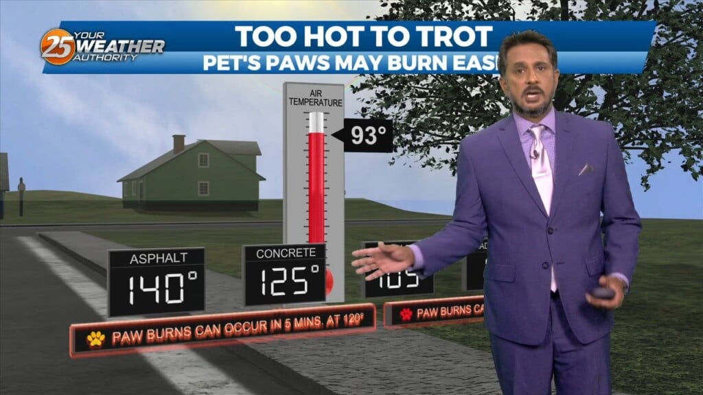
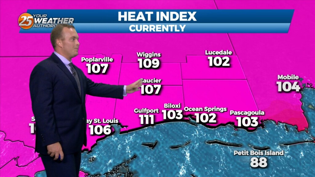
A HEAT ADVISORY is in effect until 7 pm as heat indices will max out between 107 to 111 degrees. High pressure is the dominant feature…