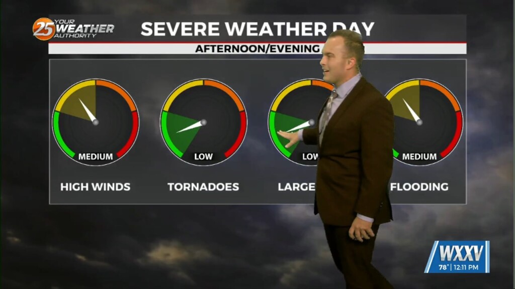
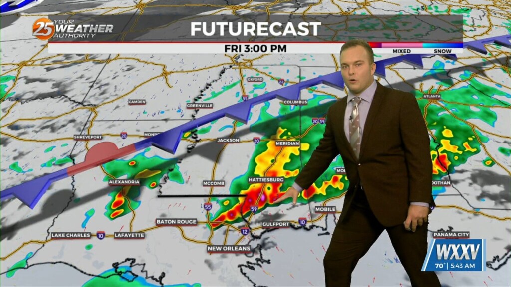
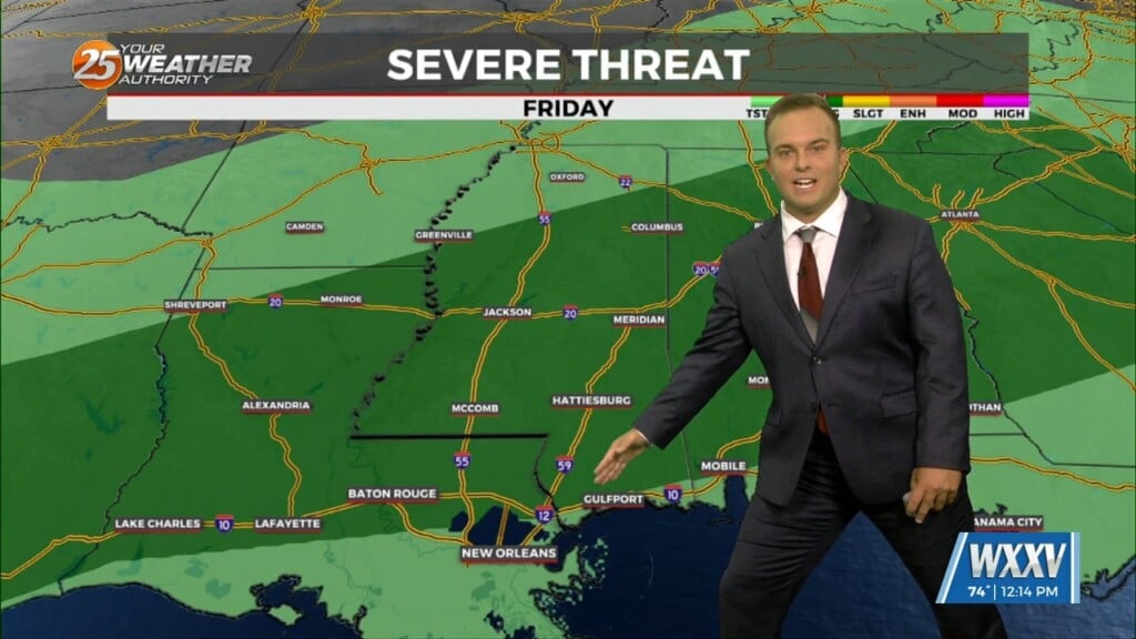
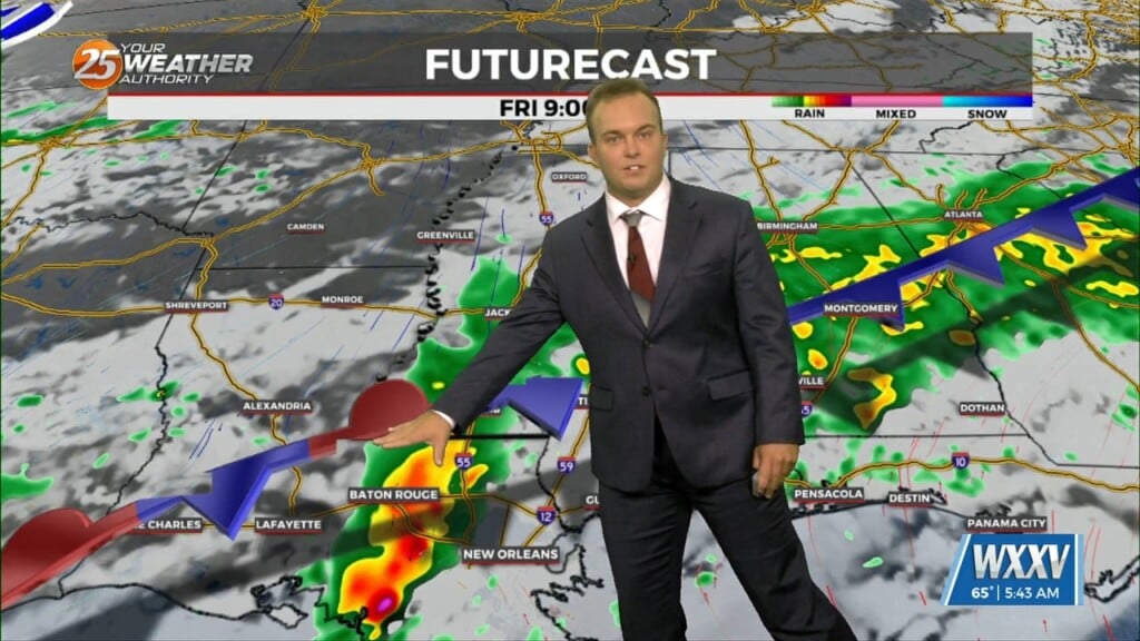
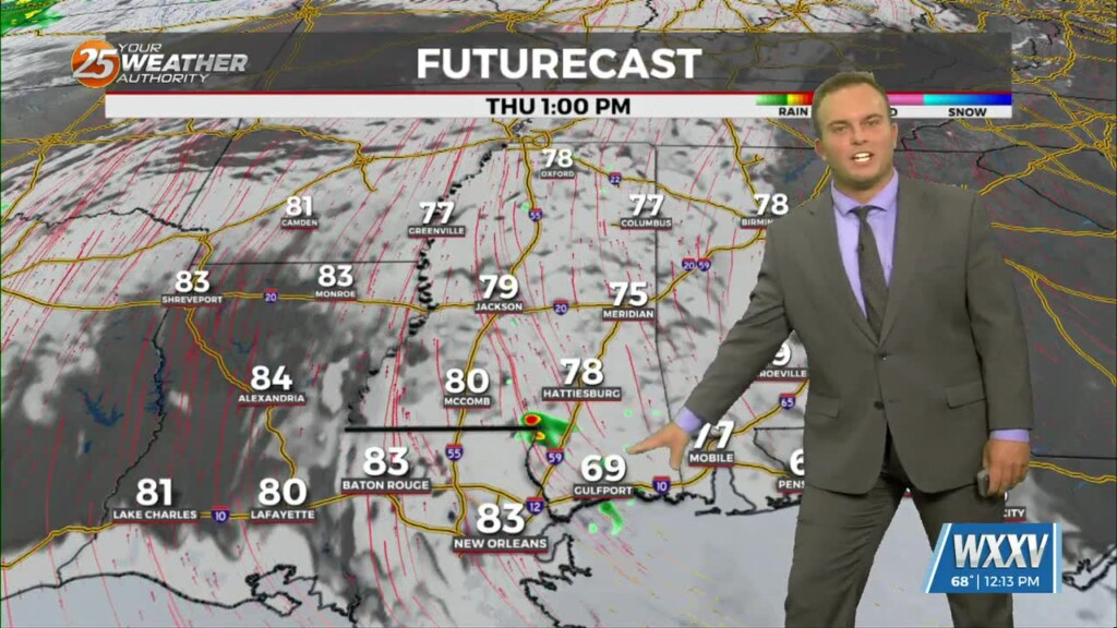
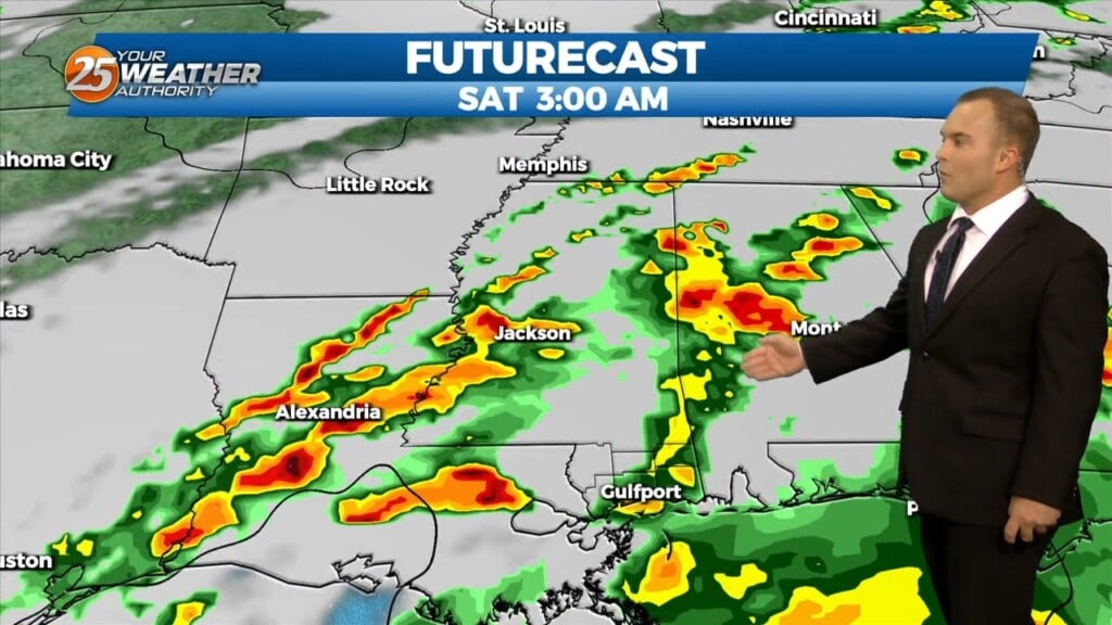
3/15 - Jeff's "Severe Thunderstorm WATCH" Friday Afternoon Forecast
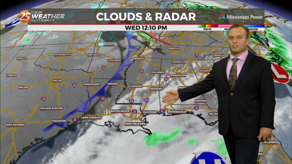
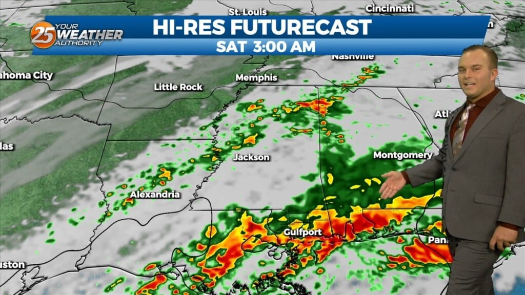
A Severe Thunderstorm WATCH is in effect until 7 PM. This means conditions are favorable for thunderstorms to produce winds in excess of 60 MPH, small hail,…
A Severe Thunderstorm WATCH is in effect until 7 PM. This means conditions are favorable for thunderstorms to produce winds in excess of 60 MPH, small hail,…
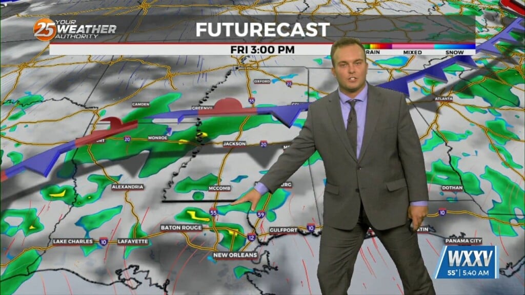
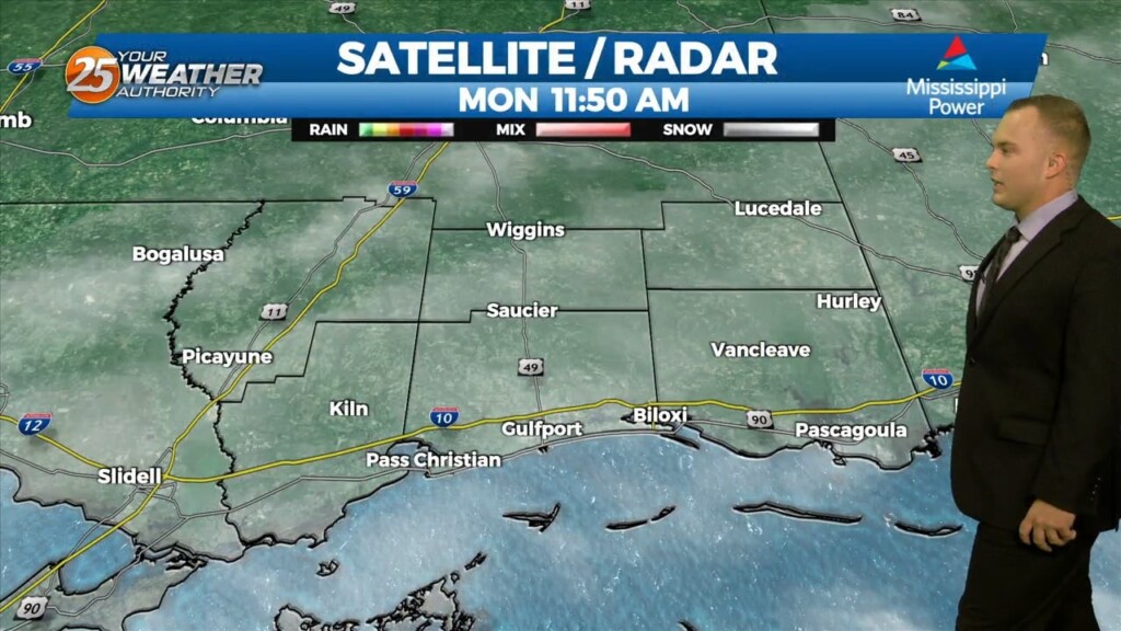
A Dense Fog Advisory is in effect until 10 AM for our whole area, and until 11 AM for marine zones. Fog will gradually lift through…
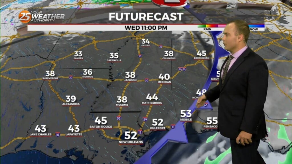
Breezy conditions will take hold this afternoon and more cloud cover will fill in. In addition to that, there will be a 30% or so chance of rain…
Some spots may find dense patches of fog out the door this morning. Fog will quickly dissipate and give way to a warm one…
Cloudy skies remain through a good portion of the afternoon with a 20% chance of light showers as well. Skies will clear out somewhat towards this evening and…
More clouds are around to start your Wednesday. A cool start will turn into a warm one today with temperatures reaching the 70s by…
Areas of patchy dense fog will dissipate quickly this morning. Cloud cover will remain in place with peeks of sunshine here and there. Temperatures will be quite…
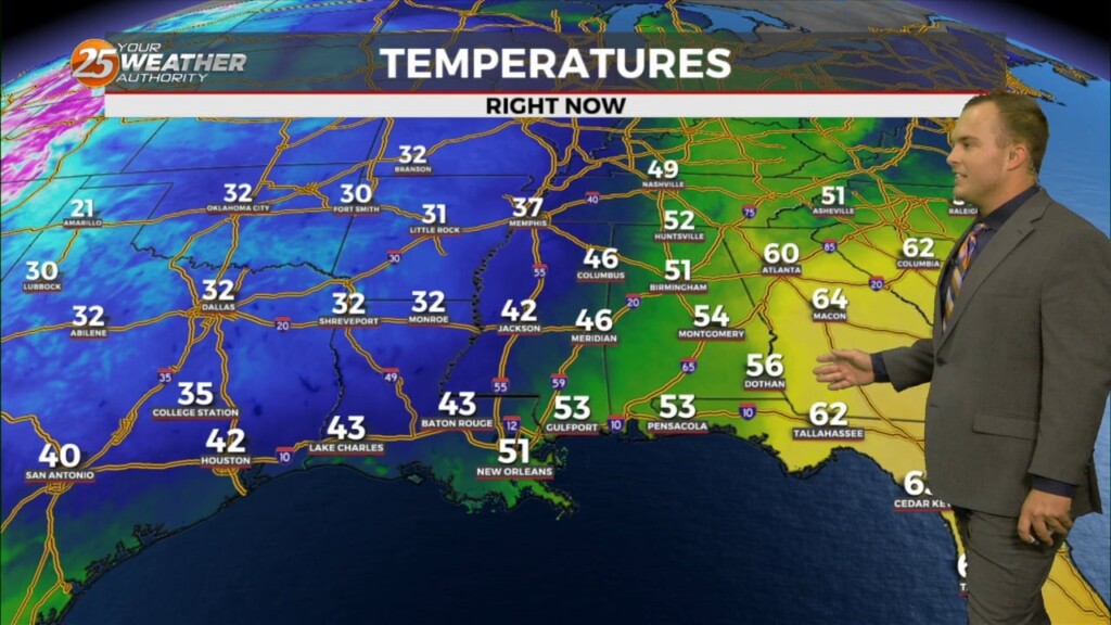
It is chilly, but not frigid to start off this week. Morning temperatures a few degrees below average temperatures for the day will warm to near-seasonal averages…
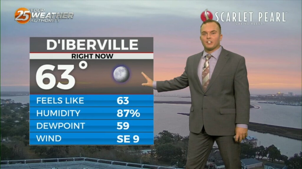
Cloud cover is present this afternoon with mid-level and upper-level clouds overhead. Temperatures will be near-average this afternoon with low-60s. Winds will remain southwesterly for a few hours…
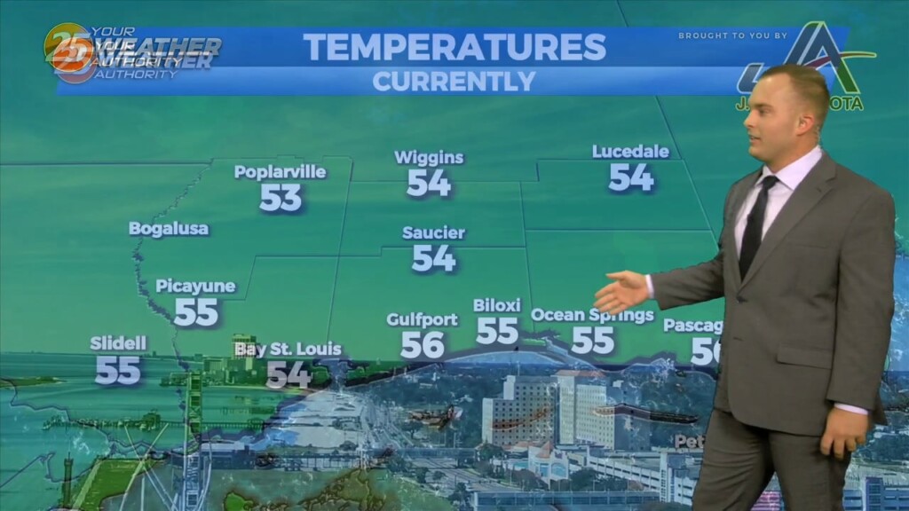
While it is a few degrees colder than yesterday out the door this morning, temperatures are near average in terms of low temperatures are concerned. Mostly…
Cloud cover has moved back in with upper-level clouds streaming in. Temperatures are a few degrees cooler out the door this morning and winds have shifted…
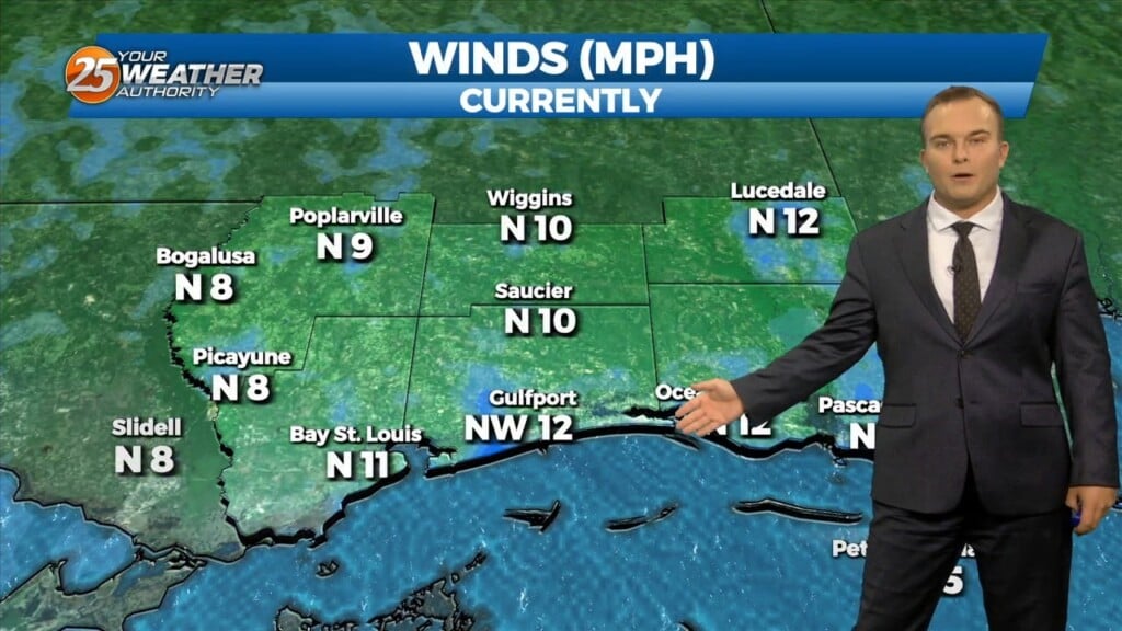
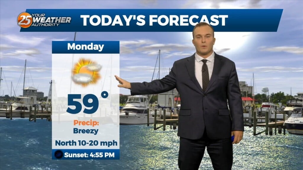
Even with more sunshine, temperatures will struggle to reach the 60-degree mark today. Winds out of the north will be quite breezy for some portions of…
This afternoon will be a repeat of yesterday with slightly cooler temperatures and a bit less wind. Cool conditions linger into this evening and clouds will clear out…
Some sunshine will be around this afternoon with thin upper-level clouds continuing to stream in. Temperatures will be fairly mild but winds will be breezy at times…
Some dry time will be around this afternoon and you may even find a few breaks in the cloud cover. Rain chances begin to come back…
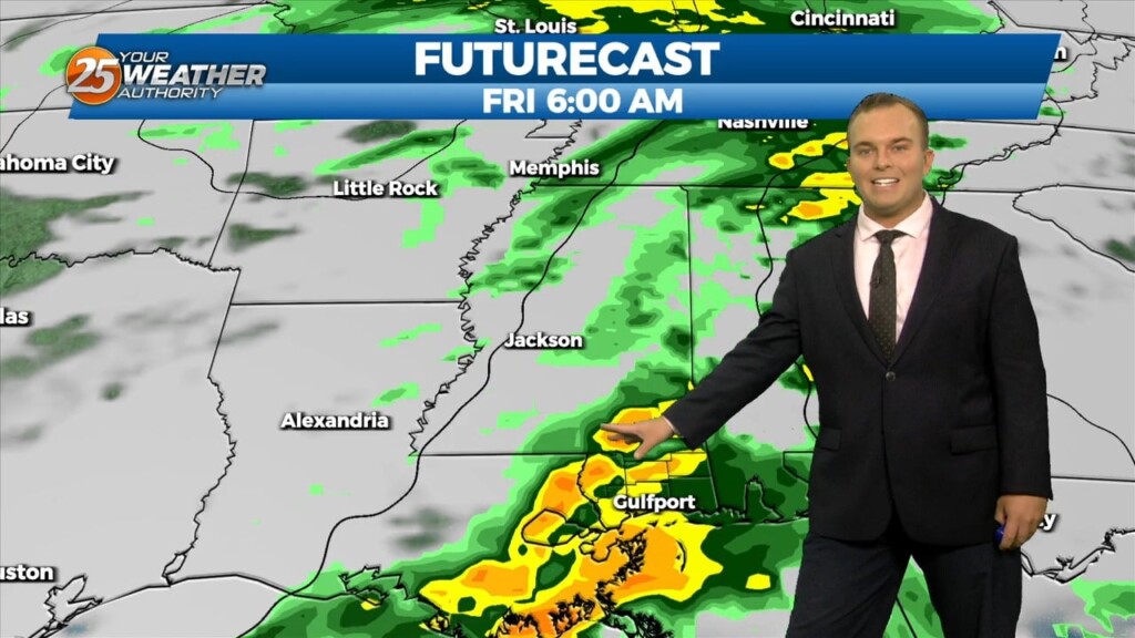
The transition in our pattern is underway. Gradually, winds will turn southeasterly by this evening as a frontal system makes its way into our region. Moe humidity…
Winds turn southerly this afternoon which will begin the transition in our local weather pattern. Some upper-level clouds move in through this afternoon but otherwise, expect mainly…
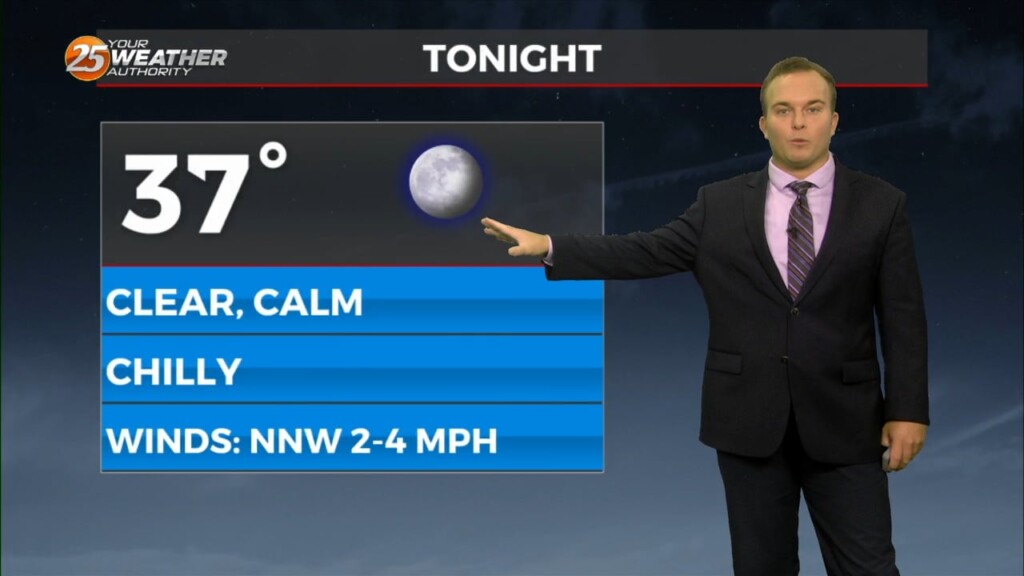
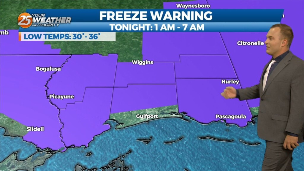
A Freeze Warning remains in effect until 8 AM for our entire area. A frigid start under clear skies will yield to a quick warm-up with lots of…
Another cool and breezy afternoon will be in store for us. Temperatures will be similar to yesterday but winds will be slightly more tolerable. Lots of sunshine…
It is another cold start to the day with winds still remaining in play. Temperatures in the upper-30s to lower-40s will have a wind chill factor to…
Some thin, upper-level clouds move in this afternoon. Outside of that, sunshine does dominate and expect cool conditions. It will be breezy if not windy at times.…
It is a much colder start this morning with temperatures in the 40s and breezy northerly winds behind a cold front. Expect sunshine to dominate early but…
Some opportunities for sunshine return this afternoon and rain chances are out of the equation. Expect cool conditions and a light breeze out of the northeast. Clouds clear…
Cloud cover remains dominant for a lot of Black Friday with a cool and somewhat unsettled pattern around. There will be a 20% chance of…