
6/17 - The Chief's "Tropical Rain/T-Storms" Monday Morning Forecast
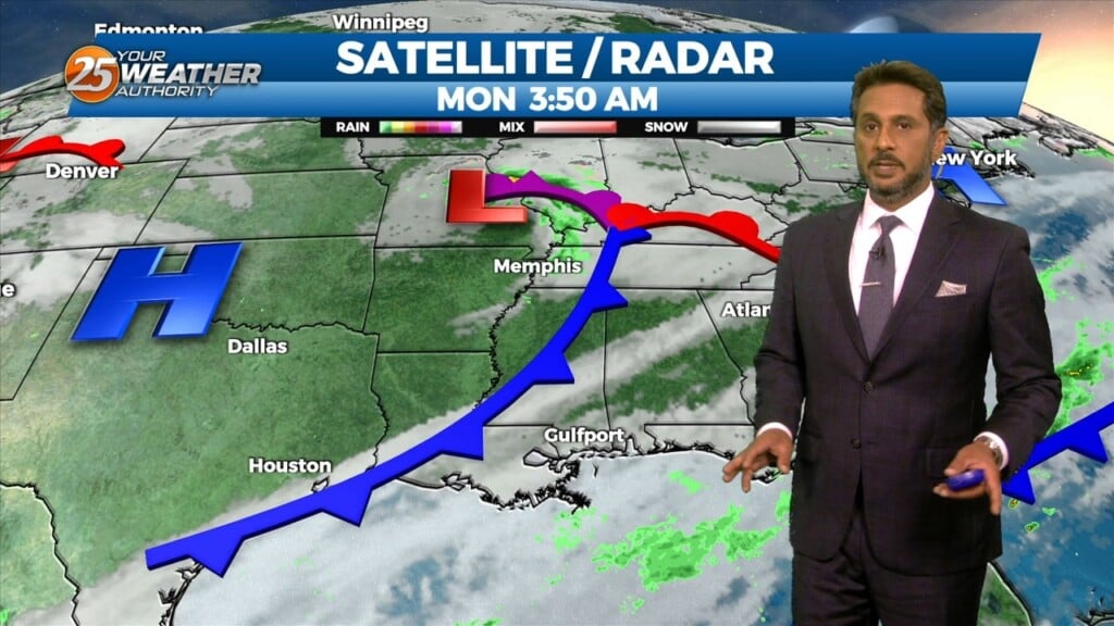
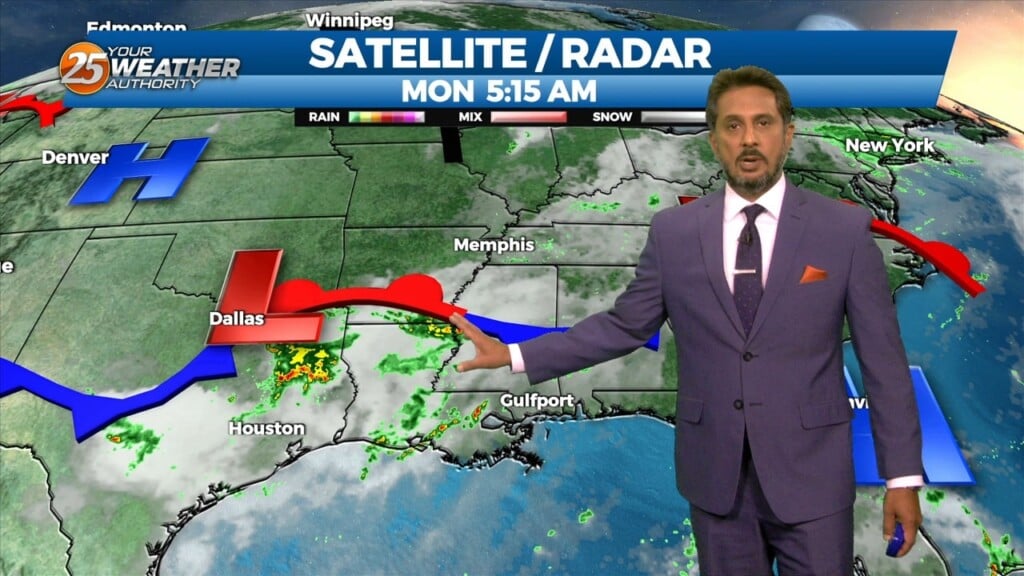
An area of high-pressure is currently centered over the Carolinas this morning, with a weakness along the southern plains. This is combining with the Central American flow to…
An area of high-pressure is currently centered over the Carolinas this morning, with a weakness along the southern plains. This is combining with the Central American flow to…
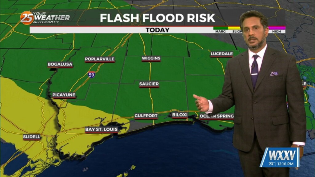
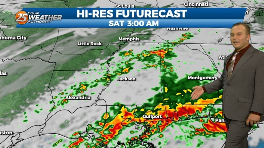
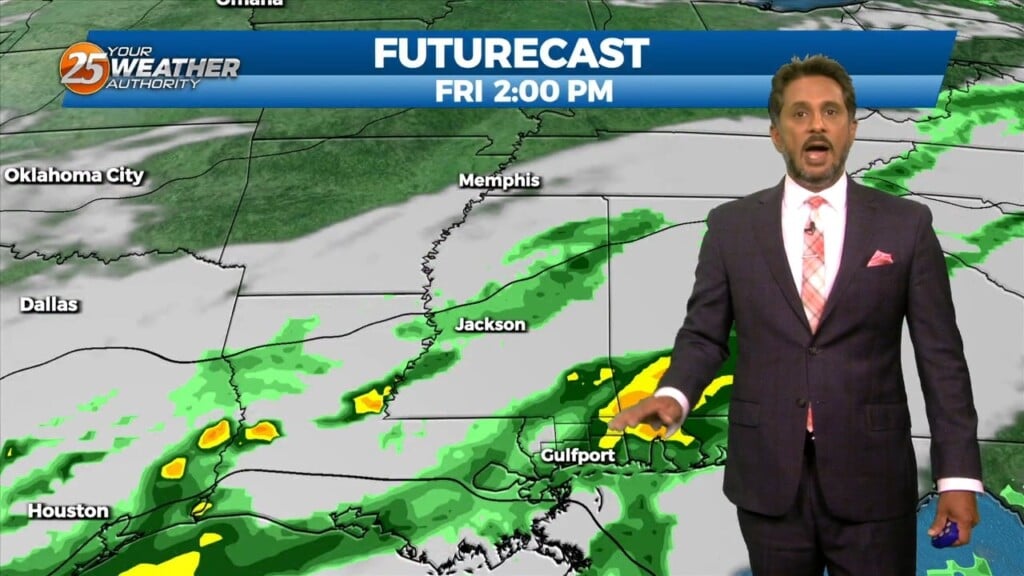
SEVERE & HEAVY RAIN THREAT THIS AFTERNOON/OVERNIGHT... Showers/t-storms will begin around midday with activity increasing this evening and overnight. The next thing would be…
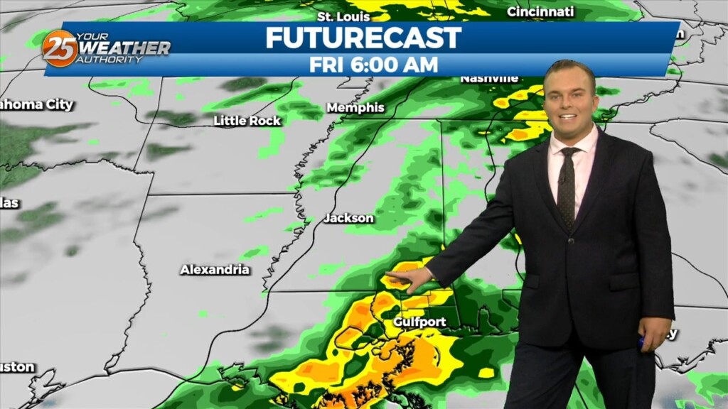
UNSETTLED is the word for the next several days. Heavy rainfall will tapper slowly through the day. Very few severe storms are expected with this…

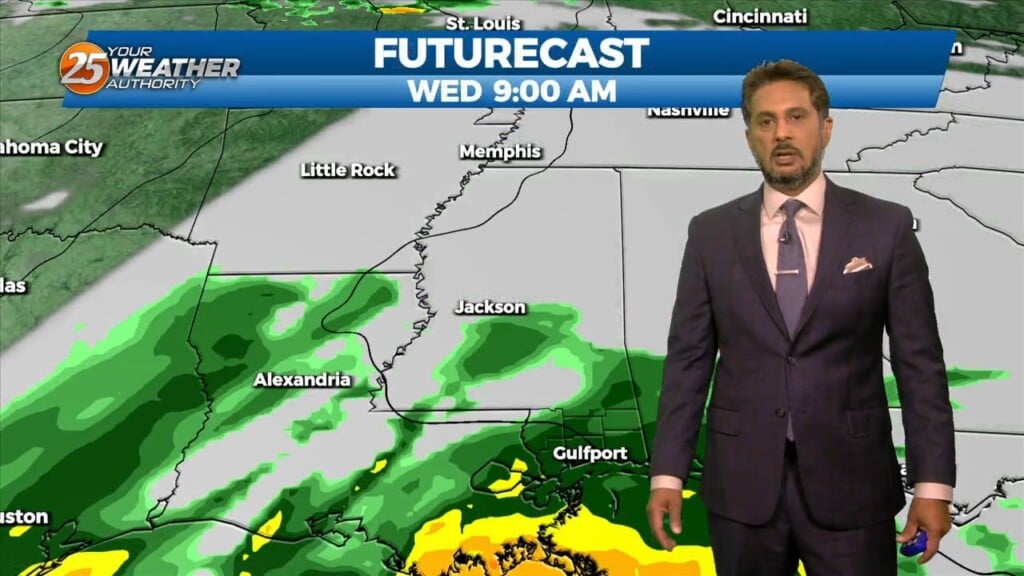
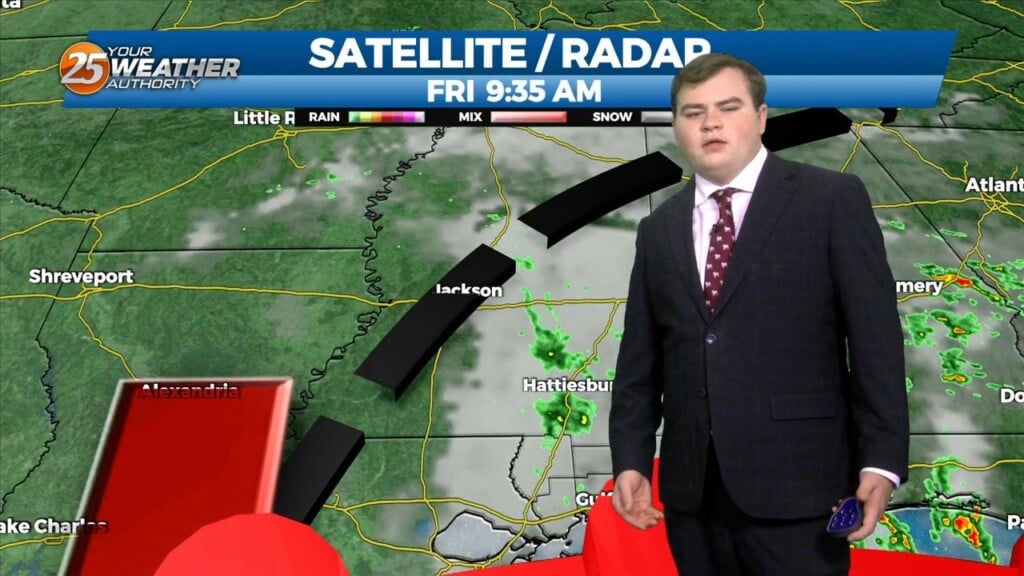
With a stalled frontal boundary overhead and moisture surge from the GOM, another round of showers/t-storms will move in around mid-morning. Moisture values will support…
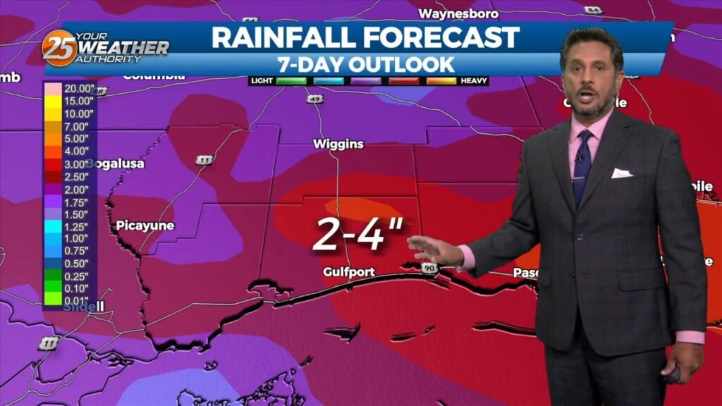
The primary concern through Saturday morning will be the threat of additional flash flooding from heavy rainfall and high rainfall rates. This concern is driven…
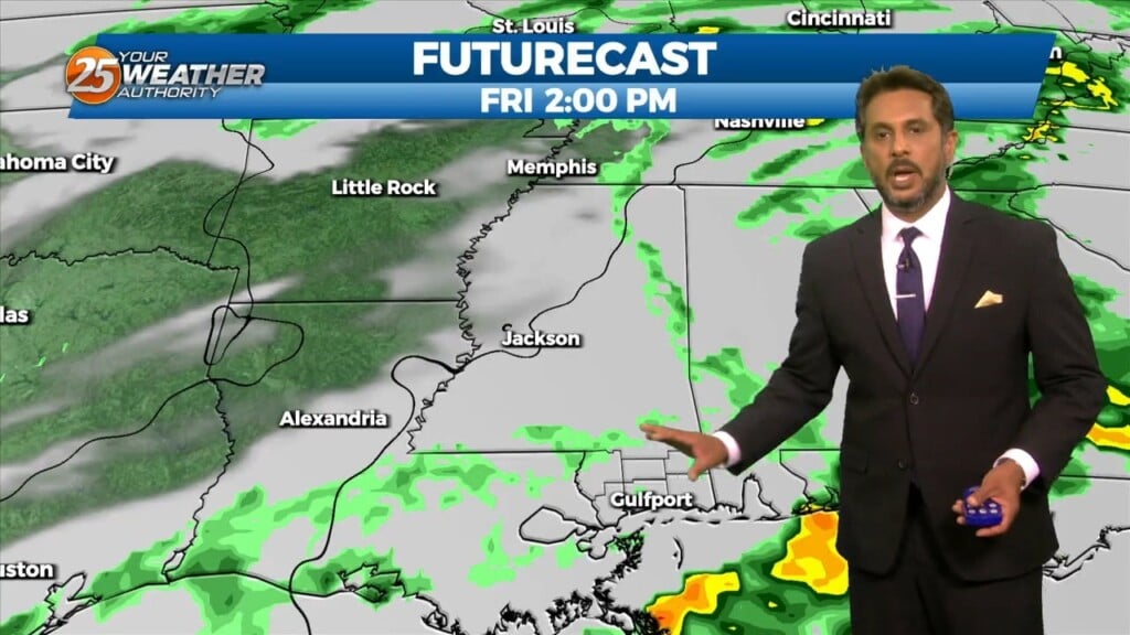
Expect a very active 24 to 48 hours in store with multiple impacts some of could bring severity to the area. Widespread moderate to heavy…
This afternoon will bring an abundant of cloud cover, and at least light precipitation. However, current indications are that rain amounts through Tuesday afternoon…

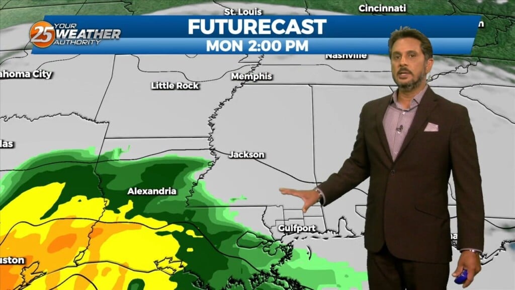
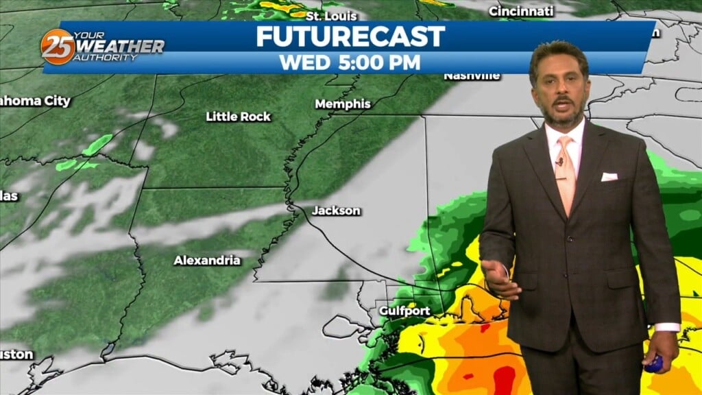
A warm front will remain along the coast today while the surface low-pressure developing over the NW gulf rides along it. This system will kick east rapidly through…
A broad upper level disturbance over the eastern third of the CONUS will be the primary feature impacting the forecast area through Wednesday. Pacific based…
Some dry time will be around this afternoon and you may even find a few breaks in the cloud cover. Rain chances begin to come back…
The transition in our pattern is underway. Gradually, winds will turn southeasterly by this evening as a frontal system makes its way into our region. Moe humidity…
It’s a warmer start this morning but still cold across the region. Surface flow will begin to transition today as the high continues to migrate east and…
Any rain this afternoon will be light in nature with drizzle and intermittent bouts of showers fading by the evening. Winds remain elevated as an area of…
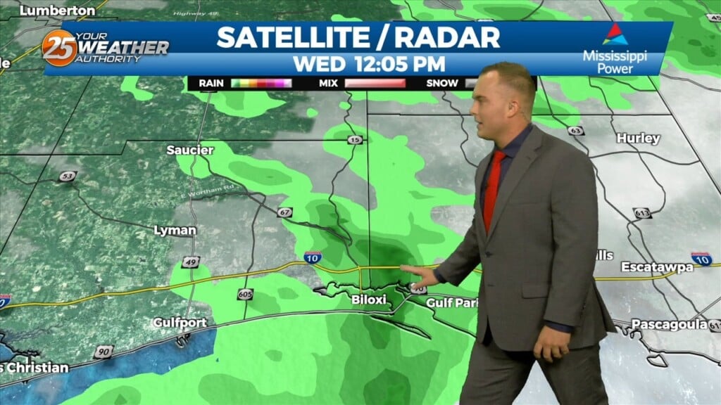
Mostly light showers have been intermittent across the region this morning as rain continues to move in from the south. An area of…
High pressure has shifted well to the east of the area, with a weakness running from the Great Lakes to near Phoenix. At the surface, a…
Dense fog has developed again across portions of the area this morning. Smoke from the wildfire in New Orleans East could reduce visibility to less than…
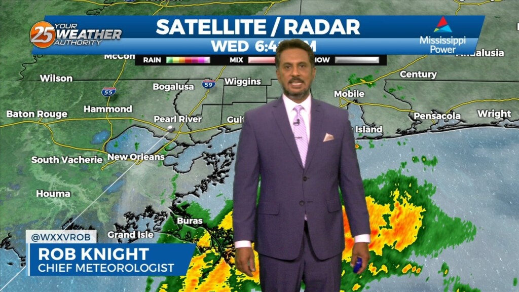
All eyes continue to focus upstream at the nontropical low pressure system across the western Gulf of Mexico. This feature will begin to strengthen as it…
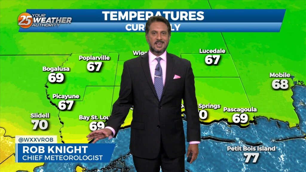
It’s another October morning with crisp temperatures in the mid to upper 50s across much of the area. Drier air and surface high pressure remains…
The upper level pattern across the country remains complex, with an area of high pressure extending from northern Mexico to the Great Lakes and low…
An area of low pressure has formed along a stalled frontal boundary west of the area. We can expect much needed showers and thunderstorms, as activity will…
An area of low pressure has formed along a stalled frontal boundary west of the area. We can expect much needed showers and thunderstorms this morning,…

Some light showers continue across the area, mainly near the coast and over the coastal waters…with more of the same on tap for today. We will…
Spotty Showers continue through the area this morning, as radar is indicating activity in the vicinity. This activity will continue through this morning with the activity…
Surface warming will once again commence bringing us to convective temperatures in the upper 80s by noon, however, more abundant high clouds may just keep us…