3/2 - Rob's "Friday Eve" Improving Forecast
In the wake of a cold front which moved through last night, BREEZY conditions are in place gusting into the 20 mph range...
In the wake of a cold front which moved through last night, BREEZY conditions are in place gusting into the 20 mph range...
Wind flow switched to the south yesterday afternoon for a few hours, increasing the humidity allowing for slightly warmer overnight temps...
Windy conditions tapered-off yesterday evening with light winds and clear skies overnight. After a CHILLY start, today will bring changes...

It's a COLD start to the weekend as a cold/dry air mass continues to move into the Gulf coast...
In the wake of cold frontal passage last night, rain is out of the area but the clouds will continue to linger...
After a clear and chilly morning, upper-level clouds continue to move in from the SW as temperatures warm...
In the wake of a cold front, clearing skies occurred overnight with chilly conditions this morning...
As a weak cold front moves across northern Mississippi, areas of patchy fog has developed once again...
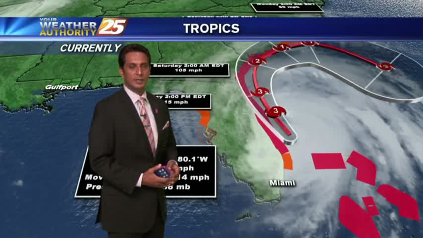
As hurricane Matthew pounds Florida, a dry north wind along the Gulf coast has very pleasant conditions to close-out the workweek...
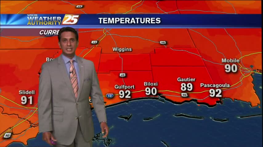
Humidity has been on the increase over the past couple day...this afternoon HOT conditions will trigger a few t-storms...
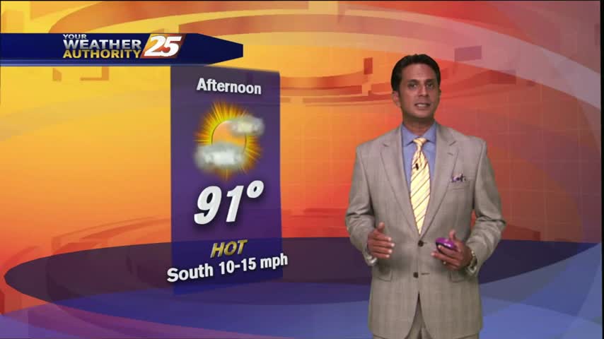
Hot temps are in the area with the mercury getting into the 90s once again before seasonal conditions return...
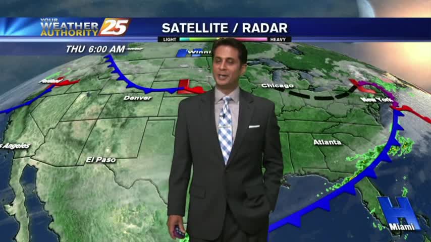
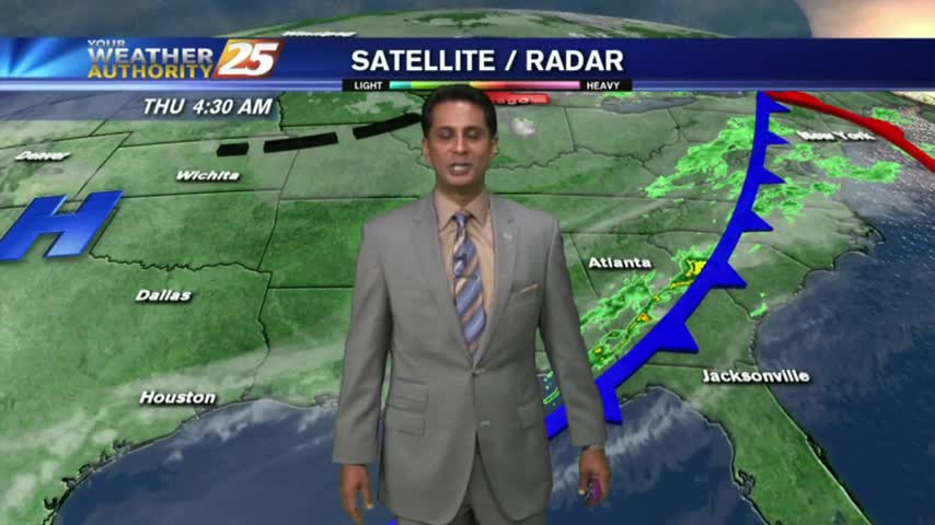
To close-out the workweek, we have mostly cloudy skies this morning along with VERY LIGHT rain and areas of patchy fog...
Showers have developed and will continue to build into t-storms this afternoon...about a 30% chance.
The clouds have thinned considerably as temps continue to rise...

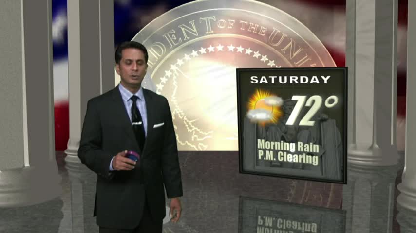
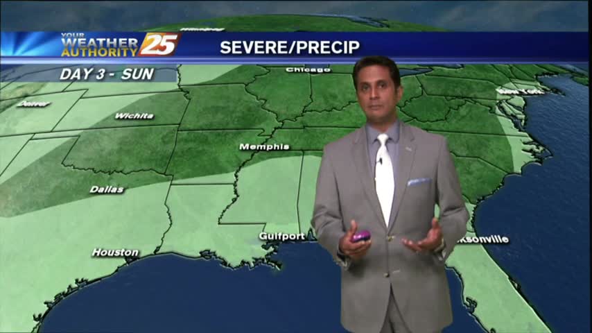
The Mississippi Emergency Management Agency (M.E.M.A) wants to remind Mississippians to be prepared for heavy rainfall with the potential for flash flooding on Saturday into Sunday.