2/22 - The Chief's "Warm & Often Breezy" Thursday Morning Forecast
An area of upper-level high pressure remains over Mexico with weakness off both coasts. At the surface, low pressure was centered over Oklahoma with a…
An area of upper-level high pressure remains over Mexico with weakness off both coasts. At the surface, low pressure was centered over Oklahoma with a…

DENSE FOG ADVISORY in effect through mid-morning… High pressure extends northward from Mexico through the Plains States with upper level weakness off the Carolina and…
High-pressure over the Rockies will shift eastward to the lower and middle Mississippi River Valley by Wednesday afternoon, with the surface high shifting to our…
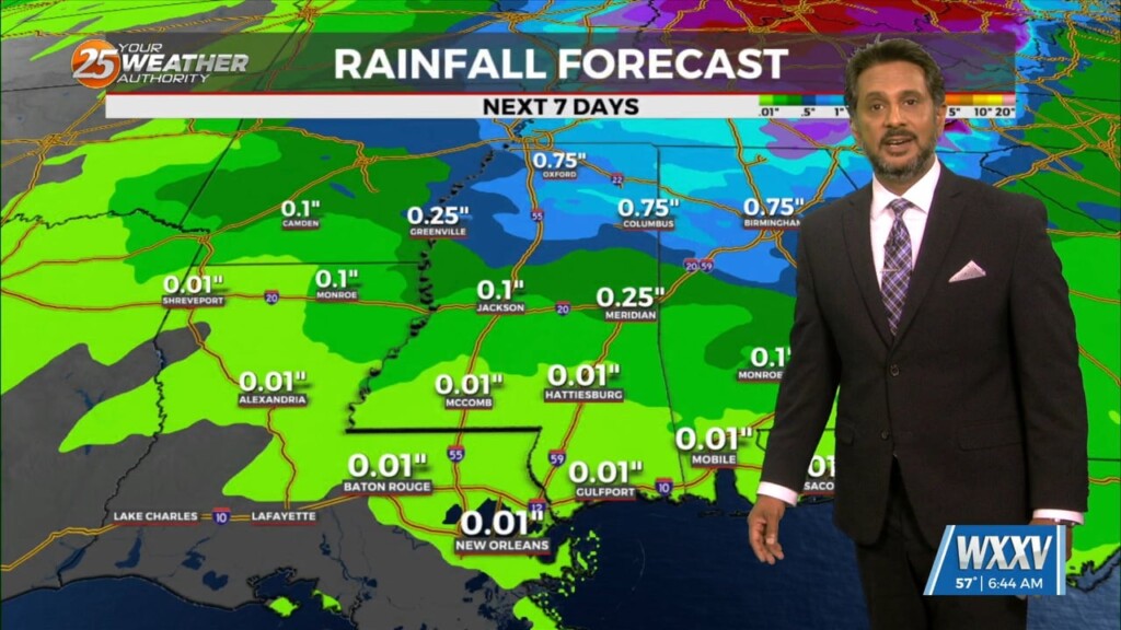
A broad region of enhanced upper level forcing will develop over the Gulf South today and continue into Saturday. This forcing will be driven by the…
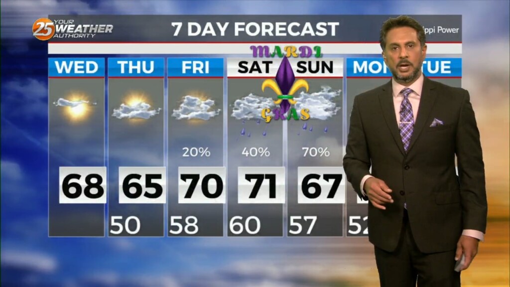
No significant changes in forecast though the weekend. An area of low-pressure along the W’tern Gulf will bring higher rain chances for the start of the weekend.…

A post frontal airmass continues to push into the region with the center of surface ridge currently over the state of Mississippi. The remainder of…
The forecast through the remainder of the workweek is pleasant with no major impacts. Rain should at least hold off till late Friday if not…
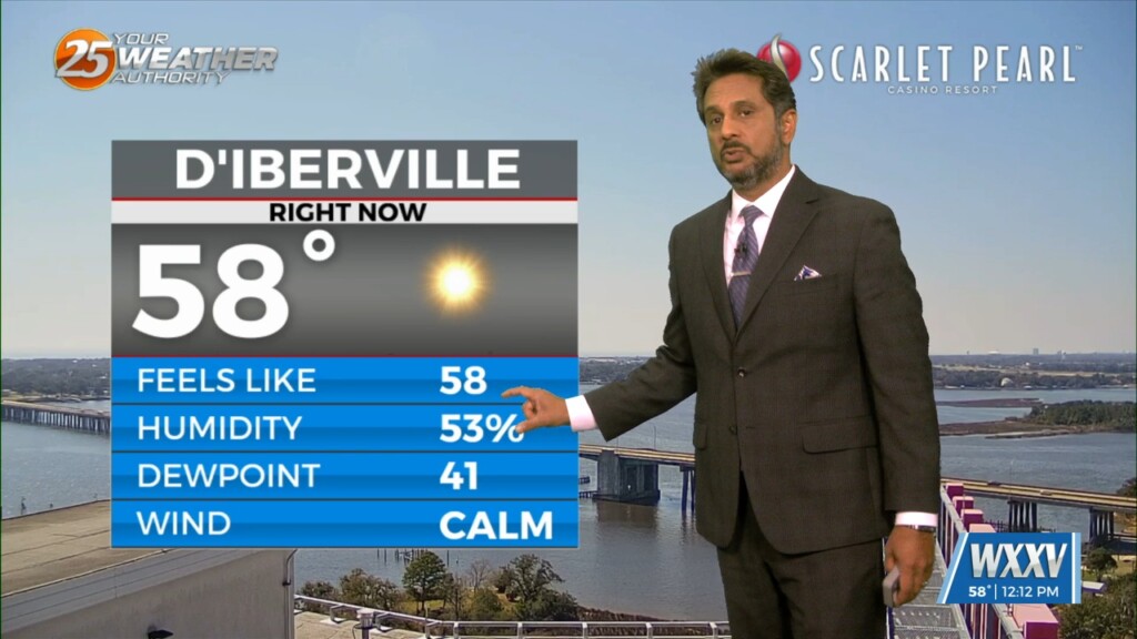
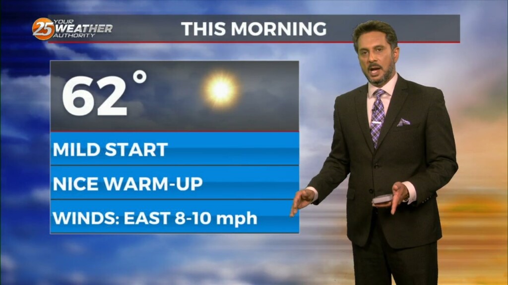
Low level moisture continues to increase with dew-points rising into the upper 40s or tower 50s. This warming/moistening trend will continue today. The…
High pressure will continue to move downstream over the Mid-Atlantic States through today. As the high moves east, onshore flow will be initiated at the surface.…
Today can be best characterized as the transition day across the area/region. High pressure will continue to move downstream over the Mid-Atlantic States through today. As…
High pressure will continue to build into the region from the west as the low pressure that gave us rain/hail on Sunday continues to move…
The system to the SE that brought thunder/hail to parts of the area yesterday evening will continue to meander south and east today. On the backside…
A lovely day is ahead with mild temperatures and sunny skies. A few upper level non-rain producing clouds will move through from time…
Winds will start to come around to southerly today for most of the area. This will help transport some moisture to the area but not enough for…
The primary concern through Saturday morning will be the threat of additional flash flooding from heavy rainfall and high rainfall rates. This concern is driven…
Expect a very active 24 to 48 hours in store with multiple impacts some of could bring severity to the area. Widespread moderate to heavy…
WINTER WEATHER ADVISORY in effect... Obvious forecast problem through Tuesday night is the arctic air and it`s effect on any precipitation that may fall late…
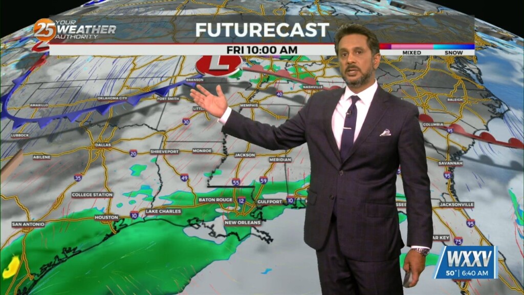
With an approaching system to the west, showers and t-storms are expected through midday. It seems that the best instability and forcing will remain north.…

The main forecast issues will be the potential for severe weather late tonight and Friday morning, along with rather gusty winds on Friday. Temporarily fairly zonal…
The deep upper-level system that produced Monday night’s severe weather is now over the Mid-Atlantic states and moving into New England. The next disturbance in a…
The area of disturbed weather over the Gulf of Mexico appears to be centered south of Lake Charles, which will drift slowly westward over the next…