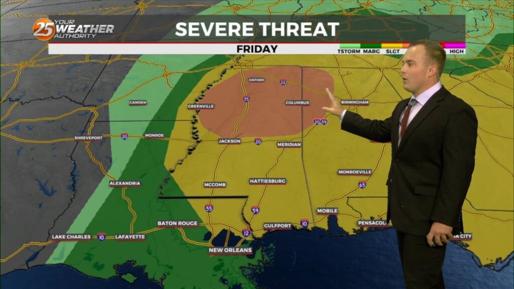
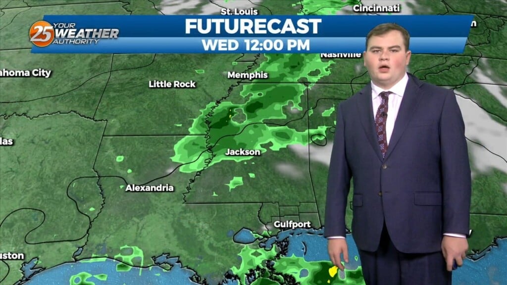
3/7 - Jeff's "Severe Weather Potential" Thursday Night Forecast
Expect increasing clouds and a mild start temperatures-wise for your Friday. While it will be rain-free at the start of the day, rain chances begin as soon…
Expect increasing clouds and a mild start temperatures-wise for your Friday. While it will be rain-free at the start of the day, rain chances begin as soon…
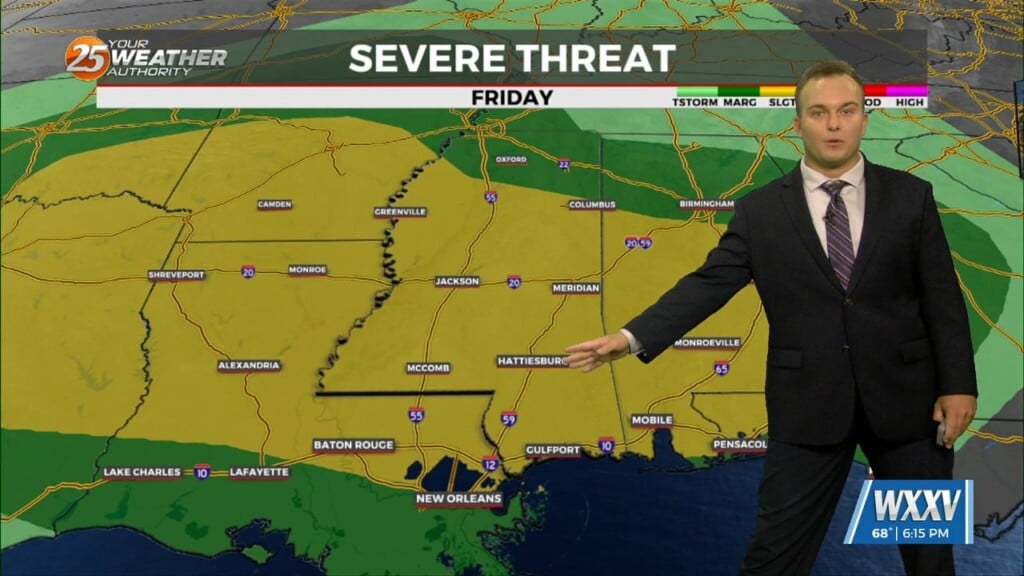
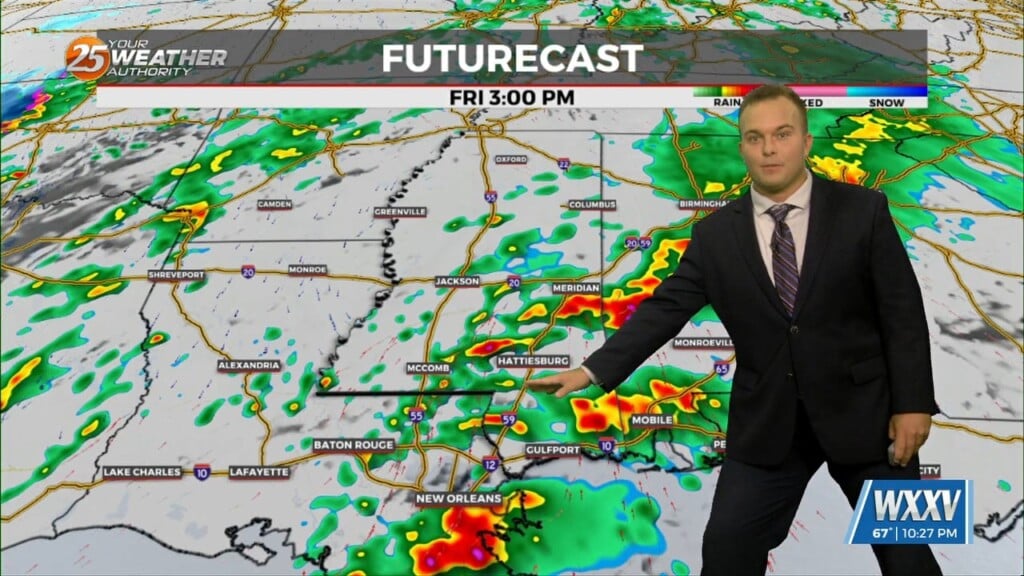
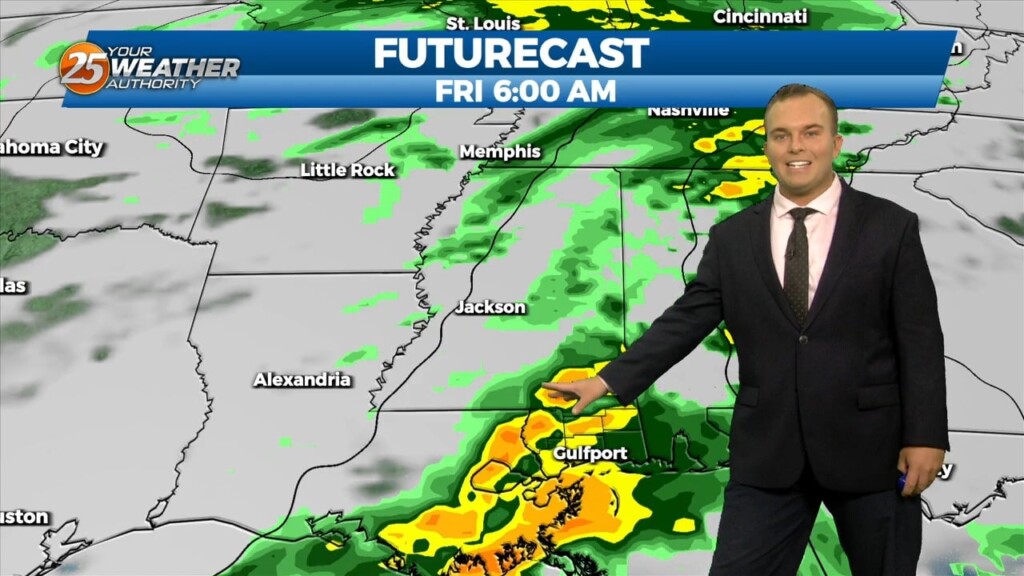
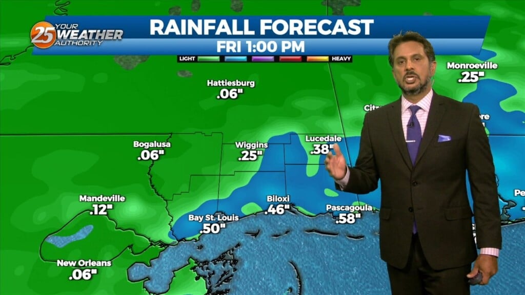
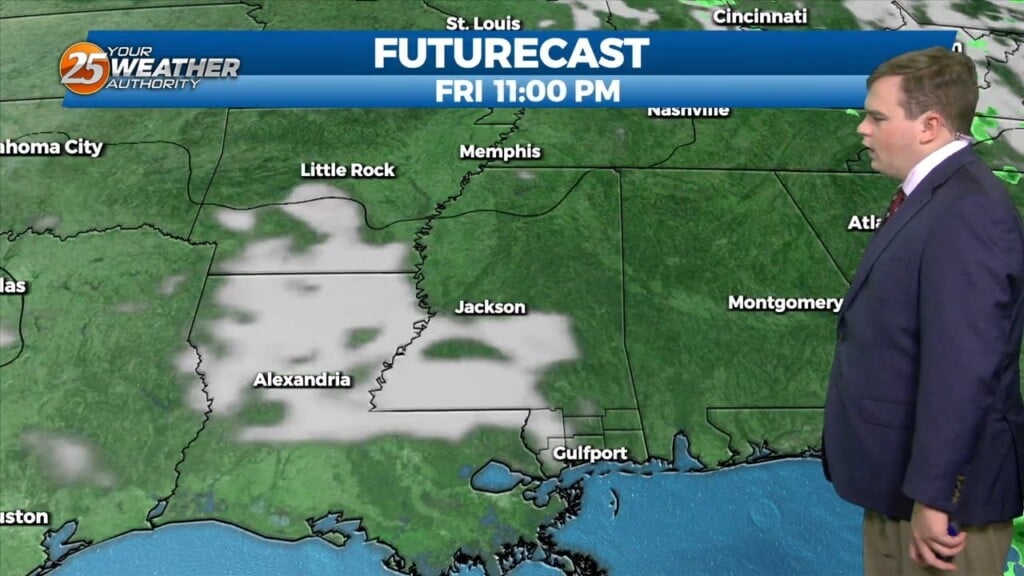
Pleasant conditions will be around this evening but expect increasing clouds and a mild start for your Friday. The big focus becomes the potential for…
Tonight, eyes begin to shift upstream as a cold front begins to move southeastward toward our region. Prior to the frontal passage, surface winds should begin…
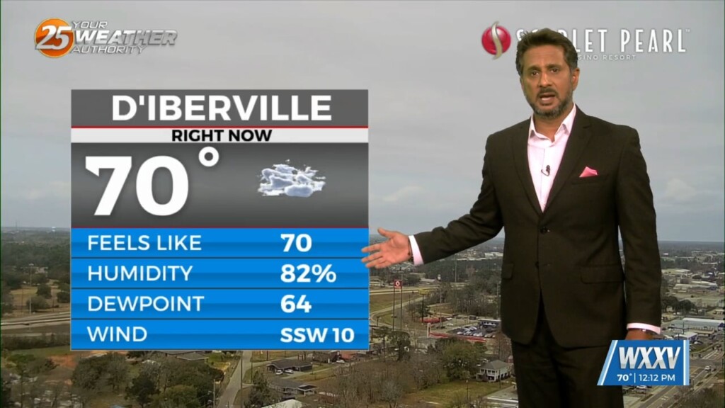
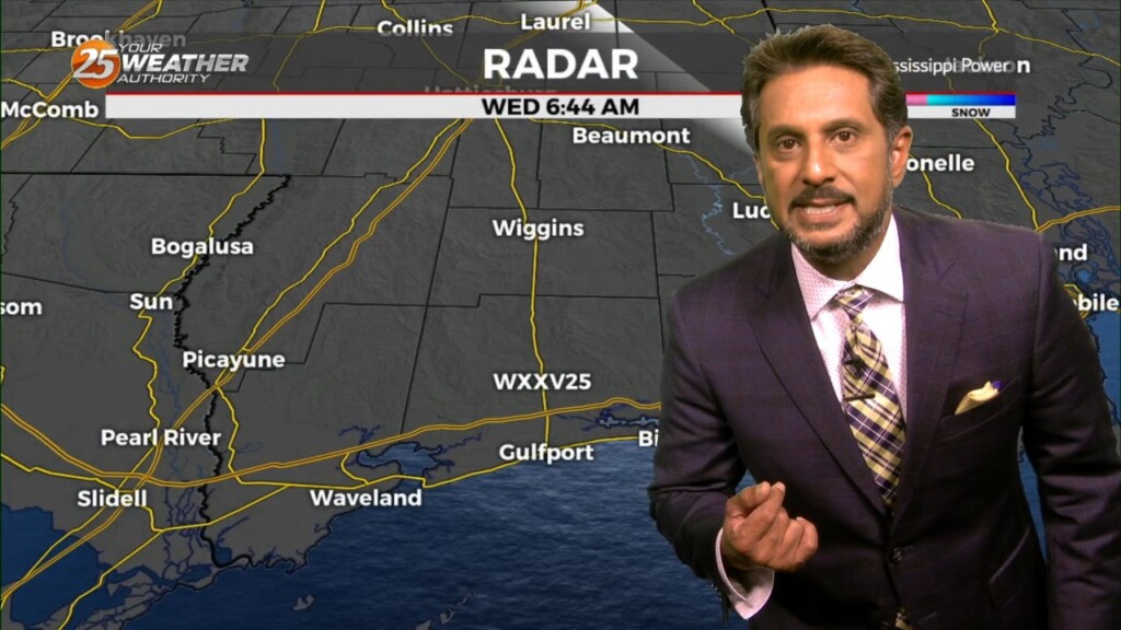
The only story this morning will be fog developing along the MS Gulf Coast. Aloft, a dry northwesterly flow should persist through the near term period.…

A cold front has cleared the area with cloud coverage clearing from west to east. The upper-level feature will also move through the area today…
Very nice comfortable/dry conditions ahead today as highs top out in the mid-60s for most. Cool tonight, but no freezing temps expected. The nice continues into…
A reinforcing shot of dry air has started moving into the area. A back door cold front has moved into the N’tern GOM and…
The next reinforcing shot of dry air will move down behind a new backdoor cold front overnight/Wednesday morning. There is not a lot of boundary…
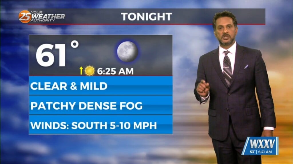
Rain chances early this evening will be put to bed temporarily while fog has the possibility of forming again. A Dense Fog Advisory will be in effect from…
This afternoon will bring an abundant of cloud cover, and at least light precipitation. However, current indications are that rain amounts through Tuesday afternoon…

* Freeze and Hard Freeze Conditions expected again tonight and Saturday night. Wind chill values in the single digits and teens will be likely across the…

A very deep longwave pattern still encompasses almost ¾ of the country with the apex now east of the Mississippi River Valley. This feature has…
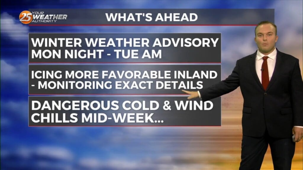
A fairly tame one we’ve had this weekend will give way to a challenging week at times for the Mississippi Coast. DANGEROUSLY COLD temperatures arrive…
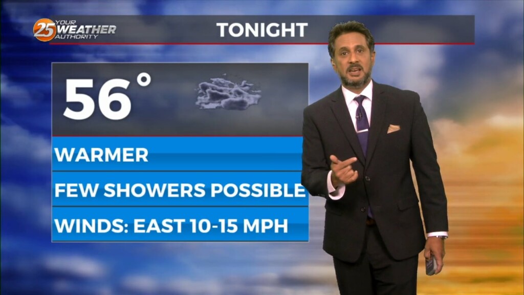
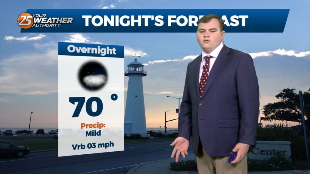
Mild temperatures persist overnight while winds will be picking up and remaining breezy overnight. They will elevate through the overnight hours and a Wind Advisory will…
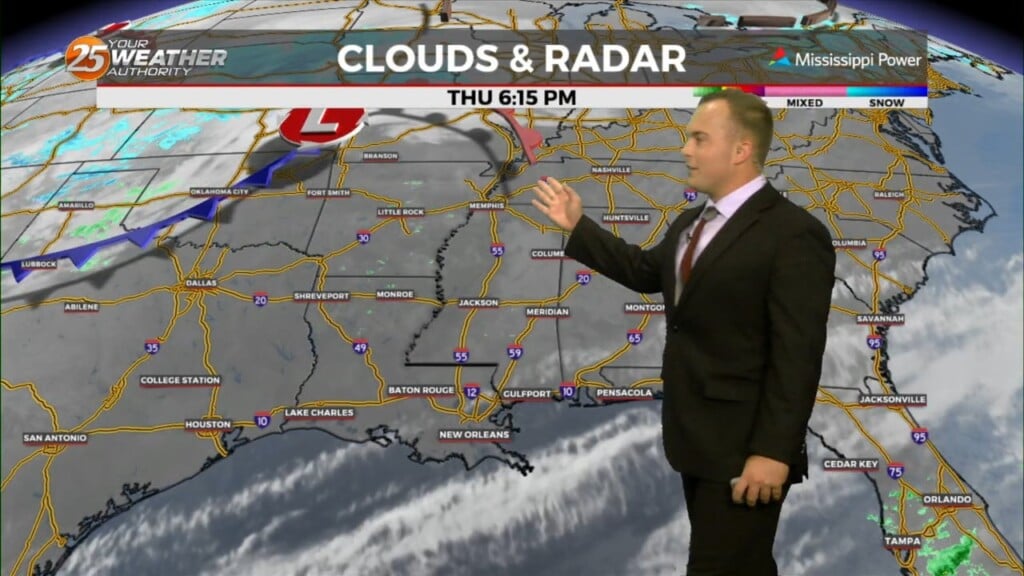
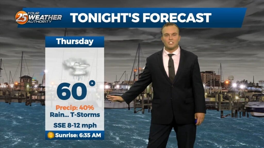
Temperatures remain mild this evening and overnight, and cloud cover fills back in after this evening. The main focus turns to the potential for severe thunderstorms…
The deep upper-level system that produced Monday night’s severe weather is now over the Mid-Atlantic states and moving into New England. The next disturbance in a…
An upper-level high-pressure sits over the Mississippi River Valley with weakness off the New England and California coasts. At the surface, high pressure was centered near the…
The current large scale pattern has an upper level closed low-pressure moving into the desert southwest and broad high pressure over the Caribbean, combining…
Rain arrives this evening and sticks around for some of tonight. It will be a steady light rain that will not be widespread in coverage. Some dry time…
The transition in our pattern is underway. Gradually, winds will turn southeasterly by this evening as a frontal system makes its way into our region. Moe humidity…
An upper level trough of low pressure is currently ranging from Canada across the upper/mid-Mississippi Valley and will continue to rotate through the Ohio River…
This afternoon an area of high pressure is located over New Mexico, with a trough from the eastern Great Lakes to Georgia. The remnants of the line of…
High pressure is centered over New Mexico this morning, with a trough from the eastern Great Lakes to Georgia. The remnants of the line of thunderstorms that dove…
An area of high pressure is currently centered near El Paso extending through the Mid-Atlantic States. A weakness in the overall pattern in the upper levels currently…