8/13 - Sam Lucey's "Less Cloudy" Wednesday Evening Forecast
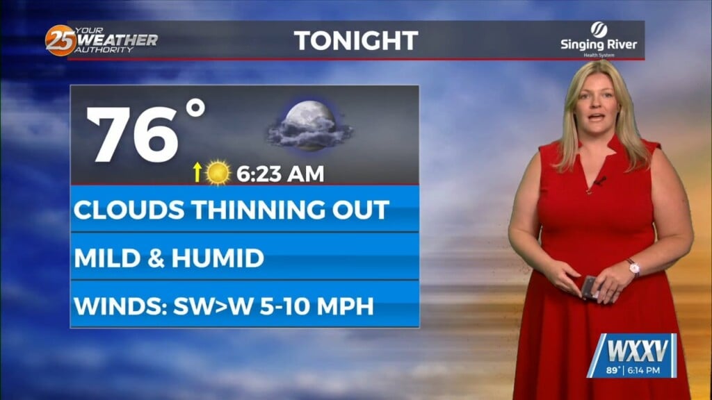
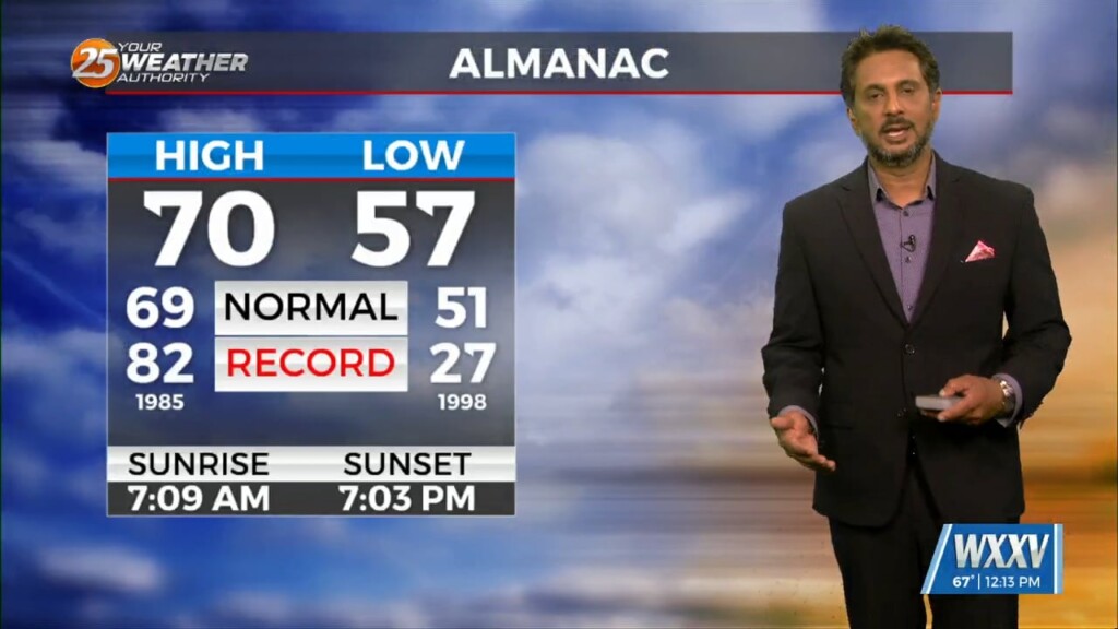
Tonight stays warm with just a brief chance of rain before 9, then partly cloudy and muggy with lows in the mid 70s. Thursday will be hot…
Tonight stays warm with just a brief chance of rain before 9, then partly cloudy and muggy with lows in the mid 70s. Thursday will be hot…
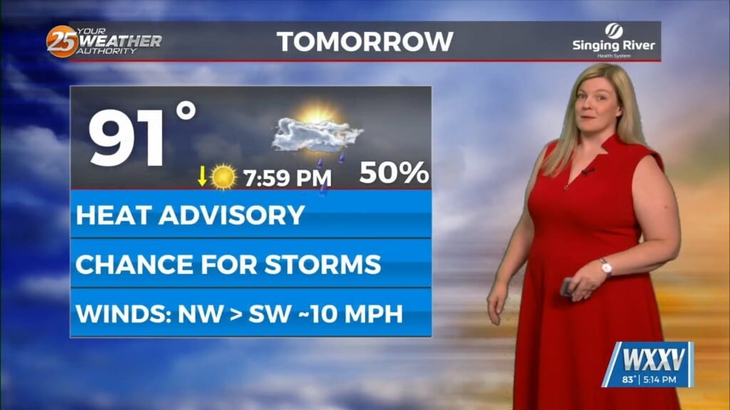
After a very hot day across South Mississippi we are in for more heat on Friday, which is also the official start to summer. There is a heat…
Overall the forecast as a whole is a tale of two scenarios with the first part being: high confidence, mostly dry, and HOT. The second part:…
At the surface, a frontal boundary was drifting into the N’tern GOM. Dew-points are in the low/mid 60s in the area with slight cooler temperatures this…
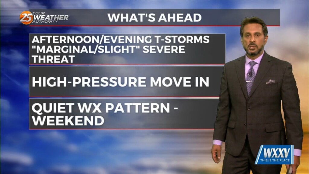
A drier air mass will continue throughout the column bringing rain chances close to zero. As high pressure moves into the region to shape the forecast…
A complex of t-storms well to the NW will continue SE and dissipate late this evening. The activity will move in to the region and traverse…
A disturbance moving east over central Mississippi this morning will help cause some shower activity over the northern half of the area. There will be some boundaries…
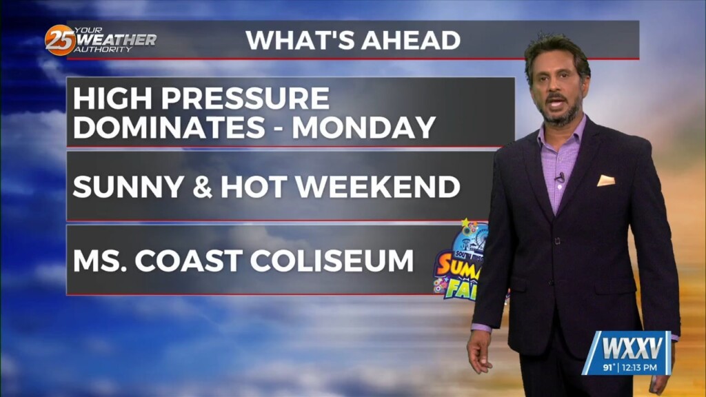
Little change in the ongoing pattern of deep layer high pressure currently in place across the Gulf South is expected through Thursday night. The result will be…
High-pressure and strong dry air in the mid/upper levels of the atmosphere will continue. This will effectively suppress cloud development to below the inversion, and result in…

Low stratus continues this morning as very rich low level moisture continues to stream northward from the Gulf. The low stratus deck will begin…
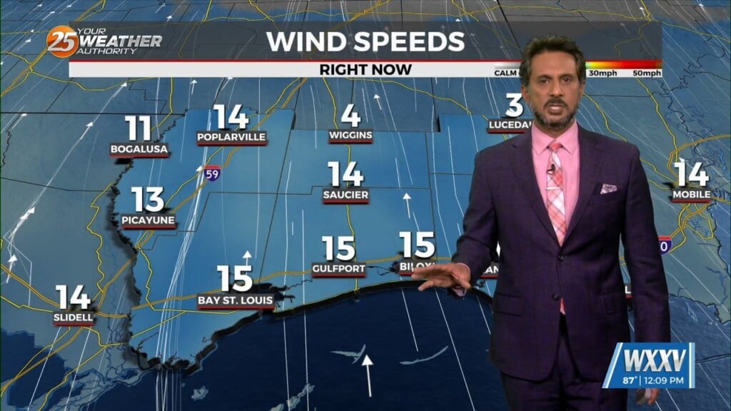
Another wonderful day ahead with sun and clouds mixed, with increasing cloud coverage tonight. A tightening gradient will continue to bring breezy conditions to the area…
For the next few days and through the weekend the word is...WARM. So basically today, April 25th, is probably not the perfect date this year as…

In the wake of yesterday’s cold front, strong dry air surge at the mid and upper levels is continues to move into the area.…
As temperatures warm into the 80s, low level instability will increase and some cumulus development is expected to take hold by late morning. However, a…
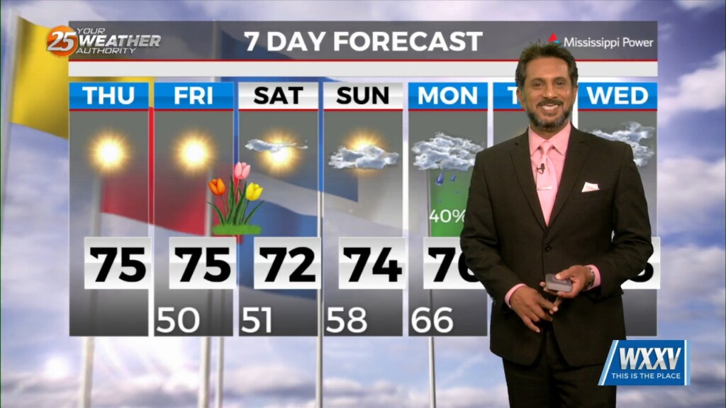
MAKE PLANS FOR OUTDOOR ACTIVITIES THIS WEEKEND... High pressure moving into the region from the NW will provide for dry conditions, which will go a long…
Again today, we should see showers and a few t-storms around. But as we move forward in time, a few of these storms could become…
A highly amplified pattern in the mid and upper levels will remain in place through Saturday night across the CONUS. Today into tonight, the forecast area…
High pressure is moving eastward as a trough of low-pressure is progressing into the area, extending from the Great Lakes down through Texas. At…
No real issues to discuss today. High pressure over the Gulf will continue to dominate the region while low level temps keep slowly stepping up.…
We’ll likely see a period of sunny skies this afternoon and mostly clear skies overnight. However, the upper level support to this feature to the NW won’t…
Anticipate multiple potential hazards in the first 24 hours of the forecast before the weather quiets down for a while. Low pressure over western Kansas this…
Surface high pressure in the region will lend to a cool but pretty spectacular day. Moving into the overnight period, surface high will be right along…
Pretty quiet conditions expected through the short term as high pressure gradually shifts eastward allowing southeasterly winds to take hold of the area. The southeasterly winds…

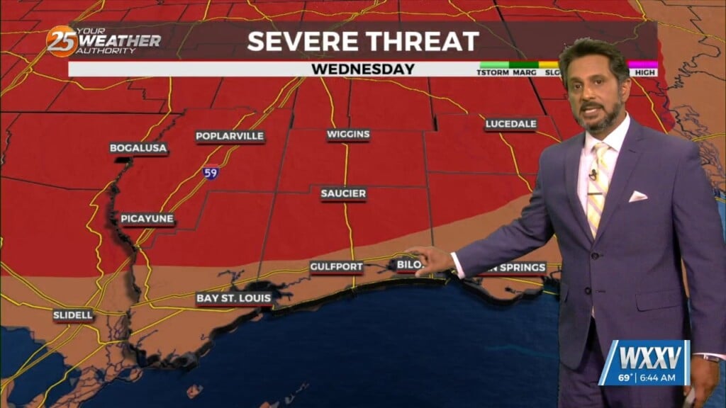
A surface warm front is at the coast moving northward continuing to destabilize the atmosphere. All variables that would support severe storms will also exist today…