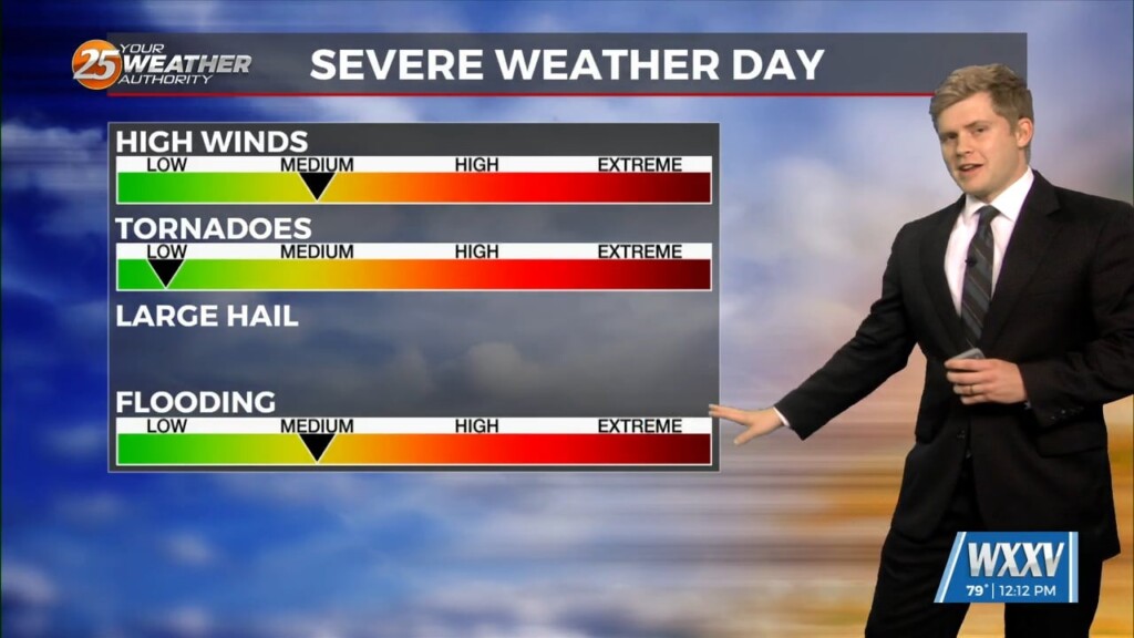
11/13 - Sam Parker's "Possible Severe Storms" Wednesday Midday Forecast
Tuesday was much cooler than it has been thanks to the consistent light rain that stuck with us for the front half of the…
Tuesday was much cooler than it has been thanks to the consistent light rain that stuck with us for the front half of the…
...WIDESPREAD RAIN ALONG WITH SCATTERED SHOWERS AND ISOLATED THUNDERSTORMS WITH HEAVY RAINFALL WILL AFFECT WESTERN ST. BERNARD... ORLEANS...ST. TAMMANY...TERREBONNE...LAFOURCHE...JEFFERSON...ST. JOHN THE BAPTIST...EAST CENTRAL ASCENSION...ST. JAMES...ST. CHARLES... EASTERN LIVINGSTON...TANGIPAHOA...NORTHWESTERN PLAQUEMINES... SOUTHEASTERN ASSUMPTION AND WASHINGTON
The Mississippi Emergency Management Agency (M.E.M.A.) and the National Weather Service (N.W.S.) are highlighting the importance of severe weather alerts for the final day of Tornado Preparedness Week.
