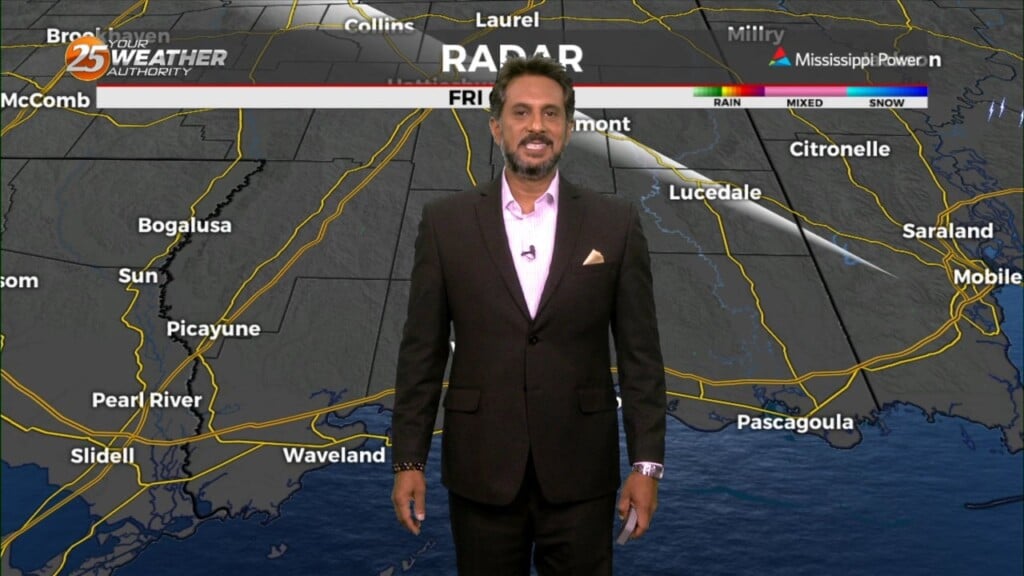
5/16 - The Chief's "Humidity Returns" Thursday Morning Forecast
The old frontal boundary is stalled near the coast this morning and drapes inland near Terrebonne Parish westward to Beuregard Parish. The back end of this front…
The old frontal boundary is stalled near the coast this morning and drapes inland near Terrebonne Parish westward to Beuregard Parish. The back end of this front…
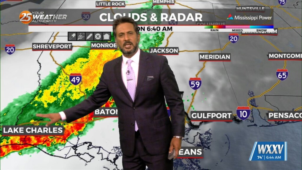
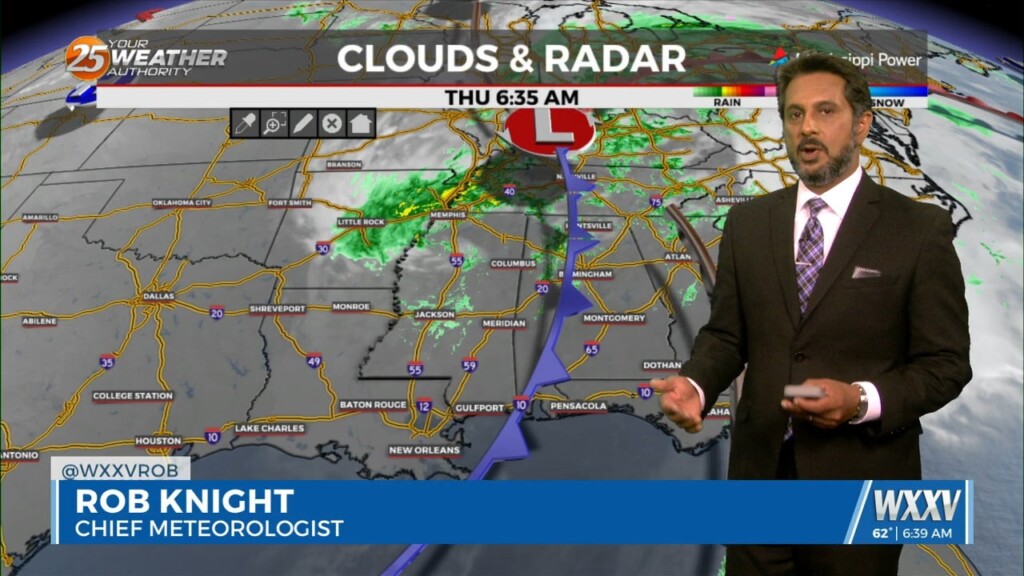
A cold front is currently slowly moving south through the area this morning. This boundary will be very important for this forecast, as it will…
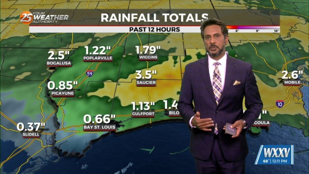
THREAT FOR HEAVY RAINFALL AND SEVERITY. The Flood Watch will remain as rainfall amounts are still coming in from 3 to 6 inches with the…
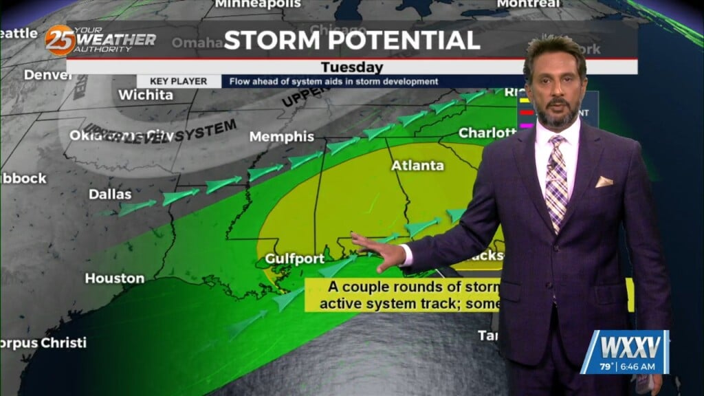
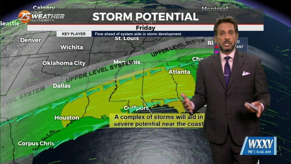
The upper flow is now supportive and subsequent lower level flows are also lining up to support the training of HEAVY RAINFALL. The first of 2 rounds…
Cold front is moving through the area this morning and will be slow to do so. Dry air will move over the area bringing cloud…
First things first this morning it appears there could be a few isolated low topped showers develop with the initial impulse moving into NW Louisiana.…
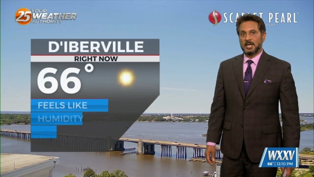
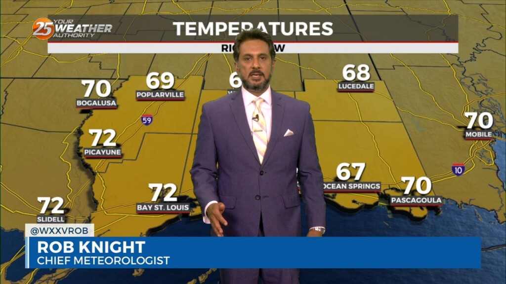
A somewhat weak high pressure across the Bay of Campeche and southern Gulf will help warm most of our region well into the 80s again…
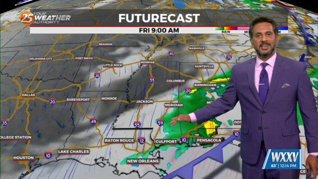
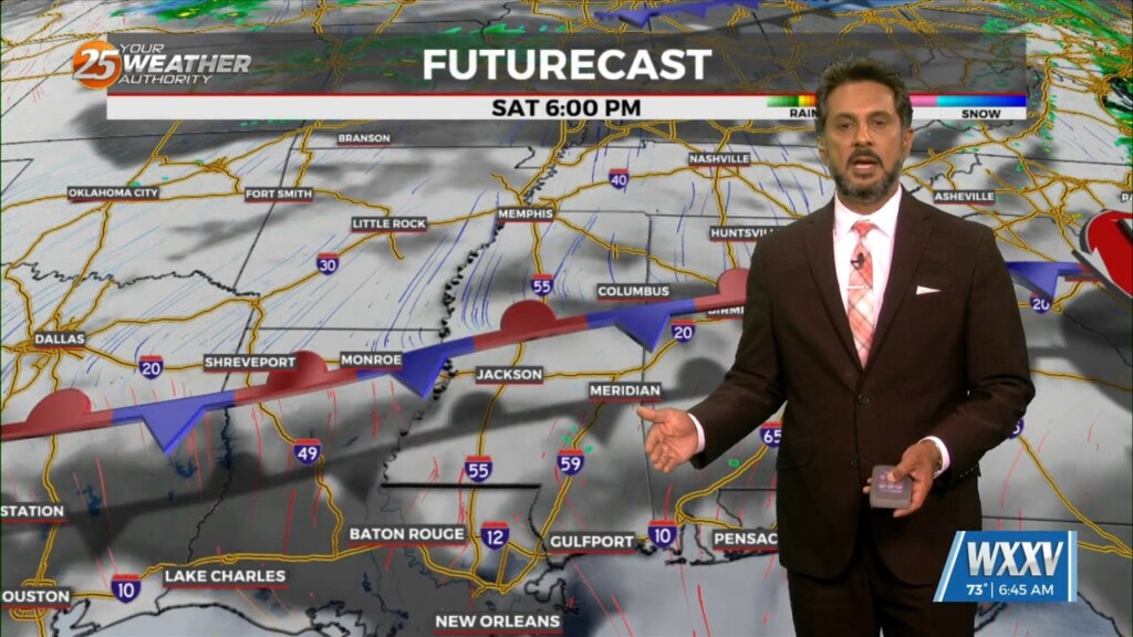
A disturbance along the NE’tern portion of Texas will continue to eject to the NE moving across the extreme NW portion on Mississippi later this afternoon. Friday…
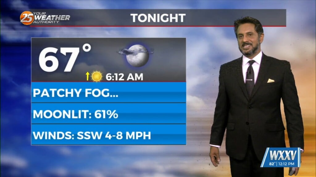
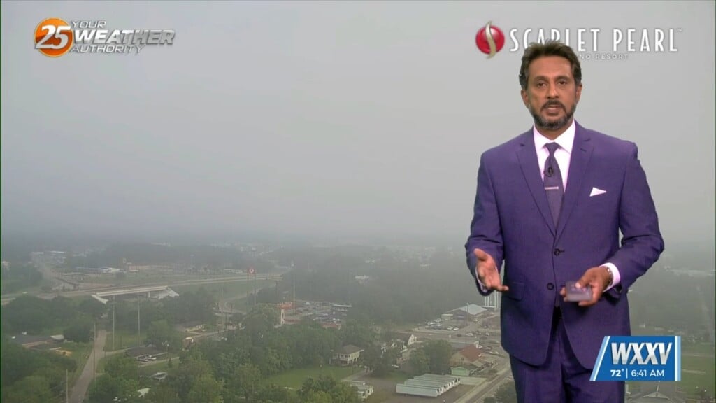
Sunny skies on-tap this afternoon as the cloud cover continues to move to the east. Again tonight, it will be a radiation fog night as well…
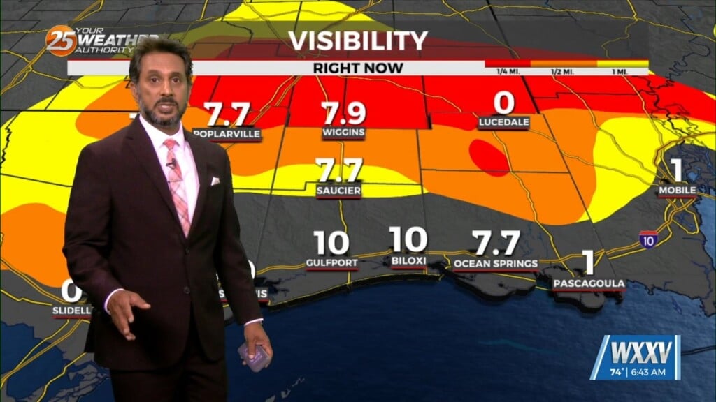
Fog has been an issue this morning and will continue to be a factor through the weekend. The cloudy skies are hanging on over areas where the…
Finally…winds will begin to weaken today dropping below advisory thresholds. But there will still be gusts to 25mph at times and even higher winds up…
The forecast over the next few days and generally even into the weekend is quiet with the only real noticeable change being warmer temps and slowly increasing…
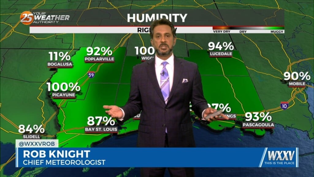
A MUCH DRIER air mass at the surface though the upper levels continue to flow into the region. This dry surge will move through and out…

In the wake of yesterday’s cold front, strong dry air surge at the mid and upper levels is continues to move into the area.…
As temperatures warm into the 80s, low level instability will increase and some cumulus development is expected to take hold by late morning. However, a…
Conditions will remain relatively similar for the next few days with cloud coverage and breezy conditions from the south. The main feature on the map…
High pressure continues across the Gulf of Mexico, with an upper level disturbance noted over southern Minnesota and over Saskatchewan into the Idaho Panhandle. Surface…
At the surface, high pressure extended from near Bermuda westward across much of the northern Gulf of Mexico. A stationary frontal boundary was well to the…
Now that the most violent weather has moved east, we will now work with the back side of the surface low-pressure that still wants to hang…
Cloud coverage and breezy conditions will increase this morning as an approaching cold front to the west stalls. Early Wednesday we will see a cold front…
The strong solar insolation expected this afternoon will allow highs to climb to near average this afternoon, but low tonight will quickly plunge into the 40s north…
High pressure is moving eastward as a trough of low-pressure is progressing into the area, extending from the Great Lakes down through Texas. At…

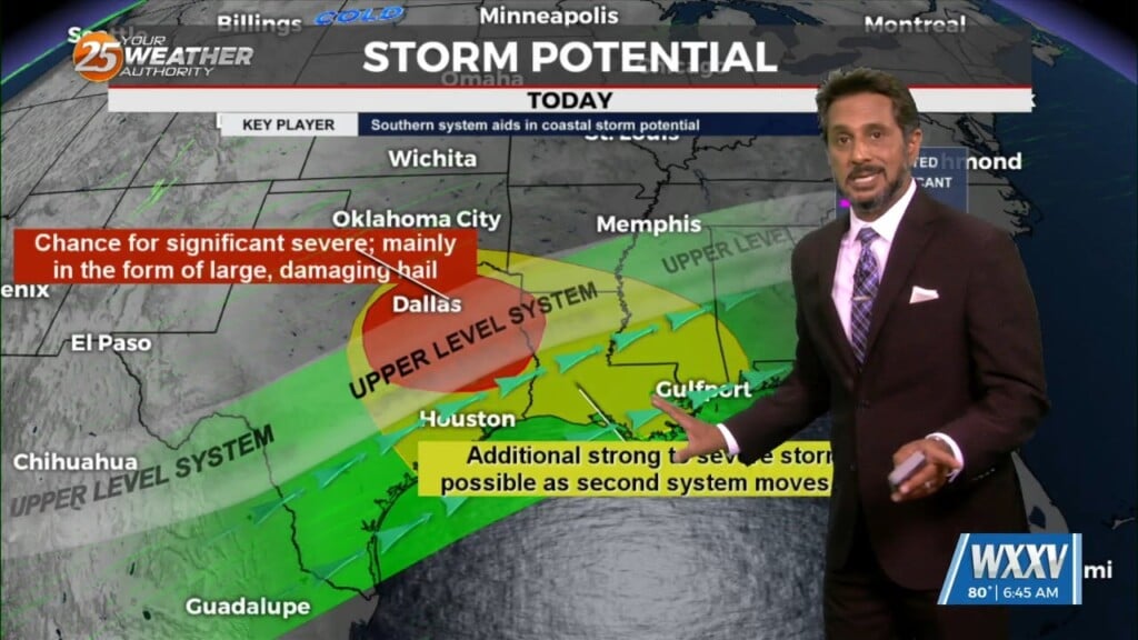
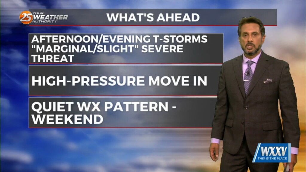
SEVERE THREAT this afternoon/tonight, with multiple potential hazards in the first 24 hours of the forecast before the weather quiets down for a while. A…
An area of upper-level high pressure remains over Mexico with weakness off both coasts. At the surface, low pressure was centered over Oklahoma with a…