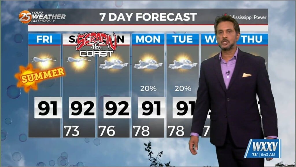
6/21 - The Chief's "Sunny & Hot 1st Weekend of Summer" Friday Morning Forecast
While the low level circulation of former Tropical Storm Alberto dissipated yesterday afternoon, the mid and upper circulation is still evident with…
While the low level circulation of former Tropical Storm Alberto dissipated yesterday afternoon, the mid and upper circulation is still evident with…
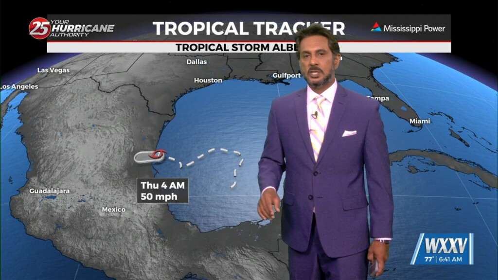
Tropical Storm Alberto has made landfall along the Mexico coastline and continues to move west and weaken. As the pressure gradient weakens, the wind field should…
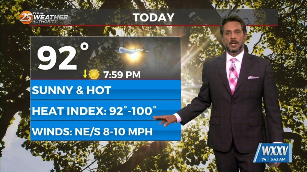
Today will bring increasing subsidence through the area.as high pressure begins to expand eastward from the southern Plains and Texas. At most, some fair weather cumulus cloud…
At the surface, a frontal boundary was drifting into the N’tern GOM. Dew-points are in the low/mid 60s in the area with slight cooler temperatures this…
A stationary front overhead will be the focal point for activity into the weekend. This boundary will help a very large complex of elevated storms develop later…
High pressure through the region will continue to provide subsidence and warming through the period. This will result in a dry forecast through the…
High-pressure and strong dry air in the mid/upper levels of the atmosphere will continue. This will effectively suppress cloud development to below the inversion, and result in…
High pressure to the NE continues to shape the forecast but as expected, models have backed off of bringing showers into the area from the gulf…
High pressure remains dominate over the area and this will remain the case through at least Wed. A few showers could tickle the coast from…

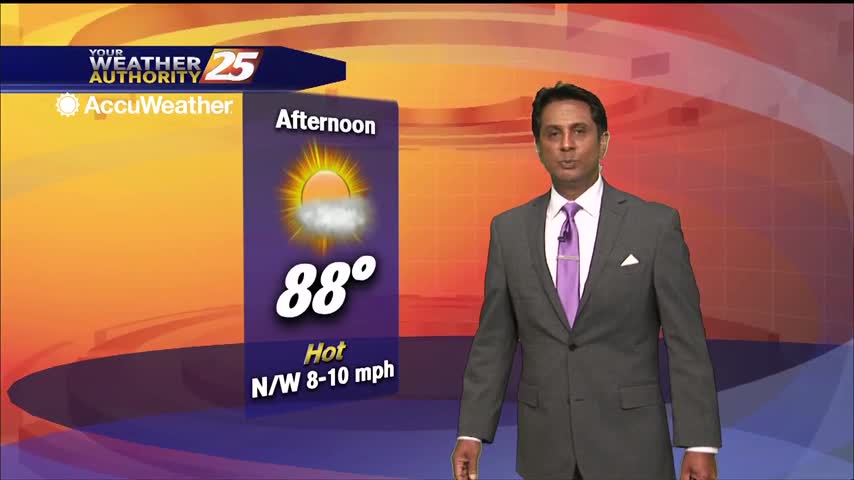
A BEAUTIFUL Friday afternoon ahead with high-pressure to the NW and a weakling stationary front well to the south. Models pinpoint enough moisture above a well-mixed layer…
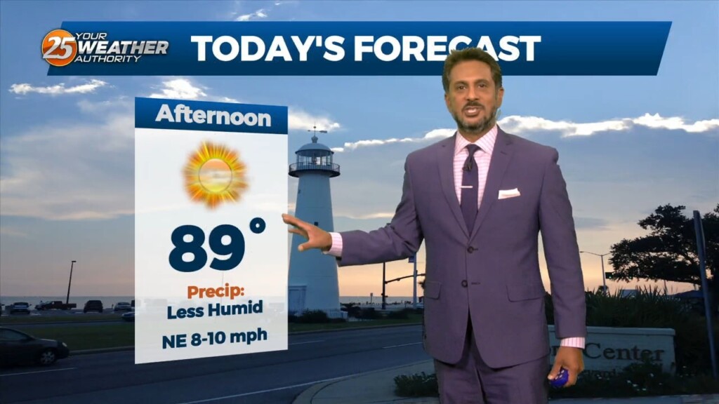
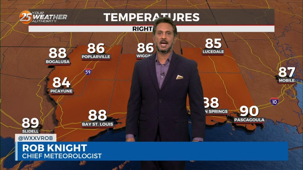
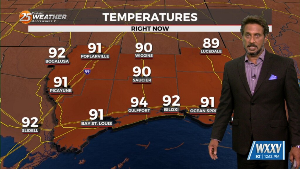
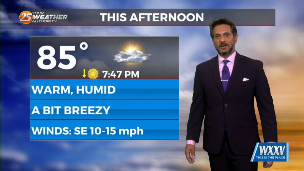
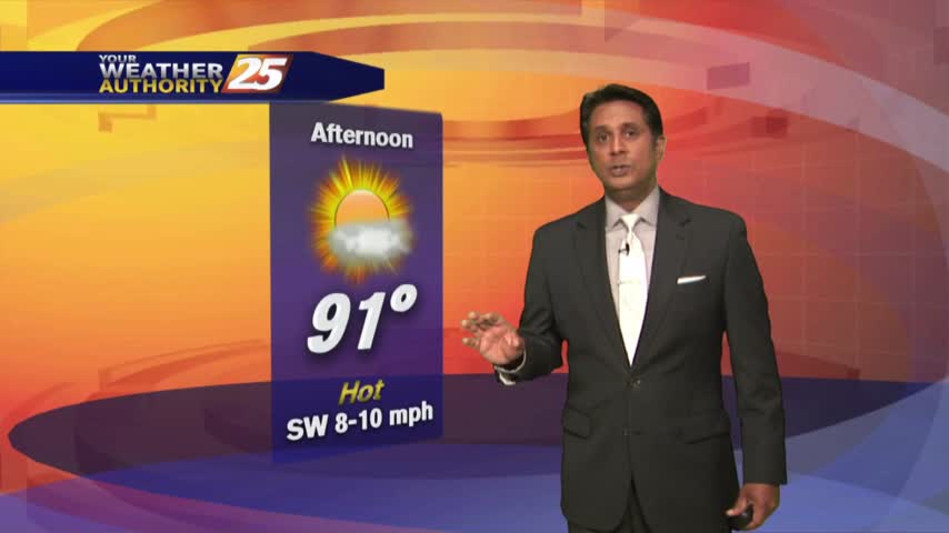
This afternoon will be very similar to yesterday in terms of low humidity values and temperatures warming back into the upper 80s to low 90s. Tuesday…
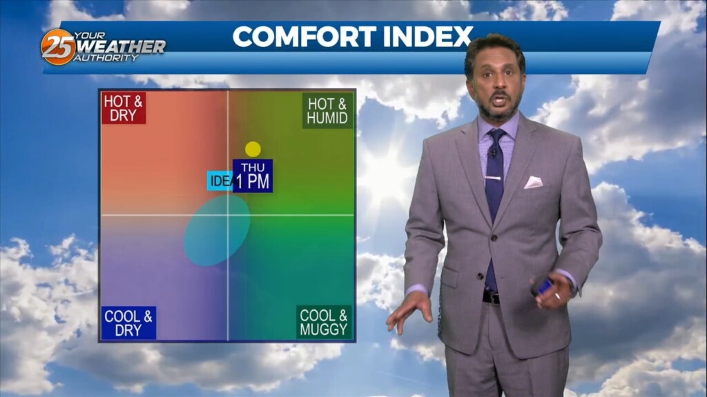
Relative humidity has been rather low the past few days…and that trend will continue heading into the weekend. The current weak upper low pressure over…
A drier day today as additional dry air advects into the region as northwesterly flow continues to take shape. Temperature will likely be a bit…
A cold front has pushed through the area with HOT TEMPERATURES ahead this afternoon before the cool-down. Tuesday, the frontal system will have pushed through and…

Expect sunny and hot conditions this afternoon as summer is determined to hold on until the very last minute... A strong mid-level high pressure situated…
An upper-level low pressure over southern Illinois this morning will slowly drift off the eastern seaboard tonight into the weekend. High-pressure will be the main factor shaping…
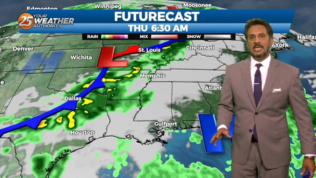
Today and Friday, the lingering frontal boundary will continue to move southward into the open Gulf waters. Upper level high-pressure will build in on Thursday followed by a short wave upper level weakness moving through Friday overnight. Overall rain chances…
Hot temperatures heading into the afternoon won't feel to terribly bad as lower humidity continues...
After a beautiful morning, temperature continue to warm into the upper 80s...
Another beautiful start to the day with lower humidity and light winds from the north...
A mild start under clear skies with areas of patchy fog inland...

A very warm/humid start to the day has once again allowed for patchy fog to develop...
Another beautiful start to the day under clear skies but changes will occur later today...
As the temperatures continue to warm, it feels more comfortable with low humidity...