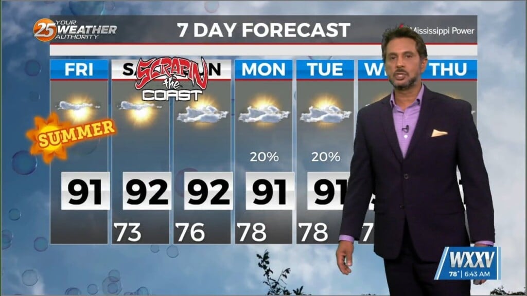
6/21 - The Chief's "Sunny & Hot 1st Weekend of Summer" Friday Morning Forecast
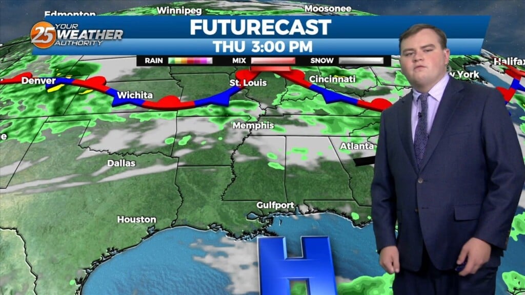
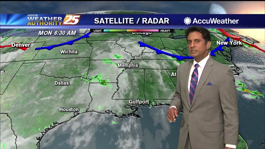
While the low level circulation of former Tropical Storm Alberto dissipated yesterday afternoon, the mid and upper circulation is still evident with…
While the low level circulation of former Tropical Storm Alberto dissipated yesterday afternoon, the mid and upper circulation is still evident with…
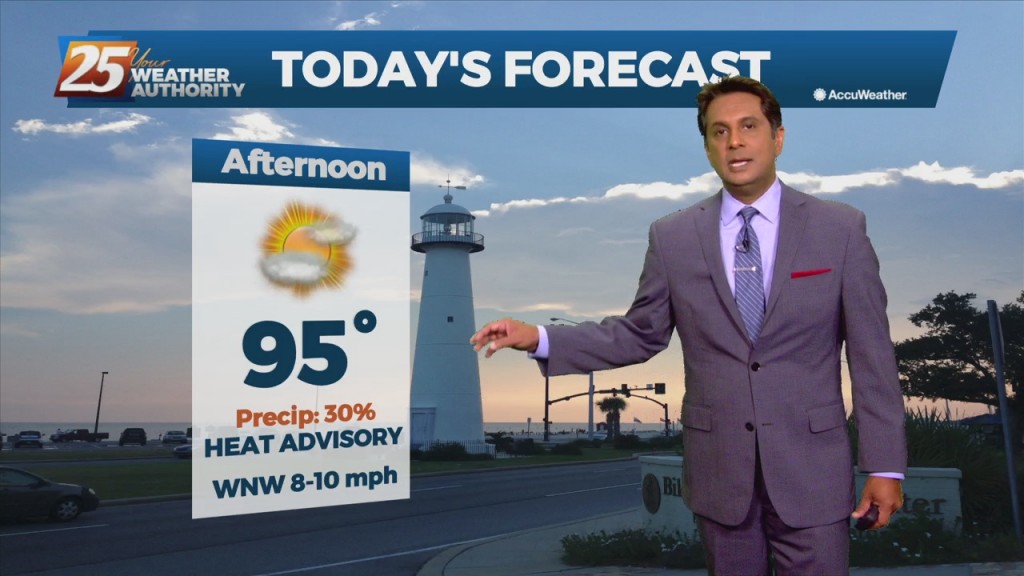
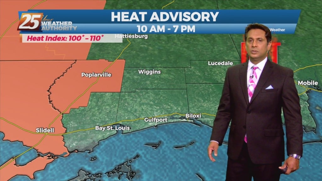
A HEAT ADVISORY is in effect until 7 pm as heat indices will max out between 107 to 111 degrees. High pressure is the dominant feature…
A broad upper level high-pressure remains centered near New Mexico and extends from Mexico to Canada and the Pacific Ocean to the MS River Valley. A…
This afternoon, high-pressure NE will easily support max temperatures around 90 degrees, with isolated locations approaching mid-90 with the heat index. Low-pressure currently in the western Atlantic will approach…
High-pressure slightly stronger than yesterday, is still centered along to just west of the TX/LA border and remains the biggest influence on the local weather. Its close proximity to the area means low rain potential and HOT TEMPERATURES. From a…
The expansive mid to upper level high pressure area will remain just off to the north and west of the region which will keep the forecast area in a battle between very warm/hot low level temperatures and scattered diurnally driven…
A very warm start with multiple location reporting the low 80s for overnight low temperatures...
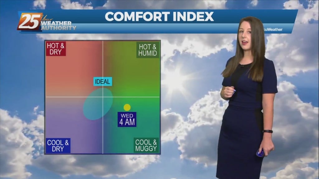
HOT temperatures this afternoon as the HEAT INDEX will average 104 degrees, please be safe...
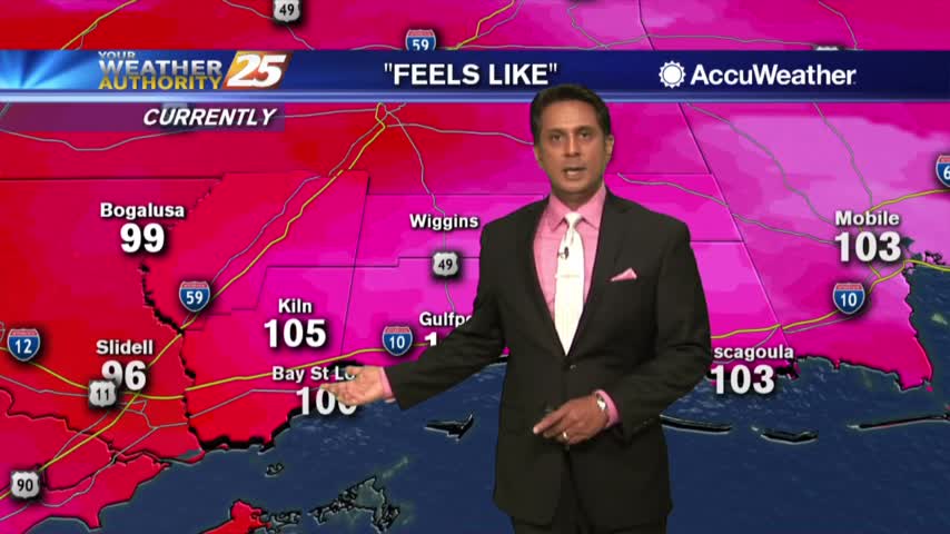
A very warn start to the day with hot temperatures this weekend as the heat index will be between 103-115 degrees...