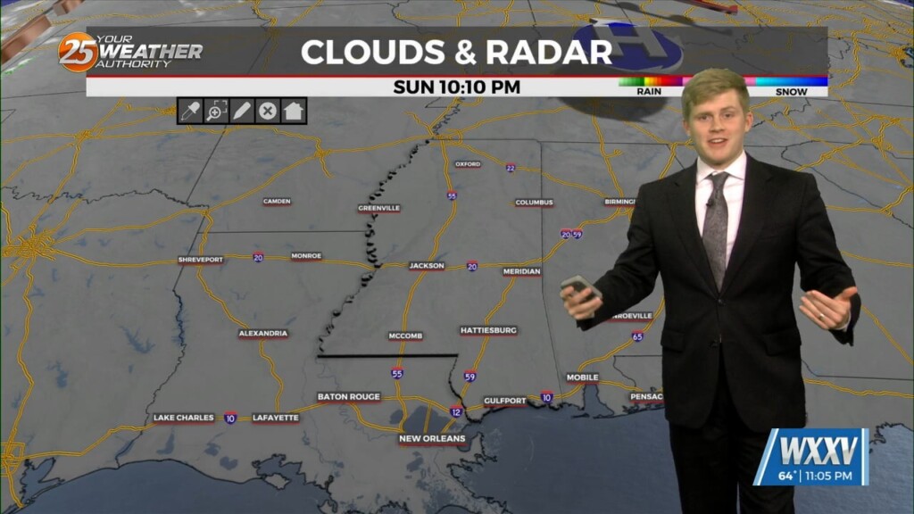
10/27 - Sam Parker's "Getting You Ready" Sunday Night Forecast
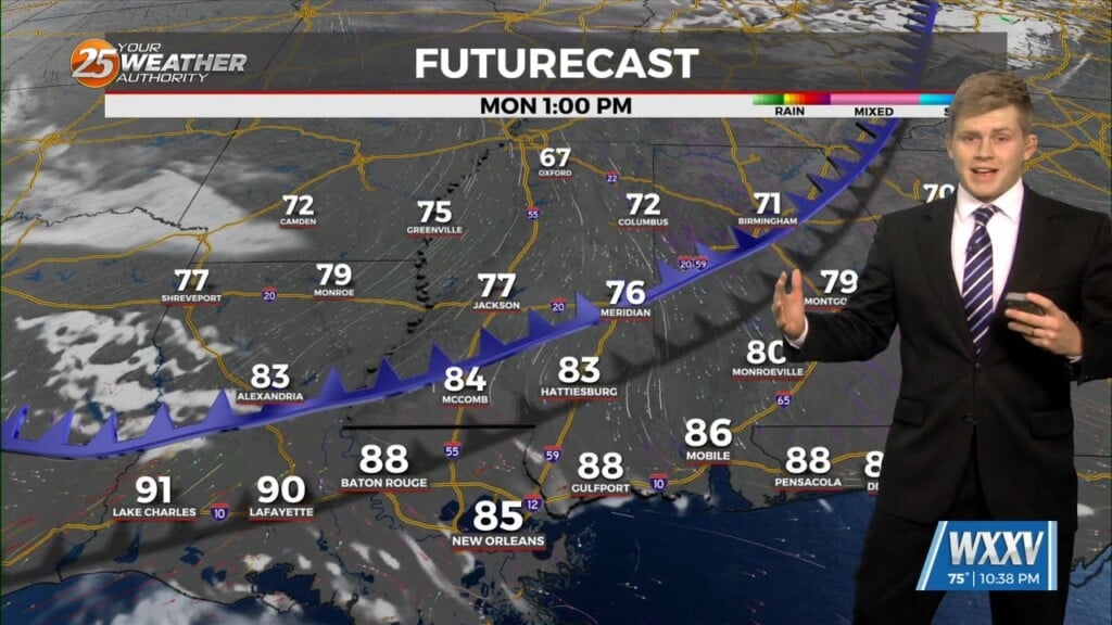
Monday and Monday night will be fairly similar to the past several days With the front weakening the chances for fog Monday morning. Temperatures will still…
Monday and Monday night will be fairly similar to the past several days With the front weakening the chances for fog Monday morning. Temperatures will still…
...Ready for it? Skies will remain free of overhead clouds today, though you may see a few in the distance and eventually see some popping up locally…
Much of the same like yesterday we see continued dry and warm with highs a verity in the mid and upper 80s and lows in the upper 50s…
Dry conditions at least through the the next few days. Temperatures will be a bit warmer today in the mid 80s. This is where these temps will…
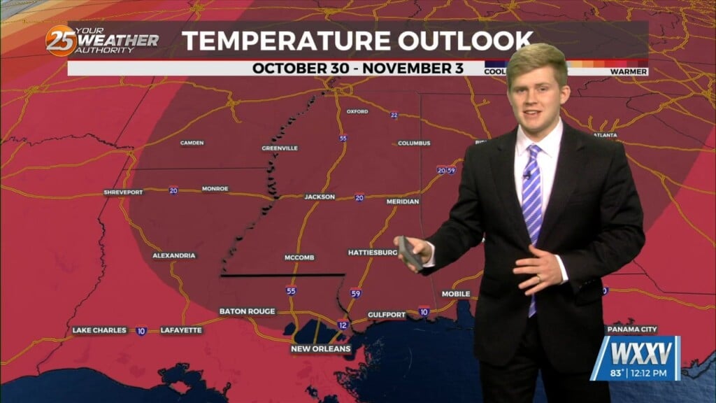
High pressure will remain in control through the first part of the week. This results in highs warming slightly above average into the low to mid 80s…
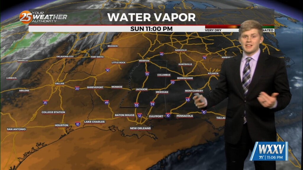
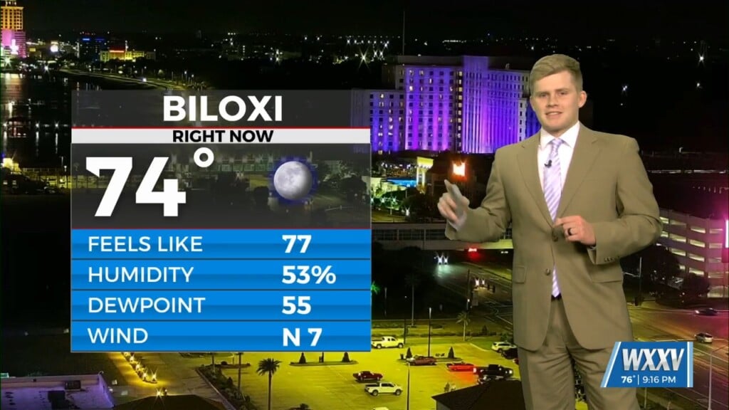
Cool, crisp, and dry conditions continue across south Mississippi this morning. Only slight change from the prior forecast at least early this morning would be adding…
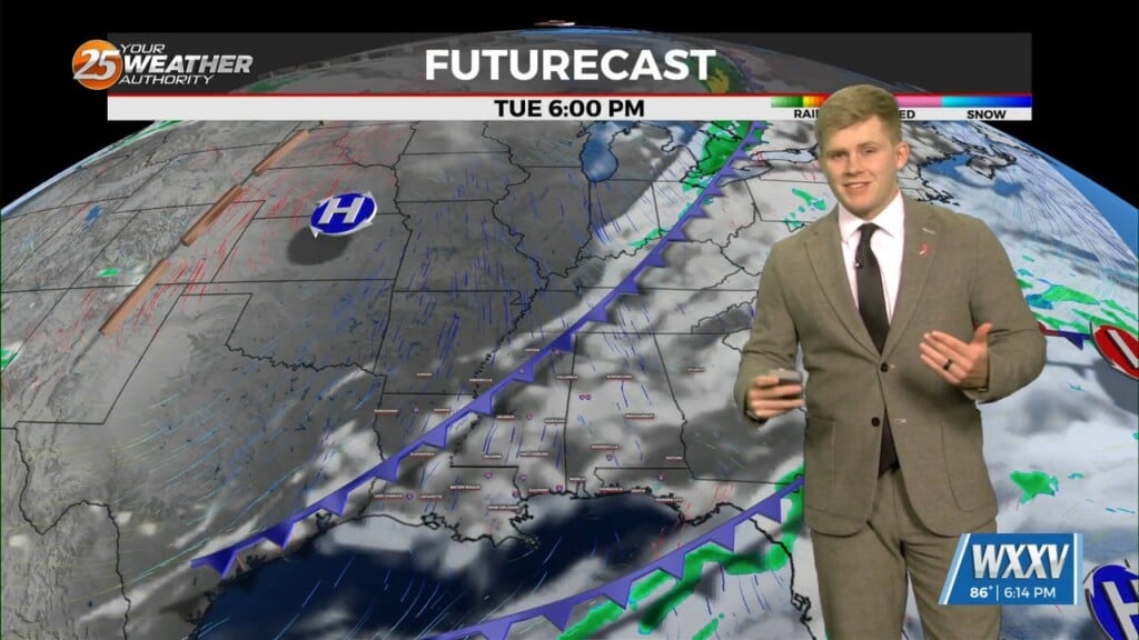
Today brings normal temperatures with highs in the low 80's but the stronger effects of a cold front moves through. This front will move rapidly through around…
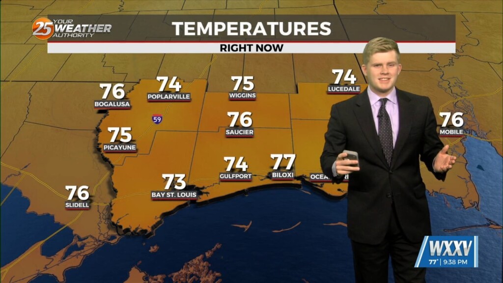
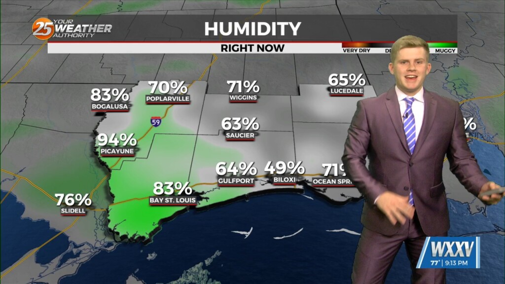
Highs on the warm side to start the week off. Still have relatively low dewpoints in place from previous air mass, so will still have near…
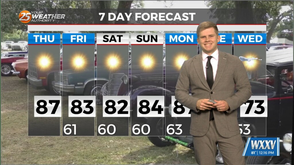
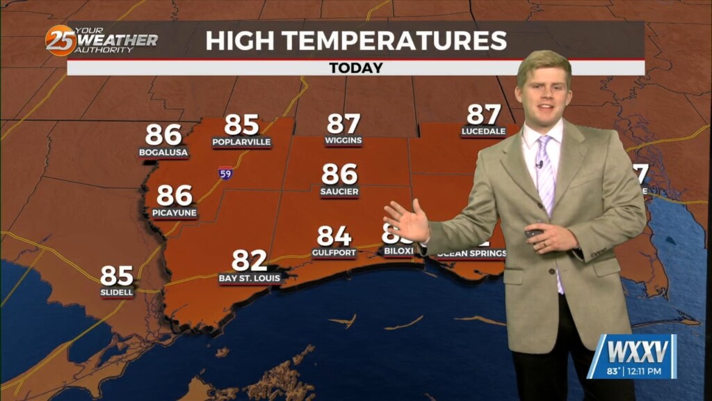
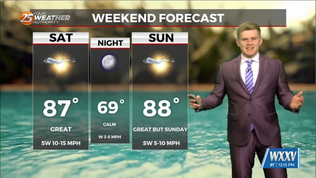
Todays date is like todays weather 10 out of 10! The dry cool nights and warm days continue with mid to upper 80s for highs with a few…
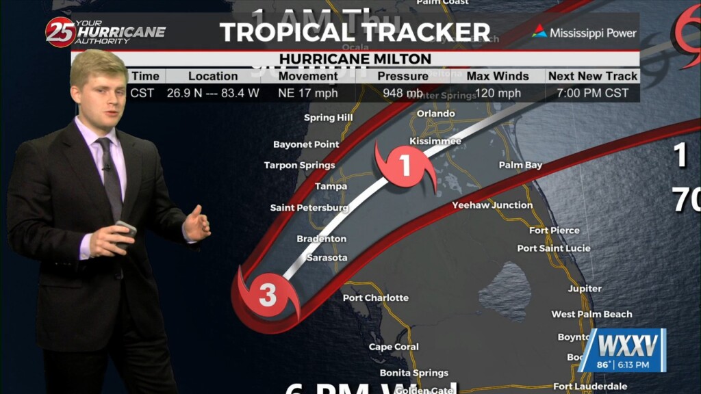
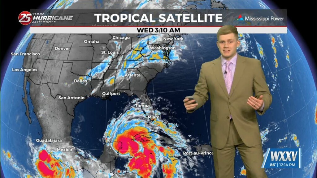
Hurricane Milton is a Few hours away from landfall as a Category 3 Hurricane. Milton had a wide spread tornado outbreak earlier this afternoon now flash…
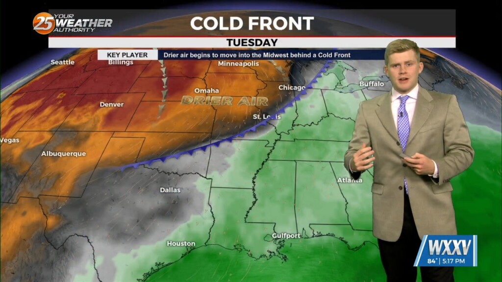
A trough pushed farther southeast over the last 24 hours, drove weak cold front through the local area. Much drier air has and will continue to remain…
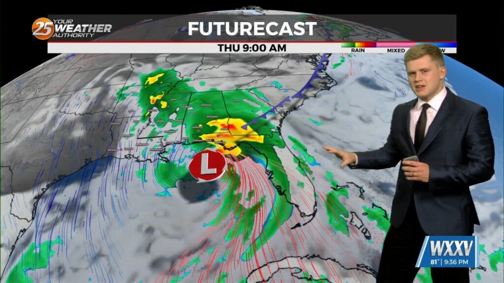
Your Thursday will get off to a nice, sunny start, but it won’t last too long as cloud cover and rain moves in quickly later…
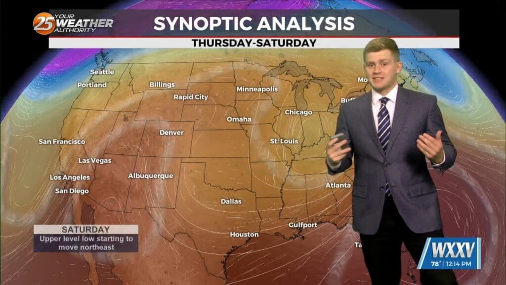
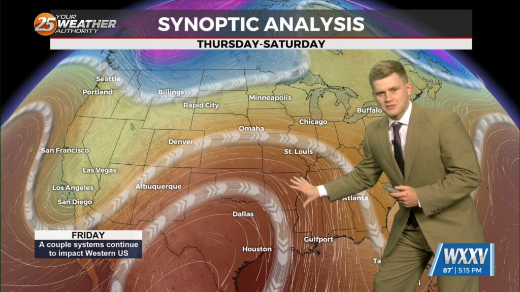
A upper level trough is moving east through the southern US with a broad upper ridge expanding east across the southern US. No appreciable…
Rain chances to increase toward the end of the work week as a weak front interacts with increasing moisture. Rainfall looks to arrive earliest on Thursday and…
There are no significant weather impacts to the local area for the next few days, though rain chances are currently forecast to increase toward the…
Weakening hurricane Helene racing north-northeast through Georgia. The low pressure centered near Memphis helping to accelerate Helene northward. Both are helping to pump cooler and drier…
Weakening hurricane Helene racing north-northeast through Georgia. The low pressure centered near Memphis helping to accelerate Helene northward. Both are helping to pump cooler and drier air…
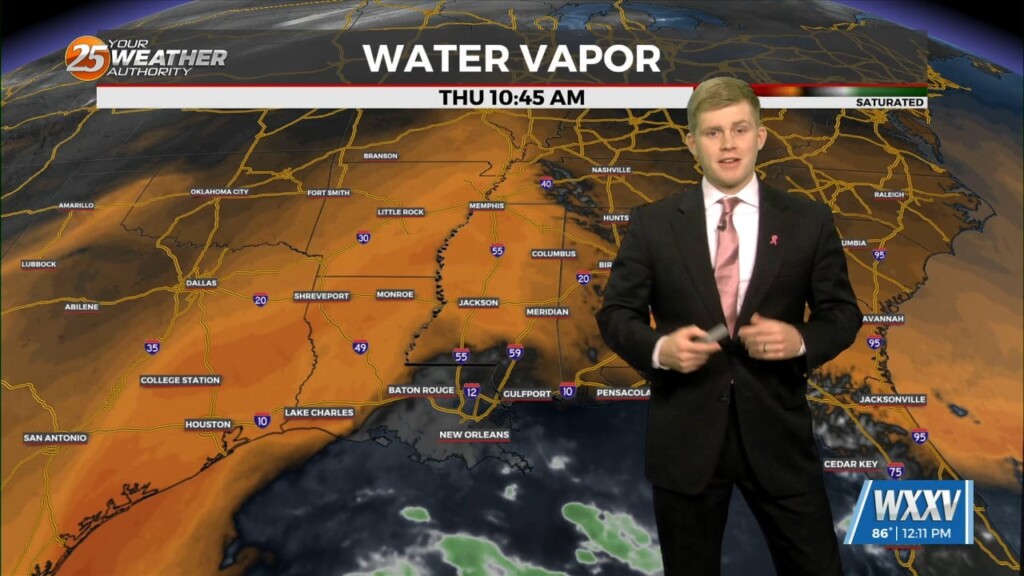
A cold front that continues to push south and east into the Gulf of Mexico this morning. This front, moves drier air into the region, which…
Still watching the cold front to our north which hasn`t moved very much over the last day or so. Eventually, the broader scale upper trough will…
For the first few days, ridging and high pressure will continue to build over the area. As a result, expect dry conditions…
All is quiet for the as the upper level ridge tries to push east. Continuing to see highs in the upper 80s maybe low 90s tomorrow. A…
Few lingering showers around, these are expected to dissipate going into Wednesday Did take a closer look at the potential for more widespread patchy fog…
Forecast models tracking ongoing showers/storms across coastal areas. This activity will persist through around 12-3 AM before we dry out overnight. Quiet overnight other than some patchy fog…
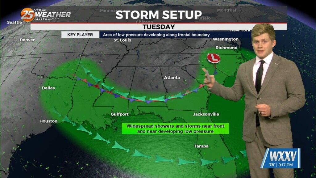
A low pressure system has been hanging around the area for the past few days will continue to bring a risk of showers and thunderstorms to the forecast…