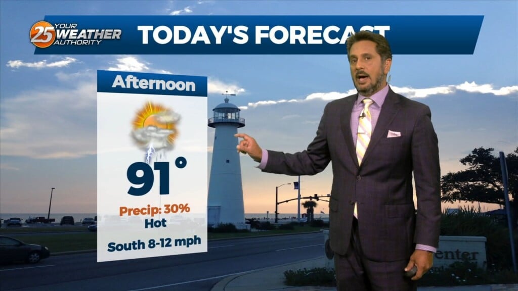
10/3 - The Chief's "Beautiful Cruisin' Weather" Tuesday Afternoon Forecast
High pressure to the NE continues to shape the forecast but as expected, models have backed off of bringing showers into the area from the gulf…
High pressure to the NE continues to shape the forecast but as expected, models have backed off of bringing showers into the area from the gulf…
High pressure remains dominate over the area and this will remain the case through at least Wed. A few showers could tickle the coast from…

A BEAUTIFUL Friday afternoon ahead with high-pressure to the NW and a weakling stationary front well to the south. Models pinpoint enough moisture above a well-mixed layer…

The main story remains to be a weak inverted trough situated over the northern Gulf just south of a weakening stationary front. This continues to…
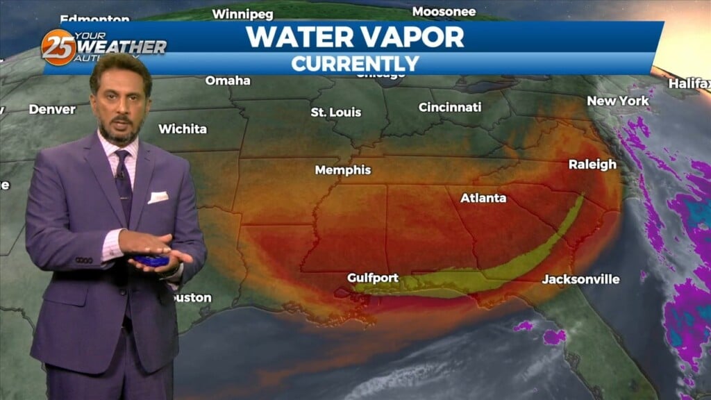
The upper level pattern across the country remains complex, with an area of high pressure extending from northern Mexico to the Great Lakes and low…
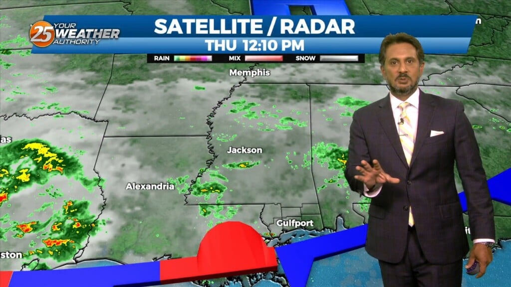
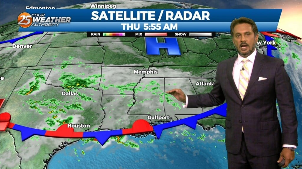
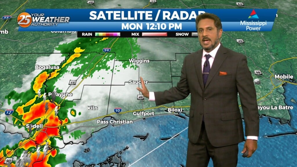
A few showers and isolated thunderstorm have been ongoing early this afternoon over the Mississippi Sound. This is in response to a weak easterly wave in the…
A few showers and isolated thunderstorm have been ongoing early this morning over the Mississippi Sound. This is in response to a weak easterly wave in…
A dry northwesterly flow aloft continues over the region. An impulse of energy to the south will begin to amplify a bit later…
Conditions continue to be gorgeous this afternoon with plenty of sunshine and low humidity. A surface high pressure system remains mostly in control across the eastern…
We have clear skies and cool temperatures across the area this morning with the warmest conditions right along the immediate coast. A surface high pressure system remains…
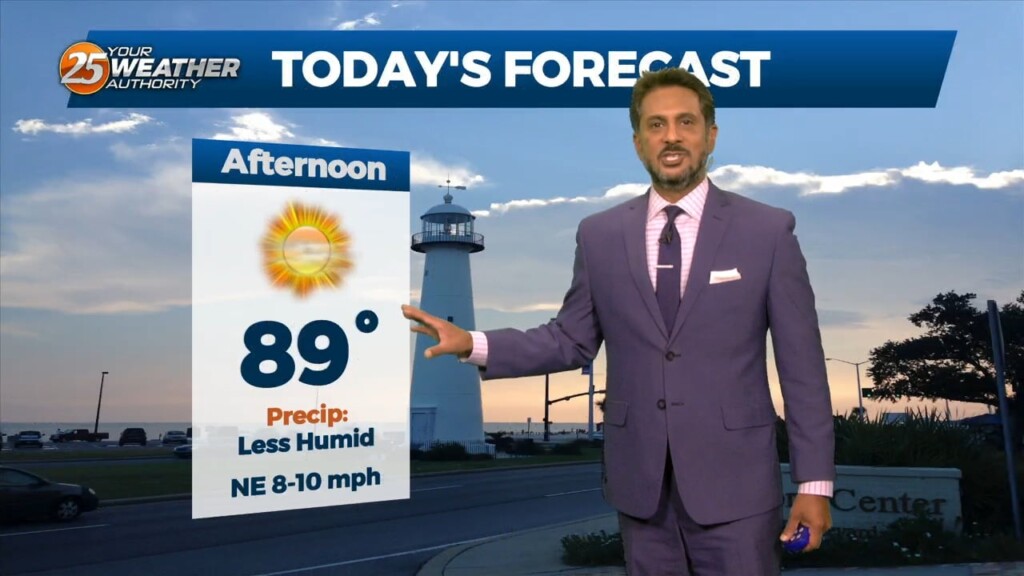
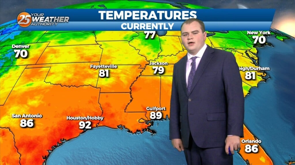
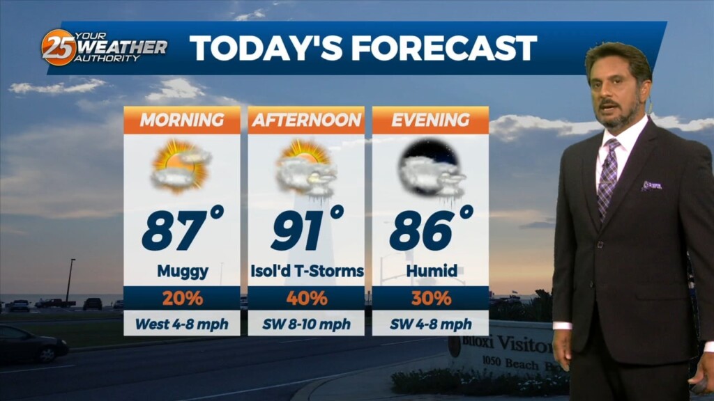
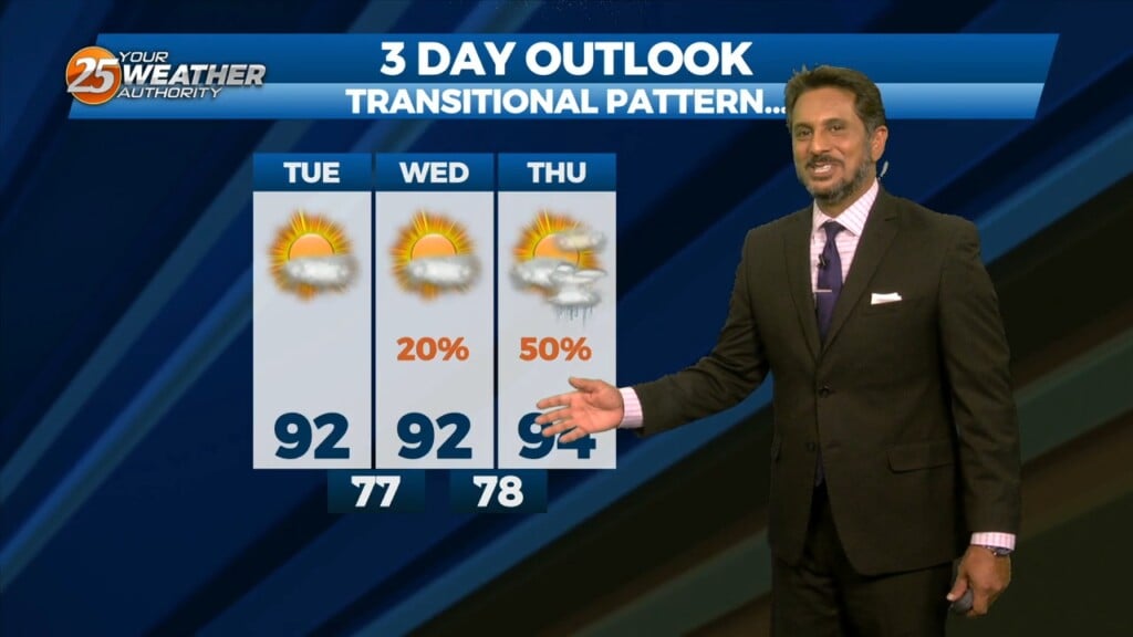
This afternoon will be very similar to yesterday in terms of low humidity values and temperatures warming back into the upper 80s to low 90s. Tuesday…
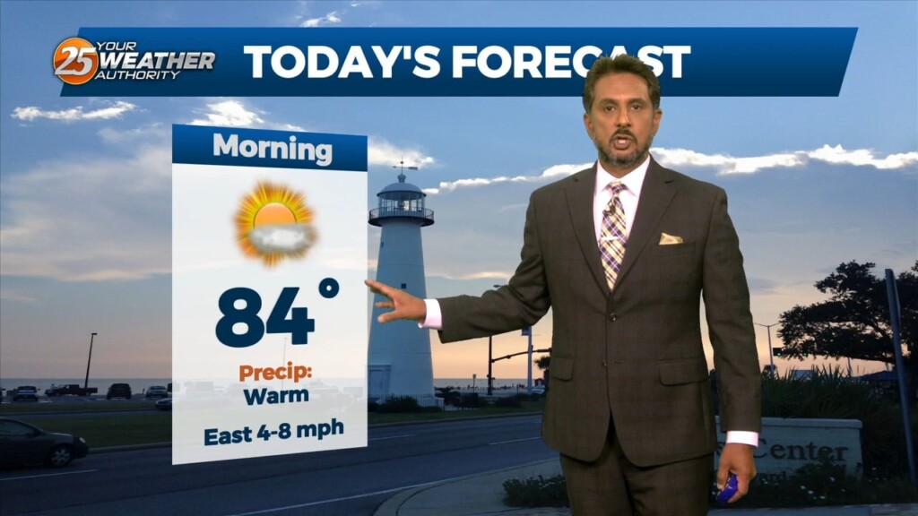
Overall, it’s a very tranquil and "cool" morning across the region with temperatures generally in the 60s with light northerly surface flow continuing. Surface dew-points…
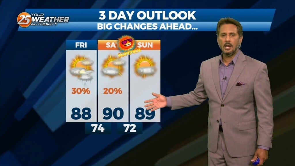
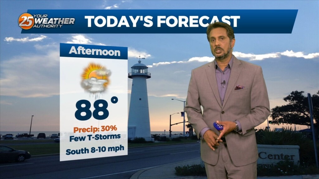
Scattered showers and thunderstorms will be possible this afternoon as temps warm into the upper 80s/low 90s within a fairly moisture regime. Although the latest…
The stalled stationary front to the south is beginning to wash out quite a bit, but will linger into the final weekend of summer.…
The upper level trough that brought the current stalled front across the area is currently east of the Ohio River Valley and quickly moving eastward.…
The upper level trough that brought the current stalled front across the area is currently east of the Ohio River Valley and quickly moving eastward.…
An upper level trough of low pressure currently moving across the Great Lakes will continue to move through the Ohio River Valley today. With the base…
An upper level trough of low pressure is currently ranging from Canada across the upper/mid-Mississippi Valley and will continue to rotate through the Ohio River…
Upper level high pressure is currently entered over the Gulf of California extending northward through the northern Rockies. Weakness extended from the Appalachians into…
High Pressure continues to be centered near El Paso, Texas this morning, extending northward through the Plains States. At the surface, high pressure was centered over…
An area of high pressure is currently centered near El Paso extending through the Mid-Atlantic States. A weakness in the overall pattern in the upper levels currently…
The month of September will bring a changing pattern where dominant high-pressure in the SE begins to break down allowing cold fronts to move through the…
As we head toward the equinox, the upper pattern is becoming more active across the northern half of the US. Upper level high pressure was noted…
Today most things point to a favorable day for scattered to numerous storms but again obviously current events are highly impacting the thought process. This…