11/9 - The Chief's "Changing/Wet Pattern Ahead" Thursday Morning Forecast
Dense fog has developed again across portions of the area this morning. Smoke from the wildfire in New Orleans East could reduce visibility to less than…
Dense fog has developed again across portions of the area this morning. Smoke from the wildfire in New Orleans East could reduce visibility to less than…
Patchy dense fog has formed across portions of southeast LA and southern MS this morning and could become more widespread toward sunrise. Dense fog development will remain…
It’s another cool or coldish morning across the forecast area as the air mass has been slowly modifying. In the upper levels, an area of high…
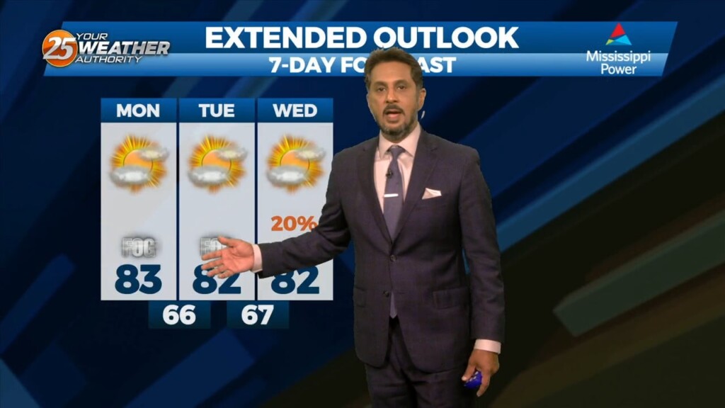
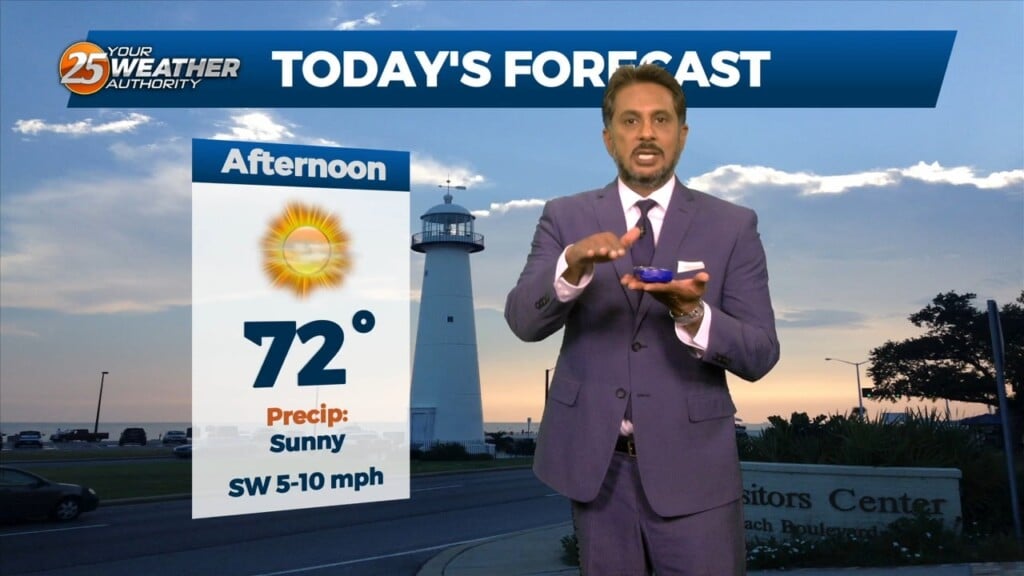
Today looks a little warmer than yesterday, but only by a few degrees. Aloft, the upper levels will begin to shift to a more…
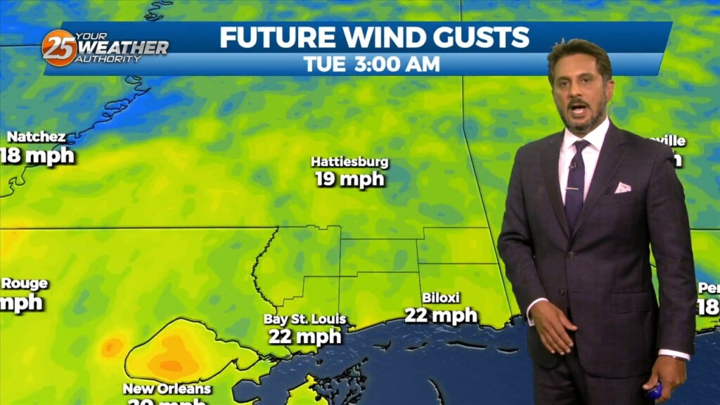
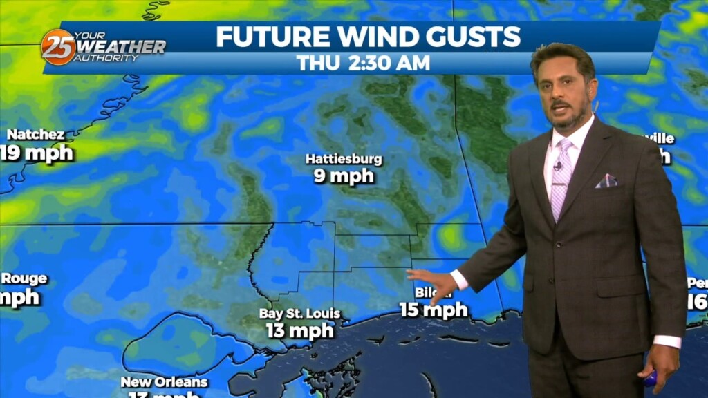
Strong winds will begin to ease today and the wind advisory will be allowed to drop as the gale warning drops this morning. Winds may not be…
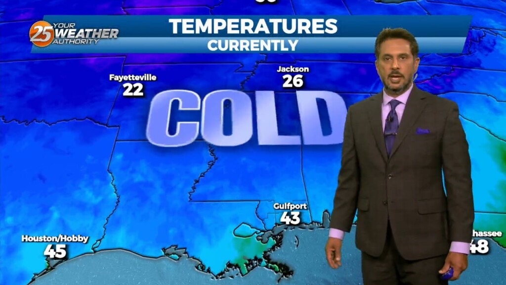
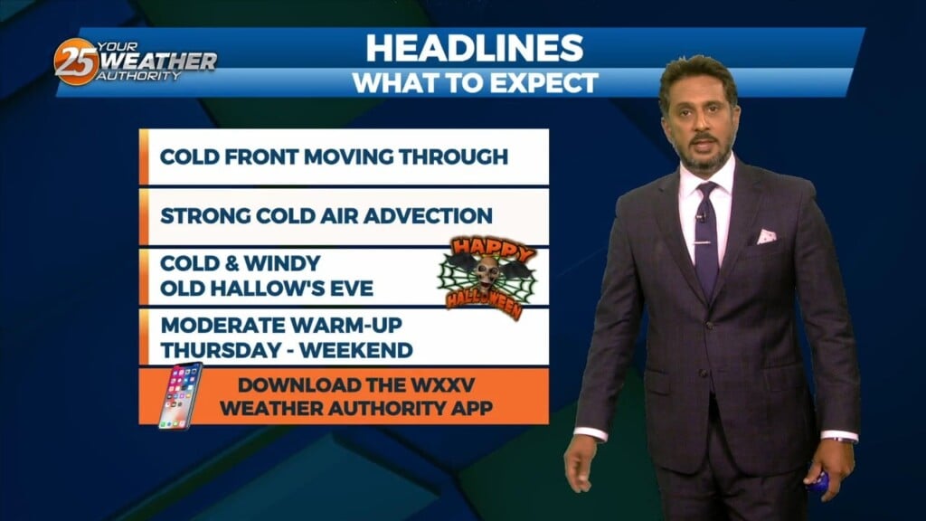
Strong cold advection and this looks to continue over the next 24 hours or so. This will help force temps to the lowest levels…
To say the obvious, there is some very strong cold advection and this looks to continue over the next 24 hours or so. This will…
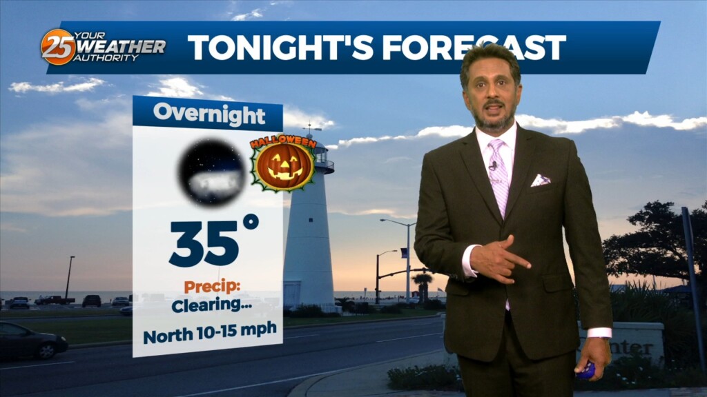
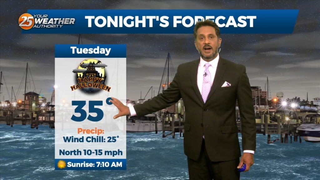
A n approaching surface front should clear the land by the afternoon as winds shift out of the north. The upper front will lag behind the…
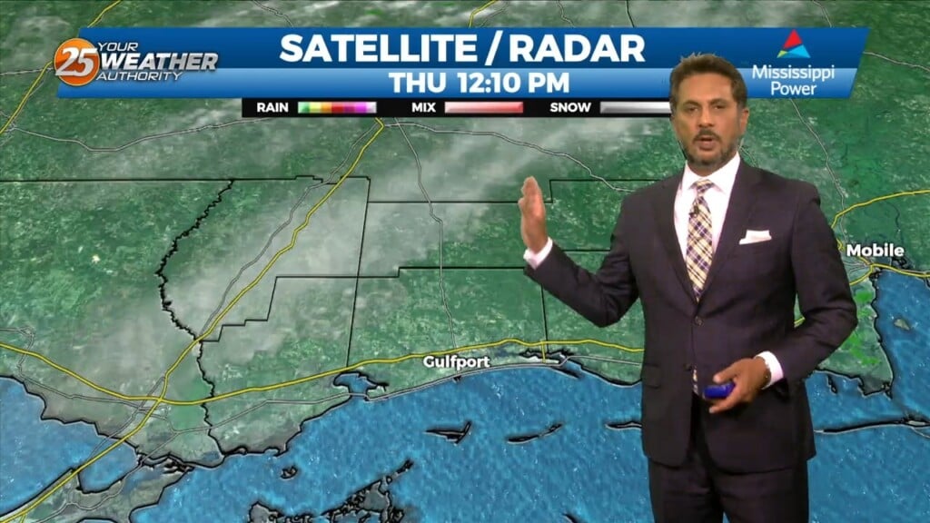
The biggest impact of this morning is the fog development out ahead of the front across our area. The front is just starting to get into…
A disturbance over northern Mexico is promoting its development as it ejects over the southern plains. High pressure over the GOM will keep the disturbance too…
The biggest impact of the short-term is the fog potential this morning. With the east-southeasterly surface winds promoting low-level moisture, the areas where the winds have…
Upper level high pressure is now over the Mississippi River Valley with weakness along both Atlantic and Pacific Coasts. At the surface, high pressure was centered…
A very weak front just north of the area will continue to move toward the Atlantic Coast today and Saturday with upper high pressure beginning…
The axis of the upper disturbance extended from the Great Lakes to the Florida Panhandle early this morning with upper high pressure over the Rockies. If…
At the surface, high pressure currently extends along the Atlantic Coast into the northeast Gulf of Mexico. Low pressure over Wisconsin had a cold front…
An area of upper level high pressure is centered over the Appalachians and over Nevada this morning with a sharp disturbance running from the Great Lakes to…
High pressure yesterday just west of Shreveport/Bossier City La has shifted to our NE. This will innate the return flow from the Gulf of Mexico. Warmer…
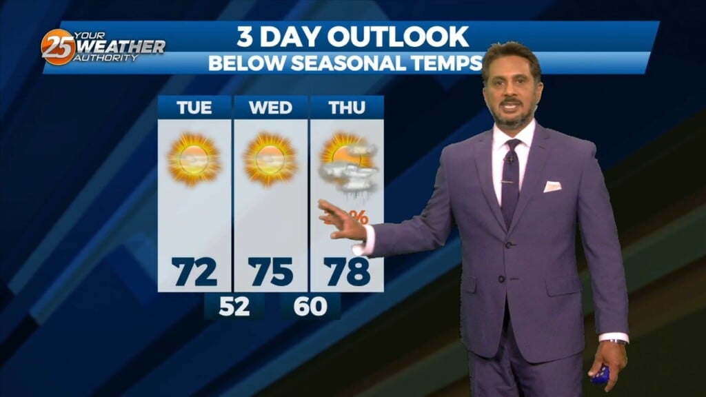
Lovely…but below seasonal temperatures will continue this afternoon as high pressure slides eastward to the Atlantic Coast by Wednesday afternoon, eventually turning low level flow onshore…
An upper level disturbance extends from off the New England coast to the Carolinas, down to the northeast and central Gulf of Mexico. High…
Clouds really hung around yesterday and definitely had an impact on the highs and then winds have held on for much of the evening and even…

It’s a bit on the warm side across the region this morning. A low level thin stratus deck has developed, which is keeping most of the…
The low pressure system that brought some measurable rainfall across the region yesterday as well as gusty winds will continue to move downstream today. In the…
All eyes continue to focus upstream at the nontropical low pressure system across the western Gulf of Mexico. This feature will begin to strengthen as it…
It’s another October morning with crisp temperatures in the mid to upper 50s across much of the area. Drier air and surface high pressure remains…