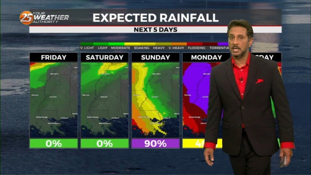
1/18 - The Chief's "Warmer With Spotty Rain" Thursday Morning Forecast
At the surface, high pressure is centered near the Carolina coastline, producing light easterly to southerly surface flow across much of the Lower and Middle Mississippi…
At the surface, high pressure is centered near the Carolina coastline, producing light easterly to southerly surface flow across much of the Lower and Middle Mississippi…

A very deep longwave pattern still encompasses almost ¾ of the country with the apex now east of the Mississippi River Valley. This feature has…
WIND CHILL & HARD FREEZE WARNINGS in effect tonight... Temperatures will struggle to warm into the 40s this afternoon especially with a strong north wind…
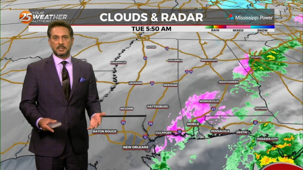
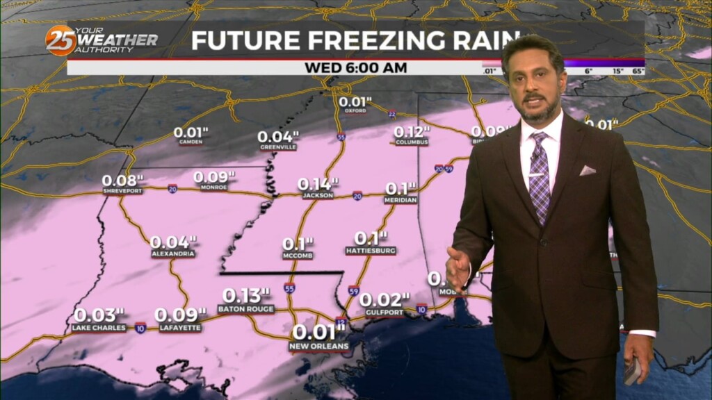
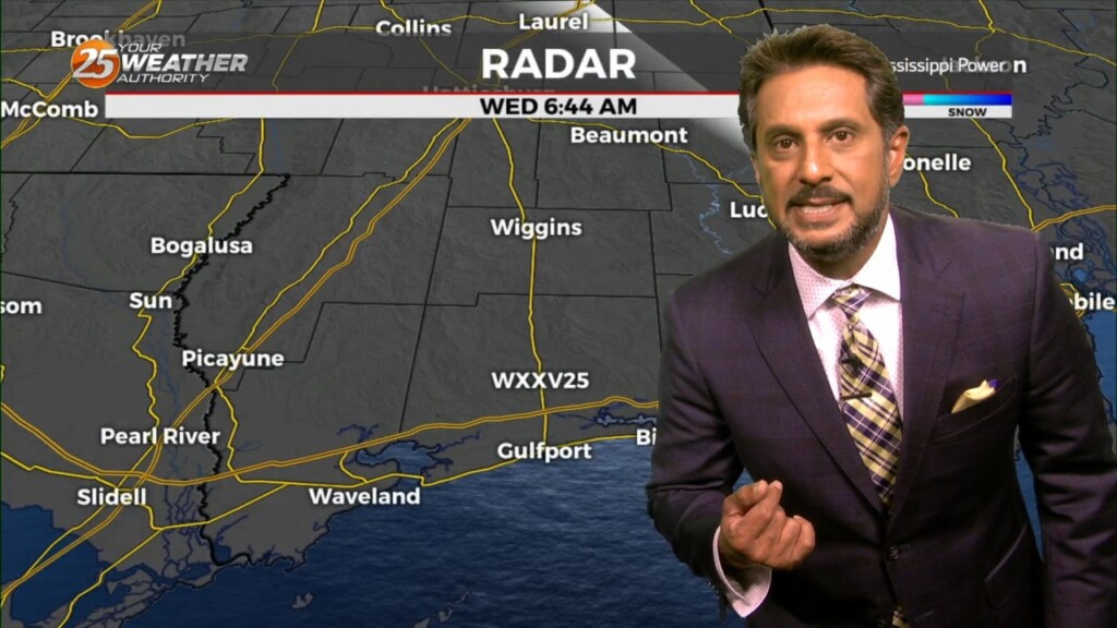
The arctic front has started to creep slowly to the east as a WINTRY MIX is occurring in south Mississippi a couple of hours prior to…
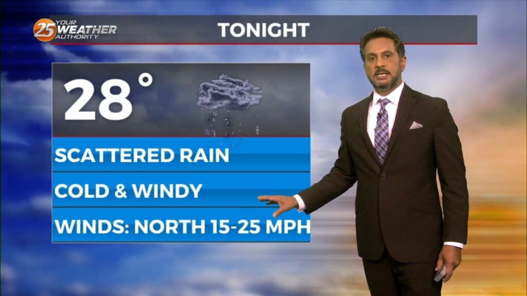
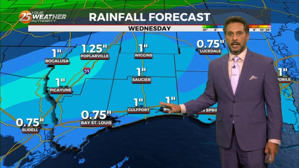
WINTER WEATHER ADVISORY in effect... Obvious forecast problem through Tuesday night is the arctic air and it`s effect on any precipitation that may fall late…
A large upper level disturbance encompasses about the northern half of the country, with relatively zonal flow across the southern half of the country. The next…
T-storms and rain from this morning is now east of the area with little or no precipitation expected this afternoon. Expect rapid clearing with a few…
With an approaching system to the west, showers and t-storms are expected through midday. It seems that the best instability and forcing will remain north.…
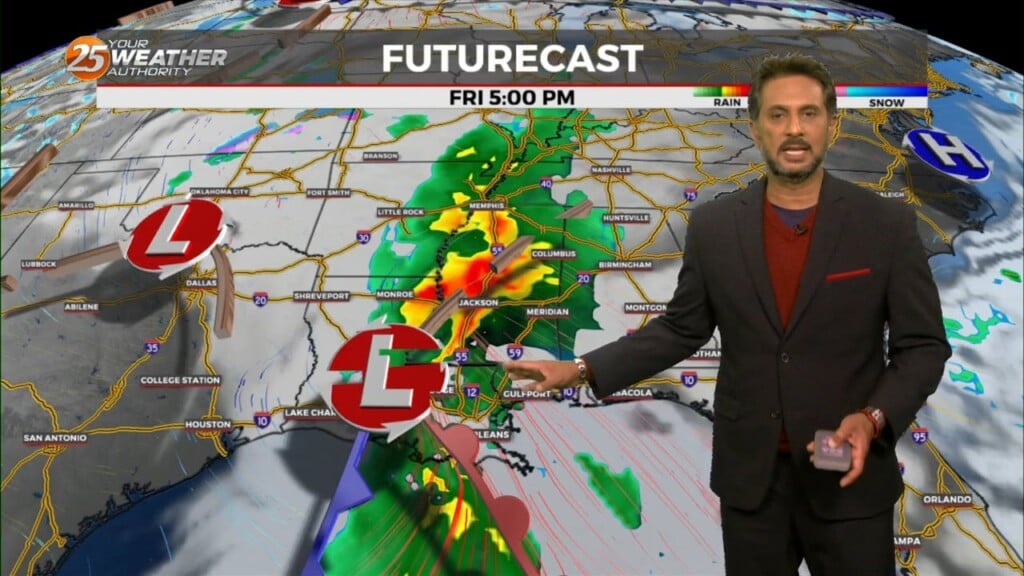
The main forecast issues will be the potential for severe weather late tonight and Friday morning, along with rather gusty winds on Friday. Temporarily fairly zonal…
The deep upper-level system that produced Monday night’s severe weather is now over the Mid-Atlantic states and moving into New England. The next disturbance in a…
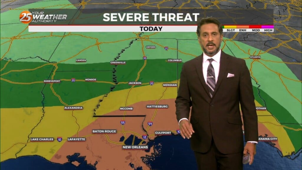
Heading into this afternoon, a severe storm may not even be a probability but a certainty for some areas. There will be a lot going…
I will try to keep things as simple and non-confusing as possible by keeping headlines to what is necessary and only ramping up to the highest…
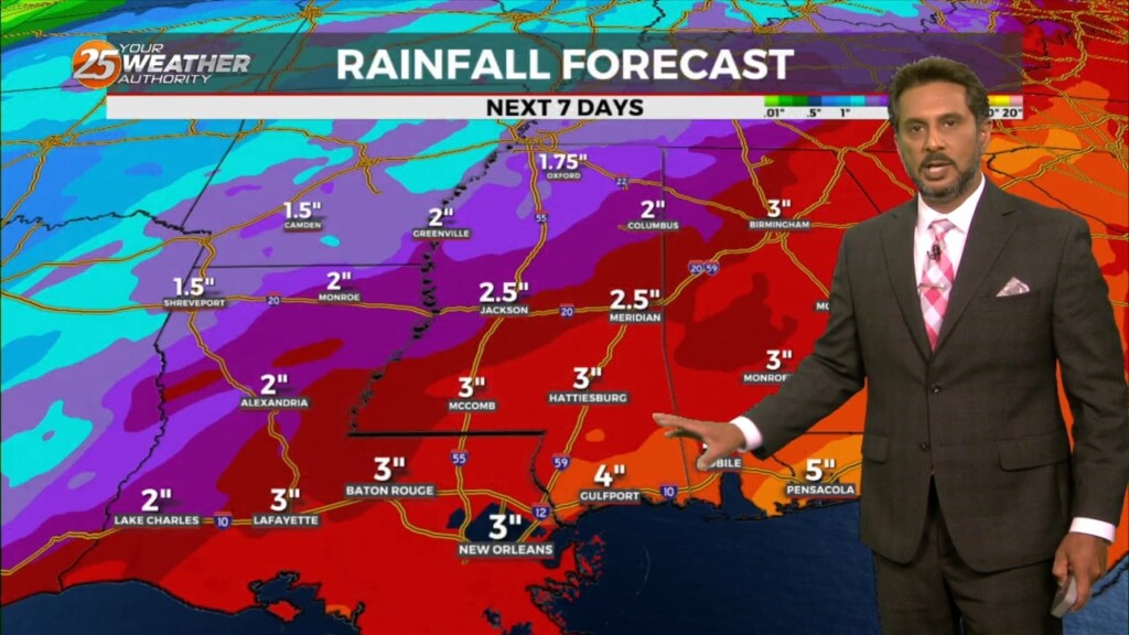
Out with one, in with the next. All these systems will continue in rapid succession for the next several days. Very nice conditions will remain behind…

A warm front will remain along the coast today while the surface low-pressure developing over the NW gulf rides along it. This system will kick east rapidly through…
A lovely day ahead with sunshine and cool temperatures before the next system moves in. A new surface low-pressure system to the SW will develop and…
In the wake of an upper feature which moved through earlier this afternoon, clouds will rapidly clear this evening/tonight. A fairly potent upper level high…
A very progressive upper level wave pattern will keep things rather unsettled through the short term period as a series of disturbances pass…
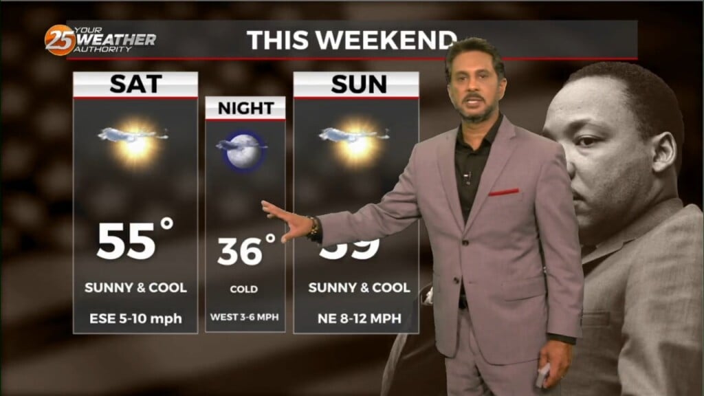
Today will be a cool day as highs will only get into the lower to mid-50s and this will provide a decent starting point for…
The main focus is once again on the possibility of a light freeze in areas that may not have experienced a freeze, then on the…
The biggest forecast challenge in the short term is the temperature forecast and the threat of a light freeze for many areas that may have not seen…
Weak upper level high pressure is currently over the southern Gulf of Mexico with a weakness moving eastward through Kansas. A stronger disturbance was…
An upper-level high-pressure sits over the Mississippi River Valley with weakness off the New England and California coasts. At the surface, high pressure was centered near the…
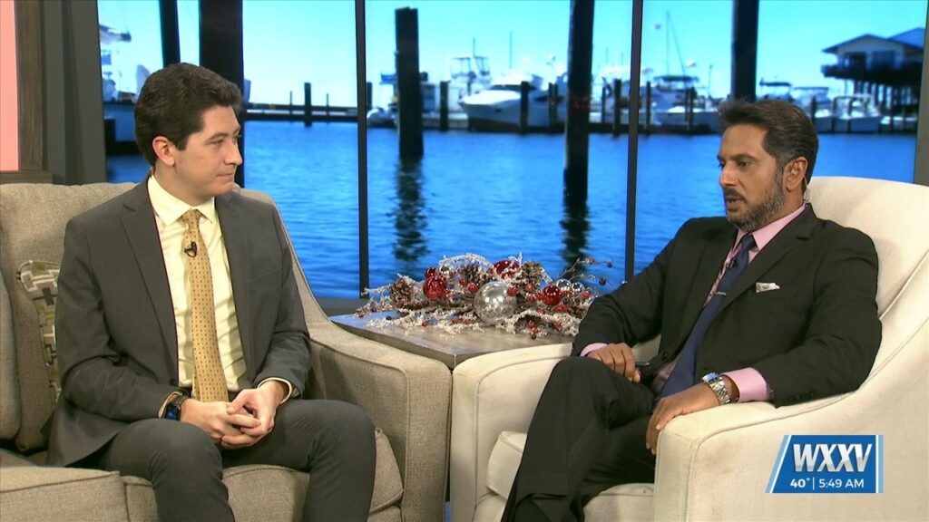
All day today, we celebrated the man we all know and love, the one we call chief, Rob Knight! Rob is celebrating his 10th anniversary here at WXXV this month and we’re going to talk a lot about how he…
The general upper high pressure over the lower and middle Mississippi River Valley extends off the eastern seaboard. At the surface, high pressure was centered…