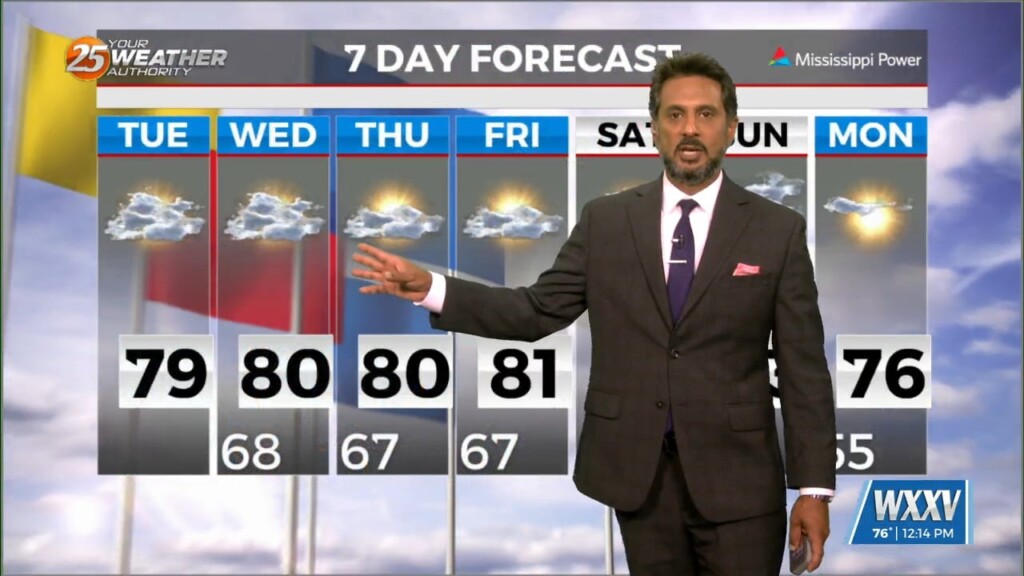
4/22 - The Chief's "Sunny & Mild" Monday Afternoon Forecast
A MUCH DRIER air mass at the surface though the upper levels continue to flow into the region. This dry surge will move through and out…
A MUCH DRIER air mass at the surface though the upper levels continue to flow into the region. This dry surge will move through and out…

In the wake of yesterday’s cold front, strong dry air surge at the mid and upper levels is continues to move into the area.…
As temperatures warm into the 80s, low level instability will increase and some cumulus development is expected to take hold by late morning. However, a…
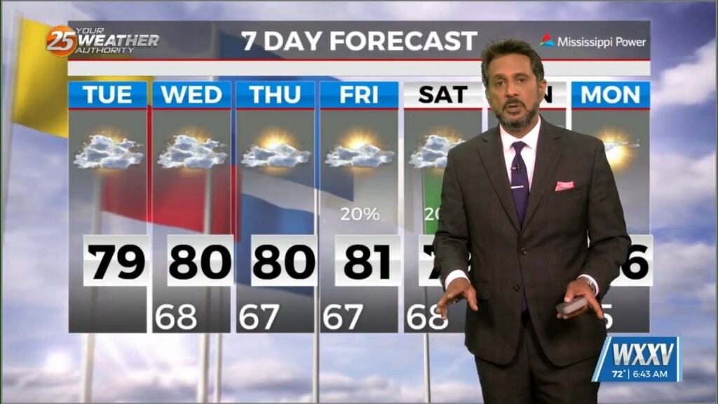
Conditions will remain relatively similar for the next few days with cloud coverage and breezy conditions from the south. The main feature on the map…
High pressure continues across the Gulf of Mexico, with an upper level disturbance noted over southern Minnesota and over Saskatchewan into the Idaho Panhandle. Surface…
An are of upper-level low pressure will continue to move northeast over the next 36 hours as it gradually gets absorbed by a stronger system over…
High pressure extended from the Gulf of Mexico to Wisconsin, with an upper-level low pressure near the Colorado-Kansas border. Low pressure was noted over Nebraska with a…
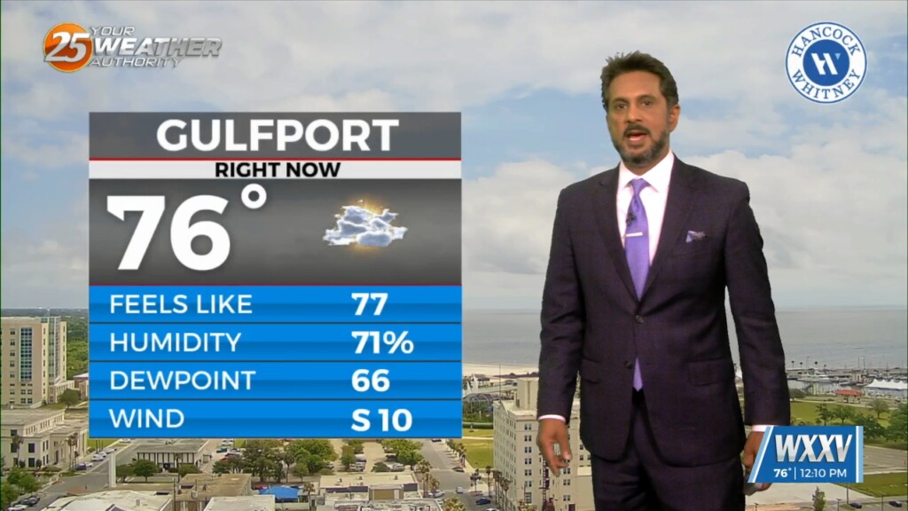
At the surface, high pressure extended from near Bermuda westward across much of the northern Gulf of Mexico. A stationary frontal boundary was well to the…
The upper air pattern shows high-pressure extending from south Texas to the Dakotas, with an upper low-pressure centered near Las Vegas. At the surface, high pressure…
MAKE PLANS FOR OUTDOOR ACTIVITIES THIS WEEKEND... High pressure moving into the region from the NW will provide for dry conditions, which will go a long…
Now that the most violent weather has moved east, we will now work with the back side of the surface low-pressure that still wants to hang…
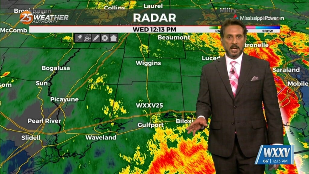
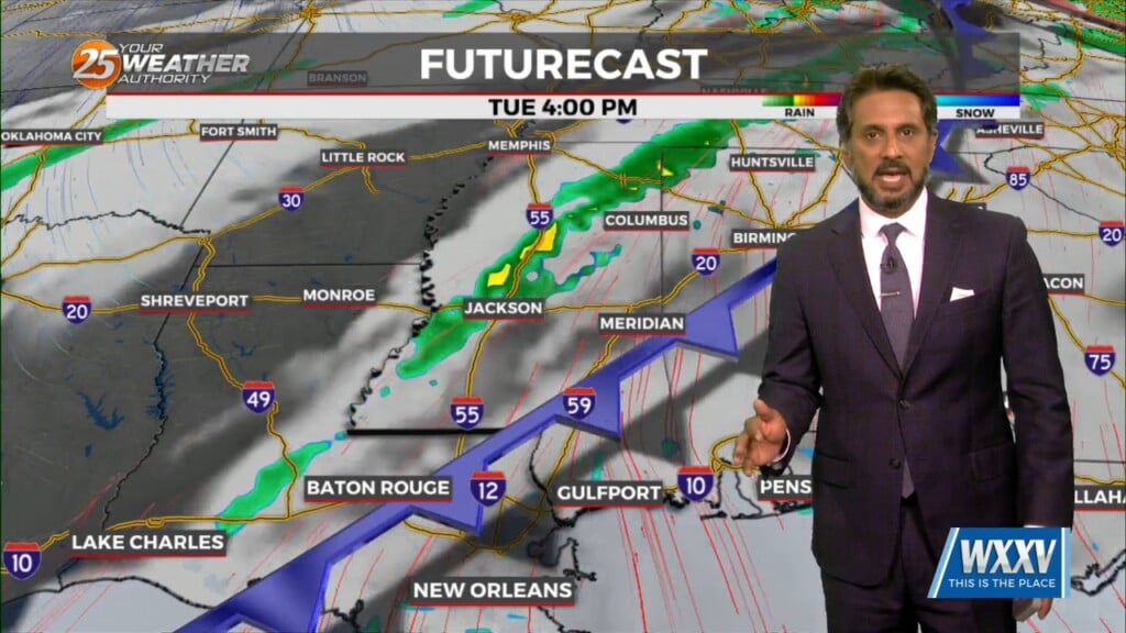
A vigorous storm system continues to move east though the region. Activity from this morning will begin to taper-off…with another batch of energy moving tough the…
A stable layer in the low-levels of the atmosphere is eroding, Which thus far has protected us so far, but this is currently leaving and…
Again today, we should see showers and a few t-storms around. But as we move forward in time, a few of these storms could become…

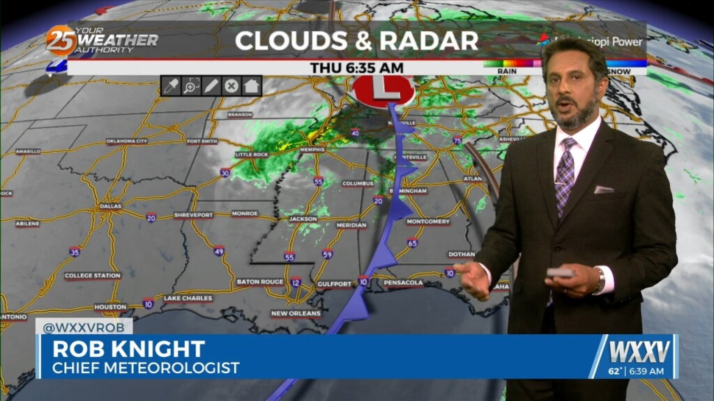
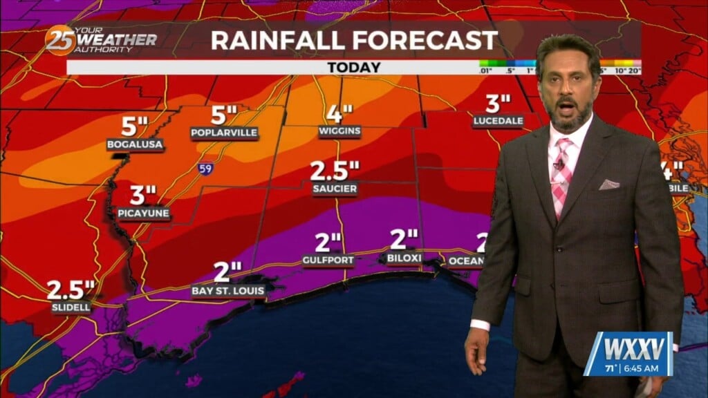
Early Wednesday we will see a cold front moving toward the area with very moisture content for this time of year. If this were stalled over the…
Cloud coverage and breezy conditions will increase this morning as an approaching cold front to the west stalls. Early Wednesday we will see a cold front…
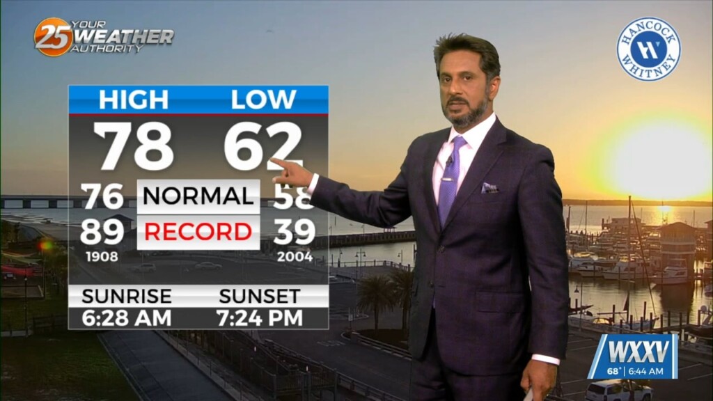
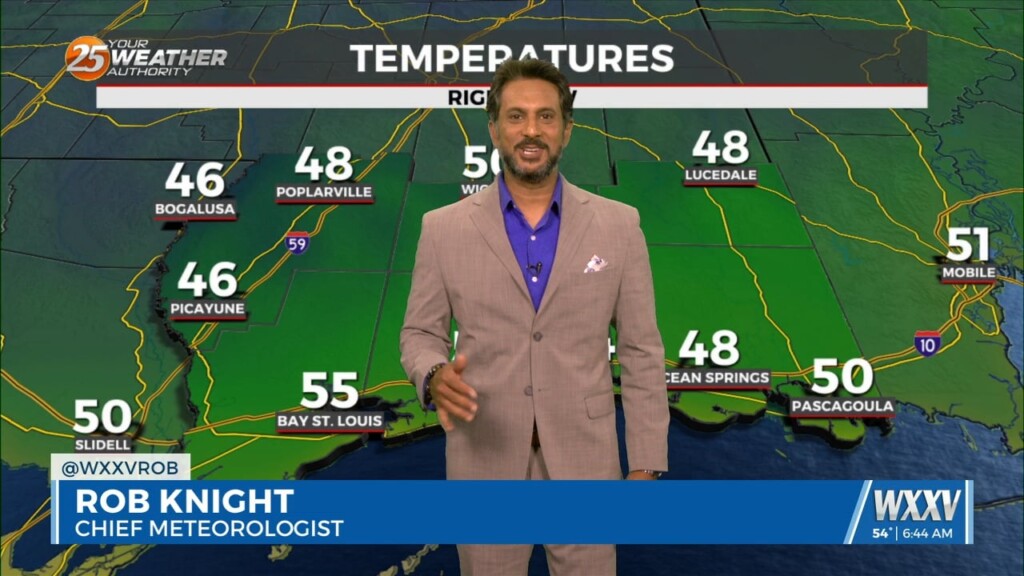
The strong solar insolation expected this afternoon will allow highs to climb to near average this afternoon, but low tonight will quickly plunge into the 40s north…
A highly amplified pattern in the mid and upper levels will remain in place through Saturday night across the CONUS. Today into tonight, the forecast area…
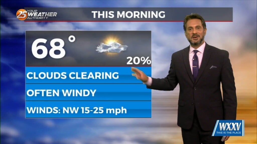
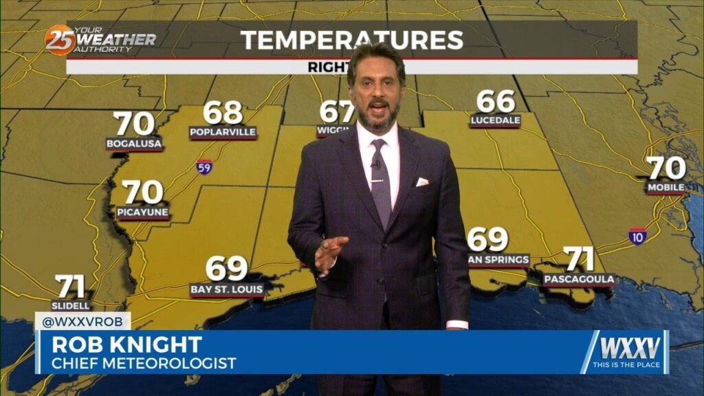
All precipitation has cleared the coast at this point as cloud coverage will continue through mid/late morning. High pressure to the NW will move in…
High pressure is moving eastward as a trough of low-pressure is progressing into the area, extending from the Great Lakes down through Texas. At…
This afternoon will continue to bring breezy conditions from the south...increasing the moisture. Tuesday is still the main forecast issue but honestly it…
No real issues to discuss today. High pressure over the Gulf will continue to dominate the region while low level temps keep slowly stepping up.…

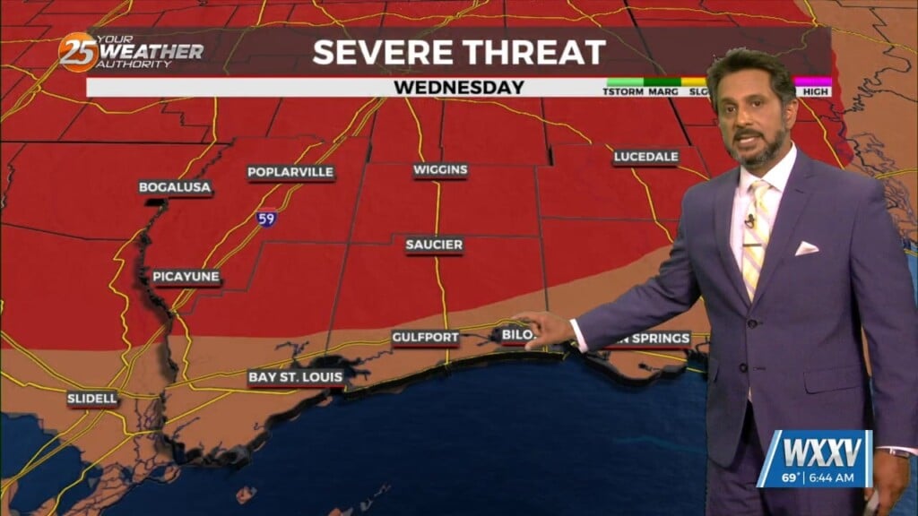
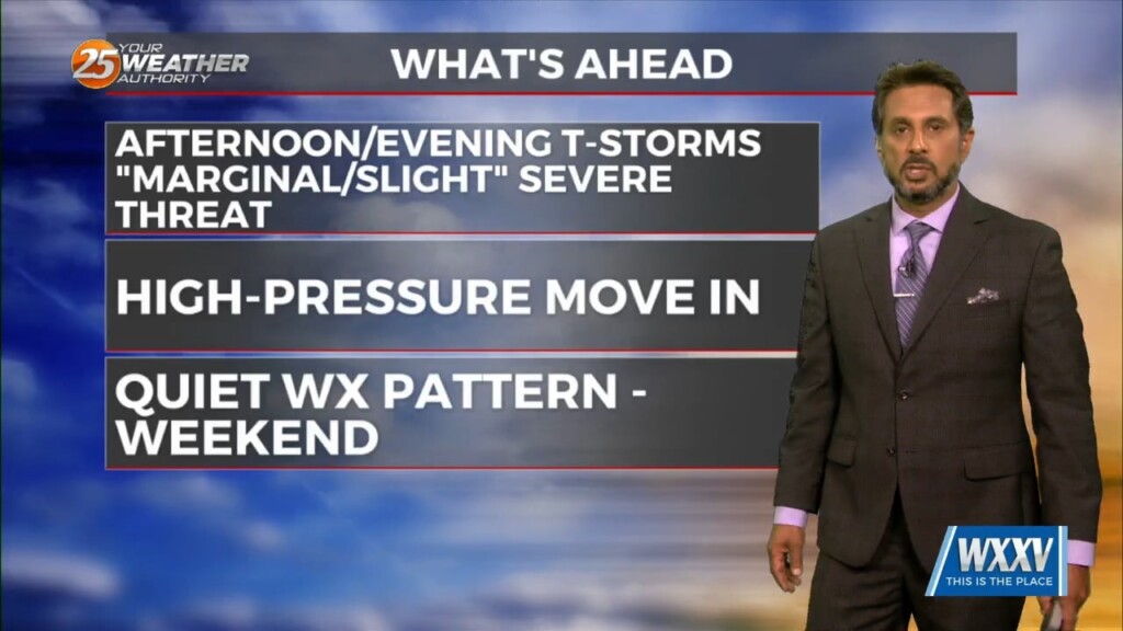
SEVERE THREAT this afternoon/tonight, with multiple potential hazards in the first 24 hours of the forecast before the weather quiets down for a while. A…
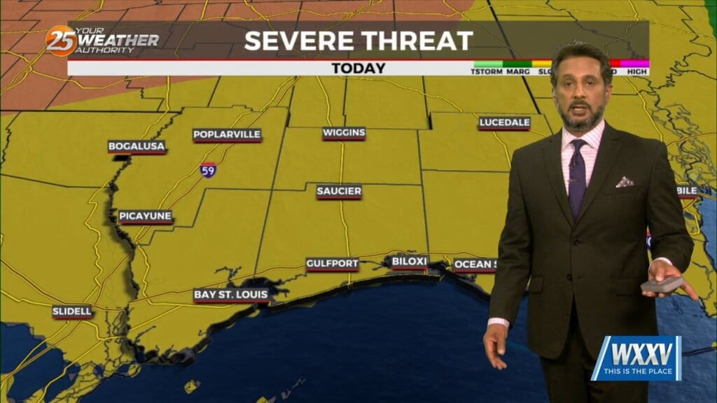
Anticipate multiple potential hazards in the first 24 hours of the forecast before the weather quiets down for a while. Low pressure over western Kansas this…