
7/4 - The Chief's "Independence Day" Tuesday Morning Forecast
Happy Independence Day! Scattered showers and an occasional rumble of thunder have developed across the area this morning moving to the NE. While rather isolated in coverage…
Happy Independence Day! Scattered showers and an occasional rumble of thunder have developed across the area this morning moving to the NE. While rather isolated in coverage…
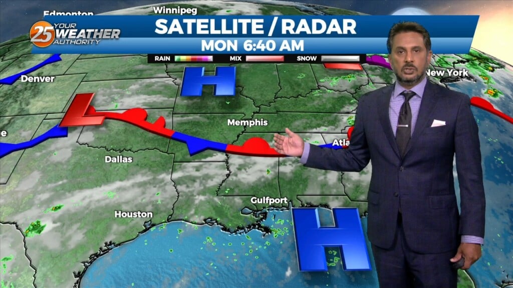
At the surface, the Bermuda high “High Pressure” extends westward across Florida into the northern Gulf of Mexico. A front is extended from Lake Erie into…
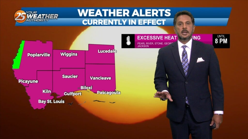
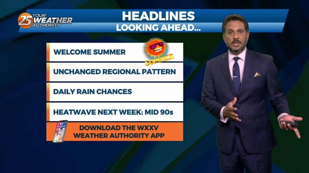
A EXCESSIVE HEAT WARNING is in effect through this evening. High pressure is centered off the coast, and doesn’t look to be going anywhere this afternoon.…
Just like the past couple of days…high pressure is still centered off the coast, and doesn’t look to be going anywhere today. The area…
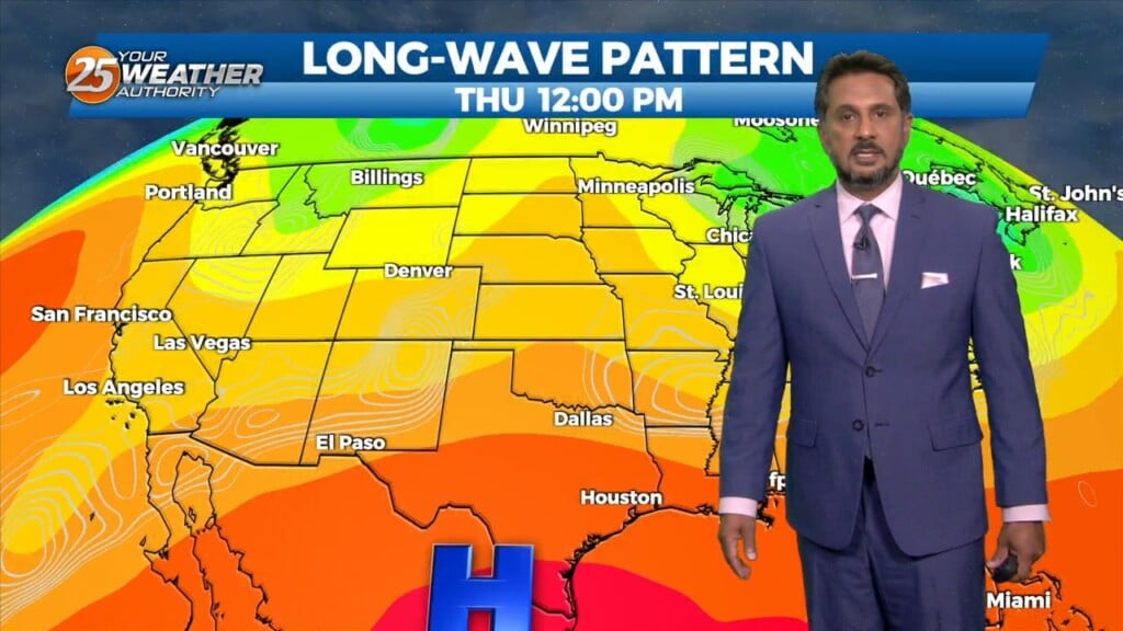
High pressure is currently centered just south of the central Louisiana coast. High pressure isn’t going anywhere through Friday night, meaning not much is going…
At the surface, high pressure remains centered over much of the Gulf of Mexico. If any thunderstorm activity develops at all the next couple…
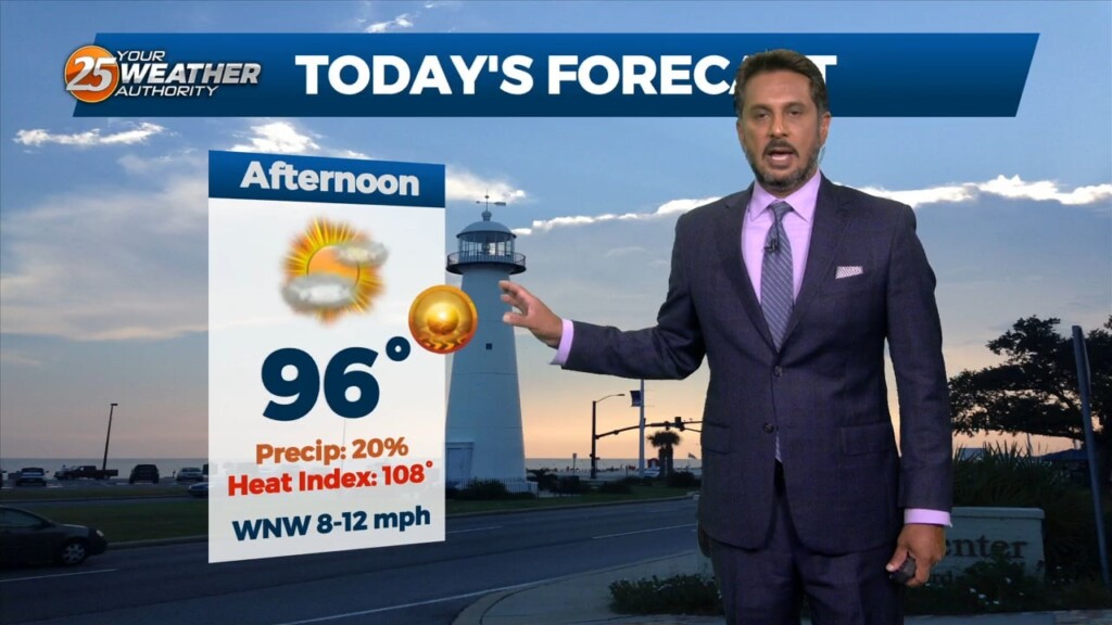
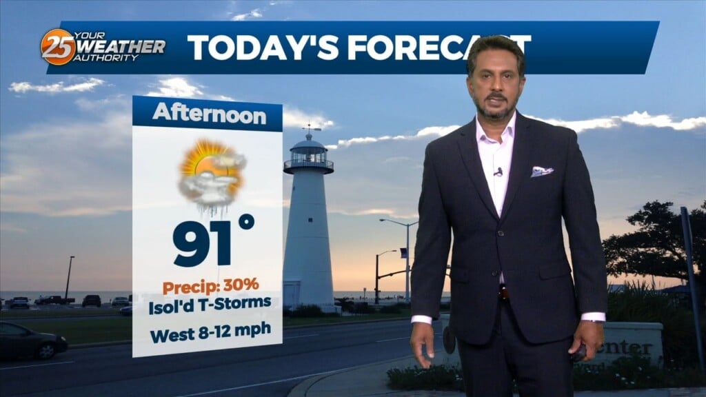
An EXCESSIVE HEAT WARNING is in effect for south Mississippi until 8 PM. Main concern through Wednesday will be the heat, with a secondary concern… the…
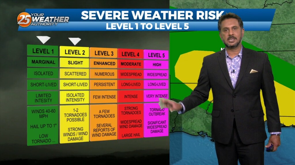
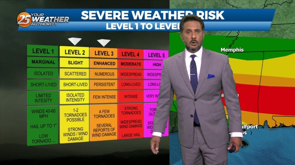
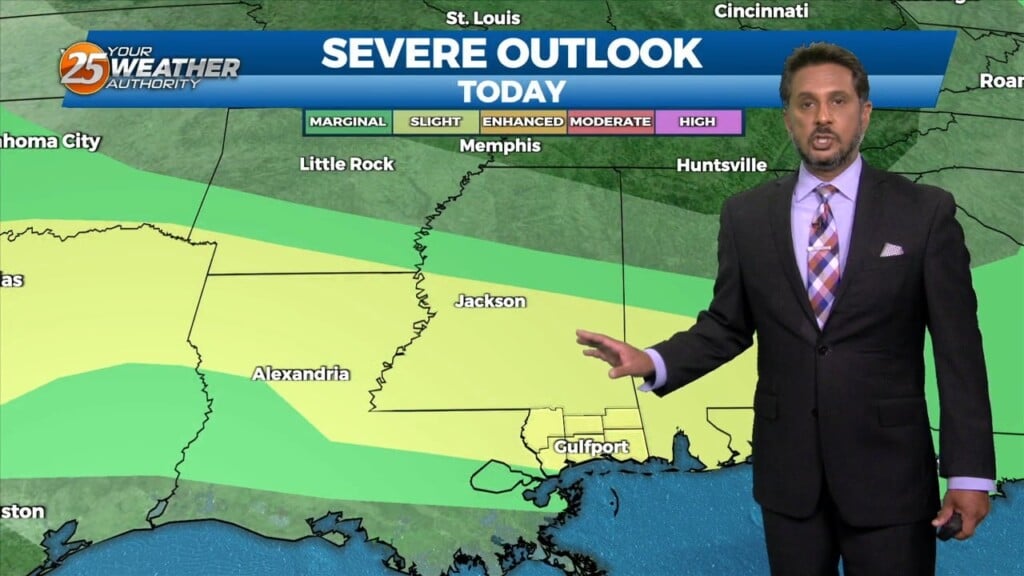
Main concern through Wednesday will be the heat, with a secondary concern… the threat for thunderstorms which could bring a low end threat for severe potential.…
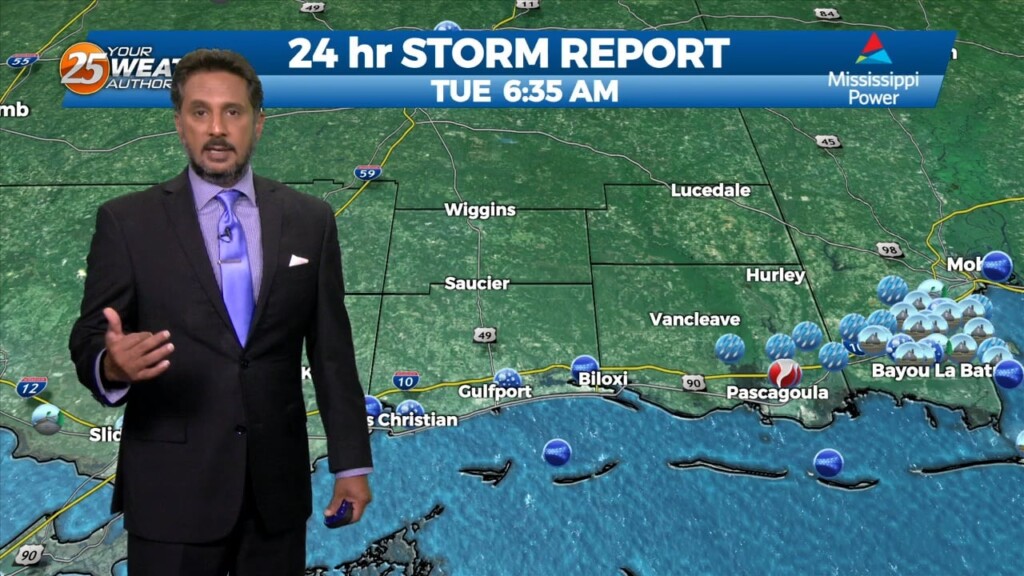
A line of Thunderstorms associated with a cold front to the NW made its way through our area prior to sunrise. There are two main concerns…
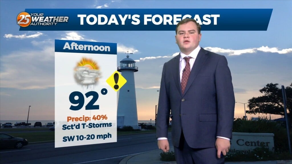
This afternoon there is a chance for showers and thunderstorms. This is because there is a stationary front overhead. However it will begin to get…
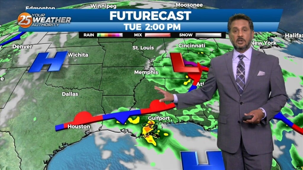
A stationary front overhead will begin to get displaced by an area of low pressure currently out west. This new disturbance will provide a new front…
A stationary front is overhead or just to the south of our area. With that being said activity may be ignited along the stationary…
There is a disturbance in the pattern located in our area this morning. This disturbance will move SW just a bit and should be located…
With a weak cold front overhead and drier airmass, showers and thunderstorms will pop a little later this afternoon. The activity will get started farther NW and…
Outflow boundary is firing new cells this morning where it meets the surface front just to the N/NW of our area. Stability should begin to increase over…
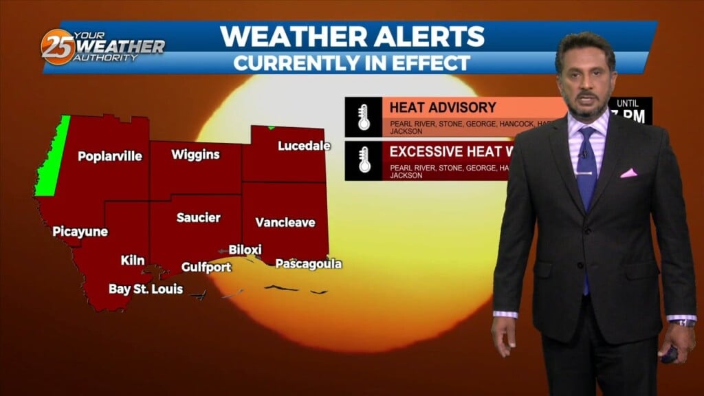
A Heat Advisory is in effect untill 7pm, showers and thunderstorms will bring relief to a lucky few. How long can our NW to westerly upper…
A Heat Advisory will be in effect from 11am to 7pm. How long can our NW to westerly upper flow continue to dominate our…
A Heat advisory is in affect for area from 11 am to 7 pm, be sure to practice summertime safety. The boundary has generally been north of our…
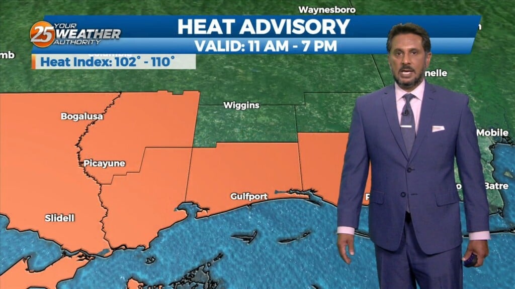
A Heat Advisory is in effect for our area from 11am to 7pm. This afternoon looks to be somewhat similar to the last day or…
A few scattered showers have developed across the region early this morning, which will continue to develop into t-storms as we progresses towards midday. Today looks…
There is plenty to talk about in the first 24-48 hours with a challenging forecast ahead. An impulse riding SE along a stationary front to the…
A secondary disturbance has settled into SE LA coastal areas. This is bringing a highly unstable marine airmass to the There will be a brief, disorganized…
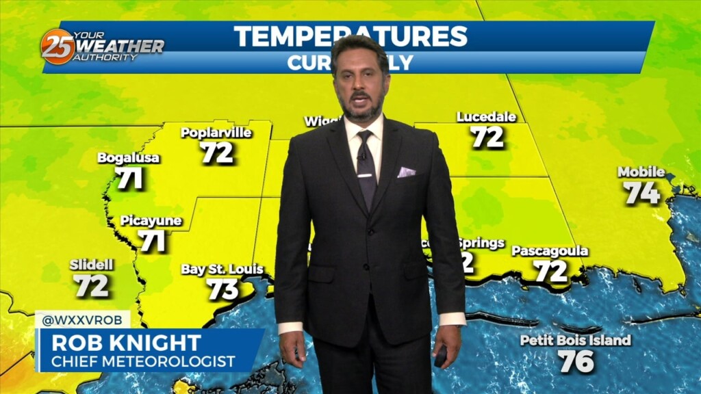
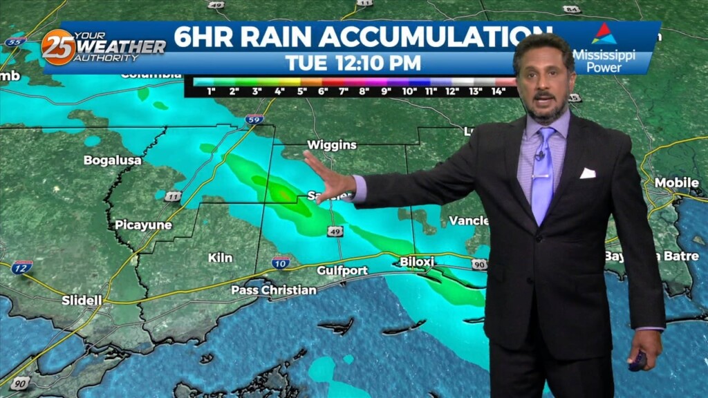
Starting out this Tuesday morning on the calm side after a rather active late afternoon/evening yesterday. Upper-level clouds are spreading east across the area from earlier thunderstorm…
There is a low pressure system is in the Great Lakes region with a cold front draped just north of the area that has become stationary. This…