8/1 - The Chief's "DANGEROUS HEATWAVE CONTINUES" Tuesday Afternoon Forecast
The main focus through this afternoon and the next couple of days will be the continuation of Excessive heat across the southern six counties. AN EXCESSIVE…
The main focus through this afternoon and the next couple of days will be the continuation of Excessive heat across the southern six counties. AN EXCESSIVE…
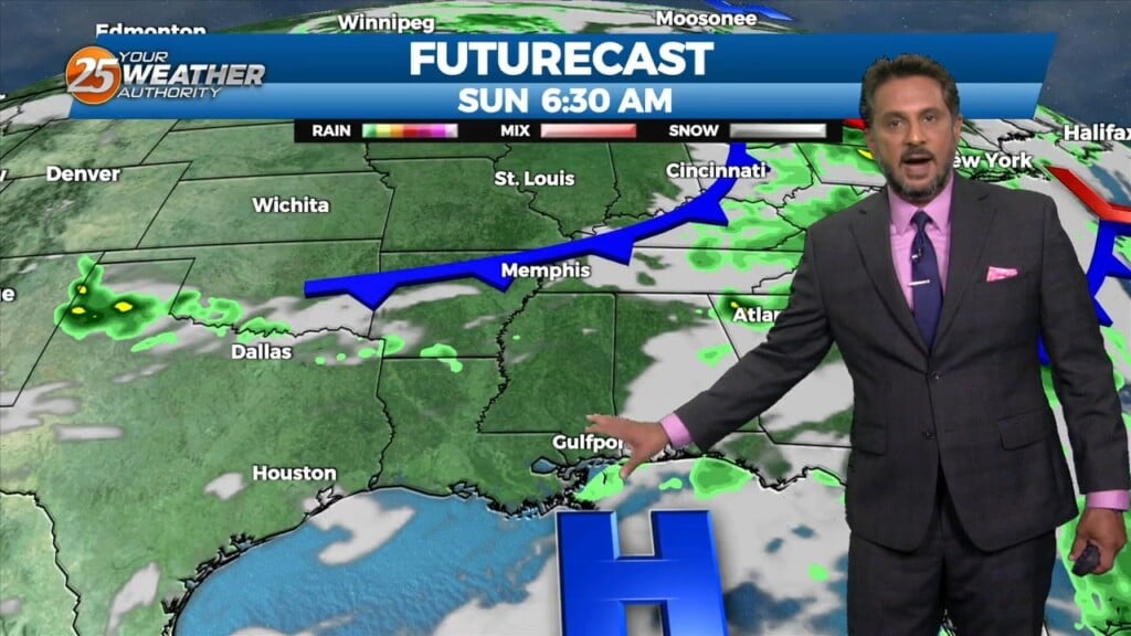
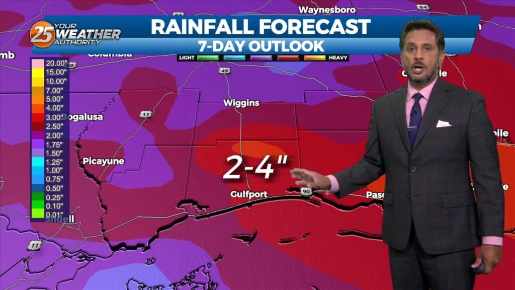
With little in the way of upper level support across the central Gulf States, expect only limited rain chances through mid-week…with another hot afternoon ahead. Models…
Earlier this morning, the MCS continues to decay as it moves south of our marine waters. Expect a few more isolated showers or storms…
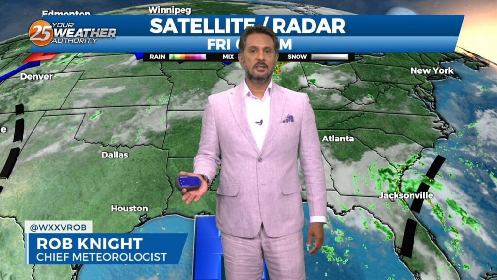
Starting the last Friday morning of July with cloud coverage in the area, due to a disturbance over the eastern portions of Florida off the coast.…
Not much difference this morning than the past couple of days with another warm and humid start. A possible shower can be expect this afternoon…
Not much in the way of anything to help showers/t-storms get started today and relatively low chances will continue over the next several days. But some…
The pattern has change slightly as the cold front overhead dissipated overnight. The lower dew-points will remain with us as drier air will once again…
Another day of manageable heat and more in the way of sunshine is in store for the southern six counties. Currently a cold front is to…
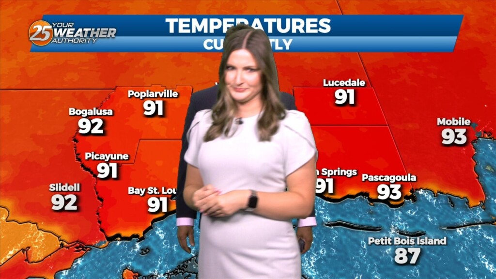
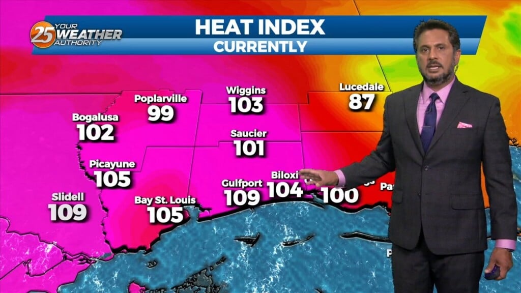
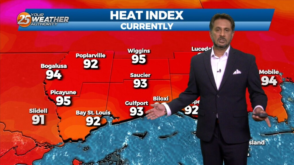
A HEAT ADVISORY is in effect once again this afternoon with heat indices between 106-112 degrees expected. Synoptically, the region remains under the influence of a large…
The short term is practically a rinse and repeat of the last day or two, with continued hot conditions expected. A HEAT ADVISORY is in effect…

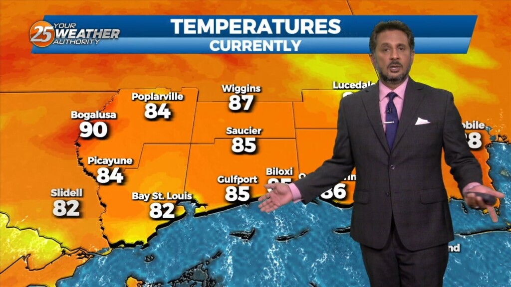
The pattern in the area is starting to feel like a broken recorded with oppressive temperatures daily. High pressure is the dominant feature and will continue…
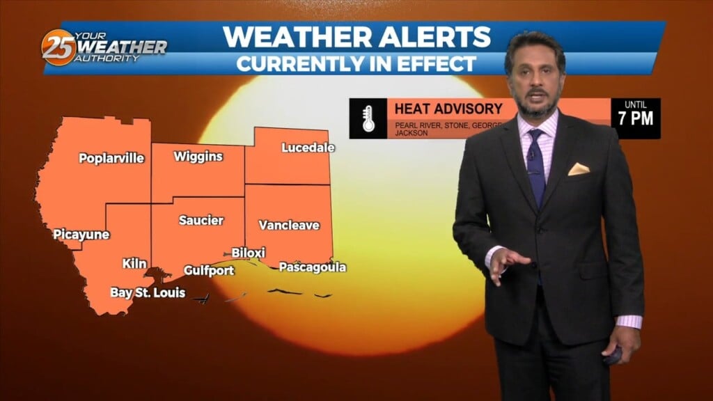
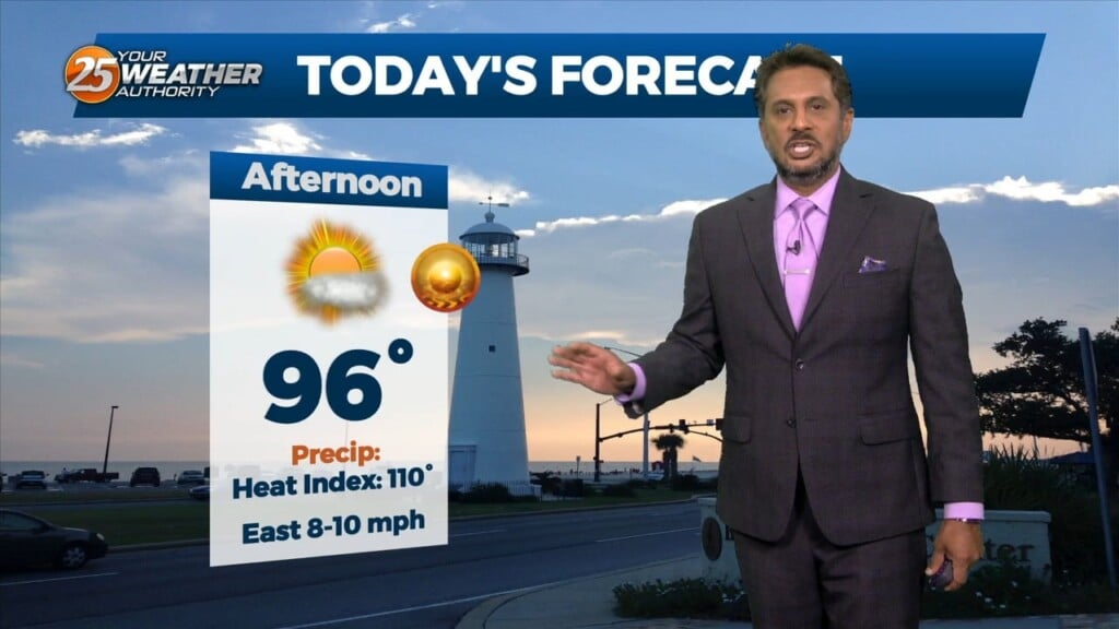
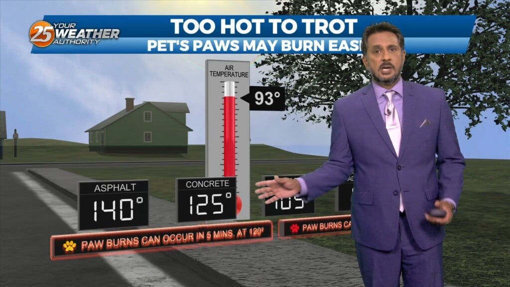
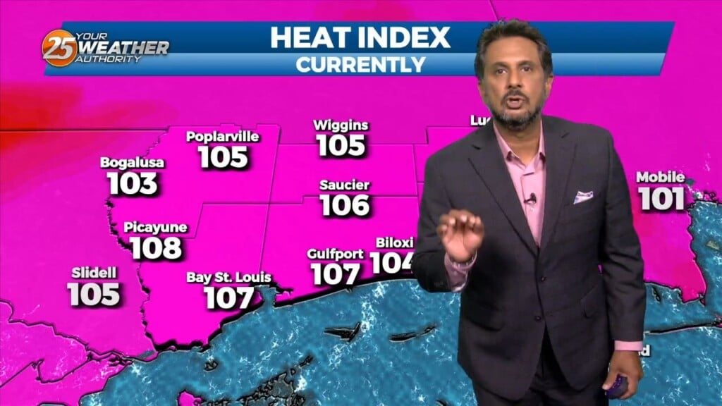
Another day of dangerous heat is expected across the area. A HEAT ADVISORY goes in effect from 12 pm until 7 pm as heat indices…

Another hot and humid day is expected across the Southern 6 counties. A HEAT ADVISORY goes in effect from 12pm until 7pm as heat indices will…
A HEAT ADVISORY is in effect until 8PM for today as dew-points in the mid to upper 70s support heat index values of 105 to 110 degrees…

An area of strong high pressure will extend eastward into our area and induce both warming and drier air. We will still have the chance of…
With temperatures in the upper 80s showers and thunderstorms are likely going to have an easier time forming today. Once diurnal thunderstorms get going later into…
There is no distinct change in the state of the atmosphere compared to yesterday, with tropical airmass in place. With temperatures expected to be in the…
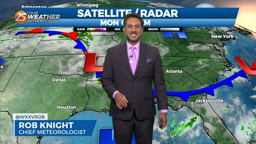
This morning there is an area of low pressure situated over the AR/LA/TX region with a decaying stationary front north of our area. Out ahead of…
Just like the past couple of days there is as stationary front to the north of our area this morning. In the Gulf of Mexico high pressure…
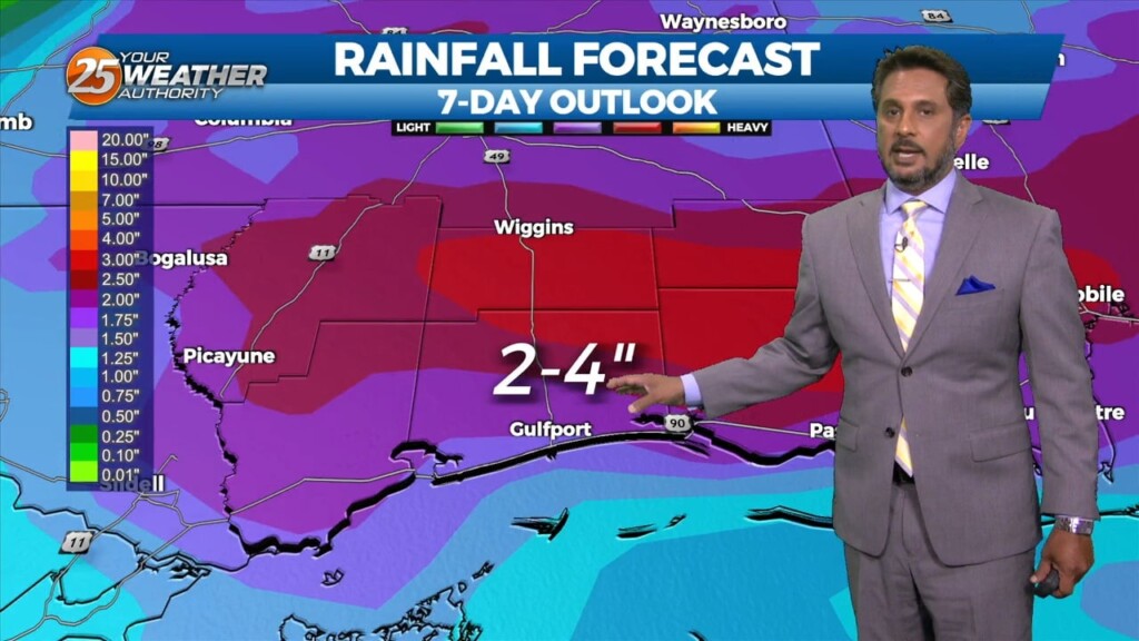
Another day of mid/late afternoon showers/t-storms, as high pressure to the south will continue to pump in the moisture. Temperatures may be a little higher than forecast...but…

Some light showers continue across the area, mainly near the coast and over the coastal waters…with more of the same on tap for today. We will…
Showers/t-storms will once again ramp up this afternoon with daytime heating. High pressure is still in place but there has been just enough of a weakness…
Spotty Showers continue through the area this morning, as radar is indicating activity in the vicinity. This activity will continue through this morning with the activity…
Not as much activity on radar when compared to this time yesterday morning. Expect things to continue to be fairly quiet throughout the rest of…