3/8 - Jeff's "All Clear/Cold Front" Weekend Forecast
The Tornado WATCH for our area has been canceled. Our area is ALL CLEAR from the threat for severe weather. There will be the chance for scattered showers…
The Tornado WATCH for our area has been canceled. Our area is ALL CLEAR from the threat for severe weather. There will be the chance for scattered showers…
A Tornado WATCH is in effect until 9 PM. Showers and thunderstorms, some capable of being severe, will be around into some parts of this evening.…
Fog will be primed to form ahead of your Thursday morning. Be sure to take extra care if you have an early morning commute! Fog and early-day cloud…
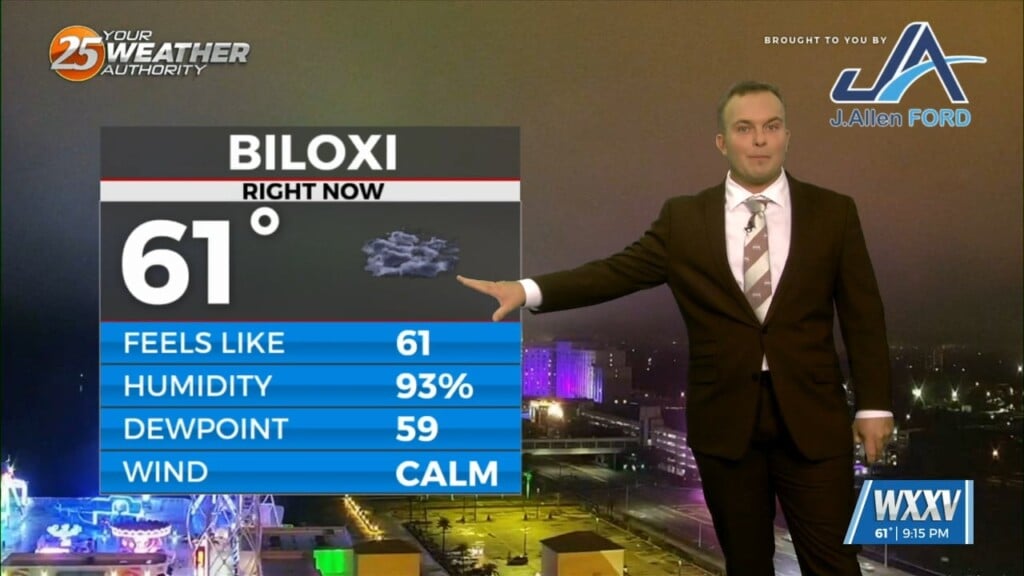
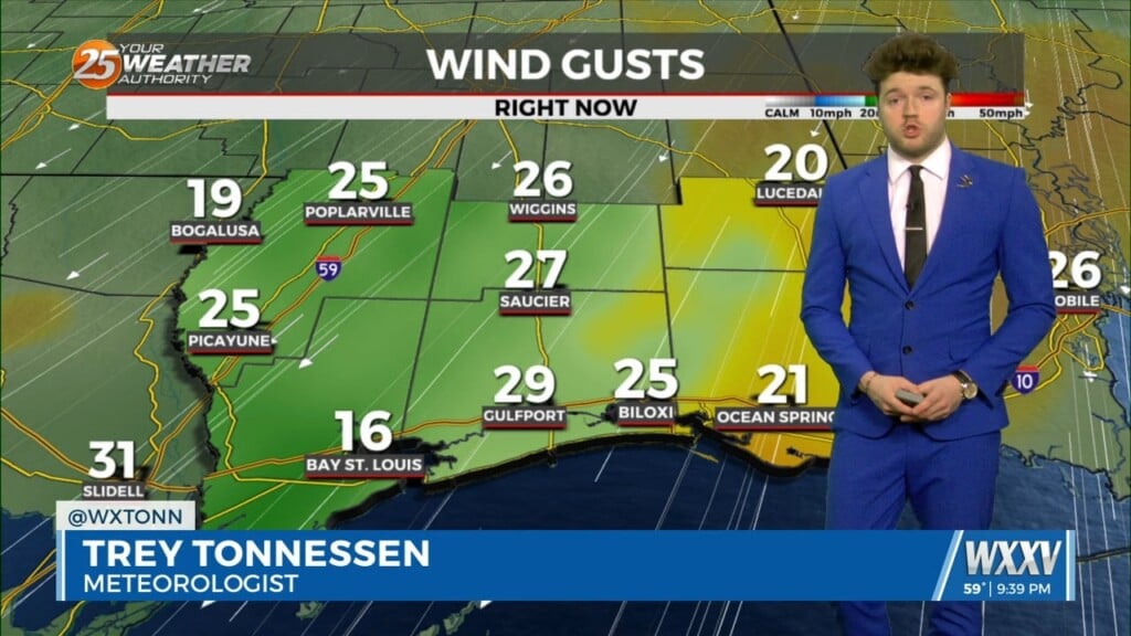
Tonight will feature mild, but slightly cooler temperatures for the Mississippi Coast. If winds can back down quickly, fog will be an issue for your Thursday morning. This…
Your Wednesday will likely start with reduced visibility in the form of dense fog. Any fog and cloud coverage will dissipate throughout the day. It will get…
Expect rain and thunderstorms to come to an end this evening and rain-free conditions to commence overnight. You may encounter an isolated shower or two after sunset…
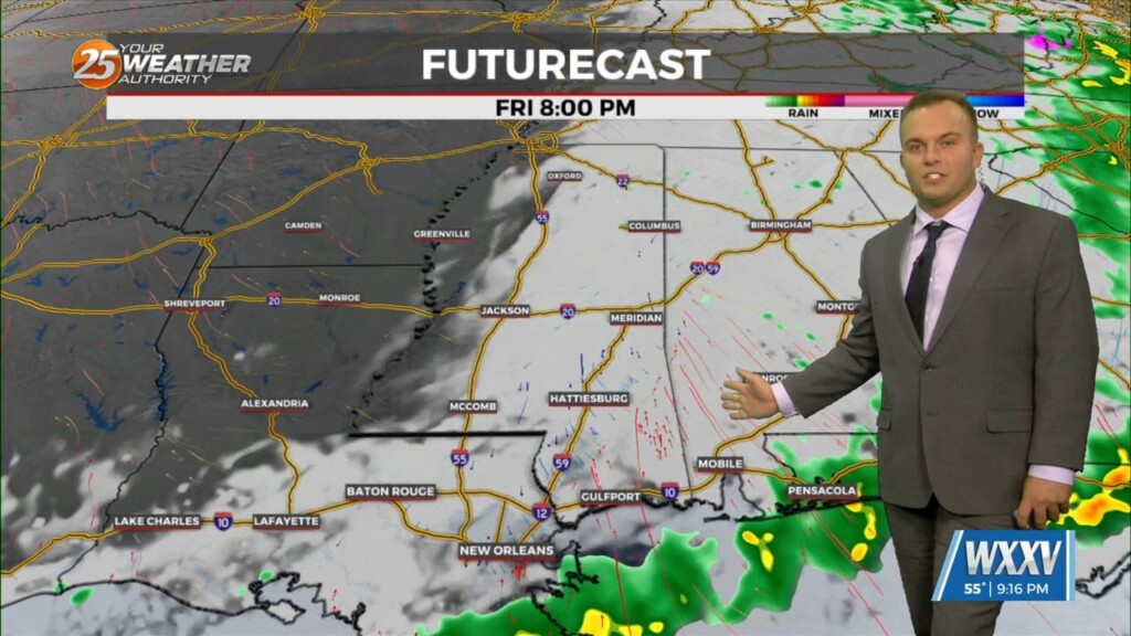
While there will be some dry time overnight, rounds of showers and thunderstorms will continue. Expect coverage of 40-60% on average with thunderstorms remaining below severe limits…

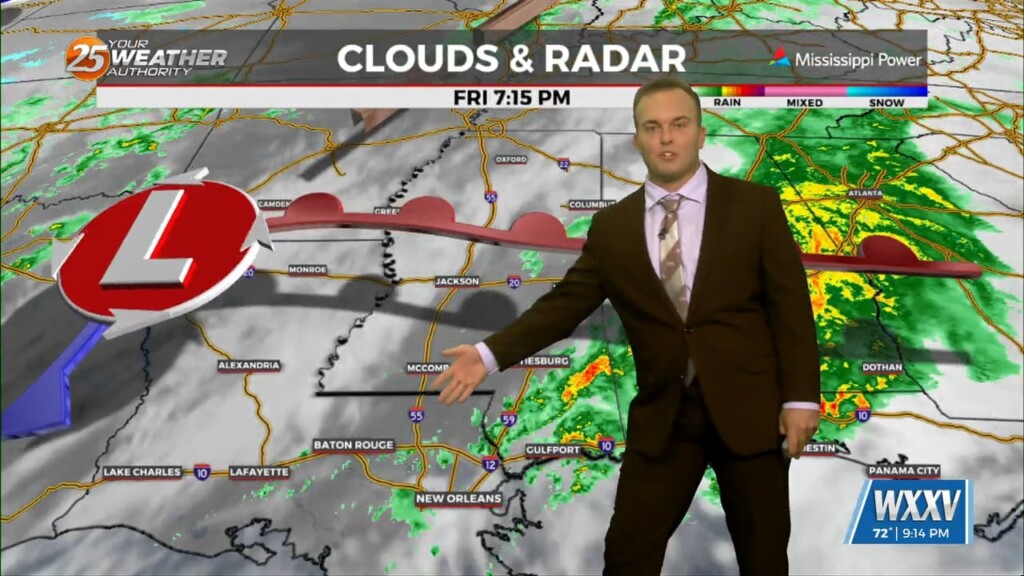
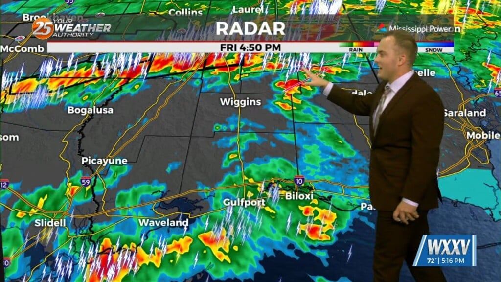
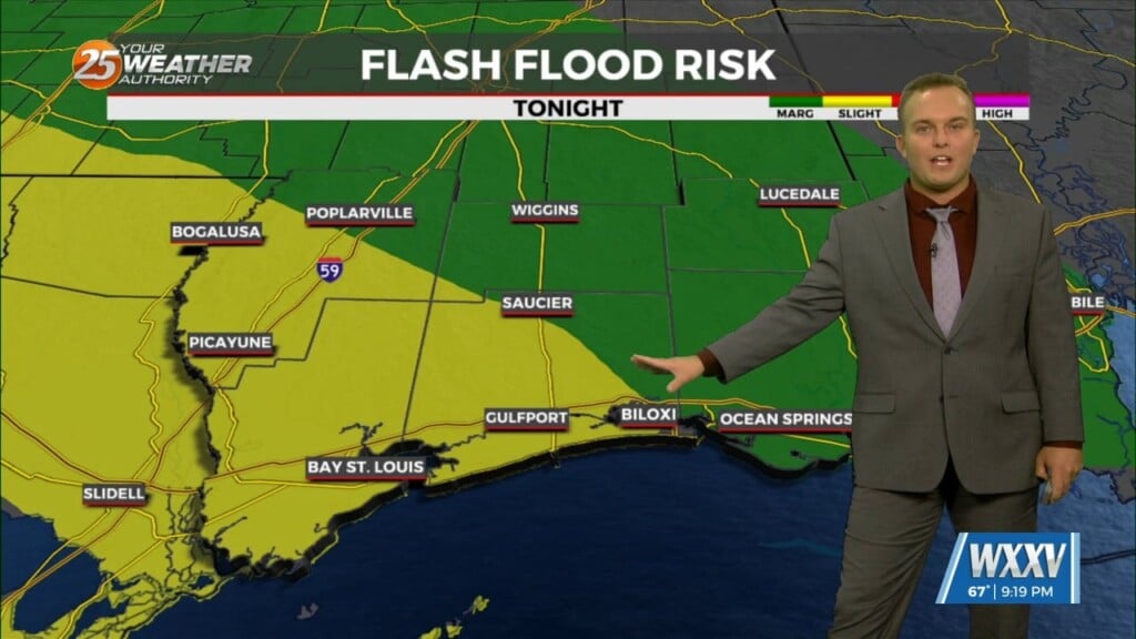
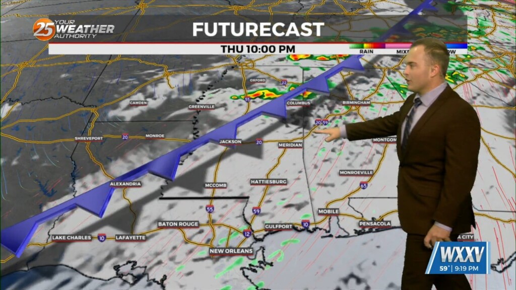
Coverage of rain in the form of showers and thunderstorms picks up this evening and you can expect thunderstorms capable of heavy rain overnight. Some thunderstorms…
Other than a 20% chance of a stray shower, it will be mainly rain-free ahead of your Saturday morning. Fog will be a concern out the…
Expect mainly dry conditions this evening into the overnight hours. A 20% chance of a stray shower cannot be ruled out but the main concern will become…
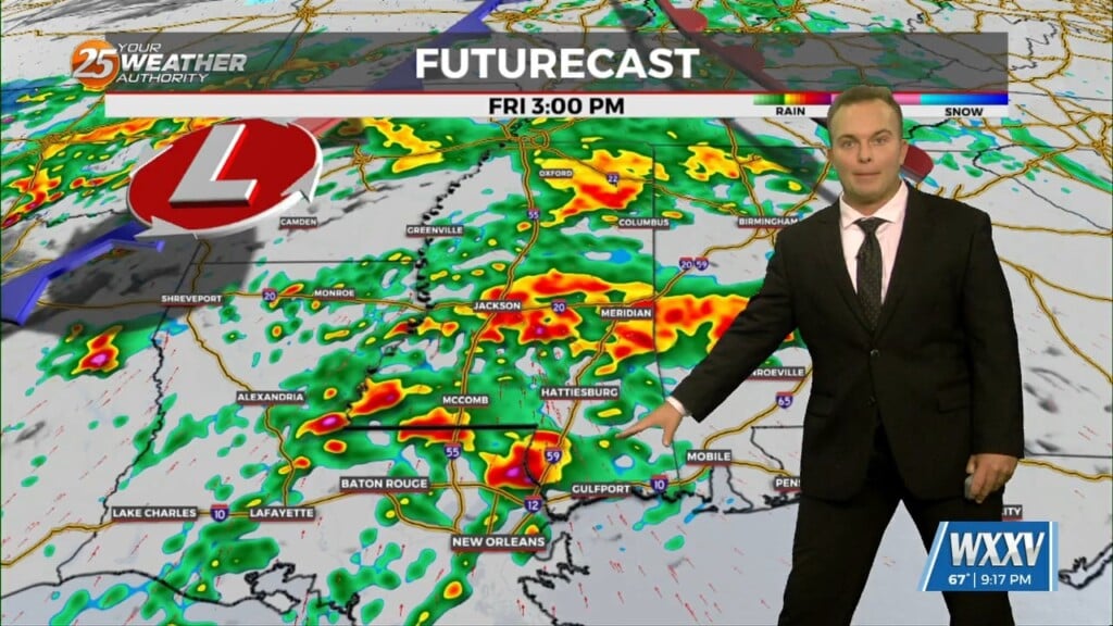
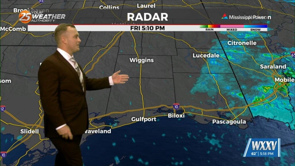
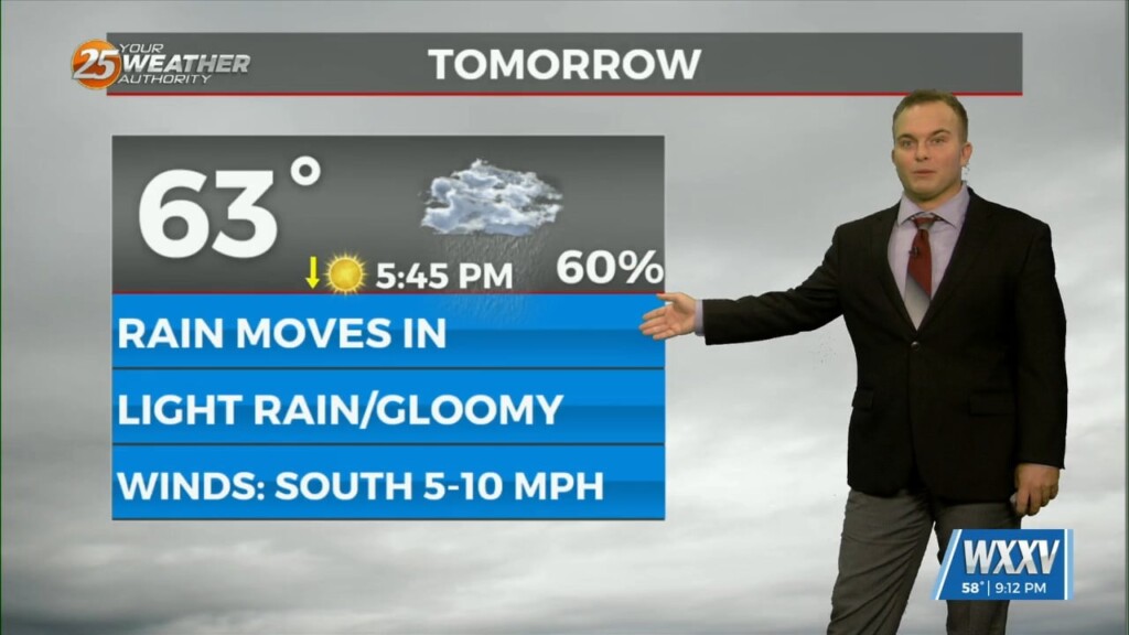
Rain will be moving into the area prior to sunrise Friday. Expect coverage of showers and embedded thunderstorms to peak during the morning hours, and rainfall to…
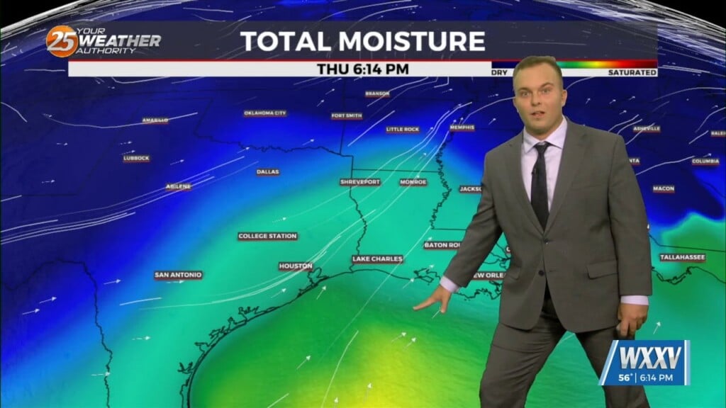
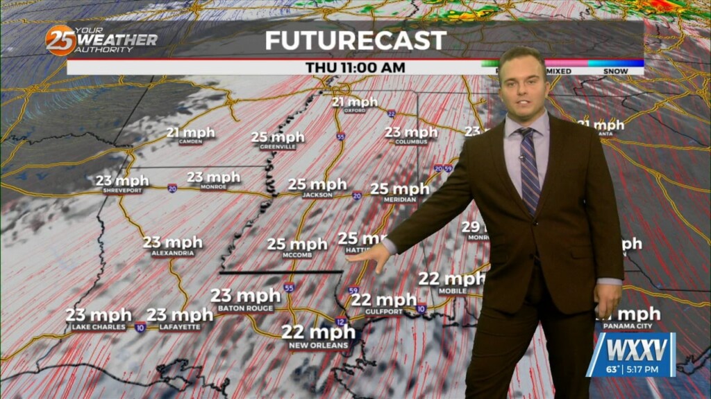
Cloudy skies remain into tonight and winds will begin to pick up. Moisture/humidity will be on the upswing ahead of the first of several disturbances that will…
A zonal flow pattern will be in firm control of the area through next Tuesday. A series of fast moving shortwave troughs embedded within this zonal flow…
Clouds increase ahead of the start of your Thursday morning. Fog should not be a widespread issue again but some spots may have light patches of it.…
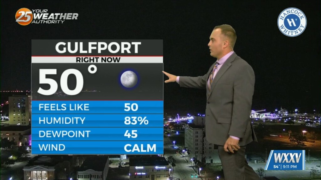
A fairly comfortable one is on tap this evening and temperatures will be fairly mild overnight. Clouds will increase after midnight and while fog is not a widespread…
It will be cool but much less cold as compared to last night. Some patches of dense fog will develop across the Mississippi Coast ahead of daybreak…
Temperatures will be cool but fairly pleasant this evening as the colder pattern loosens its grip. As we get into the overnight hours, there will be the possibility…
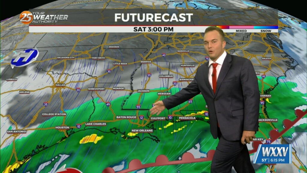
Some dry time arrives overnight but by the time your Saturday could be beginning, light rain will be in the area coinciding with/shortly after a cold front…
A shield of mist and light rain continues to plague our area as a pair of storm systems interact. Light rain will be around into some parts…
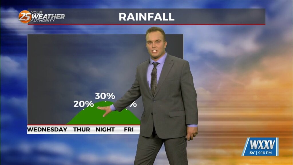
Cloudy skies continue tonight with mild temperatures. Some spots could see light fog develop & there is a 20% chance of rain past about 2 AM…
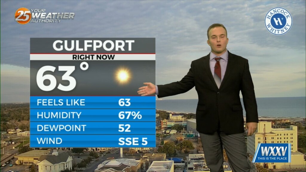
Mid-level and upper-level clouds continue to stream in as an active subtropical jet stream is in the region. Temperatures will remain fairly mild overnight as more humidity works back…

Thursday starts off cool/chilly but it will be milder than the last couple of mornings. Cloud cover will be around through the day tomorrow as an active…
Relatively nice conditions we experienced this afternoon will give way to a cool evening. Temperatures overnight will not be as chilly as this morning and winds will be…
Temperatures overnight will be slightly below average so it will be chilly to start Ash Wednesday/Valentine's Day. Expect a few clouds to partly cloudy skies Wednesday as an active…