Flash flooding and strong to severe storms may be possible this weekend
Heavy rainfall will be possible late Saturday through Sunday night with a risk for flash flooding. Additionally, there is a slight risk for severe weather on Sunday.
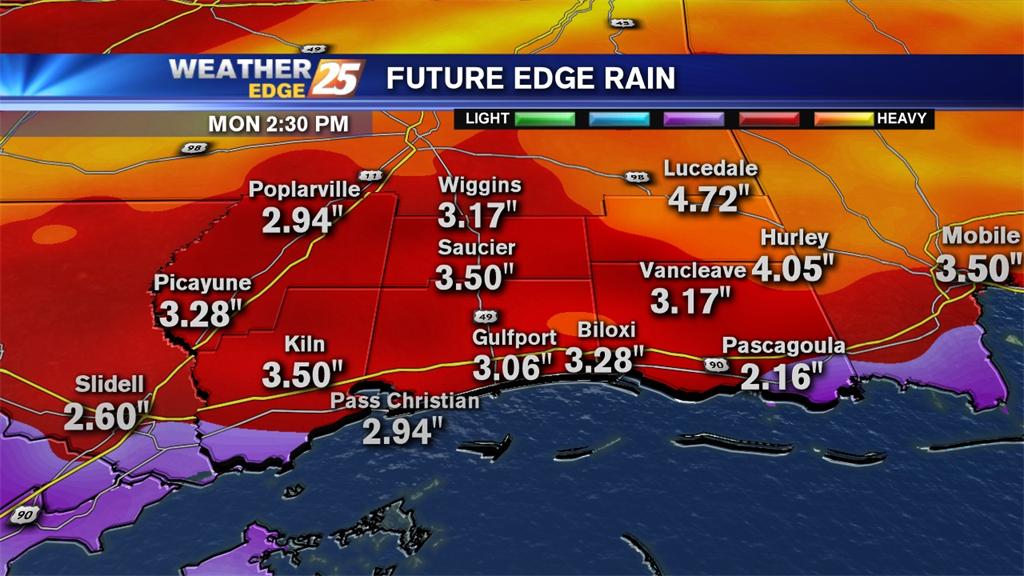
Heavy rainfall will be possible late Saturday through Sunday night with a risk for flash flooding. Additionally, there is a slight risk for severe weather on Sunday.
Tonight: Mostly cloudy with a slight chance for an isolated storm. Lows will be in the mid-60s with winds from the south at 10 to 15 mph.

Cloudy tonight with areas of fog, isolated showers and lows in the mid-50s.
A Flash Flood Watch is in effect until 7 a.m. for our viewing area. Expect scattered showers and storms overnight with a slight risk for severe weather for the western portion of our area. If a few strong to severe storms develop, damaging winds and hail would be the main threat, although an isolated tornado cannot be ruled out.
Scattered showers and storms will be possible overnight; lows fall into the lower to middle 60s with southeast winds at 10 to 15 mph.
Mostly cloudy skies return overnight with lows dropping into the middle to upper 40s inland and upper 40s to lower 50s inland. Winds will be from the southeast around 10 mph.
Clouds decrease overnight with lows in the lower to middle 40s.
Becoming mostly cloudy with areas of patchy fog and lows in the middle to upper 50s.

As a cold front slides through the area a few passing clouds will be possible and a very slight chance for an isolated shower. Lows tonight will be in the middle to upper 40s inland and upper 40s to lower 50s along the coast.

Mostly clear with areas of patchy fog possible overnight into tomorrow morning. Lows will be in the middle to upper 40s.

Decreasing clouds overnight with lows in the upper 30s to lower 40s.

Mostly cloudy tonight with areas of patchy fog and lows in the mid-50s.

Mostly clear tonight with lows in the middle to upper 30s and winds from the north at 10 to 15 mph.

Mostly cloudy tonight with rain chances decreasing and lows in the middle to upper 50s.

Partly cloudy overnight with lows in the lower to middle 40s inland and middle to upper 40s along the coast.

Rain diminishes overnight under cloudy skies with lows in the lower to middle 40s.

Mostly cloudy tonight with scattered showers and storms. Lows will be in the upper 40s to lower 50s.
Mostly cloudy and cold tonight with lows in the lower to middle 30s.

Mostly clear tonight with lows in the upper 20s to lower 30s.

A Freeze Warning is in effect from 2 a.m. to 8 a.m. Thursday morning. Expect lows to fall into the upper 20s to lower 30s.

Mostly cloudy with scattered showers and isolated storms overnight. Lows will be near 50.

Scattered rain possible for Tuesday and Wednesday, then morning temperatures fall below freezing for the end of the workweek.

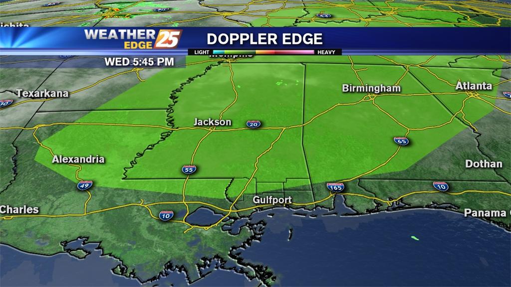
A Tornado Watch is in effect for our area until 3 a.m. Wednesday. Strong to severe storms will be possible in front of and along an approaching cold front.
There is a slight risk for severe weather for the northern portion of our viewing area Thursday. Strong to severe storms will be possible along the approaching cold front with damaging winds the main threat.