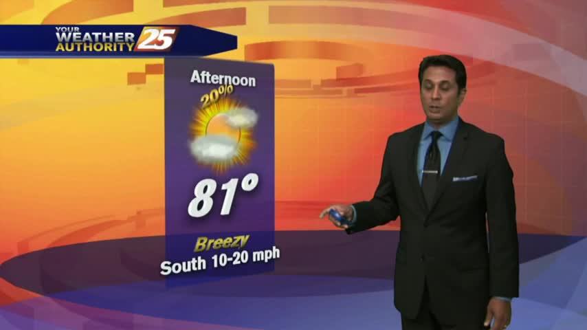
1/19 - Rob Knight's "Warm & Breezy" Wednesday Afternoon Forecast
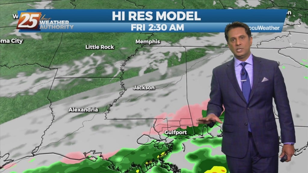
High pressure will remain centered east of the area, and this will allow for continued warm air and moisture advection into the forecast area. In advance…
High pressure will remain centered east of the area, and this will allow for continued warm air and moisture advection into the forecast area. In advance…
Temperatures are a bit cooler this afternoon due to cloud coverage and spotty rainfall...
It's a warmer start to the day with isolated showers moving across the viewing area...
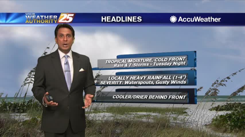
After a FRIGID start, major changes will occur as an area of high-pressure to our east brings the return flow back to the region...
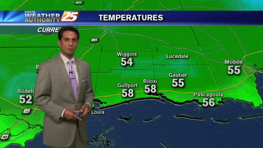
A FRIGID start to the day/workweek as a cold front from the central plains continues to move to the SE and into our area Tuesday...
Another HUMID start to the day with areas of PATCHY DENSE FOG. A pretty nice day is on-tap after fog burns off with warmer temps...